geo.wikisort.org - Mountains
The Coast Mountains (French: La chaîne Côtière) are a major mountain range in the Pacific Coast Ranges of western North America, extending from southwestern Yukon through the Alaska Panhandle and virtually all of the Coast of British Columbia south to the Fraser River.[1] The mountain range's name derives from its proximity to the sea coast, and it is often referred to as the Coast Range.[2] The range includes volcanic and non-volcanic mountains and the extensive ice fields of the Pacific and Boundary Ranges, and the northern end of the volcanic system known as the Cascade Volcanoes. The Coast Mountains are part of a larger mountain system called the Pacific Coast Ranges or the Pacific Mountain System, which includes the Cascade Range, the Insular Mountains, the Olympic Mountains, the Oregon Coast Range, the California Coast Ranges, the Saint Elias Mountains and the Chugach Mountains. The Coast Mountains are also part of the American Cordillera—a Spanish term for an extensive chain of mountain ranges—that consists of an almost continuous sequence of mountain ranges that form the western backbone of North America, Central America, South America and Antarctica.
| Coast Mountains | |
|---|---|
| Coast Range | |
 Coast Mountains taken from the International Space Station from outer space, the Canadian Rockies can be seen at the right | |
| Highest point | |
| Peak | Mount Waddington, British Columbia |
| Elevation | 4,019 m (13,186 ft) |
| Coordinates | 51°22′30″N 125°15′30″W |
| Dimensions | |
| Length | 1,600 km (990 mi) north–south |
| Width | 300 km (190 mi) east–west |
| Area | 336,962 km2 (130,102 sq mi) |
| Geography | |
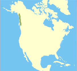 Locator map of the Coast Mountains
| |
| Countries | Canada and United States |
| Regions | Alaska, British Columbia and Yukon |
| Range coordinates | 54°N 128°W |
| Parent range | Pacific Coast Ranges |
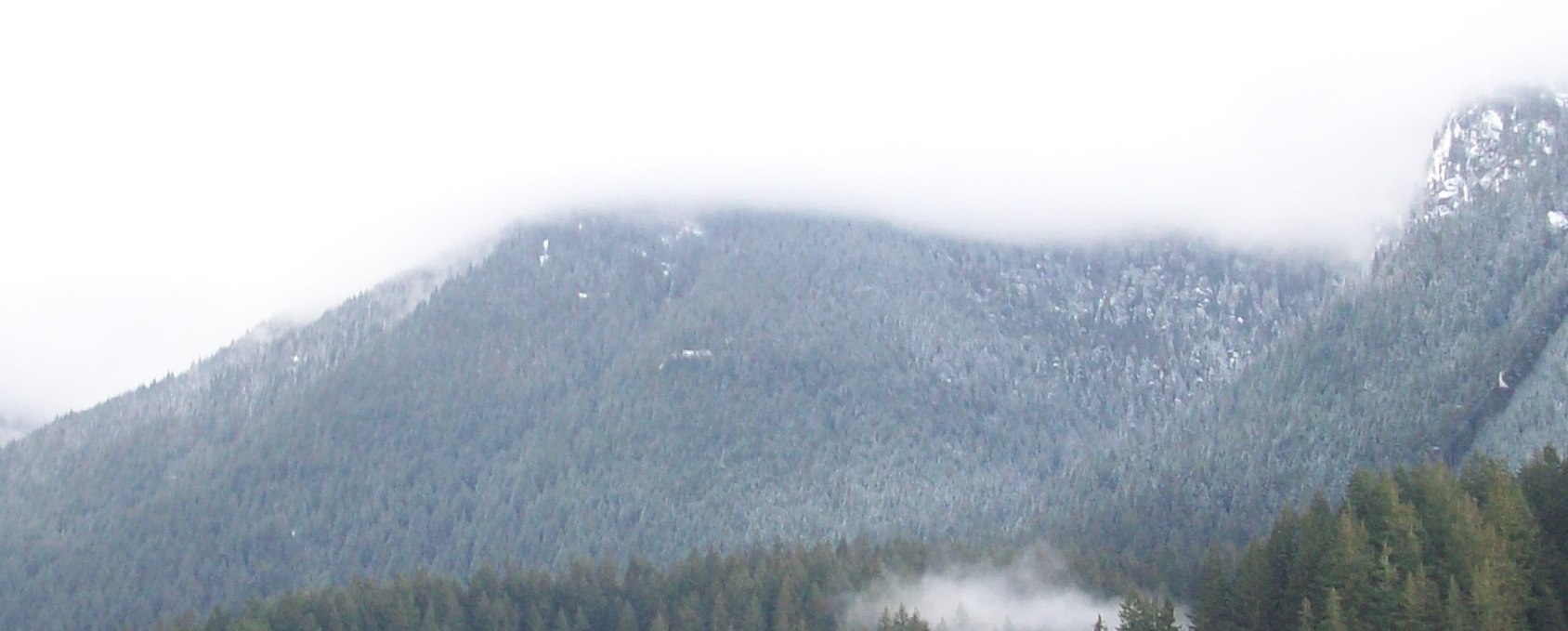
The Coast Mountains are approximately 1,600 kilometres (1,000 mi) long and average 300 kilometres (190 mi) in width.[2] The range's southern and southeastern boundaries are surrounded by the Fraser River and the Interior Plateau while its far northwestern edge is delimited by the Kelsall and Tatshenshini Rivers at the north end of the Alaska Panhandle, beyond which are the Saint Elias Mountains, and by Champagne Pass in the Yukon Territory.[3][4] Covered in dense temperate rainforest on its western exposures, the range rises to heavily glaciated peaks, including the largest temperate-latitude ice fields in the world. On its eastern flanks, the range tapers to the dry Interior Plateau and the subarctic boreal forests of the Skeena Mountains and Stikine Plateau.
The Coast Mountains are part of the Pacific Ring of Fire—the ring of volcanoes and associated mountains around the Pacific Ocean—and contain some of British Columbia's highest mountains. Mount Waddington is the highest mountain of the Coast Mountains and the highest that lies entirely within British Columbia, located northeast of the head of Knight Inlet with an elevation of 4,019 metres (13,186 ft).[5]
Geography
The Coast Mountains consists of three subdivisions known as the Pacific Ranges, the Kitimat Ranges, and the Boundary Ranges. The Pacific Ranges are the southernmost subdivision of the Coast Mountains, extending from the lower stretches of the Fraser River to Bella Coola. Included in this subdivision is four of the five major coastal icecaps in the southern Coast Mountains. These are the largest temperate-latitude icecaps in the world and fuel a number of major rivers. Other than logging and a large ski resort at the resort town of Whistler, most of the land in the range is completely undeveloped. Mount Waddington, the highest mountain of the Coast Mountains, lies in the Waddington Range of the Pacific Ranges.
Just north of the Pacific Ranges lies the central subdivision known as the Kitimat Ranges. This subdivision extends from the Bella Coola River and Burke Channel in the south to the Nass River in the north.

The third and northernmost subdivision of the Coast Mountains is the Boundary Ranges, extending from the Nass River in the south to the Kelsall River in the north. It is also the largest subdivision of the Coast Mountains, spanning the British Columbia-Alaska border and northwards into Yukon flanking the west side of the Yukon River drainage as far as Champagne Pass, north of which being the Yukon Ranges. The Boundary Ranges include several large icefields, including the Juneau Icefield between Juneau, Alaska and Atlin Lake in British Columbia, and the Stikine Icecap, which lies between the lower Stikine River and the Whiting River.
Because the Coast Mountains are just east of the Pacific Ocean, they have a profound effect on British Columbia's climate by forcing moisture-laden air off the Pacific Ocean to rise, dropping heavy rainfalls on the western slopes where lush forests exist.[2] This precipitation is among the heaviest in North America.[2] The eastern slopes are relatively dry and less steep and protect the British Columbia Interior from the Pacific weather systems, resulting in dry warm summers and dry cold winters.[2]
Beyond the eastern slopes is a 154,635 km2 (59,705 sq mi) plateau occupying the southern and central portions of British Columbia called the Interior Plateau. Included within the Interior Plateau is a coalescing series of layered flood basalt lava flows. These sequences of fluid volcanic rock cover about 25,000 km2 (9,700 sq mi) of the Interior Plateau and have a volume of about 1,800 km3 (430 cu mi), forming a large volcanic plateau constructed atop of the Interior Plateau. North of the Interior Plateau on the range's northeastern slopes lies a huge mountainous area known by geographers as the Interior Mountains, which includes the neighbouring Skeena, Cassiar and Hazelton Mountains.
Geology
Origins and growth
The Coast Mountains consists of deformed igneous and metamorphosed structurally complex pre-Tertiary rocks. These originated in diverse locations around the globe: the area is built of several different terranes of different ages with a broad range of tectonic origins. In addition, oceanic crust under the Pacific Ocean is being subducted at the southern portion of the range to form a north–south line of volcanoes called the Garibaldi Volcanic Belt, a northern extension of the Cascade Volcanoes in the northwestern United States, and contains the most explosive young volcanoes in Canada. Further north the northwesterly structural trend of the Coast Mountains lies partly in a large continental rift responsible for the creation of several volcanoes. These volcanoes form part of the Northern Cordilleran Volcanic Province, the most volcanically active area in Canada.
Insular and Omineca Arc eruptive periods

The first event began 130 million years ago when a group of active volcanic islands approached a pre-existing continental margin and coastline of North America.[6] These volcanic islands, known as the Insular Islands by geoscientists, were formed on a pre-existing tectonic plate called the Insular Plate by subduction of the former Farallon Plate to the west during the early Paleozoic era.[6] This subduction zone records another subduction zone to the east under an ancient ocean basin between the Insular Islands and the former continental margin of North America called the Bridge River Ocean.[6] This arrangement of two parallel subduction zones is unusual in that very few twin subduction zones exist on Earth; the Philippine Mobile Belt off the southeastern coast of Asia is an example of a modern twin subduction zone.[6] As the Insular Plate drew closer to the pre-existing continental margin by ongoing subduction under the Bridge River Ocean, the Insular Islands drew closer to the former continental margin and coastline of western North America, supporting a pre-existing volcanic arc on the former continental margin of North America called the Omineca Arc.[6] As the North American Plate drifted west and the Insular Plate drifted east to the old continental margin of western North America, the Bridge River Ocean eventually closed by ongoing subduction under the Bridge River Ocean.[6] This subduction zone eventually jammed and shut down completely 115 million years ago, ending the Omineca Arc and the Insular Islands collided, forming the Insular Belt.[6] Compression resulting from this collision crushed, fractured and folded rocks along the old continental margin.[6] The Insular Belt then welded onto the pre-existing continental margin by magma that eventually cooled to create a large mass of igneous rock, creating a new continental margin.[6] This large mass of igneous rock is the largest granite outcropping in North America.[6]

Coast Range Arc eruptive period
The final event began when the Farallon Plate continued to subduct under the new continental margin after the Insular Plate and Insular Islands collided with the old continental margin, supporting a new continental volcanic arc called the Coast Range Arc about 100 million years ago during the Late Cretaceous period.[7] Magma rising from the Farallon Plate under the new continental margin ascended through the newly accreted Insular Belt, injecting huge quantities of granite into older igneous rocks of the Insular Belt.[6] At the surface, new volcanoes were built along the continental margin.[6] Named after the Coast Mountains, the basement of this arc was likely Early Cretaceous and Late Jurassic intrusions from the Insular Islands.[7]

One of the major aspects that changed early during the Coast Range Arc was the status of the northern end of the Farallon Plate, a portion now known as the Kula Plate.[6] About 85 million years ago, the Kula Plate broke off from the Farallon Plate to form a mid-ocean ridge known to geoscientists as the Kula-Farallon Ridge.[6] This change apparently had some important ramifications for regional geologic evolution. When this change was completed, Coast Range Arc volcanism returned and sections of the arc were uplifted considerably in latest Cretaceous time.[8] This started a period of mountain building that affected much of western North America called the Laramide orogeny.[9] In particular a large area of dextral transpression and southwest-directed thrust faulting was active from 75 to 66 million years ago.[8] Much of the record of this deformation has been overridden by Tertiary age structures and the zone of Cretaceous dextral thrust faulting appears to have been widespread.[8] It was also during this period when massive amounts of molten granite intruded highly deformed ocean rocks and assorted fragments from pre-existing island arcs, largely remnants of the Bridge River Ocean.[6] This molten granite burned the old oceanic sediments into a glittering medium-grade metamorphic rock called schist.[6] The older intrusions of the Coast Range Arc were then deformed under the heat and pressure of later intrusions, turning them into layered metamorphic rock known as gneiss.[6] In some places, mixtures of older intrusive rocks and the original oceanic rocks have been distorted and warped under intense heat, weight and stress to create unusual swirled patterns known as migmatite, appearing to have been nearly melted in the procedure.[6]
Volcanism began to decline along the length of the arc about 60 million years ago during the Albian and Aptian faunal stages of the Cretaceous period.[7] This resulted from the changing geometry of the Kula Plate, which progressively developed a more northerly movement along the Pacific Northwest.[6] Instead of subducting beneath the Pacific Northwest, the Kula Plate began subducting underneath southwestern Yukon and Alaska and during the early Eocene period.[6] Volcanism along the entire length of the Coast Range Arc shut down about 50 million years ago and many of the volcanoes have disappeared from erosion.[6] What remains of the Coast Range Arc to this day are outcrops of granite when magma intruded and cooled at depth beneath the volcanoes, forming the present Coast Mountains.[6] During construction of intrusions 70 and 57 million years ago, the northern motion of the Kula Plate might have been between 140 mm (6 in) and 110 mm (4 in) per year.[10] However, other geologic studies determined the Kula Plate moved at a rate as fast as 200 mm (8 in) per year.[10]
High-prominence peaks

| Mountain/Peak | Height (metres) | Prominence (metres) | Height (feet) | Prominence (feet) | Location |
|---|---|---|---|---|---|
| Mount Waddington | 4019 | 3289 | 13,186 | 10,791 | |
| Monarch Mountain | 3555 | 2930 | 11,663 | 9,613 | |
| Skihist Mountain | 2968 | 2463 | 9,738 | 8,081 | |
| Mount Ratz | 3090 | 2430 | 10,138 | 7,972 | |
| Mount Queen Bess | 3298 | 2355 | 10,820 | 7,726 | |
| Razorback Mountain | 3183 | 2253 | 10,295 | 7,392 | |
| Wedge Mountain | 2892 | 2249 | 9,488 | 7,379 | |
| Otter Mountain | 2692 | 2242 | 8,832 | 7,356 | |
| Kwatna Peak | 2290 | 2225 | 7,513 | 7,300 | |
| Scud Peak | 2987 | 2172 | 9,800 | 7,126 |
Mountain ranges
| Range Name | Parent | Region(s) | Country |
|---|---|---|---|
| Boundary Ranges | Coast Mountains | British Columbia, Yukon, Alaska | Canada, United States |
| Boundary Range | Boundary Ranges | British Columbia, Alaska | Canada, United States |
| Adam Mountains | Boundary Ranges | Alaska | United States |
| Ashington Range | Boundary Ranges | British Columbia | Canada |
| Burniston Range | Boundary Ranges | British Columbia | Canada |
| Dezadeash Range | Boundary Ranges | Yukon | Canada |
| Florence Range | Boundary Ranges | British Columbia | Canada |
| Halleck Range | Boundary Ranges | Alaska | United States |
| Juneau Icefield | Boundary Ranges | British Columbia, Alaska | Canada, United States |
| Sawtooth Range | Juneau Icefield | Alaska | United States |
| Kakuhan Range | Boundary Ranges | Alaska | United States |
| Lincoln Mountains | Boundary Ranges | Alaska | United States |
| Longview Range | Boundary Ranges | British Columbia | Canada |
| Peabody Mountains | Boundary Ranges | Alaska | United States |
| Rousseau Range | Boundary Ranges | Alaska | United States |
| Seward Mountains | Boundary Ranges | Alaska | United States |
| Snowslide Range | Boundary Ranges | British Columbia | Canada |
| Spectrum Range | Boundary Ranges | British Columbia | Canada |
| Stikine Icecap | Boundary Ranges | British Columbia, Alaska | Canada, United States |
| Chechidla Range | Stikine Icecap | British Columbia | Canada |
| Cheja Range | Stikine Icecap | British Columbia | Canada |
| Kitimat Ranges | Coast Mountains | British Columbia | Canada |
| Bare Top Range | Kitimat Ranges | British Columbia | Canada |
| Countess of Dufferin Range | Kitimat Ranges | British Columbia | Canada |
| Kitlope Range | Kitimat Ranges | British Columbia | Canada |
| North Coastal Archipelago | Kitimat Ranges | British Columbia | Canada |
| Bell Range | North Coastal Archipelago | British Columbia | Canada |
| Burnaby Range | North Coastal Archipelago | British Columbia | Canada |
| Cape Range | North Coastal Archipelago | British Columbia | Canada |
| Chismore Range | North Coastal Archipelago | British Columbia | Canada |
| Murphy Range | North Coastal Archipelago | British Columbia | Canada |
| Richardson Range | North Coastal Archipelago | British Columbia | Canada |
| Spiller Range | North Coastal Archipelago | British Columbia | Canada |
| Williams Range | North Coastal Archipelago | British Columbia | Canada |
| Wimbledon Range | North Coastal Archipelago | British Columbia | Canada |
| Tenaiko Range | Kitimat Ranges | British Columbia | Canada |
| Pacific Ranges | Coast Mountains | British Columbia | Canada |
| Ashlu-Elaho Divide | Pacific Ranges | British Columbia | Canada |
| Bazalgette Range | Pacific Ranges | British Columbia | Canada |
| Bendor Range | Pacific Ranges | British Columbia | Canada |
| Bridge-Lillooet Divide | Pacific Ranges | British Columbia | Canada |
| Broughton Archipelago | Pacific Ranges | British Columbia | Canada |
| Calliope Range | Broughton Archipelago | British Columbia | Canada |
| Georgina Range | Broughton Archipelago | British Columbia | Canada |
| Bunster Range | Pacific Ranges | British Columbia | Canada |
| Cadwallader Range | Pacific Ranges | British Columbia | Canada |
| Caren Range | Pacific Ranges | British Columbia | Canada |
| Charlotte Alplands | Pacific Ranges | British Columbia | Canada |
| Douglas Ranges | Pacific Ranges | British Columbia | Canada |
| Chilcotin Ranges | Pacific Ranges | British Columbia | Canada |
| Camelsfoot Range | Chilcotin Ranges | British Columbia | Canada |
| Dickson Range | Chilcotin Ranges | British Columbia | Canada |
| Leckie Range | Chilcotin Ranges | British Columbia | Canada |
| Pantheon Range | Chilcotin Ranges | British Columbia | Canada |
| Potato Range | Chilcotin Ranges | British Columbia | Canada |
| Shulaps Range | Chilcotin Ranges | British Columbia | Canada |
| Clendinning Range | Pacific Ranges | British Columbia | Canada |
| Colville Range | Pacific Ranges | British Columbia | Canada |
| Conical Range | Pacific Ranges | British Columbia | Canada |
| Earle Range | Pacific Ranges | British Columbia | Canada |
| Edwards Range | Pacific Ranges | British Columbia | Canada |
| Florence Range | Pacific Ranges | British Columbia | Canada |
| Franklyn Range | Pacific Ranges | British Columbia | Canada |
| Fraser Range | Pacific Ranges | British Columbia | Canada |
| Garibaldi Ranges | Pacific Ranges | British Columbia | Canada |
| Garibaldi Névé | Garibaldi Ranges | British Columbia | Canada |
| Fitzsimmons Range | Garibaldi Ranges | British Columbia | Canada |
| McBride Range | Garibaldi Ranges | British Columbia | Canada |
| Spearhead Range | Garibaldi Ranges | British Columbia | Canada |
| Golden Ears | Garibaldi Ranges | British Columbia | Canada |
| Misty Icefield | Garibaldi Ranges | British Columbia | Canada |
| Bastion Range | Garibaldi Ranges | British Columbia | Canada |
| Gastineau Range | Pacific Ranges | British Columbia | Canada |
| Ha-Iltzuk Icefield | Pacific Ranges | British Columbia | Canada |
| Homathko Icefield | Pacific Ranges | British Columbia | Canada |
| Koeye Range | Pacific Ranges | British Columbia | Canada |
| Lewis Range | Pacific Ranges | British Columbia | Canada |
| Lillooet Icecap | Pacific Ranges | British Columbia | Canada |
| Compton Névé | Lillooet Icefield | British Columbia | Canada |
| Lillooet Ranges | Pacific Ranges | British Columbia | Canada |
| Cantilever Range | Lillooet Ranges | British Columbia | Canada |
| Cayoosh Range | Lillooet Ranges | British Columbia | Canada |
| Mission Ridge | Pacific Ranges | British Columbia | Canada |
| Monarch Icefield | Pacific Ranges | British Columbia | Canada |
| North Shore Mountains | Pacific Ranges | British Columbia | Canada |
| Fannin Range | North Shore Mountains | British Columbia | Canada |
| Britannia Range | North Shore Mountains | British Columbia | Canada |
| Namu Range | Pacific Ranges | British Columbia | Canada |
| Nicholl Range | Pacific Ranges | British Columbia | Canada |
| Niut Range | Pacific Ranges | British Columbia | Canada |
| Pemberton Icefield | Pacific Ranges | British Columbia | Canada |
| Pembroke Range | Pacific Ranges | British Columbia | Canada |
| Powell Divide | Pacific Ranges | British Columbia | Canada |
| Sir Harry Range | Pacific Ranges | British Columbia | Canada |
| Squamish-Cheakamus Divide | Pacific Ranges | British Columbia | Canada |
| Tantalus Range | Pacific Ranges | British Columbia | Canada |
| The Tahumming | Pacific Ranges | British Columbia | Canada |
| Tottenham Range | Pacific Ranges | British Columbia | Canada |
| Unwin Range | Pacific Ranges | British Columbia | Canada |
| Waddington Range | Pacific Ranges | British Columbia | Canada |
| Wharncliffe Range | Pacific Ranges | British Columbia | Canada |
| Whitemantle Range | Pacific Ranges | British Columbia | Canada |
See also
- Coast Range Arc
- Geography of British Columbia
- Geology of British Columbia
- Volcanism of Canada
- Volcanism of Western Canada
- List of mountain ranges
- Rocky Mountains
- Columbia Mountains
 Pacific Northwest portal
References
- BC Names/GeoBC entry "Coast Mountains"
- "BCGNIS Query Results". Government of British Columbia. Retrieved 2008-11-13. [dead link]
- S. Holland, Landforms of British Columbia, Province of British Columbia, 1976, pp 41 Archived March 4, 2016, at the Wayback Machine
- map from Bulletin 48: Landforms of British Columbia Archived March 3, 2016, at the Wayback Machine
- "BCGNIS Query Results". Government of British Columbia. Archived from the original on 2007-08-15. Retrieved 2008-11-13.
- "The Coast Range Episode (115 to 57 million years ago)". Burke Museum of Natural History and Culture. Retrieved 2008-04-09.
- Stowell, Harold H.; McClelland William C. (2000-01-01). Tectonics of the Coast Mountains, Southeastern Alaska and British Columbia. Geological Society of America. p. 101. ISBN 0-8137-2343-4. Retrieved 2008-09-04.
- Geology of a Transpressional Orogen Developed During Ridge-Trench ... - Google Books. Books.google.ca. Retrieved on 2013-07-21.
- "Laramide orogeny". Encyclopædia Britannica, Inc. 1998. Archived from the original on May 26, 2009. Retrieved November 16, 2008.
- "Tectonic overview of the CPC". University of Arizona. Retrieved 2008-09-07.
Canada | |||||
|---|---|---|---|---|---|
| History |
| ||||
| Provinces and territories |
| ||||
| Government |
| ||||
| Politics |
| ||||
| Geography |
| ||||
| Economy |
| ||||
| Society |
| ||||
| Demographics |
| ||||
| Culture |
| ||||
| Symbols |
| ||||
| Contents |
| ||||
| Research |
| ||||
| |||||
| Authority control: National libraries |
|---|
На других языках
[de] Coast Mountains
Die Coast Mountains (dt. "Küstengebirge") sind ein Gebirgszug in Kanada, der zu den Pazifischen Küstengebirgen Nordamerikas gehört. Sie erstrecken sich überwiegend entlang der kanadischen Pazifikküste vom Alaska Panhandle im Norden bis zur Kaskadenkette im Süden – der Fraser River, der längste Fluss British Columbias, bildet die südliche Begrenzung.- [en] Coast Mountains
[es] Montañas Costeras
Las montañas Costeras (en inglés, Coast Mountains'), cadena Costera,[1] constituyen la rama más occidental de la Cadena costera del Pacífico, extendiéndose hacia el norte desde la costa suroeste del continente norteamericano y cubriendo la mayor parte de la zona costera de la Columbia Británica y una porción del sureste de Alaska. Se les llama así debido a su proximidad con el litoral, y a menudo se les llama Coast Range.[2] Incluye montañas volcánicas y no volcánicas y los enormes campos de hielo de las cordilleras del Pacífico y Limítrofes, y el extremo norte del destacado sistema volcánico conocido como los volcanes de la Cascada.[fr] Chaîne Côtière
La chaîne Côtière[1],[2] (en anglais : Coast Mountains ou officieusement en anglais : Coast Range) est une vaste chaîne de montagnes qui s'étend à travers la Colombie-Britannique et le Yukon au Canada, et l'Alaska Panhandle aux États-Unis, dans la continuité des chaînes côtières du Pacifique aux États-Unis. Son plus haut sommet est le mont Waddington.[it] Montagne Costiere
Le Montagne Costiere sono una catena montuosa facente parte della Cordigliera Pacifica che corre lungo la sponda nord-occidentale del continente nordamericano, e si estende dal sud dell'Alaska coprendo la maggior parte della costiera della Columbia Britannica. Fanno parte di un raggruppamento molto più ampio, la Catena Costiera Pacifica, che da nord a sud comprende i Monti Kenai, i Monti Chugach, i Monti Sant'Elia, le Montagne Costiere, la Catena delle Cascate, la Sierra Nevada e la Sierra Madre Occidentale in Messico.[ru] Береговой хребет
Берегово́й хребе́т (англ. Coast Mountains) — самая западная цепь горных хребтов, протянувшихся вдоль побережья Северной Америки от озера Атлин до реки Фрейзер. Береговой хребет является частью Тихоокеанских Береговых хребтов горной системы Кордильеры[1]. Длина хребта около 1600 км[2], ширина до 300 км. Средняя высота хребта составляет около 3000 метров, наибольшая высота 4016 метров[3] (гора Уоддингтон). Сложен большей частью гранитами. Сильно расчленён глубокими поперечными долинами и фьордами, возникшими вдоль тектонических трещин.Другой контент может иметь иную лицензию. Перед использованием материалов сайта WikiSort.org внимательно изучите правила лицензирования конкретных элементов наполнения сайта.
WikiSort.org - проект по пересортировке и дополнению контента Википедии