geo.wikisort.org - Mountains
Abajo Peak is the highest peak in the Abajo Mountains of southeast Utah, United States and is located in the Manti-La Sal National Forest. The summit is 7 miles (11 km) southwest of Monticello, Utah and 23 miles (37 km) west of the Colorado border. There are several communication towers on the peak.[3]
| Abajo Peak | |
|---|---|
 | |
| Highest point | |
| Elevation | 11,368 ft (3,465 m) NAVD 88[1] |
| Prominence | 4,550 ft (1,387 m)[2] |
| Coordinates | 37°50′22″N 109°27′45″W[1] |
| Geography | |
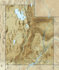 Abajo Peak San Juan County, Utah, U.S. | |
| Parent range | Abajo Mountains |
| Topo map | USGS Abajo Peak Quad |
| Climbing | |
| Easiest route | Hike |
References
- "Abajo Peak 2". NGS data sheet. U.S. National Geodetic Survey.
- "Abajo Peak, Utah". Peakbagger.com.
- "Abajo Peak". SummitPost.org.
External links
![]() Media related to Abajo Peak at Wikimedia Commons
Media related to Abajo Peak at Wikimedia Commons
- "Abajo Peak". Geographic Names Information System. United States Geological Survey.
This article about a location in Utah is a stub. You can help Wikipedia by expanding it. |
На других языках
[de] Abajo Peak
Der Abajo Peak ist mit 3465 m[1] der höchste Berg des Abajo Mountains im Südosten Utahs. Der Berg liegt im Manti La Sal National Forest. Der Gipfel liegt 11 km südwestlich von Monticello und 30 km westlich von der Grenze zu Colorado. Vom Gipfel aus kann man den Vier-Staaten-Punkt, an dem sich Utah, Arizona, New Mexico und Colorado treffen, sehen. Auf dem Gipfel stehen mehrere Kommunikationstürme.[2]- [en] Abajo Peak
Текст в блоке "Читать" взят с сайта "Википедия" и доступен по лицензии Creative Commons Attribution-ShareAlike; в отдельных случаях могут действовать дополнительные условия.
Другой контент может иметь иную лицензию. Перед использованием материалов сайта WikiSort.org внимательно изучите правила лицензирования конкретных элементов наполнения сайта.
Другой контент может иметь иную лицензию. Перед использованием материалов сайта WikiSort.org внимательно изучите правила лицензирования конкретных элементов наполнения сайта.
2019-2026
WikiSort.org - проект по пересортировке и дополнению контента Википедии
WikiSort.org - проект по пересортировке и дополнению контента Википедии