geo.wikisort.org - Mountains
The San Jacinto Mountains (Avii Hanupach[1] in Mojave) are a mountain range in Riverside County, located east of Los Angeles in southern California in the United States.[2] The mountains are named for one of the first Black Friars, Saint Hyacinth (San Jacinto in Spanish), who is a popular patron in Latin America.
| San Jacinto Mountains | |
|---|---|
| Jalisco Mountains, Indian Land | |
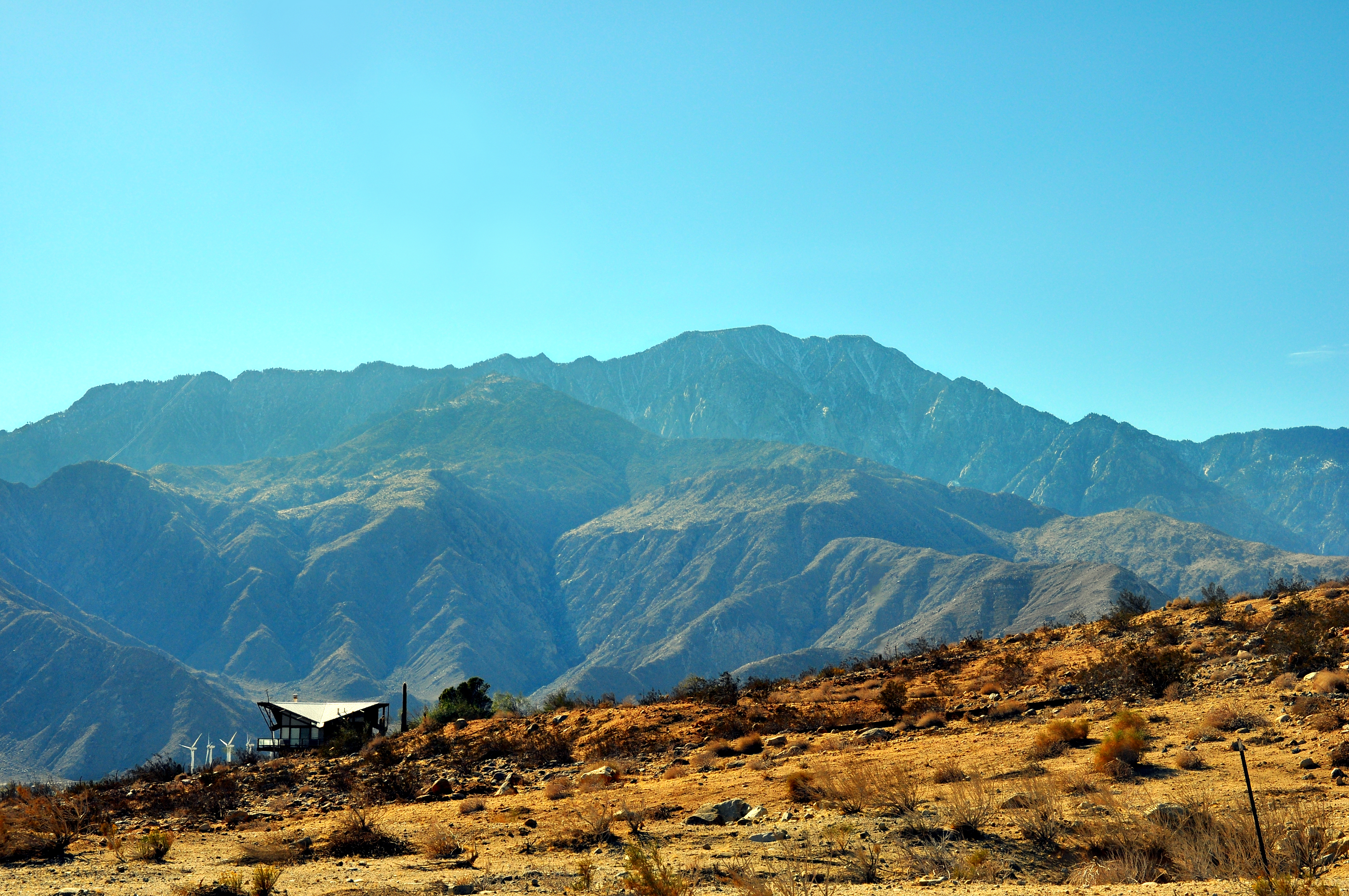
 The San Jacinto Mountains seen from Hemet | |
| Highest point | |
| Peak | San Jacinto Peak |
| Elevation | 3,302.3 m (10,834 ft) |
| Naming | |
| Native name | Avii Hanupach (Mohave) |
| Geography | |
 San Jacinto Mountains | |
| Country | United States |
| State | California |
| District | Riverside County |
| Range coordinates | 33°48′52″N 116°40′45″W |
| Topo map | USGS San Jacinto Peak |
Geography
The range extends for approximately 30 mi (50 km) from the San Bernardino Mountains southeast to the Santa Rosa Mountains. The San Jacinto Mountains are the northernmost of the Peninsular Ranges, which run 1,500 km (930 mi) from Southern California to the southern tip of the Baja California Peninsula. The highest peak in the range is San Jacinto Peak (3,302 m; 10,834 ft) NAVD 88,[3] and the range is also a Great Basin Divide landform for the Salton Watershed to the east.
The Coachella Valley stretches along the eastern side of the range, including the cities of Palm Springs and Rancho Mirage. San Gorgonio Pass separates the range from Mount San Gorgonio to the north. The western slope holds the community of Idyllwild. The range is the eastern boundary of the San Jacinto Valley, location of Hemet; it also marks the eastern edge of the fast-growing Inland Empire region and Greater Los Angeles as a whole.
Much of the range is embraced by the Santa Rosa and San Jacinto Mountains National Monument created in 2000. Mount San Jacinto State Park is located along the flank of San Jacinto Peak. Part of the eastern flank of the range is located within the Agua Caliente Indian Reservation. In 1990, the California Legislature created the Coachella Valley Mountains Conservancy to protect the mountains surrounding the valley.
Geology
The range is a fault block of granitic rocks squeezed between the San Jacinto fault on the west and the San Andreas fault system on the east. The fault scarp on the northern and eastern side is one of the most abrupt in North America, going from sea level to 10,000 feet in a few miles. The height and steepness of the range points out that the San Jacinto fault and San Andreas fault are very active and very capable of producing major earthquakes (well in excess of magnitude 7). The last massive quake struck the southern segment of the San Andreas-San Jacinto fault complex more than 200 years ago making another major earthquake likely but not currently possible to predict. Rock slides from the range are possible during major earthquakes in the future, as they have been in the past. These slides may potentially impact the communities built directly adjacent to the steep escarpment on the desert side of the range.
Climate
The San Jacinto Mountains, like the neighboring San Bernardino Mountains, are a humid island above the surrounding desert and semi-desert. Annual precipitation ranges from about 15 inches at the western base (and only 6 inches on the eastern, desert base) to as much as 32 inches above 5,500 feet (the mountain town of Idyllwild averages 27 inches per year). The coastal (western) side of the range receives more precipitation than the eastern (desert) side. Most of the precipitation falls between November and March, with a secondary maximum associated with thunderstorms during the summer monsoon season between July and September. The precipitation totals are highly variable from year to year. Snow usually falls above 4,000 feet elevation in winter. Above 8,000 feet, snow sometimes persists until June. Near the crest, there are often a few patches of snow that may persist all year in shady spots.
Flora and fauna

The range can be thought of as a sky island, as it contains numerous species of flora and fauna that cannot tolerate the triple-digit-Fahrenheit heat of the surrounding valleys. Vegetation found on the mountain flanks is strongly influenced by elevation and climate. Near the valley floor, conditions are often arid and hot, limiting the vegetative palette to species that are adapted to such conditions.[4] At lower elevations forestation of the San Jacinto Mountains includes considerable California black oak associated with Coulter pine.[5] At higher elevations, forests include Ponderosa pine, Jeffrey pine, Lodgepole pine, Incense cedar, White fir, Red fir, Manzanita, and deciduous oak. There is also a grove of over 150 giant sequoia trees on the northeast facing slope. The sequoias (native to the Sierra Nevada Mountains) were planted by the U.S. Forest Service in the 1970s, and are now apparently healthy and producing seedlings.[6] As in many other western U.S areas, bark beetle infestations have caused loss of some of the forest trees in recent years, especially during droughts. Wildfires, such as the Mountain Fire and the Cranston Fire, have also temporarily denuded some areas.
Human use
The communities of Idyllwild-Pine Cove, Mountain Center, and Pinyon Pines are located in the San Jacinto Mountains.
The indigenous Cahuilla live in the deserts around the San Jacinto Mountains and used the range for hunting, foraging, and to escape the summer heat.
The range was a frequent subject for Palm Springs artists Carl Eytel (1862–1925) and Paul Grimm (1892–1974).
Hollywood film directors have used the mountains to shoot film scenes. In Frank Capra's 1937 film, Lost Horizon, the Tahquitz Falls in Tahquitz Canyon was used as a scene.[7]
Today, the range is a destination for outdoor recreation. The Pacific Crest Trail runs along the spine of the range. A popular walking route runs from the Palm Springs Aerial Tramway Mountain Station above Palm Springs, to the high point of the range, with a relatively mild climb of 2,400 ft (700 m) compared to other routes with more elevation gain.
Above Idyllwild is historic Tahquitz Peak and other rock climbing areas.
Wilderness
Established in 1964 by the U.S. Congress with the original Wilderness Act, the San Jacinto Wilderness protects two areas to the north and south of Mount San Jacinto State Park (the location of San Jacinto Peak). The 32,168 acre wilderness area is all within the San Bernardino National Forest and is managed by the U.S. Forest Service.[8]
See also
- Tahquitz (spirit)
References
- Munro, P., et al. A Mojave Dictionary. Los Angeles: UCLA. 1992.
- "San Jacinto Mountains". Geographic Names Information System. United States Geological Survey, United States Department of the Interior. Retrieved 2009-05-03.
- "San Jacinto". NGS Data Sheet. National Geodetic Survey, National Oceanic and Atmospheric Administration, United States Department of Commerce. Retrieved 2012-11-30.
- University of California Publications in Botany, Published by University of California Press, Berkeley, Ca., 1903, Item notes: v.1 (1902–1903)
- C. Michael Hogan (2008) Quercus kelloggii, Globaltwitcher.com, ed. Nicklas Stromberg "Archived copy". Archived from the original on 2012-02-18. Retrieved 2012-02-18.
{{cite web}}: CS1 maint: archived copy as title (link) - Masters, Nathan (21 May 2014). "These Sequoia Trees Are Thriving 175 Miles South of Their Natural Range". gizmodo.com. Retrieved 7 April 2018.
- Lost Horizon at the American Film Institute Catalog
- San Jacinto Wilderness - Wilderness Connect
- Robinson, John W.; Risher, Bruce D.; Bakker, Elna (1993). The San Jacintos: The Mountain Country from Banning to Borrego Valley. Arcadia, CA: Big Santa Ana Historical Society. p. 252. ISBN 0-9615421-6-0.
External links
- San Jacinto Wilderness - San Bernardino National Forest
Authority control | |
|---|---|
| General |
|
| National libraries | |
| Other |
|
На других языках
[de] San Jacinto Mountains
Die San Jacinto Mountains (Mohave-Sprache: Avii Hanupach) sind ein Gebirgszug im Riverside County des US-Bundesstaats Kalifornien. Sie sind der nördlichste Teil der Peninsular Ranges. Die höchste Erhebung des Gebirges stellt mit 3302 m der San Jacinto Peak dar.[1] Die San Jacinto Mountains sind nach dem heiligen Hyacinthus von Caesarea benannt.- [en] San Jacinto Mountains
[fr] Monts San Jacinto
Les monts San Jacinto sont un massif montagneux situé au sud de la Californie qui culmine au pic San Jacinto à 3 302 m d'altitude. Ils font partie des Peninsular Ranges dans les chaînes côtières du Pacifique.[ru] Сан-Джасинто (горы)
Сан-Джасинто[2] (англ. San Jacinto Mountains) — горный хребет к востоку от Лос-Анджелеса, на юге штата Калифорния, США. Протянулся на 48 км от хребта Сан-Бернардино на севере до хребта Санта-Роза на юге. Самый северный хребет в группе Полуостровных хребтов, которая протянулась отсюда вплоть до южной точки полуострова Калифорния почти на 1500 км.Другой контент может иметь иную лицензию. Перед использованием материалов сайта WikiSort.org внимательно изучите правила лицензирования конкретных элементов наполнения сайта.
WikiSort.org - проект по пересортировке и дополнению контента Википедии