geo.wikisort.org - Mountains
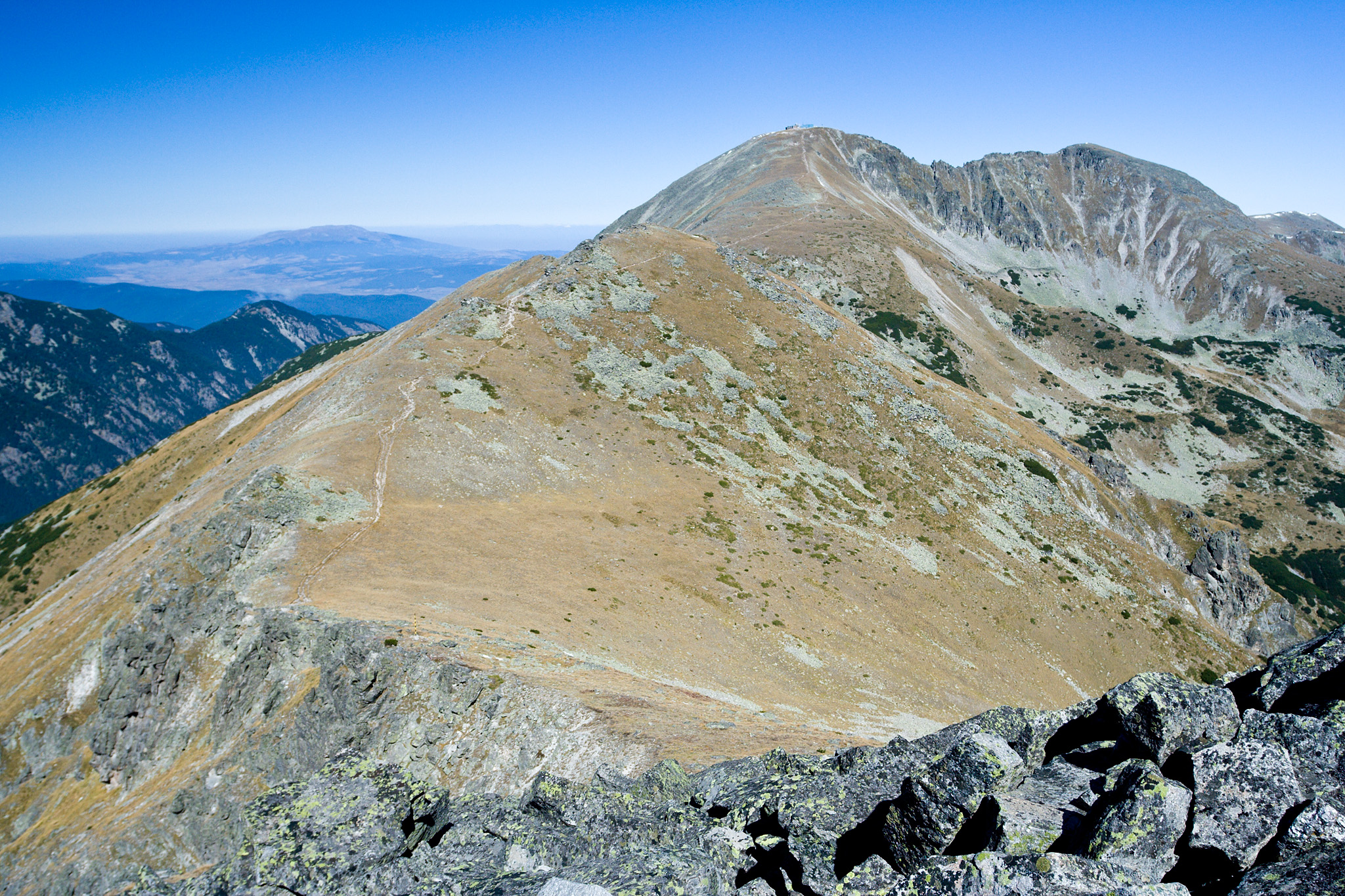
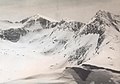
Musala (Bulgarian: Мусала [mosɐˈɫa]); from Arabic through Ottoman Turkish: from Musalla, "near God" or "place for prayer" [1][2] is the highest peak in the Rila Mountains, as well as in Bulgaria and the entire Balkan Peninsula, standing at 2,925 metres (9,596 ft).
| Musala | |
|---|---|
| Мусала | |
 Musala seen from the south | |
| Highest point | |
| Elevation | 2,925.4 m (9,598 ft) |
| Prominence | 2,473 m (8,114 ft) |
| Isolation | 881 km (547 mi) |
| Listing | Country high point Ultra |
| Coordinates | 42°10′47″N 23°35′12″E |
| Geography | |
 Musala Musala in Bulgaria | |
| Location | Sofia Region, Bulgaria |
| Parent range | Rila |
| Climbing | |
| Easiest route | Gondola lift from Borovets, then hike |
With a topographic prominence of 2,473 metres (8,114 ft), Musala is also the 6th highest peak by topographic prominence in mainland Europe.[3] Musala is also the 3rd most topographically isolated major peak in Continental Europe.[4]
Musala is situated within the Rila National Park, which is noted for its rich flora, including species such as Macedonian Pine and Bulgarian Fir in the forests on its middle slopes, and fauna; it is one of the easiest places in Europe to see the wallcreeper. All major mountain ranges of Bulgaria can be seen from the top; these include Vitosha to the northwest, Sredna Gora towards the northeast, the Balkan Mountains along most of the northern horizon behind Vitosha and Sredna Gora, the Rhodope Mountains to the southeast, Pirin to the south, Osogovo and Ruy Mountain to the west, and of course, the rest of Rila.
A cosmic ray station was built on the peak in 1960 with cooperation from the Hungarian Academy of Science. The station conducted scientific experiments using a muon telescope. The station was destroyed by an electrical fire on October 29, 1983.[5]
With an average annual temperature of -2.3 °C Musala is the coldest place in Bulgaria and the entire Balkan Peninsula.[citation needed] Temperatures stay below 0 °C for about 8 months each year.[citation needed] Due to this about 45% of the annual precipitation on Musala is snow, and snow cover lasts for about 200 days (more than six months).[citation needed] Three of the main rivers of Bulgaria, the Iskar, Maritsa and Mesta have their sources near Musala.
The next highest peaks in the vicinity of Musala are Malka (Little) Musala (2,902 metres (9,521 ft)) and Irechek (2,852 metres (9,357 ft)).
Climate
Peak Musala has an alpine climate with long, cold winters and short, cool summers. Usually, through winter, the temperatures don't exceed the freezing point for months. Snow cover lasts for about 8–9 months. Through the summer, temperatures rarely go above 14-15C. The summer season only lasts for 2 months, and snowfalls are possible. For the period 1931–2013, the highest recorded temperature was 20.0 °C (68.0 °F), and the lowest - −31.2 °C (−24.2 °F). The average annual temperature is −2.5 °C (27.5 °F), which makes the peak the coldest place in Bulgaria.
| Climate data for Musala Peak (2000–2013) | |||||||||||||
|---|---|---|---|---|---|---|---|---|---|---|---|---|---|
| Month | Jan | Feb | Mar | Apr | May | Jun | Jul | Aug | Sep | Oct | Nov | Dec | Year |
| Record high °C (°F) | 7.0 (44.6) |
8.0 (46.4) |
12.1 (53.8) |
13.7 (56.7) |
12.6 (54.7) |
18.0 (64.4) |
20.0 (68.0) |
18.7 (65.7) |
16.4 (61.5) |
14.2 (57.6) |
9.6 (49.3) |
6.8 (44.2) |
20.0 (68.0) |
| Average high °C (°F) | −8.2 (17.2) |
−7.6 (18.3) |
−5.6 (21.9) |
−1.2 (29.8) |
2.7 (36.9) |
7.1 (44.8) |
10.1 (50.2) |
10.2 (50.4) |
6.3 (43.3) |
2.2 (36.0) |
−1.8 (28.8) |
−6.1 (21.0) |
0.7 (33.3) |
| Daily mean °C (°F) | −11.0 (12.2) |
−10.6 (12.9) |
−8.6 (16.5) |
−4.1 (24.6) |
−0.1 (31.8) |
4.4 (39.9) |
6.9 (44.4) |
7.2 (45.0) |
3.4 (38.1) |
−0.6 (30.9) |
−4.4 (24.1) |
−8.6 (16.5) |
−2.1 (28.2) |
| Average low °C (°F) | −13.8 (7.2) |
−13.6 (7.5) |
−11.6 (11.1) |
−7.0 (19.4) |
−3.1 (26.4) |
1.6 (34.9) |
3.7 (38.7) |
4.2 (39.6) |
0.5 (32.9) |
−3.1 (26.4) |
−6.9 (19.6) |
−11.0 (12.2) |
−4.9 (23.2) |
| Record low °C (°F) | −30.6 (−23.1) |
−29.8 (−21.6) |
−26.8 (−16.2) |
−20.6 (−5.1) |
−15.6 (3.9) |
−12 (10) |
−8 (18) |
−9.8 (14.4) |
−14 (7) |
−17.5 (0.5) |
−27.4 (−17.3) |
−31.2 (−24.2) |
−31.2 (−24.2) |
| Average precipitation mm (inches) | 126 (5.0) |
110 (4.3) |
130 (5.1) |
128 (5.0) |
119 (4.7) |
105 (4.1) |
80 (3.1) |
56 (2.2) |
47 (1.9) |
72 (2.8) |
88 (3.5) |
115 (4.5) |
1,176 (46.3) |
| Average rainy days | 1 | 0 | 0 | 0 | 4 | 8 | 9 | 7 | 6 | 3 | 1 | 0 | 39 |
| Average snowy days | 13 | 14 | 17 | 18 | 14 | 5 | 2 | 1 | 4 | 8 | 13 | 15 | 124 |
| Mean monthly sunshine hours | 114 | 112 | 140 | 127 | 168 | 181 | 250 | 250 | 182 | 169 | 128 | 104 | 1,925 |
| Source: Stringmeteo.com | |||||||||||||
Namesakes
Musala Glacier on Greenwich Island in the South Shetland Islands, Antarctica is named after Musala Peak.
Gallery
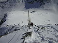 Hikers near the summit of Musala. The pyramid in the background is the Everest shelter
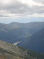 The Pirin Mountains can be seen from Musala
 The origin of the Maritsa River seen from Musala
 Musala as seen from Yastrebets. The chalet Musala and the Everest shelter can be seen as well.


See also
- Rila
- Malyovitsa
- Rila National Park
- List of mountains in Bulgaria
- Geography of Bulgaria
- List of mountains of the Balkans
- List of European ultra-prominent peaks
- List of the highest European ultra-prominent peaks
- Most isolated major summits of Europe
- List of mountain ranges
- List of World Heritage Sites in Bulgaria
References
- Известия на българското географско дружество, 1964 г. стр. 197.
- Bŭlgarski ezik, Volume 19,Institut za bŭlgarski ezik (Bŭlgarska akademii͡a na naukite), 1969, str. 573.
- "Europe Ultra-Prominences". Peaklist. Retrieved 26 February 2015.
- "Most Isolated Peak of Europe Countries - Peakbagger.com".
- Kavlakov, S. (2009-11-16). "Cosmic Ray investigations on peak Musala in Bulgaria: A memoir". Advances in Space Research. Cosmic Rays From Past to Present. 44 (10): 1178–1182. Bibcode:2009AdSpR..44.1178K. doi:10.1016/j.asr.2008.10.040.
- "Мусала". Българска енциклопедия А-Я (in Bulgarian). БАН, Труд, Сирма. 2002. ISBN 978-954-8104-08-1. OCLC 163361648.
External links
- Musala – controllable web camera (in Bulgarian)
- Musala climb on youtube
На других языках
[de] Musala
Der Musala (bulgarisch Мусала), gelegen im Rila-Nationalpark, ist der höchste Berg Bulgariens und der gesamten Balkanhalbinsel. Sein Gipfel wurde von Bergsteigern erstmals im 19. Jahrhundert erreicht. Auf seiner breiten Kuppe befinden sich zwei wissenschaftliche Beobachtungsstationen der Bulgarischen Akademie der Wissenschaften[3][4].- [en] Musala
[es] Musala
El Musala (en búlgaro, Мусала) es la cumbre más alta de Bulgaria y de toda la península de los Balcanes, con 2925 msnm. Musala es también el cuarto pico en Europa continental en cuanto a aislamiento topográfico.[1][fr] Moussala (montagne)
Le mont Moussala[1] (en bulgare : Мусала, translittération internationale Musala) est un ensemble de sommets des Balkans (dont il constitue le point culminant), dans le massif du Rila. Il culmine à 2 925 mètres d'altitude.[it] Mussala
Il Monte Mussala (in bulgaro Мусала, Musala) rappresenta la vetta più elevata del massiccio del Rila. È inoltre con i suoi i 2925 m s.l.m. la maggior elevazione della Bulgaria e dell'intera penisola balcanica.[ru] Мусала
Мусала́[2] (болг. Мусала, с 1949 по 1962 - Пик Сталина) — высочайшая горная вершина Болгарии, Балканского полуострова и всей Восточной Европы. Высота — 2925 метров. Сложена палеозойскими гранитами, прорезаными гранитпорфирными жилами. Горноледниковый рельеф.Другой контент может иметь иную лицензию. Перед использованием материалов сайта WikiSort.org внимательно изучите правила лицензирования конкретных элементов наполнения сайта.
WikiSort.org - проект по пересортировке и дополнению контента Википедии