geo.wikisort.org - Mountains
Mulhacén ([mulaˈθen]), with an elevation of 3,479 metres (11,414 ft), is the highest mountain in peninsular Spain and in all of the Iberian Peninsula. It is part of the Sierra Nevada range in the Cordillera Penibética. It is named after Abu l-Hasan Ali, known as Muley Hacén in Spanish, the penultimate Muslim King of Granada in the 15th century who, according to legend, was buried on the summit of the mountain.
| Mulhacén | |
|---|---|
 | |
| Highest point | |
| Elevation | 3,478.6 m (11,413 ft)[1] |
| Prominence | 3,285 m (10,778 ft)[2] Ranked 65th |
| Isolation | 529 km (329 mi) |
| Listing | Ultra |
| Coordinates | 37°03′12″N 3°18′41″W[1] |
| Geography | |
 Mulhacén Location in Spain | |
| Location | Granada, Spain |
| Parent range | Sierra Nevada |
| Climbing | |
| First ascent | Unknown (before 1500)[3] |
| Easiest route | Hike |
Mulhacén is the highest peak in Western Europe[note 1] outside of the Alps. It is also the third-most topographically prominent peak in Western Europe, after Mont Blanc and Mount Etna, and is ranked 64th in the world by prominence.[2] The peak is not exceptionally dramatic in terms of steepness or local relief. The south flank of the mountain is gentle and presents no technical challenge, as is the case for the long west ridge. The shorter, somewhat steeper northeast ridge is slightly more technical. The north face of the mountain is much steeper and offers several routes involving moderately steep climbing on snow and ice (up to French grade AD) in the winter.[3]
Mulhacén can be climbed in a single day from the villages of either Capileira or Trevélez, but it is more common to spend a night at the mountain refuge at Poqueira, or in the bare shelter at Caldera to the west. Those making the ascent from Trevélez can also bivouac at the tarns to the northeast of the peak.
Accidents
On 5 March 2006, three British climbers from Teesside died on the mountain from suspected hypothermia. Initial reports quoting the Spanish Civil Guard stated that the three were ill-equipped for the extreme conditions. This claim was subsequently disputed both by the family and a colleague of one of the climbers, and by one of the rescuers.[4][5] A plaque dedicated to them has been placed at the summit.[6]
 Mulhacén from Punta de Loma Pelada
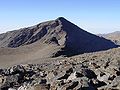 Mulhacén from Alcazaba
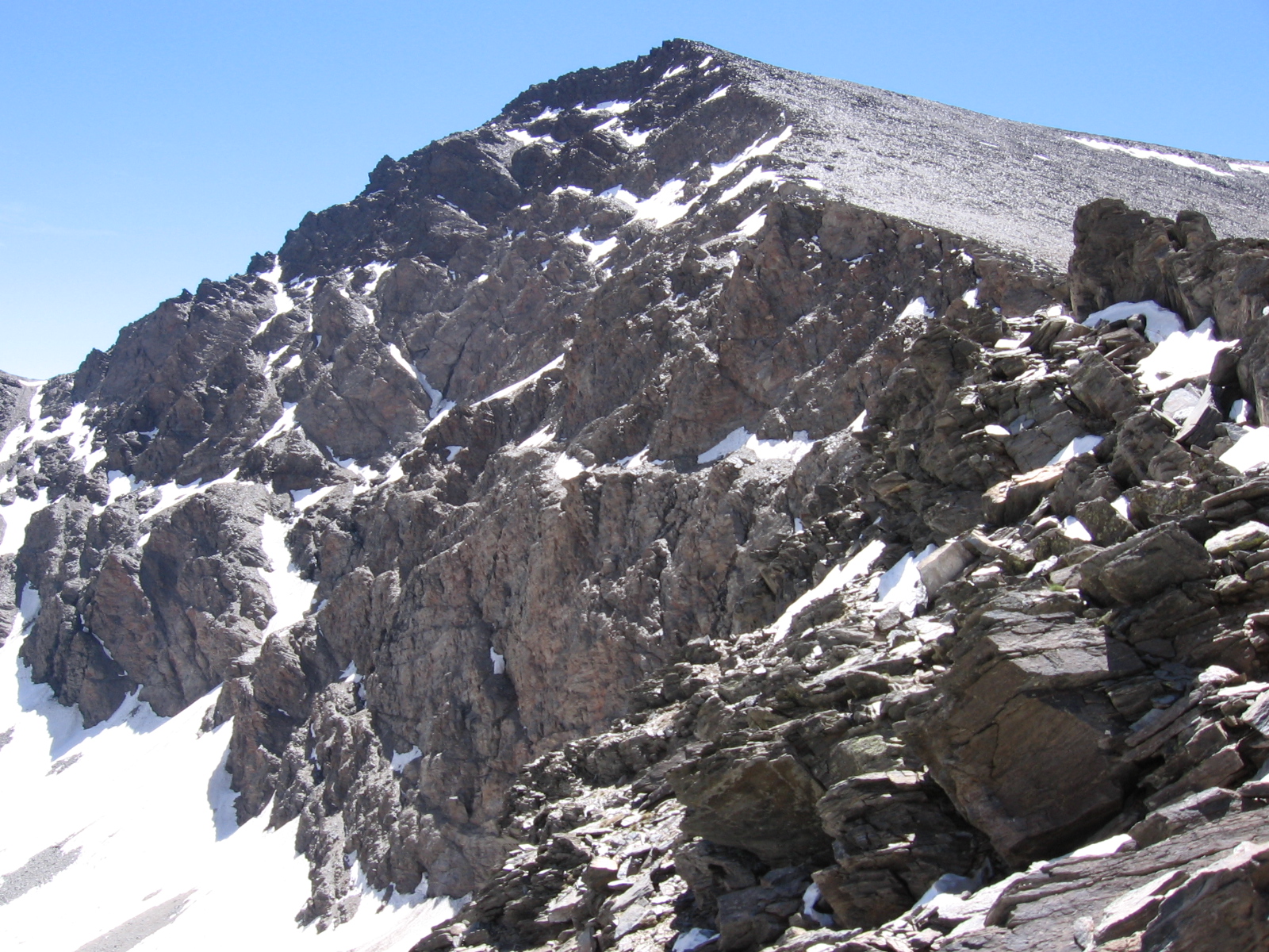
 North face of Mulhacén
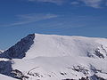 Mulhacén in the winter from the west
 Ruined mountain hut on the summit
 Mulhacén in summer, from the Laguna Hondera


References
- Document supplied by Spanish National Mapping Agency. The coordinates given here have been converted from ED50 to WGS84.
- "European ultra-prominent peaks". peakList.org. Retrieved 24 January 2015.
- Griffin, Lindsay (1998). "Mulhacén". In Salkeld, Audrey (ed.). World Mountaineering. Bulfinch Press. ISBN 0-8212-2502-2.
- "Climbers die despite rescue bid". BBC News. 7 March 2006. Retrieved 24 January 2015.
- "Three British climbers die on Spanish mountain after son's rescue bid fails". The Guardian. 7 March 2006. Retrieved 24 January 2015.
- Photograph of the plaque at the summit dedicated to the British climbers
- Notes
- The Canary Islands and Greenland, which are politically attached to Europe, but which are geographically part of Africa and North America respectively, have higher peaks.
External links
- (in Spanish) Route to climb Mulhacén
- Mulhacen - Alpujarras.eu: your holiday quide, travel information and rural accommodation
Authority control | |
|---|---|
| General |
|
| National libraries | |
На других языках
[de] Mulhacén
Der Mulhacén [.mw-parser-output .IPA a{text-decoration:none}mulaˈθen] ist mit 3482, nach anderen Quellen 3479 Metern der höchste Berg des spanischen Festlands und der Iberischen Halbinsel. Er liegt in der Provinz Granada in der Sierra Nevada (Betische Kordillere) in der Nähe Granadas.- [en] Mulhacén
[es] Mulhacén
El Pico Mulhacén, con una altitud de 3479 m s. n. m., es el pico más alto de la península ibérica y el segundo de España tras el Pico del Teide, de 3718 m s. n. m. (Tenerife, Canarias). El Pico Mulhacén forma parte del parque nacional de Sierra Nevada. Está enclavado en la provincia de Granada, en el sur peninsular de España, y pertenece a Sierra Nevada, en la cordillera Penibética.[fr] Mulhacén
Le mont Mulhacén est le plus haut sommet de la péninsule Ibérique. Selon les sources il culmine à 3 479 m. Il se trouve dans la province de Grenade, dans le Sud-Est de l'Espagne et fait partie de la sierra Nevada, elle-même rattachée aux cordillères Bétiques.[it] Mulhacén
Il Mulhacén, con i suoi 3.482 m s.l.m., è la cima più alta della Spagna continentale e della Penisola iberica, la seconda montagna più alta dello Stato iberico dopo il Teide (Tenerife) e anche la montagna più alta d'Europa, fuori delle Alpi e del Caucaso.[1][ru] Муласен
Муласе́н (исп. Mulhacén) — гора на юге Испании, самая высокая вершина Пиренейского полуострова (3479 м). Расположена в хребте Сьерра-Невада, одного из отрогов Кордильеры-Пенибетики. На северном склоне горы лежит небольшой лавинный ледник (самый южный в Европе), с которого берёт начало река Хениль (приток Гвадалквивира).Другой контент может иметь иную лицензию. Перед использованием материалов сайта WikiSort.org внимательно изучите правила лицензирования конкретных элементов наполнения сайта.
WikiSort.org - проект по пересортировке и дополнению контента Википедии