geo.wikisort.org - Mountains
Pico de Malpaso (English: "difficult step peak") is the highest point on the island of El Hierro in the Canary Islands, Spain.
| Pico de Malpaso | |
|---|---|
 | |
| Highest point | |
| Elevation | 1,501 m (4,925 ft)[1] |
| Prominence | 1,501 m (4,925 ft)[1] |
| Listing | Ultra |
| Coordinates | 27°43′46″N 18°02′26″W |
| Naming | |
| English translation | Difficult step peak |
| Language of name | Spanish |
| Geography | |
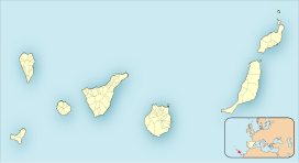 Pico de Malpaso Location in the Canary Islands | |
| Location | El Hierro, Canary Islands |
| Geology | |
| Mountain type | volcano |
| Climbing | |
| Easiest route | hike |
Geography
The summit rises at the centre of the island on the border between Frontera and El Pinar de El Hierro municipalities (Province of Santa Cruz de Tenerife).[2] On the mountain's top, at an elevation of 1,501.762 m above sea level, is located a trig point.[2]
From the mountain one can see the island of La Palma and others islands of Canary archipelago.
Geology
The island of El Hierro is the youngest of the archipelago and is around 3 million years old. Its present shape is derived from the erosion on its volcanic cone.[1]
Environment
Malpaso slopes host woods and heaths with relevant samples of Canary Islands juniper (Juniperus cedrus), some of them said to be more than one thousand years old. The most important animal from a conservationist point of view is El Hierro giant lizard (in Spanish lagarto Salmor), an endangered species of reptile.[1]
See also
- List of European ultra prominent peaks
References
- "Naturaleza, El Hierro, Islas Canarias". el-hierro.costasur. Retrieved 2016-01-01.
- "Reseña de vértice geodésico: Malpaso" (PDF). IGN. Retrieved 2016-01-01.
Bibliography
- Hausen, Hans M. "Rasgos geológicos generales de la Isla del Hierro (Archipiélago Canario)". Anuario de Estudios Atlánticos. 1 (10): 547–594. ISSN 2386-5571.
![]() Media related to Malpaso at Wikimedia Commons
Media related to Malpaso at Wikimedia Commons
На других языках
- [en] Pico de Malpaso
[es] Pico de Malpaso
El Pico de Malpaso es una elevación montañosa ubicada en la isla de El Hierro ―Canarias, España―, siendo su máxima altitud con 1501 msnm.[1][2][3][fr] Pic de Malpaso
Le pic de Malpaso (en espagnol pico de Malpaso) est le point culminant de l'île d'El Hierro, dans les îles Canaries, avec une altitude de 1 502 mètres. Il est situé à la limite des territoires des communes de La Frontera et d'El Pinar de El Hierro.Другой контент может иметь иную лицензию. Перед использованием материалов сайта WikiSort.org внимательно изучите правила лицензирования конкретных элементов наполнения сайта.
WikiSort.org - проект по пересортировке и дополнению контента Википедии