geo.wikisort.org - Mountains
Jezerca Peak (Albanian: Maja Jezercë) is the highest peak in the Dinaric Alps, the fifth highest in Albania and the sixth highest in the Balkans, standing at 2,694 m (8,839 ft) above sea level. It is the 28th most prominent mountain peak in Europe, and is regarded as one of the toughest and most dangerous climbs in the Albanian Alps.[3]
| Maja Jezercë | |
|---|---|
 Maja Jezercë as seen from Maja Trojan | |
| Highest point | |
| Elevation | 2,694 m (8,839 ft)[1] |
| Prominence | 2,036 m (6,680 ft)[2] |
| Isolation | 94 km (58 mi) |
| Listing | Ultra |
| Coordinates | 42°26′33″N 19°48′51″E[2] |
| Naming | |
| English translation | Lake Peak |
| Language of name | Albanian |
| Geography | |
 Maja Jezercë Albania | |
| Location | Shkodër County |
| Parent range | Accursed Mountains, Dinaric Alps |
| Geology | |
| Mountain type | Limestone |
| Climbing | |
| First ascent | 1929 by Sleeman, Elmslie and Ellwood |
| Easiest route | North slope |
 | |
Maja Jezercë is situated within the Accursed Mountains range, which is noted for several small glaciers - among the southernmost glacial masses in Europe[4] after Snezhnika glacier (latitude of 41°46′09″ N)[5][6] and Banski Suhodol Glacier in Pirin mountain in Bulgaria. Apart from certain areas north of the peak, the limestone mountain massif is part of the National Parks of Theth and Valbonë Valley.[7] It can be climbed from the north; most climbers come from Gusinje in Montenegro as well as from Theth.[8]
The summit is 5 km (3 mi) from the border with Montenegro, between the Valleys of Valbonë to the east and the Shala to the west. In part, the whole floor between the valley of Valbonë, Shala, Ropojana and Maja Roshit 2,522 m (8,274 ft) is known as Jezercë, in addition to the peak, Jezercës borders other peaks such as the Maja e Popljuces (2,569 metres (8,428 ft)) and the Maja e Alisë 2,471 m (8,107 ft) in the west, Maja Rrogamit 2,478 m (8,130 ft) to the east, Maja Kolajet 2,498 m (8,196 ft), Maja Malësores 2,490 m (8,169 ft), Maja Bojs 2,461 m (8,074 ft) in the northwest, Maja Kokervhake 2,508 m (8,228 ft) and Maja Etheve 2,393 m (7,851 ft) in the north.
Name
Having been invaded by Serbs from the Ottomans in 1913 and annexed by the Kingdom of Serbia prior to the Treaty of London and the creation of the first Albanian state in that same year, the name is etymologically derived from the Serb word for lake: "Jezero".[9][10][11][12] Jezerski Vrh means "lake peak". The toponym refers to the cirque lakes in the lower part of the Buni i Jezercës on the northern side of the mountain. During the Titoist era it was given the name of Maja e Rinisë (Mountain of Youth), which never stuck.[8]
Topology

Jezerca is a large rocky peak of dolomitic limestone. There is almost no vegetation there. North, east and west of the mountain top is in great cirque from that in the glacial periods when glaciers were more extensive than today. Today the northern cirque is called Buni i Jezercës at a height of 1,980 metres (6,500 ft) and 2,100 metres (6,900 ft) in height around 400 metres (1,300 ft). Because it is located in the wettest region of Europe with around 6 metres (240 in) of rainfall[dubious ] equivalent believed to fall on the western slopes, snowfall is so great that only in dry years do even the less exposed sections melt away.[13]
Gallery
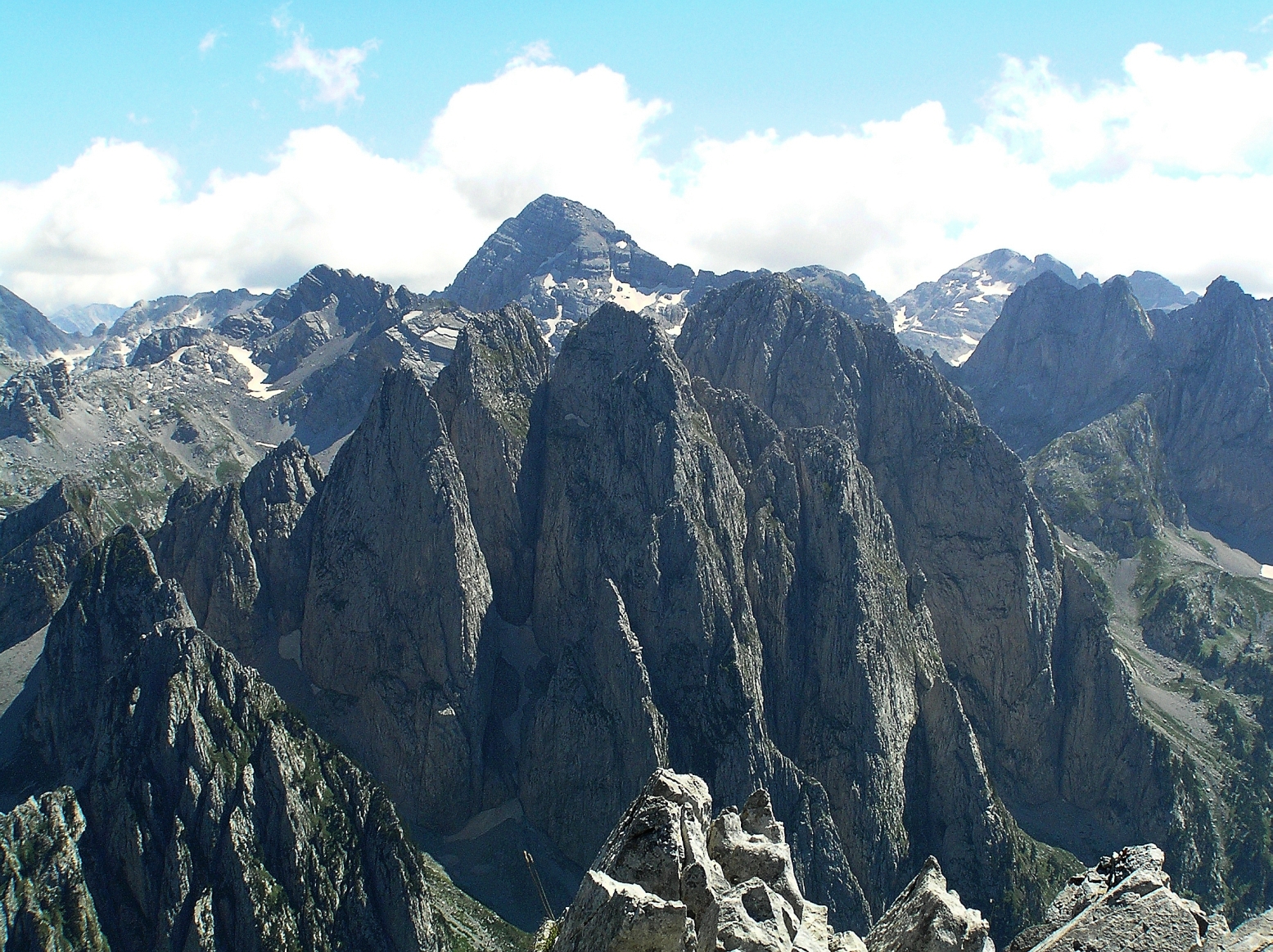
 The summit seen from the top of Karanfili 2,480 m (8,136 ft).
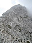 The peak from the north.
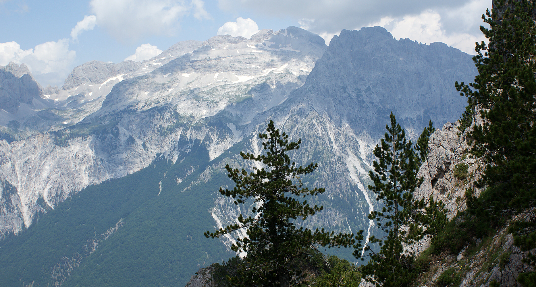
 Jezercë in front, Runica valley and Karanfil
 View from summit Zla Kolata
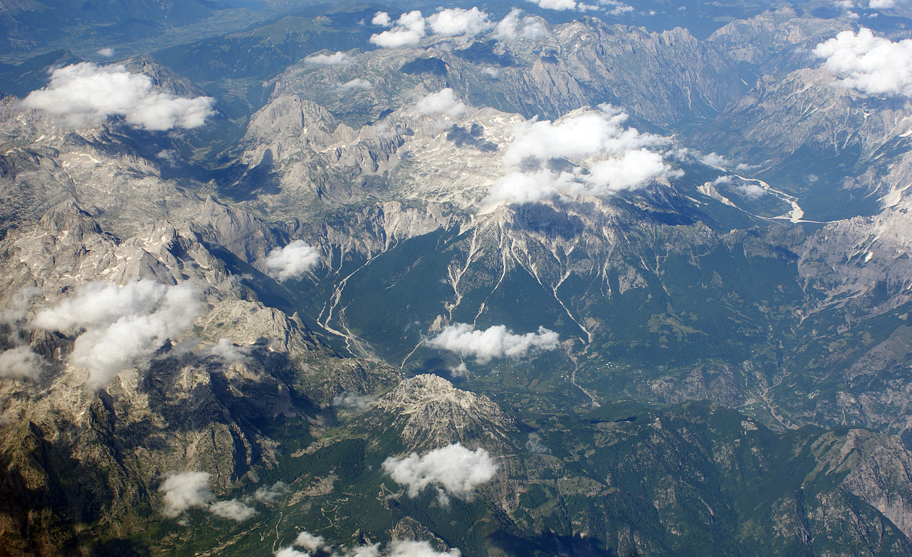
 View from a plane over the Albanian Alps
 The Jezercë massif from above


See also
- Geography of Albania
- List of non-Alpine European Ultras
References
- "Maja e Jezercës". Peakbagger.com. Retrieved 2014-05-24.
- "Europe Ultra-Prominences". Peaklist.org. Retrieved 2014-05-24.
- "EUROPE ULTRA-PROMINENCES 99 Peaks with Prominence of 1,500 metres or greater". peaklist.org.
- "Feasibility Study on Establishing a Transboundary Protected Area Prokletije / Bjeshkët E Nemuna Mountains" (PDF). condesan.org. p. 4. Archived from the original (PDF) on 2017-09-06. Retrieved 2017-07-12.
The number of glacial ponds in this area is rare for the European mainland and can only be compared to the Alps.
- Grunewald, K; Scheithauer, J (2010), "Europe's southernmost glaciers: response and adaptation to climate change" (PDF), Journal of Glaciology, 56 (195): 129–142, doi:10.3189/002214310791190947
- Grunewald, p. 129.
- Florian Baba (Herausgeber): Linja e Gjelbër Shqiptare, Tirana 2008
- "Summipost: Jezerca". Retrieved 2 August 2009.
- Elezi, Mehmet. "Kush i nemi "Bjeshkët e Nemuna"?". Gazeta55. Archived from the original on 2017-09-22. Retrieved 2017-03-10.
- Kolcakovski, Belj (1997). The periglacial zone of high mountains of Serbia and Macedonia and its basic characteristics. Observatoire de Montagne de Moussala.
- Втора југословенска ономастичка конференција. Скопје: Македонска академија на науките и уметностите. 1980.
- Petrović, Mihailo (1941). Đerdapski ribolovi u prošlosti i u sadašnjosti. Zadužbine Mikh. R. Radivojeviča. p. 8.
- Milivojević, Milovan; Menković, Ljubomir; Ćalić, Jelena (2008), "Pleistocene glacial relief of the central part of Mt. Prokletije (Albanian Alps)", Quaternary International, 190: 112–122, doi:10.1016/j.quaint.2008.04.006
External links
- archived page from SummitPost.org
- Bericht von einer Ersteigung mit hilfreichen Informationen
- Balkan Natural Adventure
| ||||||||||||||||||||||||||||||||||||||||||||||||||||||||||||||||||||||||||||||||||||||||||||||||||

На других языках
[de] Jezerca
Die Jezerca (albanisch Maja e Jezercës; serbisch Језерски Врх .mw-parser-output .Latn{font-family:"Akzidenz Grotesk","Arial","Avant Garde Gothic","Calibri","Futura","Geneva","Gill Sans","Helvetica","Lucida Grande","Lucida Sans Unicode","Lucida Grande","Stone Sans","Tahoma","Trebuchet","Univers","Verdana"}Jezerski Vrh) gilt mit 2694 m ü. A. als der höchste vollständig in Albanien gelegene Berg und ist die höchste Erhebung der Nordalbanischen Alpen. Der Korab auf der Grenze zu Nordmazedonien ist der höchste Berg Albaniens.- [en] Maja Jezercë
[es] Cresta del Lago
El topónimo Cresta del Lago es la traducción del nombre de un pico montañoso llamado Maja Jezercë en albanés y Језерски врх (Jezerski vrh) en serbio. Es la cumbre de los montes Prokletije y el punto más alto de los Alpes Dináricos: se eleva a 2.694 m sobre el nivel del mar. Forma parte de la región de Malësi e Madhe, en la Albania septentrional, que limita con Montenegro.[fr] Maja e Jezercës
Le Maja e Jezercës (traduit par « crête du lac » en français ; littéralement traduit du bulgare signifiant « le sommet au-dessus du lac ») est le point culminant de la chaîne montagneuse de Prokletije et des Alpes dinariques. Il est en outre le second sommet d'Albanie, derrière le Grand Korab. Le mont culmine à 2 692 mètres d'altitude et se situe dans la partie nord de l'Albanie.[it] Cresta del Lago
La Cresta del Lago (in albanese Maja e Jezercës, in serbo Jezerski vrh) è la maggior elevazione delle montagne di Prokletije e delle intere Alpi Dinariche, raggiungendo una quota di 2694 m s.l.m. La vetta è amministrativamente parte del distretto albanese settentrionale di Scutari, vicino al confine con il Montenegro. La montagna è costituita da calcare.[ru] Езерца
Езе́рца[2] (Ясерце[3], серб. Језерски врх, Jezerski vrh; алб. Maja Jezercë, «озёрный гребень») — гора на Балканском полуострове, высочайшая вершина хребта Проклетие и всего Динарского нагорья (высота вершины в районе 2691—2694[4] м). Находится на территории северной Албании, на границе областей Шкодер и Тропоя, недалеко от черногорской границы.Другой контент может иметь иную лицензию. Перед использованием материалов сайта WikiSort.org внимательно изучите правила лицензирования конкретных элементов наполнения сайта.
WikiSort.org - проект по пересортировке и дополнению контента Википедии