geo.wikisort.org - Mountains
Koritnik (Albanian: Maja e Koritnikut) is a wooded, limestone mountain, located in northeastern Albania and southwest Kosovo[a] between the cities of Kukës and Prizren.[4] The mountain is entirely surrounded by branches of the White Drin river. The highest point of Koritnik massif, Maja e Pikëllimës reaches an elevation of 2,393 metres (7,851 ft) above the Adriatic. Gryka e Vanavës (English: Vanave Gorge) separates the mountain from Gjallica. The gorge is 3.5 km (2.2 mi) long, 30 m (100 ft) wide, and about 300 m (980 ft) deep.[5]
| Koritnik | |
|---|---|
 Mount Koritnik on the left from Pashtrik | |
| Highest point | |
| Elevation | 2,396 m (7,861 ft)[1] |
| Listing | Ultra |
| Coordinates | 42°5′0″N 20°34′0″E |
| Geography | |
 Koritnik Location on the border of Albania and Kosovo 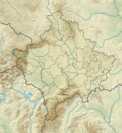 Koritnik Koritnik (Kosovo) | |
| Location | Kukës, Albania Prizren, Kosovo |
| Parent range | Korab Mountains[2] |
| Geology | |
| Age of rock | Triassic[3] |
| Mountain type | Limestone |
 | |
The massif falls within the Balkan mixed forests terrestrial ecoregion of the Palearctic temperate broadleaf and mixed forests biome. The slopes of the mountain meadows are mostly covered with coniferous forests. The Koritnik mountain because of its high pastures contains a population of 60 chamois.
Koritnik falls within the Korab-Koritnik Nature Park, forming the European Green Belt. It has been recognised as an Important Plant Area of international importance by Plantlife.[6]
 |
 |
 |
See also
- Korab-Koritnik Nature Park
- Geography of Albania
- Mountains of Albania
Notes
| a. | ^ The political status of Kosovo is disputed. Having unilaterally declared independence from Serbia in 2008, Kosovo is formally recognised as an independent state by 97 UN member states (with another 15 states recognising it at some point but then withdrawing their recognition), while Serbia continues to claim it as part of its own sovereign territory. |
References
- "TREGUES SIPAS QARQEVE INDICATORS BY PREFECTURES" (PDF). Archived from the original (PDF) on 2011-07-24. Retrieved 2011-01-12.
- "STRATEGJIA TERRITORIALE E NJËSISË VENDORE KUKËS" (PDF). kukesi.gov.al. p. 14.
- Kosovo: Sehenswürdigkeiten und Schönheiten (Dr. Dragan Ćukić ed.). Uros Maksimovic. 31 December 1970. pp. 11–12.
- Quaternary Glaciations - Extent and Chronology: Part I: Europe. Elsevier. 8 June 2004. p. 383. ISBN 9780080540146.
- "Kanioni i Vanave". akzm.gov.al (in Albanian). Archived from the original on 2019-03-07. Retrieved 2017-09-05.
- IUCN, World Wide Fund for Nature, Plantlife. "Important Plant Areas of the south and east Mediterranean region" (PDF). portals.iucn.org. p. 75.
{{cite web}}: CS1 maint: multiple names: authors list (link)
Kosovo articles | |||||||||
|---|---|---|---|---|---|---|---|---|---|
| History |
|  | |||||||
| Geography |
| ||||||||
| Politics |
| ||||||||
| Economy |
| ||||||||
| Society |
| ||||||||
| |||||||||
На других языках
[de] Koritnik (Berg)
Der Koritnik (albanisch auch Koritniku, serbisch-kyrillisch Коритник) ist ein Berg auf der Grenze von Albanien und Kosovo zwischen Kukës und Prizren. Es handelt sich um einen nordwestlichen Ausläufer des Gebirgssystems der Šar Planina am Südufer des Weißen Drin und zum nördlichen Ende des Korabgebirges. In der Maja e Pikëllimës erreicht der Berg mit 2393 Meter seine höchste Erhebung – es ist der zehnthöchste Berg des Kosovo.- [en] Koritnik
Другой контент может иметь иную лицензию. Перед использованием материалов сайта WikiSort.org внимательно изучите правила лицензирования конкретных элементов наполнения сайта.
WikiSort.org - проект по пересортировке и дополнению контента Википедии