geo.wikisort.org - Mountains
Ortler (German pronunciation: [ˈɔrtlɐ]; Italian: Ortles [ˈɔrtles]) is, at 3,905 m (12,812 ft) above sea level, the highest mountain in the Eastern Alps outside the Bernina Range. It is the main peak of the Ortler Range. It is the highest point of the Southern Limestone Alps, of South Tyrol in Italy, of Tyrol overall, and, until 1919, of the Austrian-Hungarian empire. In German the mountain is commonly referred to as "König Ortler" (King Ortler), like in the unofficial hymn of South Tyrol, the Bozner Bergsteigerlied.
| Ortler | |
|---|---|
 The Ortler seen from the North ridge showing the normal route of ascent | |
| Highest point | |
| Elevation | 3,905 m (12,812 ft) |
| Prominence | 1,953 m (6,407 ft)[1] |
| Parent peak | Piz Bernina |
| Isolation | 49 km (30 mi) |
| Listing | Ultra Alpine mountains above 3000 m |
| Coordinates | 46°30′32″N 10°32′42″E |
| Geography | |
 Ortler Location in the Alps | |
| Location | South Tyrol, Italy |
| Parent range | Ortler Alps |
| Climbing | |
| First ascent | 27 September 1804 |
| Easiest route | North ridge from the Payer house |
Geography
The massive mountain is capped by a glacier on the northwest flank and has a long north ridge that ends at the village of Gomagoi and separates the valleys of Trafoi and Sulden. The South ridge leads to the Hochjoch (3527 m) on the main ridge of the Ortler Alps that forms the border of the Province of Sondrio and South Tyrol. Going west on this main ridge are the Thurwieserspitze (3652) and Trafoier Wall (3565 m), while to the Southeast are the Monte Zebrù (3740 m) and the majestic Königspitze (3859 m). From nearby mountains in the northeast the impressive lineup of Königspitze, Zebru and Ortler is known as “das Dreigestirn” (the three heavenly bodies).[2]
First ascent

The Ortler was first climbed by Josef Pichler ("Pseirer-Josele"), a chamois hunter from St. Leonhard in Passeier, and his companions Johann Leitner and Johann Klausner from Zell am Ziller on 27 September 1804. The ascent had been a request of Archduke Johann of Austria, who felt strongly that after the first ascent of the Großglockner (3,798 m) in 1800, the highest mountain in his brother's empire ought to be climbed. The archduke ordered Johannes Nepomuk Gebhard, a "mountain official" and topographer from Salzburg, to climb the mountain with locals. The first five attempts failed and Gebhard was ready to give up, when Pichler responded to the prize money offered for reaching the peak. Pichler and his friends took a difficult, and because of avalanche danger until recently disused, route over the northwest face from Trafoi. (The route was re-opened in 2004.[3])
Upon their return, the men were not believed on their words alone. Gebhard sent Pichler onto the mountain twice more, first in August 1805 with a flag that could be observed with a telescope from the valley, and again in September 1805 with a huge torch. Only after the torch had been seen burning at night was the accomplishment acknowledged. The route Pichler and his men (two brothers named Hell and an unnamed hunter from Langtaufers) took in 1805 was the currently still popular East ridge ("Hintergrat", literally "back-ridge") route. In 1834, at the age of 70, Pichler would make his fifth and final ascent, guiding professor Karl Thurwieser to the top.
Notable other ascents and descents

The first time the Ortler was climbed via the easiest and currently normal route, the North ("Tabaretta") ridge, was more recently, in July 1865, as the approach is rather lengthy. In 1875 a hut was erected 3,029m high on the North ridge, to break up the climb in two steps. It was named the Payer house, after Julius von Payer, who had mapped the Ortler Alps between 1865–1868 and had climbed 50 of its peaks with Johann Pinggera as his guide.
The first ascent of the South ridge from the Hochjoch followed in 1875, two couloirs on the East face (the Minnigerode and Schück couloir) were opened in 1878-79 and the two steep Northeast ridges (Marlet and Rothböck ridge) were conquered in 1889 and 1909, respectively. Members of the Pinggera family were involved in most of these ascents.
The 1,200 m high ice route on the Ortler north face, longest in the Eastern Alps, was first climbed in June 1931 by Hans Ertl and Franz Schmid and the remote Southwest face in 1934. The North face was soloed first in 1963 by Dieter Drescher who had also added some first winter ascents to his name, including a traverse of Königspitze, Monte Zebrù, and Ortler in February 1975. On August 31, 1981, Reinhard Patscheider achieved the amazing feat of climbing the north faces of Königspitze, Zebrù and Ortler all in one day.
Extreme skiing started early in the Ortler mountains, with Heini Holzer descending the Schück couloir in 1971 and the Minnigerode couloir in 1975. On June 24, 1983, Andreas Orgler skied down the North face.
First World War

The Ortler Alps were one of the main battlegrounds between Austrian and Italian troops in the First World War, being on the border of Italy and the Austrian Empire. The advantage of owning the highest point was very important. The Austrian troops had quickly occupied the highest peaks, and the Italian troops' main goal, for four years, was to dislodge them from the positions. In the mid-1990s, a mountain guide discovered two guns that had been stationed very near the top of the Ortler but had been hidden by snow ever since. The discovery was kept secret until the 200th anniversary of the first ascent in 2004. The cannons are now on display in a museum in Trafoi.
See also
- List of Italian regions by highest point
- List of mountains of the Alps above 3000 m
References
- Retrieved from the Swisstopo topographic maps. The key col is Passo di Fraéle (1,952 m).
- "The famous triangle : Photos, Diagrams & Topos". SummitPost. Retrieved 13 April 2013.
- "Ortler 3905m Meranerweg Pleisshorngrat von der Berglhütte Trafoi". Seilschaft.it. Retrieved 13 April 2013.
Sources and external links
- Sabine Holzknecht, Sulden und der Ortler, ″Alpin″ June 2004 (German article at the occasion of the 200 year anniversary of the first ascent)
- German article on the first ascent
- First World War pictures of the Ortler frontline
- View from the Ortler to the southeast
- Panoramic view from the northwest of the Ortler in winter
- Coolidge, William Augustus Brevoort (1911). . Encyclopædia Britannica. Vol. 20 (11th ed.). p. 341.
- . New International Encyclopedia. 1905.
Gallery
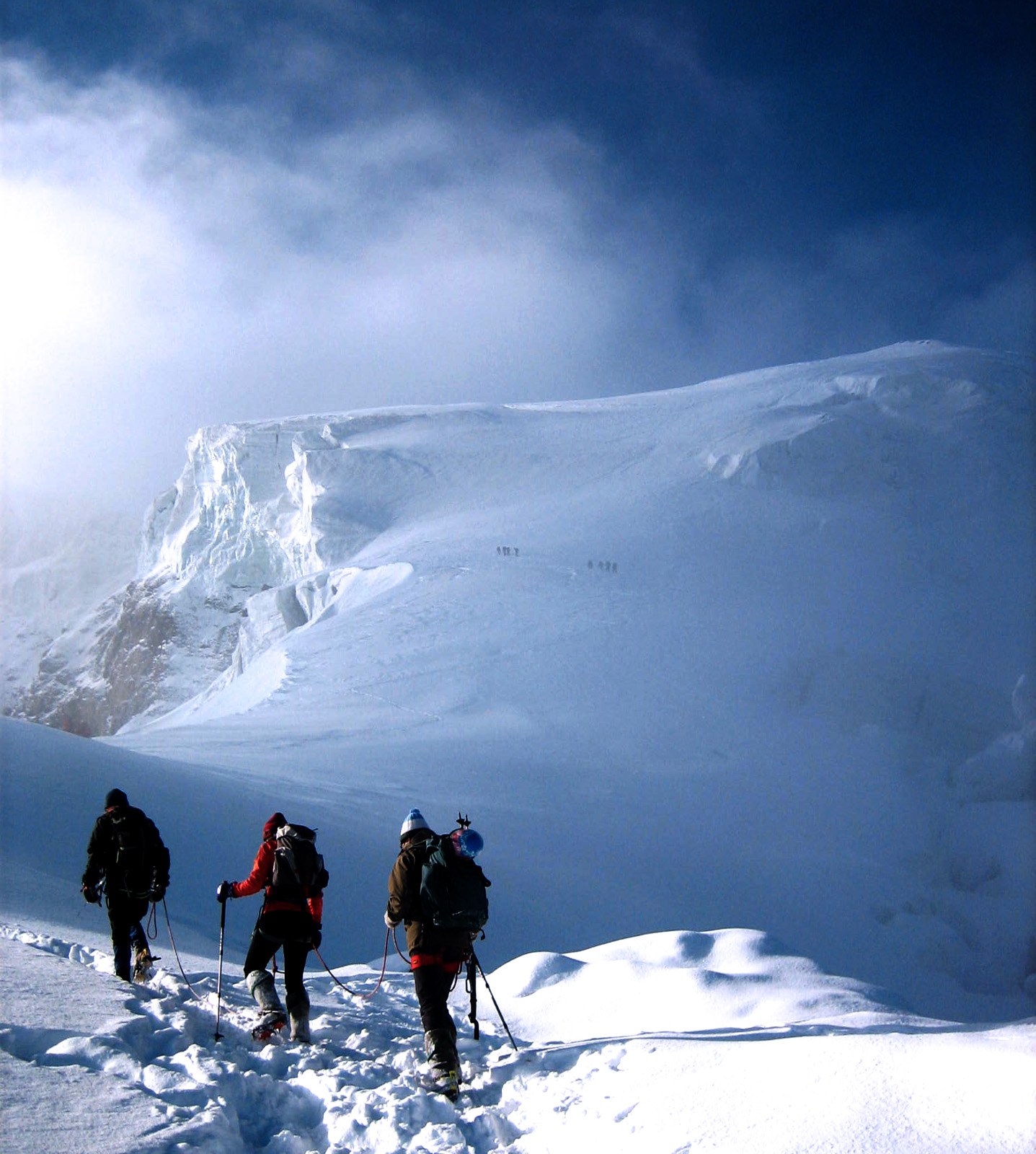
 Ortler ascent
 Königspitze, Zebrù and Ortler from the south-east
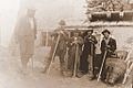 Mountaineers from Vienna at the Payer house on their way to climb the Ortler in July 1891.


| Authority control: National libraries |
|---|
На других языках
[de] Ortler
Der Ortler (italienisch Ortles) ist mit einer Höhe von 3905 m s.l.m., nach österreichischer Vermessung 3899 m ü. A.,[1] die höchste Erhebung der italienischen Provinz Südtirol und der Region Tirol. Der größtenteils aus Hauptdolomit aufgebaute, stark vergletscherte Berg ist der Hauptgipfel der Ortler-Alpen, einer Gebirgsgruppe der Südlichen Ostalpen. Seine Erstbesteigung auf Befehl von Erzherzog Johann von Österreich im Jahre 1804 zählt zu den bedeutendsten alpinistischen Ereignissen jener Zeit. Bis zur Abtrennung Südtirols von Österreich 1919 war der Ortler der höchste Berg Österreich-Ungarns. Während des Ersten Weltkriegs richtete die k.u.k. Armee auf dem Berg die mit mehreren Geschützen ausgestattete höchstgelegene Stellung dieses Krieges ein. Heute gilt der Ortler unter Bergsteigern als eines der bedeutendsten Gipfelziele der Ostalpen. Alle Routen zum Gipfel sind anspruchsvolle Hochtouren, von denen der Normalweg von Norden die am meisten begangene ist. Alpinistisch bedeutend ist auch die Nordwand des Berges, die als größte Eiswand der Ostalpen gilt, in der jedoch immer mehr Fels zutage tritt.- [en] Ortler
[es] Ortles
El Ortles (en italiano; en alemán se llama Ortler) es, con 3.905 msnm, la montaña más alta de los Alpes orientales fuera de la cordillera Bernina. Es el pico principal de la sierra Ortler. Es el punto más alto de los Alpes calizos meridionales, de la región italiana de Trentino-Alto Adigio, de todo el Tirol y, hasta 1919, del Imperio austrohúngaro. En alemán la montaña es habitualmente referida como el "König Ortler" (Rey Ortler), como en el himno no oficial del Tirol meridional, el Südtirollied.[fr] Ortles
L'Ortles en italien ou Ortler en allemand est un sommet des Alpes, à 3 905 m, point culminant du massif de l'Ortles, en Italie (Trentin-Haut-Adige). C'était également, jusqu'en 1919, le point le plus élevé de l'Autriche-Hongrie. Pendant la Première Guerre mondiale, l'armée austro-hongroise installe la position la plus élevée de la guerre sur la montagne, équipée de plusieurs pièces d'artillerie.[it] Ortles
L'Ortles (Ortler in tedesco, Òrtles in solandro, Ortèl[1] in lombardo), è una montagna delle Alpi Retiche meridionali. Con un'altitudine di 3.905 m s.l.m., costituisce la cima più elevata del gruppo Ortles-Cevedale e la vetta più alta della regione Trentino-Alto Adige.[ru] Ортлес
О́ртлес[2][3] (итал. Ortles, нем. Ortler) — гора в одноимённом горном массиве в Италии.Другой контент может иметь иную лицензию. Перед использованием материалов сайта WikiSort.org внимательно изучите правила лицензирования конкретных элементов наполнения сайта.
WikiSort.org - проект по пересортировке и дополнению контента Википедии