geo.wikisort.org - Mountains
Coma Pedrosa (Catalan pronunciation: [ˈkomə pəˈðɾozə]; 2,943 m or 9,656 ft) is the highest mountain in the principality of Andorra.[2] It is popular with mountain climbers, its ascent being technically straightforward, although strenuous. From Arinsal to Camp de Refuge (650 m climb) is considered moderate meanwhile the last 862 m is considered to be difficult. Several mountain lakes and tarns are found on the slopes, notably Estanys de Baiau, which lies on the western slopes, across the Spanish border.
| Coma Pedrosa | |
|---|---|
 Coma Pedrosa in October 2006 | |
| Highest point | |
| Elevation | 2,943 m (9,656 ft)[1] |
| Prominence | 434 m (1,424 ft)[1] |
| Listing | Country high point |
| Coordinates | 42°35′26″N 1°26′41.21″E |
| Geography | |
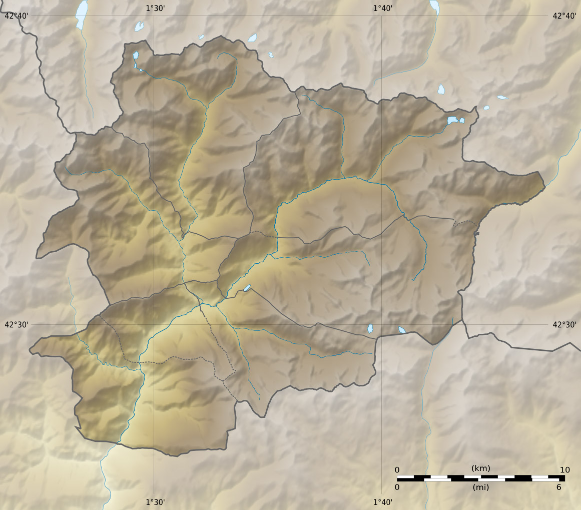 Coma Pedrosa Location of Coma Pedrosa in Andorra (near the French border) | |
| Location | Parish of La Massana, Andorra |
| Parent range | Pyrenees |
The nearest town is Arinsal, La Massana. Historically, the mountain provided ample security from invasions into Andorra.[3] Nowadays, the mountain is part of the Parc Natural Comunal de les Valls del Comapedrosa national park.
Geography

Coma Pedrosa, shaped like a pyramid,[4] is situated at the northwestern border with France and Spain. It has in the past acted as a barrier between Andorra and France. The mountainous terrain of Andorra, a landlocked country, contains 65 peaks that rise to an elevation of greater than 2,000 m (6,562 ft), and of the 65 peaks, Coma Pedrosa has the highest one at 2,943 m (9,656 ft).[5]
Its recent exposure to tourism has attracted millions to enjoy the unique scenic beauty of its hills and valleys.[5] The higher reaches of the mountain are covered with forests while the lower reaches have some arable lands. The mountain gets fully covered with snow during the winter months which provides opportunities for skiing and mountaineering, ice climbing and scrambling. During the summer season, the mountain provides many easy routes for trekking through the Arinsal valley covering neighbouring areas of Vall Ferrera in Spain after crossing the mountain pass Baiau.[6][7]
The town of Arinsal is in the narrow valley below the mountain. The Coma Pedrosa's Estany Negre, the Torta Coma, Coma's Gaspedrosa, the Puestode las Erolas, Cape dels Croes, and Puig dels Emborts in the Sierra del Aguiro surround the parish of La Massana.[8]
The local area is known as Comapedrosa. The mountain is in a natural park called Parque Natural Comunal de los Valles del Comapedrosa (Communal natural park of the Comapedrosa valleys).[citation needed]
Vegetation
The forest vegetation on the mountain and in its valleys are of pines, birch and firs. There are many glacier lakes formed within the valley created by the mountains and also vast meadows. Consequent to the popularity of skiing in and around this mountain valley near Arinsal and close to the Andorra la Vella and other valleys in Andorra, the pristine ambiance of the valley has been inundated with tourist resorts, hotels, restaurants and business establishments catering to tourists. This has created an awareness to preserve virgin mountains and forests, and put restrictions on further proliferation of ski resorts and urban activities by introducing a national network of parks as preserves.[7]
Climate
| Climate data for Coma Pedrosa (1971–2000) | |||||||||||||
|---|---|---|---|---|---|---|---|---|---|---|---|---|---|
| Month | Jan | Feb | Mar | Apr | May | Jun | Jul | Aug | Sep | Oct | Nov | Dec | Year |
| Average high °C (°F) | 1.2 (34.2) |
1.8 (35.2) |
3.5 (38.3) |
4.3 (39.7) |
8.6 (47.5) |
13.0 (55.4) |
18.1 (64.6) |
18.1 (64.6) |
14.4 (57.9) |
9.0 (48.2) |
5.3 (41.5) |
2.8 (37.0) |
5.4 (41.7) |
| Daily mean °C (°F) | −2.0 (28.4) |
−1.7 (28.9) |
−0.2 (31.6) |
0.4 (32.7) |
4.0 (39.2) |
7.6 (45.7) |
11.6 (52.9) |
12.0 (53.6) |
9.1 (48.4) |
4.9 (40.8) |
1.2 (34.2) |
−0.4 (31.3) |
1.7 (35.1) |
| Average low °C (°F) | −4.7 (23.5) |
−5.0 (23.0) |
−4.0 (24.8) |
−3.5 (25.7) |
−0.6 (30.9) |
2.3 (36.1) |
5.2 (41.4) |
5.2 (41.4) |
2.9 (37.2) |
0.1 (32.2) |
−2.5 (27.5) |
−4.0 (24.8) |
−1.7 (28.9) |
| Average precipitation mm (inches) | 86.3 (3.40) |
65.3 (2.57) |
70.2 (2.76) |
117.5 (4.63) |
134.8 (5.31) |
133.2 (5.24) |
88.6 (3.49) |
112.3 (4.42) |
112.1 (4.41) |
114.8 (4.52) |
113.9 (4.48) |
106.5 (4.19) |
1,255.5 (49.42) |
| Source: ACDA[9] | |||||||||||||
Tourism


The trek or the mountain climb starts from Arinsal, which is considered an easy route, from the picnic area at the base of the Ribal Warefall at 1,580 metres (5,180 ft). It takes about 4 to 41⁄2 hours to reach the highest point of Pic de Coma Pedrosa. The first part of the climb, taking just under half an hour, is along a wide, 800 metres (2,600 ft) long foot track past a signpost to Aigues Juntes, which is the confluence of the Coma Pedrosa River and Pla de l'Estany River rising from the mountains and arriving at Grau. The ascent continues along a steep hill slope of the Coma Pedrosa River valley and arrives at the Coma Pedrosa refuge or camping site at an elevation 2,272 metres (7,454 ft), which is located near the l'Estany de les Truites (Trout Lake). A further hour's walk leads to the Estany Negre (Black Lake), named on account of its colour. The last stretch is for about one hour from Estany Negre to the highest peak in Andorra at 2,943 metres (9,656 ft) elevation, and this trek, passing through rocky terrain, is difficult. The return trek follows the same route. A diversion through Malhiverns pass instead of Estany Negre is more enjoyable.[10][11][12]
In the Arinsal valley below the Coma Pedrosa, winter season offers skiing and snowboarding. The first ski lifts were installed in Arinsal in 1973. It is 10 kilometres (6.2 mi) northwest of Andorra la Vella and 5 kilometres (3.1 mi) northwest of Massana, providing a pleasant après-ski sight.[13][14] At an elevation of 2,260 metres (7,410 ft) lies Refugi de Coma Pedrosa, a mountain hut.[15] It was inaugurated in 1992.[16]
References
- http://www.peakbagger.com/peak.aspx?pid=9815 [bare URL]
- Simonis, Damien (October 2003). Catalunya & the Costa Brava. Lonely Planet. p. 247. ISBN 978-1-74059-381-6.
- Augustin, Byron (January 2009). Andorra. Marshall Cavendish. pp. 8–. ISBN 978-0-7614-3122-0. Retrieved 22 December 2010.
- Balari Y Jovany, Jose (2009). Orígens històrics de Catalunya (in Catalan). Editorial MAXTOR. p. 60. ISBN 978-84-9761-677-5. Retrieved 22 December 2010.
- Augustin, Byron (2009). Andorra. p. 8. ISBN 9780761431220. Retrieved 22 December 2010.
- Eur (2002). Western Europe 2003. Europa. p. 41. ISBN 978-1-85743-152-0.
- "Coma Pedrosa". Summitpost.org. Retrieved 22 December 2010.
- Bladé, Jean-François (1875). Études géographiques sur la vallée d'Andorre (in French). J. Baer et cie. p. 37.
- "Comapedrosa averages (1971–2000)" (in Spanish). Atles Climàtic Digital d'Andorra. Archived from the original on 30 August 2017. Retrieved 19 June 2016.
- Alf Robertson; Jane Meadowcroft (November 2005). The Mountains of Andorra: Walks, Scrambles, Via Ferratas, Treks. Cicerone Press Limited. p. 46. ISBN 978-1-85284-424-0.
- Kev Reynolds (October 2007). Walks and Climbs in the Pyrenees. Cicerone Press Limited. pp. 398–400. ISBN 978-1-85284-470-7.
- "The "Coma Pedrosa" 2942 m:Tackle the highest mountain in Andorra". Hola-andorra.com. Archived from the original on 4 December 2012. Retrieved 22 December 2010.
- Damien Simonis (15 March 2007). Spain. Lonely Planet. pp. 404–. ISBN 978-1-74104-554-3. Retrieved 22 December 2010.
- Loretta Chilcoat; Reuben Acciano (2005). Western Europe. Lonely Planet. p. 30. ISBN 978-1-74059-927-6.
- Dubin, Marc (2004). The rough guide to the Pyrenees. Rough Guides. p. 218. ISBN 978-1-84353-196-8.
- "Refugios". Andorra.com. Archived from the original on 12 December 2010. Retrieved 22 December 2010.
External links
На других языках
[de] Comapedrosa
Der Comapedrosa (auch Coma Pedrosa) ist ein Gebirgszug in den Pyrenäen im Westen von Andorra hinter dem Tal von Arinsal. Sein höchster Gipfel, der Alt de Comapedrosa ist mit 2944 msnm der höchste Berg Andorras.- [en] Coma Pedrosa
[es] Comapedrosa
El Comapedrosa, escrito también Coma Pedrosa, es el pico más alto del Principado de Andorra.[2] Está localizado en el noroeste de este micro-Estado y tiene una altitud de 2942 msnm. El pueblo más cercano es Arinsal, en la parroquia de La Massana.[fr] Pic de Coma Pedrosa
Le pic de Coma Pedrosa est la montagne des Pyrénées la plus haute d'Andorre, culminant à 2 943 mètres. Elle appartient à la paroisse de La Massana et se trouve près de la frontière espagnole. La ville la plus proche est Arinsal.[it] Coma Pedrosa
Coma Pedrosa è una montagna di Andorra che, con i suoi 2942 m s.l.m., costituisce il punto più elevato del Principato pirenaico.[ru] Кома-Педроса
Кома-Педроса (кат. Coma Pedrosa) — гора в андоррских Пиренеях, в паррокии Ла-Массана. Горная вершина расположена в северо-западной части страны. Высота Кома-Педроса составляет 2943 метра над уровнем моря, что делает её самой высокой точкой Андорры. Ближайший к горе населённый пункт — Аринсаль.Другой контент может иметь иную лицензию. Перед использованием материалов сайта WikiSort.org внимательно изучите правила лицензирования конкретных элементов наполнения сайта.
WikiSort.org - проект по пересортировке и дополнению контента Википедии