geo.wikisort.org - Mountains
Mount Scenery is a active volcano in the Caribbean Netherlands. Its lava dome forms the summit of the Saba island stratovolcano. At an elevation of 887 m (2,910 ft),[1] it is the highest point in both the Kingdom of the Netherlands, and, since the dissolution of the Netherlands Antilles on 10 October 2010, the highest point in the Netherlands proper.
| Mount Scenery | |
|---|---|
 Saba with Mount Scenery's peak in the clouds | |
| Highest point | |
| Elevation | 887 m (2,910 ft) |
| Prominence | 887 m (2,910 ft) |
| Listing | Country high point |
| Coordinates | 17°38′06″N 63°14′21″W |
| Geography | |
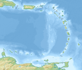 Mount Scenery location in the Lesser Antilles | |
| Location | Saba, Caribbean Netherlands |
| Geology | |
| Mountain type | Stratovolcano with lava dome |
| Volcanic arc | Lesser Antilles Volcanic Arc |
| Last eruption | 1640 |
The Saba volcano is potentially dangerous; the latest eruption was in or around the year 1640 and included explosions and pyroclastic flows.
On 2 September 2019, Mt. Scenery Nature Park was elevated to the status of national park.[2]
It has a hiking trail to its summit, which is one of Saba's biggest tourist attractions. Along the way up the mountain can be found all of the climate zones on Saba, including a cloud forest at the summit.
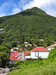 The peak as seen from Windwardside
 Mount Scenery in the clouds
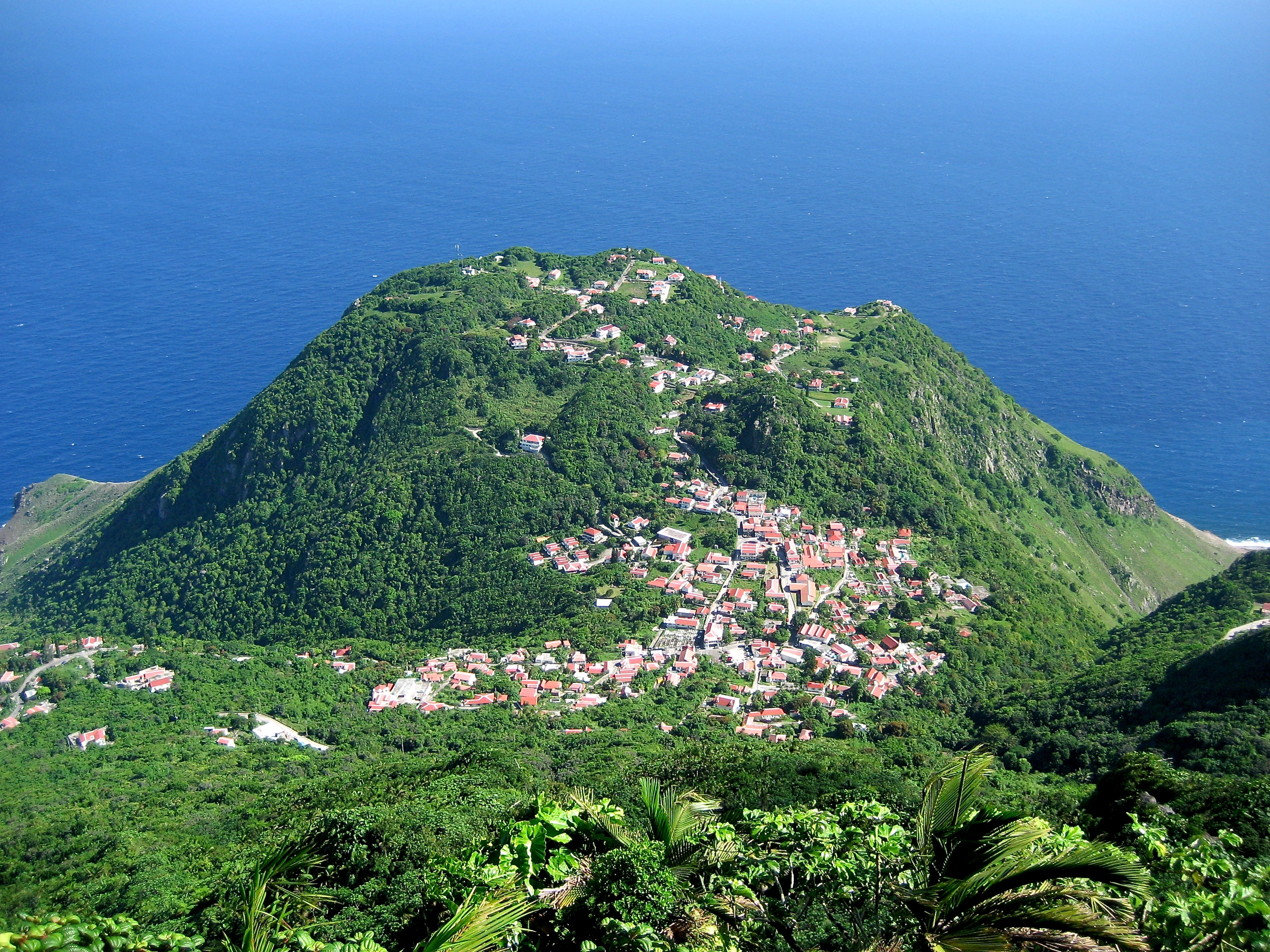
 View from Mount Scenery with Windwardside in the front


See also
- List of volcanoes in the Netherlands
- Vaalserberg - the highest point in the Netherlands in Europe
References
- "Saba". Global Volcanism Program. Smithsonian Institution. Retrieved 30 August 2020.
- "National park status for Mount Scenery Nature Park - Saba News". www.saba-news.com. Archived from the original on 2019-09-07.
| Populated places | |||
|---|---|---|---|
| Other locations |
| ||
| Transport |
| ||
| Education |
| ||
| Heraldry |
| ||
| Culture |
| ||
This Saba location article is a stub. You can help Wikipedia by expanding it. |
На других языках
[de] Mount Scenery
Der Mount Scenery auf der karibischen Insel Saba ist die höchste Erhebung sowohl der Niederlande als auch des Königreichs der Niederlande. Der Stratovulkan erreicht eine Höhe von 877 (nach anderen Quellen 887) Metern und überragt damit den Vaalserberg, den höchsten Punkt der Niederlande auf dem europäischen Festland, um fast 555 Meter. Seit der Auflösung der Niederländischen Antillen am 10. Oktober 2010 und der Eingliederung von Saba als eine „Besondere Gemeinde“ in die Niederlande[1] gilt der Mount Scenery auch als höchster Berg der Niederlande.- [en] Mount Scenery
[fr] Mont Scenery
Le mont Scenery, en anglais Mount Scenery, est un dôme de lave situé sur Saba, une île des Antilles et commune des Pays-Bas à statut particulier.[it] Monte Scenery
Il Monte Scenery è uno stratovulcano quiescente dei Caraibi olandesi. Il suo duomo di lava forma la sommità dell'isola vulcanica di Saba. Con i suoi 887 metri sul livello del mare,[1] è, dal 10 ottobre 2010, data di dissoluzione delle Antille olandesi ed incorporamento dell'isola di Saba nel territorio dei Paesi Bassi, il punto più alto del Regno dei Paesi Bassi stessi.Другой контент может иметь иную лицензию. Перед использованием материалов сайта WikiSort.org внимательно изучите правила лицензирования конкретных элементов наполнения сайта.
WikiSort.org - проект по пересортировке и дополнению контента Википедии