geo.wikisort.org - Mountains
The Vaalserberg (Dutch pronunciation: [ˈvaːlsərˌbɛr(ə)x], Ripuarian: Volserberg [ˈvɔlsəʀˌbæʀ˦(ə)ç])[tone?] is a hill with a height of 322.4 metres (1,058 ft)[1] above NAP and is the highest point in the European part of the Netherlands, also known as "Dutch Mountains". The Vaalserberg is located in the province of Limburg, at the south-easternmost edge of the country, near the town of Vaals (after which it is named).
This article needs additional citations for verification. (November 2010) |
| Vaalserberg | |
|---|---|
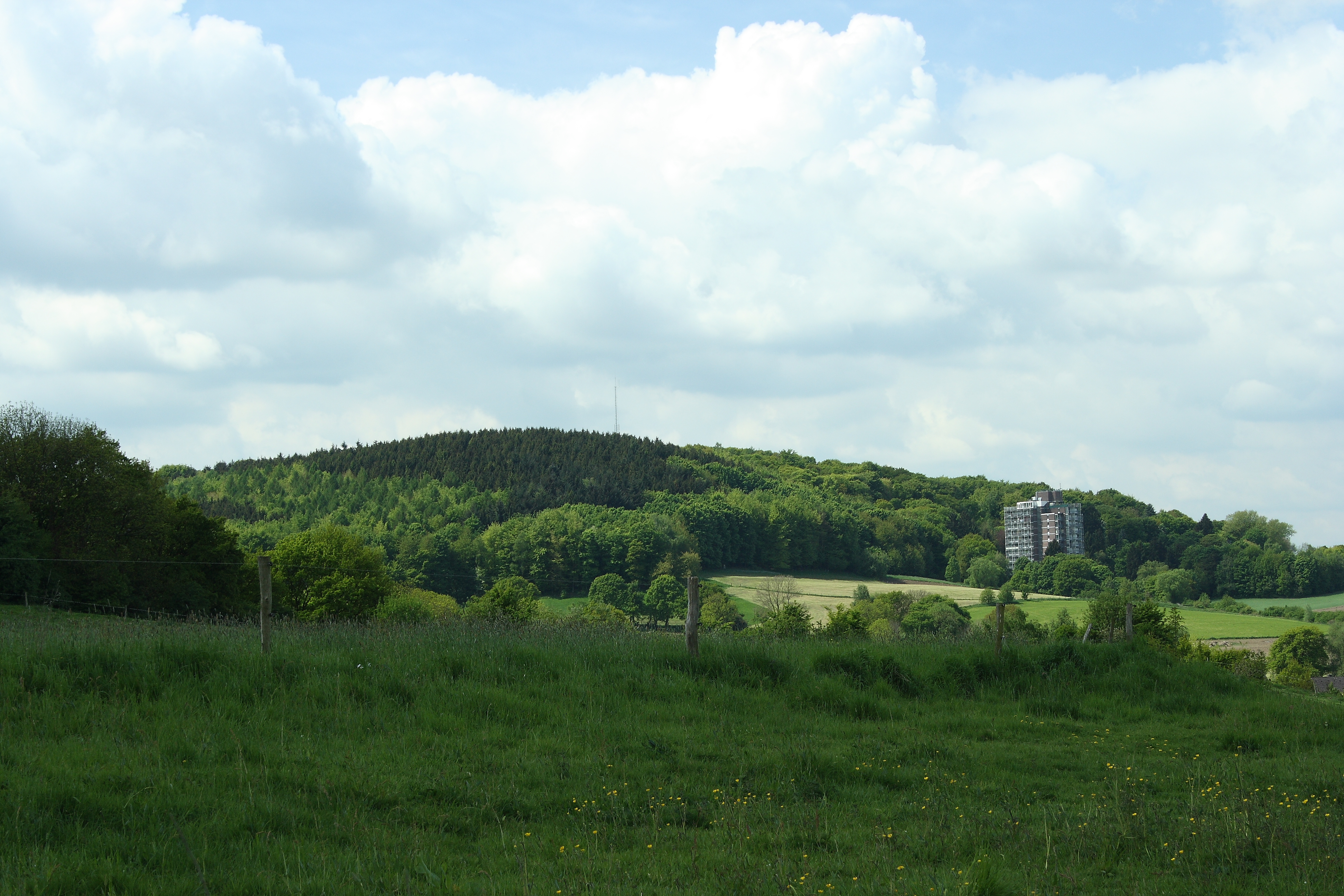 The Vaalserberg seen from Aachen | |
| Highest point | |
| Elevation | 322.4 m (1,058 ft)NAP |
| Coordinates | 50°45′17″N 6°01′15″E |
| Naming | |
| English translation | Vaals' Mountain |
| Language of name | English |
| Geography | |
 Vaalserberg Location in the Netherlands 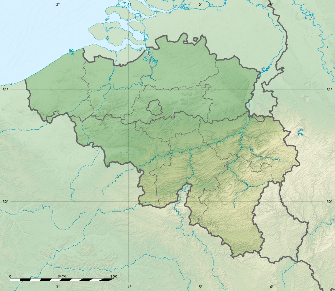 Vaalserberg Location in Belgium  Vaalserberg Location in North Rhine-Westphalia (Germany) | |
| Location | Limburg, Netherlands |
Mount Scenery on the island of Saba, which is in the Caribbean part of the Netherlands, replaced Vaalserberg as the highest point in the Netherlands, following the dissolution of the Netherlands Antilles in 2010.
Three-country point


The Vaalserberg is also the location of the tripoint between Germany, Belgium and the Netherlands and so its summit is called the Drielandenpunt ("three country point") in Dutch, Dreiländereck ("three country corner") in German and Trois Frontières ("three borders") in French.
On the Belgian side, the tripoint borders the region of Wallonia, including both the regular French-speaking area and the smaller German-speaking area. The German side falls within the city limits of Aachen in the state of North Rhine-Westphalia. Between 1830 and 1919, the summit was a quadripoint, also bordering Neutral Moresnet, which is now part of Belgium's German-speaking area.

Legend:


The current Belgian-German-border is not the same as the former eastern border of Moresnet with Prussia but is a little more to the east. Therefore, five different borders came together at this point but never more than four at one time, except possibly between 1917 and 1920, when the border situation was unclear and disputed.
The border intersection has made the Vaalserberg a well-known tourist attraction in the Netherlands, with a 50 metres (160 ft) tower on the Belgian side (Dutch: Boudewijntoren; French: Tour Baudouin; German: Balduin-Turm), opened in 1994 to replace the previous 33 metres (108 ft) tower, built in 1970. It offers a grand panorama of the surrounding landscape.
140 metres (460 ft) south of the point, a railway crosses the German-Belgian border in the Gemmenicher Tunnel. It is the freight-only railway between Tongeren and Aachen.
Four-borders road
The road leading up to this point on the Dutch side is called the Viergrenzenweg ("four borders way"), probably because of the former territory of Neutral Moresnet.The names of the roads in Belgium (Route des Trois Bornes) and Germany (Dreiländerweg) refer to only three.[2]
Along the road on the Dutch side is the 35 metres (115 ft) Wilhelminatoren observation tower, with a restaurant and forest trails. The present tower officially opened on 7 October 2011 and features a lift and a glass floor. The first tower at the site was built in 1905 during the reign of its namesake, Queen Wilhelmina of the Netherlands, and was demolished in 1945. The second 20 metres (66 ft) tower opened on 11 August 1951 and was demolished over the winter of 2010–2011 because of its poor condition and high maintenance requirements.[citation needed]
Road cycling
The Vaalserberg is often used in the Amstel Gold Race and is climbed halfway through the race. The climb is named in the roadbook of the Gold Race as Drielandenpunt and is followed by the Gemmenich climb.
See also
- List of mountains and hills in North Rhine-Westphalia
References
- (in Dutch) J.A. te Pas, Nederland van laag tot hoog, NGT Geodesia 1987 nr. 7/8 pp. 273-275
- See Google Maps showing streetnames
'Tim Travel': Holland's highest mountain (& the strange story of Neutral-Moresnet) (YouTube)
На других языках
[de] Vaalserberg
Der Vaalserberg ist mit 322,4 m ü. NHN (Deutschland), 322,4 m NAP (Niederlande), bzw. mit 324,73 m O.P. (Belgien) die höchste natürliche Erhebung des europäischen Teils der Niederlande.- [en] Vaalserberg
[es] Vaalserberg
El Vaalserberg ("Monte de Vaals") es una colina de 322,4 metros de altura, el punto más alto de Países Bajos en el continente europeo; el punto más alto del reino es el monte Scenery, en la isla de Saba, con 887 metros de altura. Se encuentra en la provincia de Limburgo, en el extremo sureste del país, en el municipio de Vaals, cerca de la ciudad homónima, a unos tres kilómetros al oeste de Aquisgrán.[fr] Vaalserberg
Le Vaalserberg (en néerlandais, « mont de Vaals ») est une colline, point le plus haut des Pays-Bas, et le tripoint frontalier entre ce pays, la Belgique et l'Allemagne. Son altitude est de 322,4 m pour les Pays-Bas, utilisant le niveau Niveau normal d'Amsterdam (NAP). Le référent altimétrique variant selon les pays, ce même point frontière est situé à la même altitude en Allemagne utilisant le niveau Normalnull (NN), mais à 324,73 m en Belgique utilisant le Deuxième nivellement général (DNG). Ce tripoint étant le seul des Pays-Bas, il est souvent appelé Drielandenpunt, « point de trois pays », en néerlandais.[ru] Валсерберг
Валсерберг (нидерл. Vaalserberg) — высшая точка Нидерландов.Другой контент может иметь иную лицензию. Перед использованием материалов сайта WikiSort.org внимательно изучите правила лицензирования конкретных элементов наполнения сайта.
WikiSort.org - проект по пересортировке и дополнению контента Википедии