geo.wikisort.org - Mountains
Velika Rudoka (Macedonian and Serbian Cyrillic: Велика Рудока; Albanian: Maja e Njeriut, Rudoka e Madhe) is the highest peak of the Rudoka Mountain, situated in the Šar Mountains range, exactly on the border between Kosovo[a] and North Macedonia.[6] With the altitude of 2,660 metres (8,727 feet),[1][2] it is the highest mountain of Kosovo and also the highest mountain of Serbia according to the view held by the government of Serbia. In some older sources, the altitude was stated to be 2,658 metres,[7][5][8] but newer measurements showed that the true altitude is 2 metres higher.[3]
| Velika Rudoka | |
|---|---|
| Maja e Njeriut Rudoka e Madhe | |
 | |
| Highest point | |
| Elevation | 2,660 m (8,730 ft)[1][2][3] |
| Prominence | 230 m (750 ft)[4] |
| Isolation | 7.42 km (4.61 mi) → Titov Vrv[4] |
| Listing | Country high point |
| Coordinates | 41°55′6″N 20°46′35″E[4][5] |
| Geography | |
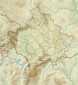 Velika Rudoka Location  Velika Rudoka Velika Rudoka (North Macedonia)  Velika Rudoka Velika Rudoka (Serbia)  Velika Rudoka Velika Rudoka (Europe) | |
| Location | Kosovo |
| Parent range | Šar Mountains |
The Rudoka Mountain is situated between Šar Planina and Vrace, southwest of Tetovo. The mountain range lies in a southwest to northeasterly direction, neighbouring Borislavec. The eastern slopes are very steep. The western slopes lightly descend into Šar Planina. Few waters are present on the mountain and there are few valleys. Two lakes are on Rudoka: Crno Jezero (Black Lake) and Belo Jezero (White Lake). The Mazdrača, a stream which flows into the Vardar, has its source in Crno Jezero. [9]
It is a common misconception that the highest mountain in Kosovo is Gjeravica at 2,656 m (8,714 ft). This was stated even in the 2020 Statistical Yearbook of Serbia,[10] and some Serbian schoolbooks.[3] The 2021 edition of the Statistical Yearbook of Serbia corrected the info,[1] naming Velika Rudoka the highest peak, as did the 2021 edition of the Geography schoolbook for Serbian elementary schools.[2] The 2021 edition of the Statistical Yearbook of Kosovo still states that Gjeravica is the highest mountain.[11]
It has been known that Velika Rudoka is the higher of the two mountains since at least 1972, when the Topographical Map of Yugoslavia was published. According to Sava Stanković, PhD, the misconception started because of unclear boundaries between the Socialist Republic of Macedonia and the Socialist Republic of Serbia. The border was conclusively determined only after the breakup of Yugoslavia by a treaty[12] between the Federal Republic of Yugoslavia and the Republic of Macedonia signed in Skopje on 23 February 2001.[3][13]
Notes
| a. | ^ The political status of Kosovo is disputed. Having unilaterally declared independence from Serbia in 2008, Kosovo is formally recognised as an independent state by 101 UN member states (with another 13 states recognising it at some point but then withdrawing their recognition) and 92 states not recognizing it, while Serbia continues to claim it as part of its own sovereign territory. |
References
- "Статистички годишњак Републике Србије, 2021". Statistical Office of the Republic of Serbia. 20 October 2021. p. 15. Retrieved 1 January 2022.
- Bubalo Živković, Milka (2021). Географија за 8. разред основне школе. Belgrade: Завод за уџбенике. p. 28. ISBN 978-86-17-20527-8.
- Vojinović, Miloš (24 June 2021). "Setiti se Šar planine: Najviši vrh Srbije nije onaj o kome se uči u školi". Radio Televizija Srbije. Archived from the original on 15 October 2021. Retrieved 26 December 2021.
- "Velika Rudoka". Peakbagger.com. Archived from the original on 12 January 2021. Retrieved 12 January 2021.
- "Great Rudoka, 2658m". Summit Post. 28 October 2018. Archived from the original on 28 October 2018. Retrieved 11 January 2021.
- From the Border Treaty signed between FR Yugoslavia and R Macedonia in 2001: [...] гранична линија се протеже општим правцем према североистоку, правом линијом, до врха на гребену Рудока, на око 80 m источно од ТТ к. 2629, наставља гребеном преко к. 2630 до ТТ к. 2658, где мења општи правац [...]
- "Topografska karta Gostivar 730-2-1 Titov Vrv". Topografska Karta JNA 1:25000. Vojnogeografski institut. 1973. Archived from the original on 11 December 2021. Retrieved 11 December 2021.
- "(Foto) Upoznajte Srbiju: Otkrivamo nedoumice, koji je najviši vrh naše zemlje?". NS Uživo. 27 July 2020. Archived from the original on 12 January 2021. Retrieved 12 January 2021.
- Narodna enciklopedija srpsko-hrvatska-slovenačka III knjiga. Bibliografski zavod D.D. Zagreb. 1928. p. 983.
- "Статистички годишњак Републике Србије, 2020". Statistical Office of the Republic of Serbia. 20 October 2020. p. 15. Retrieved 1 January 2022.
- Vjetari Statistikor i Republikës së Kosovës, 2021 (in Albanian). Agjencia e Statistikës së Kosovës (Kosovo Agency of Statistics). 2021. p. 26. ISBN 978-9951-22-727-8. Archived from the original on 1 January 2022.
- "Закон о потврђовању уговора између Савезне Републике Југославије и Републике Македоније о протезању и опису државне границе" (in Serbian). Службени лист Савезне Републике Југославије - Међународни уговори. 11 May 2001. pp. 27–32. Retrieved 30 December 2021.
- "Najviši vrh u Srbiji – Nije onaj na koji ste prvo pomislili". Srbija Pod Lupom. 24 August 2021. Retrieved 26 December 2021.
{{cite web}}: CS1 maint: url-status (link)
External links
На других языках
[de] Rudoka
Die Rudoka (auch Velika Rudoka; albanisch Maja e Njerit oder auch Rudoka e Madhe, kyrillisch (Велика) Рудока) ist ein Berg im Sharr-Gebirge (mazedonisch und serbisch Шар планина Šar planina) auf der Grenze zwischen Nordmazedonien und dem Kosovo. Mit 2658 m. i. J.[1] ist sie einer der höchsten Gipfel des Sharr-Gebirges sowie die höchste Erhebung auf dem Staatsgebiet Kosovos. Damit ist die Rudoka zwei Meter höher als die Gjeravica (2656 m. i. J.), die vollständig auf kosovarischem Staatsgebiet liegt und offiziell als höchste Erhebung Kosovos angegeben wird.[2][3][4] In einzelnen Webportalen und Reiseberichten wird die Höhe sogar mit 2661 m. i. J. angegeben.[5][6]- [en] Velika Rudoka
Другой контент может иметь иную лицензию. Перед использованием материалов сайта WikiSort.org внимательно изучите правила лицензирования конкретных элементов наполнения сайта.
WikiSort.org - проект по пересортировке и дополнению контента Википедии