geo.wikisort.org - River
The Vardar (/ˈvɑːrdɑːr/; Macedonian: ![]() Вардар (help·info), Albanian: Vardar, Turkish: Vardar) or Axios (Greek: Αξιός, romanized: Aksiós) is the longest river in North Macedonia and the second longest river in Greece, in which it reaches the Aegean Sea at Thessaloniki.[1] It is 388 km (241 mi) long, out of which 76 km (47 mi) are in Greece,[1] and drains an area of around 25,000 km2 (9,653 sq mi). The maximum depth of the river is 4 m (13 ft).
Вардар (help·info), Albanian: Vardar, Turkish: Vardar) or Axios (Greek: Αξιός, romanized: Aksiós) is the longest river in North Macedonia and the second longest river in Greece, in which it reaches the Aegean Sea at Thessaloniki.[1] It is 388 km (241 mi) long, out of which 76 km (47 mi) are in Greece,[1] and drains an area of around 25,000 km2 (9,653 sq mi). The maximum depth of the river is 4 m (13 ft).
| Vardar Вардар | |
|---|---|
 Vardar in Veles | |
| Native name |
|
| Location | |
| Countries | North Macedonia and Greece |
| Physical characteristics | |
| Source | |
| • location | Vrutok, near Gostivar |
| Mouth | |
• location | Aegean Sea, near Thessaloniki |
• coordinates | 40°30′27″N 22°43′3″E |
| Length | 388 km (241 mi) |
Etymology
The origin of the name Vardar derives from Thracian Vardários. It comes from Proto-Indo-European (PIE) *(s)wordo-wori- ("black water").[2][3] It can be considered a translation or similar meaning of Axios, which itself is Thracian for 'not-shining' from PIE *n.-sk(e)i (cf. Avestan axšaēna ("dark-coloured")).[4] It is found in another name of the city at the mouth of the Danube, called Axíopa ("dark water") in Thracian, which was later translated into Slavic as Cernavodă (“black water”).[5] The name Vardários (Βαρδάριος) was sometimes used by the Ancient Greeks in the 3rd century BC. The same name was widely used in the Byzantine era.[5] The word may ultimately be derived from the PIE root werǵ-, which is also the source of the English work. Its name Axios is mentioned by Homer (Il. 21.141, Il. 2.849)[6] as the home of the Paeonians allies of Troy. Pjetër Bogdani would call it Asi, an earlier Albanian-language name for the river.[7]
Geography

The river rises at Vrutok, a few kilometers southwest of Gostivar in North Macedonia. It passes through Gostivar, Skopje and into Veles, crosses the Greek border near Gevgelija, Polykastro and Axioupoli ("town on the Axiós"), before emptying into the Aegean Sea in Central Macedonia, west of Thessaloniki in northern Greece.
The Vardar basin comprises two-thirds of the territory of North Macedonia. The valley features fertile lands in the Polog region, around Gevgelija and in the Thessaloniki regional unit. The river is surrounded by mountains elsewhere. The superhighways Greek National Road 1 in Greece and M1 and E75 run within the valley along the river's entire length to near Skopje.
The river was very famous during the Ottoman Empire and remains so in modern-day Turkey as the inspiration for many folk songs, of which the most famous is Vardar Ovasi. It has also been depicted on the coat of arms of Skopje, which in turn is incorporated in the city's flag.[8]
Project to construct the Danube-Vardar-Aegean Canal
The project to construct the Danube-Morava-Vardar-Aegean Canal has been a dream for a long time.[9] Le Figaro published a project of Athens and Belgrade on 28.08.2017. The Greek-Serbian proposal made in Beijing is Pharaonic: 651 km. A project worth 17 billion.[10]
Vardaris wind
The Vardaris or Vardarec is a powerful prevailing northerly ravine wind which blows across the river valley in Greece as well as in North Macedonia. At first it descends along the "canal" of the Vardar valley, usually as a breeze. When it encounters the high mountains that separate Greece from North Macedonia, it descends the other side, gathering a tremendous momentum and bringing cold conditions to the city of Thessaloniki and the Axios delta. Somewhat similar to the mistral wind of France, it occurs when atmospheric pressure over eastern Europe is higher than over the Aegean Sea, as is often the case in winter.
Gallery
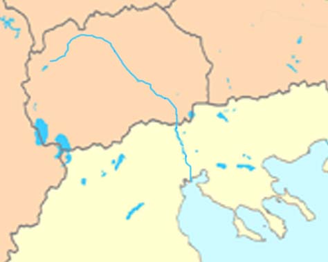
 Map of the northwestern part of North Macedonia including the source of the Vardar
 Axios/Vardar river map
 Veles Gorge
 River Vardar near Gradsko
 River Vardar near Gradsko (2)
 Vardar (Axios) river in Greece
 Longitudinal hidrographic profile of the flow of river Vardar


See also
- Great Morava
- Pčinja River
References
- "The rivers – Axios Delta National Park". axiosdelta.gr. Retrieved 2020-08-05.
- Orel, Vladimir. A Handbook of Germanic Etymology. Leiden, Netherlands: Brill, 2003: 392.
- Mallory, J.P. and D.Q. Adams. Encyclopedia of Indo-European Culture. London: Fitzroy and Dearborn, 1997: 147
- Mallory, J.P. and D.Q. Adams. Encyclopedia of Indo-European Culture. London: Fitzroy and Dearborn, 1997, p. 146
- Katičic', Radoslav. Ancient Languages of the Balkans. Paris: Mouton, 1976: 149
- Axios, Georg Autenrieth, A Homeric Dictionary, at Perseus
- Arapi, Ina (17 December 2014). "Konferenca për Eposin e Kreshnikëve, Pjetër Bogdani dhe Dardania në gusht 2014 (rreth vendlindjes së arqipeshkvit Pjetër Bogdani)". Epoka e Re, Mittwoch, 17. 12. 2014. Mittwoch: 6.
- Official portal of the city of Skopje: City symbols Archived 2014-09-29 at the Wayback Machine. – Retrieved on 13 May 2009.
- The Project to Construct the Danube-Aegean Canal(2013)
- The Greek-Serbian proposal made in Beijing
External links
- Proceedings of the 1st Axios Catchment Consortium Meeting Archived 2011-07-22 at the Wayback Machine by the European Commission—DG Research
- PIM "Ivan Milutinović", Belgrade, Serbia; Morava - Vardar (Axios) Navigation Route—About 1,200 km shorter route (three days shorter time of navigation) from Belgrade to Port of Thessaloniki than across Danube, Black Sea and Aegean Sea. Electric power production, improvement of water quality and regulation of flooding wave.
- Morava—Vardar (Axios) Navigation Route map
- Hydropower and navigation system "Morava"—Concepts of regulation of rivers Great Morava and South Morava for navigation and hydropower production
Authority control | |
|---|---|
| General |
|
| National libraries | |
На других языках
[de] Vardar
Der Vardar (auch Wardar; mazedonisch Вардар; griechisch Βαρδάρης .mw-parser-output .Latn{font-family:"Akzidenz Grotesk","Arial","Avant Garde Gothic","Calibri","Futura","Geneva","Gill Sans","Helvetica","Lucida Grande","Lucida Sans Unicode","Lucida Grande","Stone Sans","Tahoma","Trebuchet","Univers","Verdana"}Vardáris, heute zumeist Axiós Αξιός; albanisch auch Vardari) ist ein Fluss in Südosteuropa von etwa 388 km Länge. Der Großteil von 301 der 388 km verläuft auf dem Gebiet von Nordmazedonien, die verbleibenden 87 km verlaufen auf dem Gebiet der Region Zentralmakedonien in Griechenland.- [en] Vardar
[es] Río Vardar
El río Vardar (en macedonio, Вардар; en griego, Αξιός, romanizado: Axiós; en latín, Axius) es un río de Europa meridional de la vertiente del mar Egeo, ubicado en los Balcanes. Nace en Vrutok, a algunos kilómetros al norte de Gostivar, en Macedonia del Norte y recorre un total de 388 km a través de este país y de Grecia hasta el golfo Termaico, cerca de Tesalónica. Atraviesa la ciudad de Skopie, y cruza el norte de Grecia para desembocar en el Egeo en Macedonia central, al oeste de Tesalónica. La parte griega del río tiene una longitud de 76 km.[it] Vardar
Il Vardar (in macedone Bардаp/Vardar; in greco antico Ἀξιός/Axiós; in neogreco Βαρδάρης/Vardáris o Aξιός/Axiós, da cui l'italiano Assio; in latino Axius) è un fiume dell'Europa sud-orientale lungo circa 388 chilometri.[ru] Вардар
Варда́р[1][2][3] (макед. Вардар, алб. Lumi i Vardarit), Аксьо́с[4][3][5], Аксио́с[6] (греч. Αξιός) — самая длинная река в Северной Македонии и одна из основных рек Греции. Длина — 388 километров[3], из которых примерно 76 километров находятся на территории Греции, площадь водосборного бассейна — 25,4 тысячи квадратных километров[3]. Высота истока — 683 м над уровнем моря.[источник не указан 1975 дней]Другой контент может иметь иную лицензию. Перед использованием материалов сайта WikiSort.org внимательно изучите правила лицензирования конкретных элементов наполнения сайта.
WikiSort.org - проект по пересортировке и дополнению контента Википедии