geo.wikisort.org - Mountains
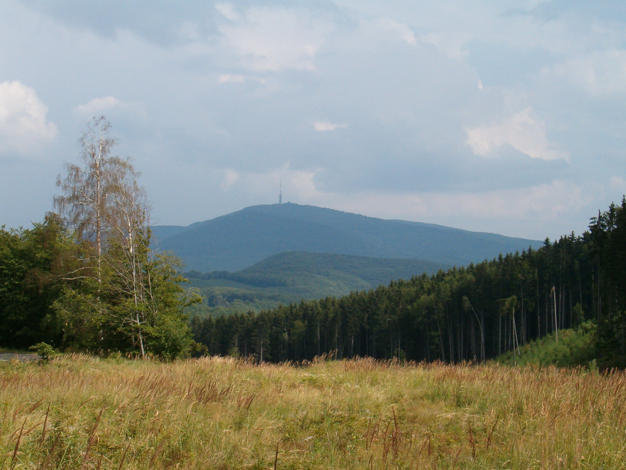
Kékes [ˈkeːkɛʃ] is Hungary's highest mountain, at 1,014 metres (3,327 ft) above sea level.[1] It lies 12 kilometres (7.5 mi) northeast of Gyöngyös,[2] in the Mátra range of Heves county. It is Hungary's third most popular tourist attraction, after Lake Balaton and the Danube, and has a number of hotels and skiing pistes. The Kékestető TV Tower stands at the summit.
| Kékes | |
|---|---|
 | |
| Highest point | |
| Elevation | 1,014 m (3,327 ft)[1] |
| Prominence | 774 m (2,539 ft)[1] |
| Listing | Country high point |
| Coordinates | 47°52′44″N 20°0′37″E |
| Naming | |
| English translation | Bluish |
| Language of name | Hungarian |
| Geography | |
 Kékes Hungary | |
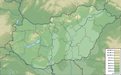
| Location | Heves county, Hungary |
| Parent range | Mátra, Western Carpathians |
The name Kékes is derived from the mountain's often bluish colour. In Hungarian, the word kék means 'blue', while kékes means implicitly 'bluish'.
History
It is home to the former Pauline Monastery of Kékes.
Climate
| Climate data for Kékestető (1991−2020 normals, extremes 1980−present) | |||||||||||||
|---|---|---|---|---|---|---|---|---|---|---|---|---|---|
| Month | Jan | Feb | Mar | Apr | May | Jun | Jul | Aug | Sep | Oct | Nov | Dec | Year |
| Record high °C (°F) | 12.2 (54.0) |
13.9 (57.0) |
17.3 (63.1) |
22.4 (72.3) |
25.6 (78.1) |
29.7 (85.5) |
31.4 (88.5) |
29.8 (85.6) |
25.8 (78.4) |
20.6 (69.1) |
17.4 (63.3) |
12.5 (54.5) |
31.4 (88.5) |
| Mean maximum °C (°F) | 6.0 (42.8) |
7.3 (45.1) |
12.0 (53.6) |
18.1 (64.6) |
21.7 (71.1) |
24.9 (76.8) |
26.6 (79.9) |
26.2 (79.2) |
20.9 (69.6) |
16.9 (62.4) |
11.6 (52.9) |
6.3 (43.3) |
27.4 (81.3) |
| Average high °C (°F) | −1.7 (28.9) |
−0.3 (31.5) |
3.5 (38.3) |
10.2 (50.4) |
14.8 (58.6) |
18.1 (64.6) |
20.0 (68.0) |
20.0 (68.0) |
14.5 (58.1) |
9.3 (48.7) |
3.8 (38.8) |
−0.9 (30.4) |
9.3 (48.7) |
| Daily mean °C (°F) | −3.3 (26.1) |
−2.3 (27.9) |
0.9 (33.6) |
6.8 (44.2) |
11.4 (52.5) |
14.9 (58.8) |
16.7 (62.1) |
16.9 (62.4) |
11.9 (53.4) |
7.1 (44.8) |
2.1 (35.8) |
−2.4 (27.7) |
6.7 (44.1) |
| Average low °C (°F) | −4.9 (23.2) |
−4.3 (24.3) |
−1.6 (29.1) |
3.6 (38.5) |
8.6 (47.5) |
11.7 (53.1) |
13.5 (56.3) |
13.9 (57.0) |
9.3 (48.7) |
5.0 (41.0) |
0.5 (32.9) |
−3.9 (25.0) |
4.3 (39.7) |
| Mean minimum °C (°F) | −13.2 (8.2) |
−11.8 (10.8) |
−8.8 (16.2) |
−4.2 (24.4) |
1.2 (34.2) |
5.8 (42.4) |
7.7 (45.9) |
7.6 (45.7) |
3.5 (38.3) |
−2.6 (27.3) |
−6.7 (19.9) |
−11.8 (10.8) |
−15.2 (4.6) |
| Record low °C (°F) | −22.6 (−8.7) |
−19.8 (−3.6) |
−19.4 (−2.9) |
−9.6 (14.7) |
−3.0 (26.6) |
1.4 (34.5) |
4.5 (40.1) |
4.0 (39.2) |
0.9 (33.6) |
−8.0 (17.6) |
−12.0 (10.4) |
−18.7 (−1.7) |
−22.6 (−8.7) |
| Average precipitation mm (inches) | 36.3 (1.43) |
44.5 (1.75) |
46.8 (1.84) |
60.8 (2.39) |
93.5 (3.68) |
80.4 (3.17) |
108.6 (4.28) |
83.0 (3.27) |
79.2 (3.12) |
72.3 (2.85) |
70.8 (2.79) |
47.3 (1.86) |
823.4 (32.42) |
| Average precipitation days (≥ 1.0 mm) | 7.0 | 7.5 | 8.7 | 8.7 | 10.9 | 9.7 | 10.5 | 8.1 | 8.2 | 8.4 | 9.2 | 8.4 | 105.3 |
| Mean monthly sunshine hours | 83.3 | 92.7 | 150.8 | 195.8 | 229.9 | 242.7 | 260.7 | 247.9 | 172.5 | 132.2 | 86.0 | 75.8 | 1,970.3 |
| Source: infoclimat.fr[3][better source needed] | |||||||||||||
Road cycling
For road bicycle racing enthusiasts, the mountain can be climbed by two main routes.
- South from Gyöngyös: 839 m over 17.8 km. This is the most famous and difficult ascent.
- North from Parád: 775 m over 16.9 km. About equal in difficulty as the Bédoin ascent, but better sheltered against the climb.
Tour de Hongrie stage finishes
| Year | Stage | Start of stage | Distance (km) | Category | Stage winner | Yellow jersey |
|---|---|---|---|---|---|---|
| 2021 | 4 | Balassagyarmat | 202.2 | 1 | ||
| 2020 | 4 | Miskolc | 187.8 | 1 | ||
| 2019 | 4 | Karcag | 138.1 | 1 | ||
| 2016 | 4 | Karcag | 144 | 1 | ||
| 2015 | 4 | Karcag | 146 | 1 | ||
| 2005 | 6 | Mátraháza | 3.4 (ITT) | - | ||
| 2005 | 5 | Mezőkövesd | 93 | 1 | ||
| 2004 | 5 | Mezőkövesd | 148 | 1 | ||
| 2003 | 5 | Mátraháza | 3.4 (ITT) | - | ||
| 2003 | 4 | Miskolc | 127.3 | 1 | ||
| 2001 | 3 | Tiszaújváros | 174 | 1 |
See also
- List of highest paved roads in Europe
- List of highest paved roads in Europe by country
References
- "Kékes". Peakbagger.com.
- G. Z. Földvary (1988). Geology of the Carpathian Region. World Scientific. ISBN 978-9971-5-0345-1.
- "Normales et records pour la période 1991-2020 à Kekesteto". infoclimat.fr. Retrieved February 18, 2022.
External links
 Media related to Kékes at Wikimedia Commons
This Heves county location article is a stub. You can help Wikipedia by expanding it. |
На других языках
[de] Kékes
Der Kékes [.mw-parser-output .IPA a{text-decoration:none}ˈkeːkɛʃ], auch als Kékestető bezeichnet, ist mit 1014 m der höchste Berg Ungarns. Er liegt im Mátra-Gebirge im Norden des Landes.- [en] Kékes
[es] Kékes
Kékes es la montaña más alta de Hungría, en los montes Mátra del condado de Heves. Es la tercera atracción turística en popularidad de Hungría, después del lago Balatón y el Danubio, y tiene una serie de hoteles y pistas de esquí. También hay una torre de telecomunicaciones en la cumbre.[fr] Kékes
Le Kékes, ou Kékestető, est un sommet et le point culminant de la Hongrie à 1 014 mètres d'altitude.[it] Kékes
Il Kékes (1.014 m s.l.m.[1]) è la montagna più alta dell'Ungheria. Si trova nella catena dei monti Mátra, sottocatena dei più ampi Carpazi. Il monte è collocato nella Provincia di Heves.[ru] Кекеш
Ке́кеш (венг. Kékes) — гора высотой 1014 метров над уровнем моря, высочайшая вершина Венгрии, находится в горной системе Матра на севере страны. Это третье место по популярности у туристов в Венгрии после озера Балатон и Дуная.Текст в блоке "Читать" взят с сайта "Википедия" и доступен по лицензии Creative Commons Attribution-ShareAlike; в отдельных случаях могут действовать дополнительные условия.
Другой контент может иметь иную лицензию. Перед использованием материалов сайта WikiSort.org внимательно изучите правила лицензирования конкретных элементов наполнения сайта.
Другой контент может иметь иную лицензию. Перед использованием материалов сайта WikiSort.org внимательно изучите правила лицензирования конкретных элементов наполнения сайта.
2019-2025
WikiSort.org - проект по пересортировке и дополнению контента Википедии
WikiSort.org - проект по пересортировке и дополнению контента Википедии