geo.wikisort.org - River
Maritsa or Maritza (Bulgarian: Марица [mɐˈrit͡sɐ]), also known as Meriç (Turkish: Meriç [meɾit͡ʃ]) and Evros (Greek: Έβρος [ˈevros]), is a river that runs through the Balkans in Southeast Europe. With a length of 480 km (300 mi),[3] it is the longest river that runs solely in the interior of the Balkan peninsula, and one of the largest in Europe by discharge. It flows through Bulgaria in its upper and middle reaches, while its lower course forms much of the border between Greece and Turkey. Its drainage area is about 53,000 km2 (20,000 sq mi), of which 66.2% is in Bulgaria, 27.5% in Turkey and 6.3% in Greece.[1] It is the main river of the historical region of Thrace, most of which lies in its drainage basin.
| Maritsa Évros, Meriç | |
|---|---|
 The source valley of the Maritsa river in the Rila Mountains with Marichini Lakes | |
| Native name | |
| Location | |
| Countries |
|
| Physical characteristics | |
| Source | |
| • location | Rila Mountains, Bulgaria |
| • elevation | 2,378 m (7,802 ft) |
| Mouth | |
• location | Aegean Sea, 14.5 km (9.0 mi) east of Alexandroupoli |
• coordinates | 40°43′50″N 26°2′6″E |
| Length | 480 km (300 mi) |
| Basin size | 53,000 km2 (20,000 sq mi)[1] |
| Discharge | |
| • average | for mouth 234 m3/s (8,300 cu ft/s)[2] |

It has its origin in the Rila Mountains in Western Bulgaria, its source being the Marichini Lakes. The Maritsa flows east-southeast between the Balkan and Rhodope Mountains, past Plovdiv and Dimitrovgrad in Bulgaria to Edirne in Turkey. East of Svilengrad, Bulgaria, the river flows eastwards, forming the border between Bulgaria (on the north bank) and Greece (on the south bank), and then between Turkey and Greece. At Edirne, the river meets it two chief tributaries Tundzha and Arda, and flows through Turkish territory on both banks. It then turns towards the south and forms the border between Greece on the west bank and Turkey on the east bank all the way to the Aegean Sea, which it enters near Enez forming a river delta. The upper Maritsa valley is a principal east–west route in Bulgaria. The unnavigable river is used for power production and irrigation.
Etymology
The earliest known name of the river is Εύρος (Euros, Alcman, 7th–6th century BC).[4] Proto-Indo-European *h₁wérus and Ancient Greek εὐρύς meant "wide".[4] The Proto-Indo-European consonant cluster *-wr- shifted in Thracian to -br-, creating the Thracian name Ebros.[4] Thereafter, the river began to be known as Ἕβρος (Hébros) in Greek and Hebrus in Latin.[5] Rather than an origin as 'wide river', an alternative hypothesis is that is borrowed from Thracian ebros meaning 'splasher'.[6]
While the name Ἕβρος (Hébros) was used in Ancient Greek, the name Μαρίτσα (Maritsa) had become standard before the ancient form Ἕβρος was artificially restituted in Modern Greek as Έβρος (now: Évros).[7] The name Maritsa may derive from a mountain near the mouth of the river known in antiquity as Μηρισός or Μήριζος, Latinized as Merit(h)us.[4][unreliable source?]
History
In 1371, the river was the site of the Battle of Maritsa, also known as the battle of Chernomen, an Ottoman victory over the Serbian rulers Vukašin Mrnjavčević and Jovan Uglješa, who died in the battle.
Migration
The Maritsa river as a natural barrier on the border between Turkey and Greece has become a major route for migrants from a variety of countries attempting to enter the EU irregularly.[8] Between 2000 and 2019, 398 bodies were found on the Greek side of the Maritsa river. Up until that time, drowning in the Maritsa was the leading cause of death among migrants trying to enter Greece.[9]
Following the heavy losses Turkish armed forces incurred at the hands of the Russian-backed Syrian government in northern Syria at the end of February 2020, a drastic change in Turkey's policy towards irregular migrants on its territory led to escalation of the situation at the Evros border crossings as well as exacerbation of tension between Turkey on one hand and Greece and the EU as a whole on the other hand.[10][11]
In May 2020, news emerged that Turkish forces occupied a 16 acres (6.5 ha) of Greek territory, Melissokomeio, as shown on maps of 1923, following a change in the flow of the Maritsa river.[12]
Tributaries


Starting from the river's source, significant tributaries of Maritsa include:
- Left tributaries:
- Topolnitsa (flows into Maritsa near Pazardzhik)
- Luda Yana (near Ognyanovo)
- Stryama (near Sadovo)
- Sazliyka (near Simeonovgrad)
- Tundzha/Tunca (in Edirne)
- Ergene (near İpsala)
- Right tributaries:
- Chepinska reka (near Septemvri)
- Vacha (near Stamboliyski)
- Chepelarska reka (near Sadovo)
- Harmanliyska reka (near Harmanli)
- Arda/Ardas (near Edirne)
- Erythropotamos/Luda reka (near Didymoteicho)
Floods


The lower course of the river Maritsa, where it forms the border of Greece and Turkey, is very vulnerable to flooding. For about 4 months every year, the low lands around the river are flooded. This causes significant economic damage (loss of agricultural production and damage to infrastructure), which is estimated at several hundreds million Euro.[13]
Recent large floods took place in 2006, 2007, 2014, with the largest flood taking place in 2021. Several causes have been proposed: more rainfall due to climate change, deforestation in the Bulgarian part of the catchment area, increased land use in the flood plains and difficult communication between the three countries.[13]
Honours
Maritsa Peak on Livingston Island in the South Shetland Islands, Antarctica is named after Maritsa River.
La Maritza is also a 1968 song written by Jean Renard and Pierre Delanoë and interpreted by Sylvie Vartan.
Hebrus Valles on Mars is named after this river.
The Bulgarian Maritsa motorway, which roughly follows the course of the river from Chirpan (where it branches out of the Trakia motorway) to the Turkish border at Kapitan Andreevo, is also named in honour of the river.
Gallery
 Spring freshet of Maritsa River at Harmanli
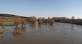
 View from the river, Edirne.
 The river viewed from Turkey. Greek land visible on the right.
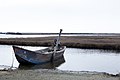 Boat on the delta.


Notes
- "Preliminary Flood Risk Assessment" (in Greek). Ministry of Environment, Energy and Climate Change. p. 90. Archived from the original on 15 February 2020.
- inweb.gr
- Statistical Yearbook 2017, National Statistical Institute (Bulgaria), p. 17
- Georgiev, Vladimir Ivanov Georgiev (1981). Introduction to the History of the Indo-European Languages (1981, p. 351). ISBN 9789535172611.
- Florov, Nicholas; Florov, Irina (2001). Three-thousand-year-old Hat. Michigan University. ISBN 9780968848708.
- Duridanov, Ivan (1985). Die Sprache der Thraker. Neuried: Hieronymus Verlag. ISBN 978-3-88893-031-7. OCLC 18925921.
- Schramm, Gottfried (1981): Eroberer und Eingesessene. Geographische Lehnnamen als Zeugen der Geschichte Südosteuropas im ersten Jahrtausend n. Chr. Stuttgart: Hiersemann, pp.290f. Referenced in Carsten Peust, How Old Are the River Names of Europe?, Linguistik Online, 2015
- Evros: The immigrants' gateway. PBS.org, May 16, 2011.
- Pavlidis, Pavlos; Karakasi, Maria-Valeria (2019). "Greek land borders and migration fatalities - Humanitarian disaster described from the standpoint of Evros". Forensic Science International. 302: 109875. doi:10.1016/j.forsciint.2019.109875. ISSN 1872-6283. PMID 31378400. S2CID 199438113.
- Turkish police bolster Greek border to stop migrants' return. 6 March 2020.
- Greece Defends Borders as Erdogan Opens the Gates: Live Updates. 1 March 2020.
- "Athens lodges demarche with Ankara over Evros dispute". ekathimerini.com. 22 May 2020.
- Environmental management of big riverine floods: the case of Evros River in Greece, Z. Nivolianitou, B. Synodinou
References
- "МАРИЦА (антично име: Хеброс, Хебър)". Българска енциклопедия А-Я (in Bulgarian). БАН, Труд, Сирма. 2002. ISBN 954-8104-08-3. OCLC 163361648.
Authority control | |
|---|---|
| General | |
| National libraries | |
| Other | |
На других языках
[de] Mariza
Die Mariza, auch Maritza geschrieben (bulgarisch Марица, griechisch Έβρος .mw-parser-output .Latn{font-family:"Akzidenz Grotesk","Arial","Avant Garde Gothic","Calibri","Futura","Geneva","Gill Sans","Helvetica","Lucida Grande","Lucida Sans Unicode","Lucida Grande","Stone Sans","Tahoma","Trebuchet","Univers","Verdana"}Evros, lateinisch Hebrus, altgriechisch Ἕβρος Hébros, türkisch Meriç Nehri), ist ein Fluss, der die Landschaft Thrakien in Südosteuropa durchfließt. In ihrem unteren Verlauf bildet sie zu einem kleinen Teil die Grenze zwischen Griechenland und Bulgarien sowie rund die Hälfte der Grenze zwischen Griechenland und der Türkei.- [en] Maritsa
[es] Río Maritsa
El Evros o Maritsa (búlgaro Марица; griego Έβρος, Évros, romanizado como Hebro; turco Meriç), es un río que nace en el noroeste de la montaña Rila, que está en el suroeste de Bulgaria. Es el curso de agua más importante de Tracia, y tiene cerca de 480 km de longitud.[it] Evros (fiume)
L'Evros o Marica (in bulgaro: Марица? /'marit͡sa/, in italiano a volte traslitterato Maritsa o Marizza; in turco Meriç; in greco: Έβρος /'evros/, in latino: Hebrus, da cui il nome italiano alternativo di Ebro) è un fiume dell'Europa sudorientale che scorre in Bulgaria, Grecia e Turchia. Con una lunghezza di 514 km e un bacino idrografico di oltre 53 000 km², costituisce uno dei più importanti corsi d'acqua della Penisola balcanica.[ru] Марица
Мари́ца[1] (болг. Марица), Мерич[2] (тур. Meriç), Э́врос[3] (греч. Έβρος, лат. Hebrus) — одна из крупнейших рек на Балканском полуострове. Длина течения Марицы — 490 км, площадь водосборного бассейна — 53 846 км²[4].Другой контент может иметь иную лицензию. Перед использованием материалов сайта WikiSort.org внимательно изучите правила лицензирования конкретных элементов наполнения сайта.
WikiSort.org - проект по пересортировке и дополнению контента Википедии