geo.wikisort.org - Island
This list of islands of California is organized into sections, generally arranged from north to south. The islands within each section are listed in alphabetical order.
The Geographic Names Information System (GNIS) lists 527 named islands in the state.[1]
Humboldt County
Offshore
| Island | Image | Coordinates | Description |
|---|---|---|---|
| Sugar Loaf Island |  |
40.438767°N 124.413783°W | Sugar Loaf Island, offshore Cape Mendocino, rises 128 feet (39 m) above mean sea level. It is a special zone in the South Cape Mendocino State Marine Reserve and is closed to public access.[2][3] Being offshore of Cape Mendocino, the westernmost point in California, Sugar Loaf Island is called the westernmost island in the state.[4] |
Humboldt Bay
All three islands in Humboldt Bay are located in the narrow midsection of the bay. This portion of the bay is located within the City of Eureka, California entirely within Humboldt County.
| Island | Image | Coordinates | Description |
|---|---|---|---|
| Daby Island |  |
40.8114°N 124.151837°W | The smallest of the three islands within Humboldt Bay, Daby Island has a maximum elevation of 3 feet (0.91 m) and is located slightly northeast of Woodley Island. |
| Tuluwat Island |  |
40°48′46″N 124°10′06″W | The largest island, 1.3 miles (2.1 km) long, was originally the center of culture and population of the indigenous Wiyot people. Now protected, no public access is allowed, except for the Wiyot and grandfathered residents. |
| Woodley Island | |
40.809516°N 124.160549°W | The second largest of the three islands within Humboldt Bay contains: the Woodley Island Marina (Eureka's largest marina), the Eureka regional office of the National Weather Service, and offices of the Humboldt Bay Harbor Recreation & Conservation District. |
Northern California
| Island | Image | Coordinates | Counties | Description |
|---|---|---|---|---|
| Bird Rock | 38°13′48″N 122°59′40″W[5] | Marin | Small Pacific island west of Tomales Point, primarily a seabird colony. It covers 2 acres (0.81 ha). | |
| Hog Island (Tomales Bay) | 38°11′50″N 122°56′09″W | Marin | A 2-acre (0.81 ha) island in Tomales Bay. | |
| Año Nuevo Island |  |
37°06′31″N 122°20′16″W[6] | San Mateo | Small Pacific island, about 0.2 miles (0.32 km) long, near Año Nuevo (New Year's) Point, south of the Golden Gate. It is protected by the Año Nuevo State Reserve as an important habitat for seabirds and other coastal wildlife. |
San Francisco Bay Area
Map: Islands of the San Francisco Bay Area | |
|---|---|
 Alameda Bay Farm Brooks Skaggs
(islands of Suisun Bay and the Sacramento–San Joaquin River delta) Newby |
Other islands of the San Francisco Bay Area:
| Island | Image | Coordinates | Counties | Description |
|---|---|---|---|---|
| Alameda Island | 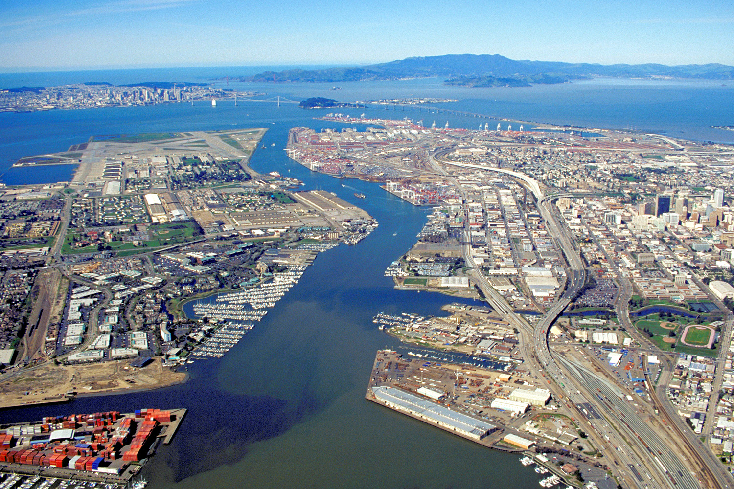 |
37°45′55″N 122°14′30″W | Alameda, San Francisco (small, uninhabited sliver) | This 6-mile (9.7 km) long island in San Francisco Bay is the main part of the City of Alameda. |
| Alcatraz Island |  |
37°49′36″N 122°25′24″W | San Francisco | This 22-acre (8.9 ha) island in San Francisco Bay once served as a lighthouse, a military fortification, a military prison, and as a federal prison until 1963. It is now part of the Golden Gate National Recreation Area. |
| Angel Island |  |
37°51′46″N 122°25′51″W | Marin | With an area of 1.2 square miles (3.1 km2), this island in San Francisco Bay processed approximately 1 million immigrants to the U.S. during 1910 to 1940. It is currently a state park. |
| Bair Island | 37°31′48″N 122°13′20″W | San Mateo | This 2,600-acre (1,100 ha) island in San Francisco Bay near Redwood City is part of the Don Edwards San Francisco Bay National Wildlife Refuge. | |
| Bay Farm Island |  |
37°44′17″N 122°15′07″W | Alameda | This former island in San Francisco Bay has been connected to the mainland. It is part of the City of Alameda. |
| Belvedere Island |  |
37°52′18″N 122°28′07″W | Marin | This former island in Richardson Bay has been connected to the mainland. It is part of the City of Belvedere. |
| Bird Island |  |
37°49′27″N 122°32′12″W[7] | Marin | Small Pacific island between Point Bonita and Rodeo Cove. |
| Brooks Island | 37°53′47″N 122°21′19″W | Contra Costa | A 65-acre (26 ha) island in San Francisco Bay south of Richmond, protected as part of the Brooks Island Regional Shoreline. | |
| The Brothers |  |
37°57′48″N 122°25′59″W | Contra Costa | Two small islands, East Brother and West Brother, located west of Point San Pablo. Each is about 300 feet (91 m) long. East Brother has a lighthouse and a bed and breakfast. |
| Castro Rocks |  |
37°55′56″N 122°25′07″W | Contra Costa | Beneath the Richmond–San Rafael Bridge. |
| Coast Guard Island | 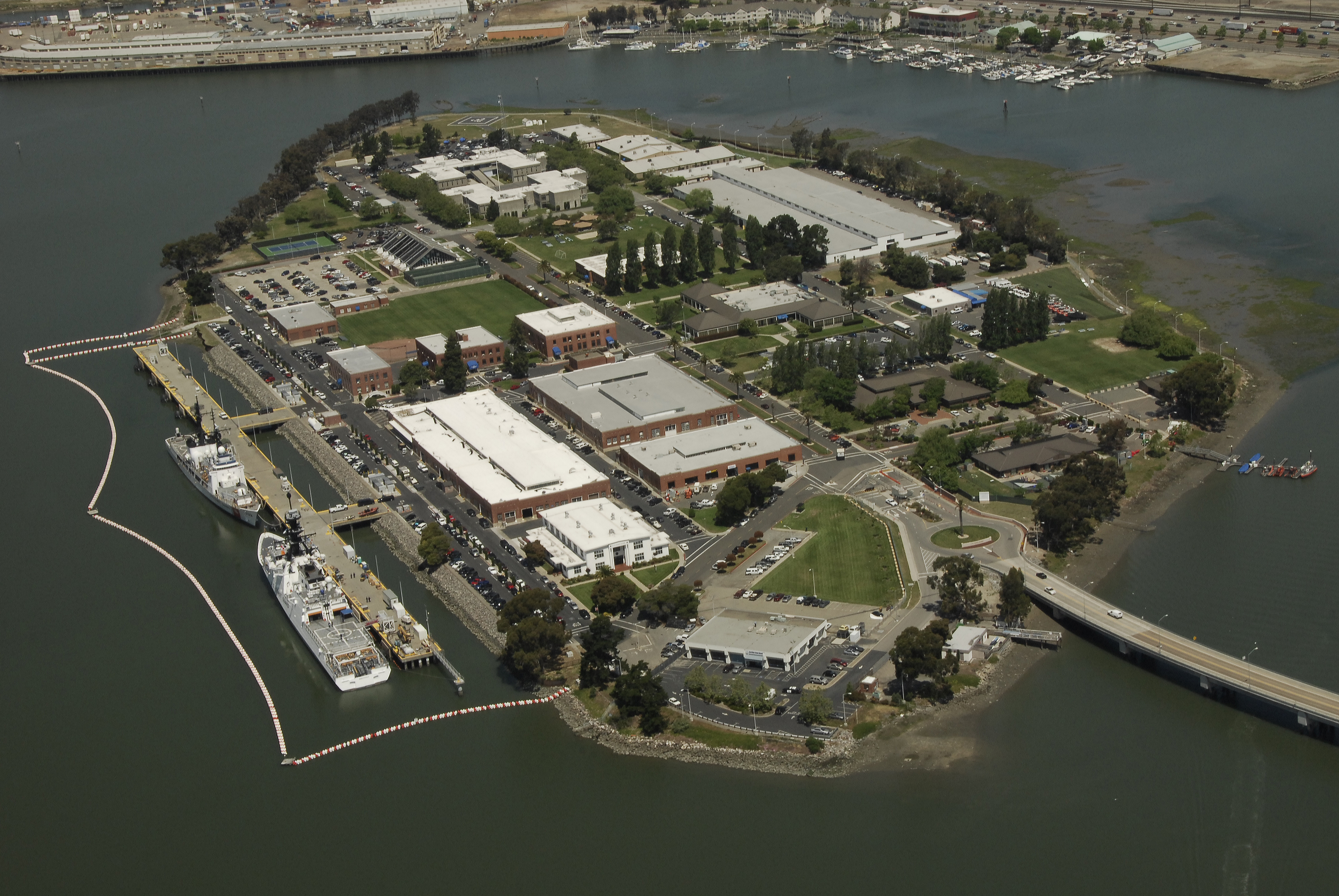 |
37°46′56″N 122°15′00″W | Alameda | Located in the Oakland Estuary, this 67-acre (27 ha) artificial island is part of the City of Alameda. It is home to various United States Coast Guard facilities. |
| Corinthian Island | 37°52′22″N 122°27′32″W | Marin | This former island was joined to the mainland in the 1980s. It is split between the city of Belvedere and the town of Tiburon. | |
| East Marin Island |  |
37°57′52″N 122°28′06″W | Marin | Near San Rafael, California. Pictured on the right in the image. |
| Greco Island |  |
37°31′04″N 122°10′59″W | San Mateo | This 817 acres (331 ha) island in San Francisco Bay near Redwood City is part of the Don Edwards San Francisco Bay National Wildlife Refuge. |
| Gull Rock | 37°52′34″N 122°36′59″W | Marin | A Pacific island near Mount Tamalpais, about 200 feet (61 m) long. | |
| Hog Island (Petaluma River) | 38°09′33″N 122°32′18″W | Sonoma | Island in the Petaluma River wetlands. | |
| Hooks Island |  |
37°27′22″N 122°05′49″W | Santa Clara | 36-acre (15 ha) tidal salt marsh island[8] in the Palo Alto Baylands Nature Preserve |
| Kent Island |  |
37°54′44″N 122°40′43″W | Marin | An island in Bolinas Lagoon, near the town of Bolinas. About 0.5 miles (0.80 km) long. |
| Mare Island |  |
38°05′44″N 122°16′21″W | Solano | An island in San Pablo Bay near Vallejo. About 3.5 miles (5.6 km) long, site of a major shipyard. |
| Mussel Rock |  |
37°40′01″N 122°29′50″W | San Mateo | A stack in the Pacific Ocean near Daly City. About 200 feet (61 m) long. |
| Rat Rock | 38°00′16″N 122°27′43″W | Marin | An 18-foot (5.5 m) tall rock north of China Camp. | |
| Red Rock Island |  |
37°55′45″N 122°25′51″W | Contra Costa, Marin and San Francisco | This uninhabited 5.8-acre (2.3 ha) island is located in San Francisco Bay just south of the Richmond–San Rafael Bridge, near the meeting point of three counties. It is privately owned. |
| San Pedro Rock |  |
37°35′43″N 122°31′27″W | San Mateo | A Pacific island near the city of Pacifica. About 800 feet (240 m) long. |
| Seal Rocks (San Francisco, California) | 37°46′43″N 122°30′58″W | San Francisco | A series of large rocks in the Pacific Ocean that host a sea lion colony. | |
| Seal Rock (San Mateo County, California) | 37°23′30″N 122°25′29″W | San Mateo | A Pacific island south of Half Moon Bay, about 500 feet (150 m) long. | |
| The Sisters |  |
37°59′18″N 122°26′28″W | Marin | A pair of small islands in San Pablo Bay, 2,000 feet (610 m) south of Point Saint Pedro. |
| Treasure Island | 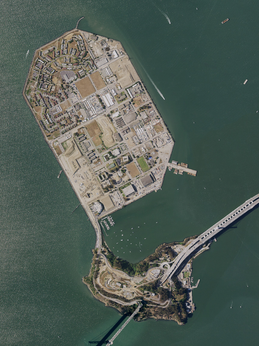 |
37°49′29″N 122°22′16″W | San Francisco | This 403-acre (163 ha) artificial island in San Francisco Bay is tied to Yerba Buena Island. It was dredged out of the bay to house the Golden Gate International Exposition of 1939-40. |
| West Marin Island | |
37°57′57″N 122°28′22″W | Marin | Near San Rafael, California. Pictured on the left in the image. |
| Newby Island | 37°27′32.1″N 121°56′38.54″W | Santa Clara | Near Alviso, San Jose. | |
| Ogilvie Island |  |
37°27′55″N 122°00′37″W | Santa Clara | Near Alviso, San Jose. |
| Yerba Buena Island | 37°48′36″N 122°21′58″W | San Francisco | This island in San Francisco Bay is home to a Coast Guard station. The San Francisco–Oakland Bay Bridge passes through it by means of a tunnel. |
Farallon Islands
The Farallon Islands are a group of rugged small islands over 20 miles (32 km) offshore from the mainland of the City and County of San Francisco, which they are also formally within. They consist of over twenty small islets divided into north, south and middle sections, as well as a major bank, Fanny Shoal. The surrounding waters were once used as a disposal site for radioactive waste.[9]
| Island | Image | Coordinates | Description |
|---|---|---|---|
| Aulone Island and Great Arch Rock |  |
37°42′08″N 123°00′15″W | North of Southeast Farallon Island, measuring 200 feet (61 m) wide and 400 feet (120 m) long. |
| Drunk Uncle Islets | Group of small islets north of Maintop Island. | ||
| Farallón Viscaíno | |||
| Middle Farallon Island | 37°43′38″N 123°01′56″W | Medium-sized islet 1.8 miles (2.9 km) northwest of Southeast Farallon Island. It is 210 feet (64 m) long and has an area of 0.8 acres (0.32 ha). | |
| North Farallon Island | 37°45′44″N 123°05′53″W | Medium-sized islet 500 feet (150 m) long and 100 feet (30 m) high, covering 2 acres (0.81 ha). | |
| Peñasco Quebrado | |||
| Piedra Guadalupe | |||
| Island of St. James | 37°46′00″N 123°06′05″W | Medium-sized islet 3 acres (1.2 ha) in size, measuring 410 feet (120 m) long and 154 feet (47 m) high. | |
| Sea Lion Rock | 37°42′10″N 123°00′19″W | Small islet northwest of Aulon Island, about 130 feet (40 m) long. | |
| Seal Rock | 37°41′38″N 123°00′12″W | Small islet south of Southeast Farallon Island, with a maximum height of 82 feet (25 m). | |
| Maintop Island | 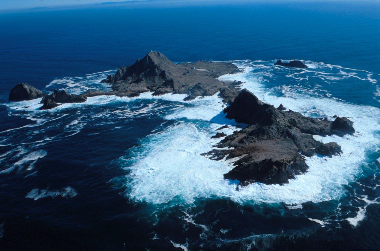 |
37°41′57″N 123°00′40″W | West of Southeast Farallon Island, and has a maximum height of 223 feet (68 m). |
| Southeast Farallon Island |  |
37°41′50″N 123°00′11″W | Is the largest of the Farallons, covering 0.19 square miles (0.49 km2). It is the only inhabited Farallon Island, and is also the site of Farallon Island Light. |
| Sugarloaf Island | 37°42′13″N 123°00′12″W | Directly to the northeast of Aulone and Great Arch Rock, about 80 feet (24 m) high. |
Suisun Bay and Sacramento-San Joaquin River delta
Map: Islands of Suisun Bay and the Sacramento–San Joaquin River Delta | |
|---|---|
 Rough and Ready (islands of the San Francisco Bay Area) |
Suisun Bay
Suisun Bay is an arm of the San Francisco Bay estuary which connects the Sacramento and San Joaquin rivers to the Carquinez Strait.
| Island | Image | Coordinates | County | Description |
|---|---|---|---|---|
| Chipps Island |  |
38°03′19″N 121°54′43″W | Solano | |
| Dutton Island |  |
38°04′54″N 121°58′14″W | Solano | |
| Freeman Island |  |
38°04′46″N 121°59′09″W | Solano | Small island, second from top on left hand of frame. |
| Grizzly Island |  |
38°09′05″N 121°58′22″W | Solano | |
| Hammond Island | 38°06′18″N 121°56′15″W | Solano | ||
| Joice Island |  |
38°09′00″N 122°03′34″W | Solano | A marshy island 6 miles (9.7 km) long, north of Grizzly Bay. |
| Morrow Island |  |
38°07′00″N 122°05′11″W | Solano | A small island that has an elevation of 2 meters- 7 feet. |
| Roe Island | |
38°04′21″N 122°02′05″W | Solano | In Suisun Bay. On far right of picture (partially out of frame). |
| Ryer Island | |
38°04′58″N 122°00′52″W | Solano | 475-hectare (1,170-acre) island, between Suisun Bay and Suisun Cutoff.[10] About 2 miles (3.2 km) long. Largest island in the photo. |
| Seal Islands | 38°03′20″N 122°02′50″W | Contra Costa | In Suisun Bay. | |
| Simmons Island |  |
38°05′49″N 121°59′26″W | Solano | |
| Snag Island | |
38°04′22″N 121°58′32″W | Solano | Smallest island in the photo, top center. |
| Van Sickle Island |  |
38°04′00″N 121°54′04″W | Solano | An island 2.5 miles (4.0 km) long at the junction of the Sacramento River, San Joaquin River, and Suisun Bay. |
| Wheeler Island | 38°05′06″N 121°56′15″W | Solano |
Sacramento-San Joaquin River Delta
The Sacramento-San Joaquin River Delta is an inverted delta at the juncture of the Sacramento and San Joaquin rivers. There are about 57 named islands in the Delta.
| Island | Image | Coordinates | County | Description |
|---|---|---|---|---|
| Andrus Island |  |
38°09′28″N 121°35′54″W | Sacramento | 3,000-hectare (7,400-acre) island, bounded by Sacramento River, Georgiana Slough, Mokelumne River, San Joaquin River, Jackson Slough, and Seven Mile Slough. |
| Bacon Island |  |
37°58′36″N 121°33′08″W | San Joaquin | 2,200-hectare (5,400-acre) island, bounded by Connection Slough, Old River, Woodward Island, and Middle River |
| Bethel Island |  |
38°01′53″N 121°38′27″W | Contra Costa | 1,450-hectare (3,600-acre) island, bounded by Taylor Slough, Piper Slough, Sand Mound Slough, and Dutch Slough |
| Bishop Tract | ||||
| Brack Tract | ||||
| Byron Tract | ||||
| Bouldin Island |  |
38°06′15″N 121°32′05″W | San Joaquin | 2,400-hectare (5,900-acre) island bounded by South Mokelumne River, Little Potato Slough, Potato Slough, and Mokelumne River. |
| Bradford Island |  |
38°04′38″N 121°39′48″W | Contra Costa | 885-hectare (2,190-acre) island in the lower delta bounded by the San Joaquin River, False River and the Bradford Island canal/slough. Accessible only by Ferry via Jersey Island, just south of it. |
| Browns Island |  |
37°57′37″N 121°21′21″W | Contra Costa | 275-hectare (680-acre) island, bounded by Middle Slough, New York Slough, and Suisun Bay. On the left in photo. |
| Canal Ranch Tract | ||||
| Coney Island |  |
37°50′45″N 121°32′58″W | Contra Costa | |
| Dead Horse Island |  |
38°13′45″N 121°30′08″W | Sacramento | |
| Decker Island |  |
38°05′26″N 121°43′09″W | Solano | Small island on the top-left in photo. |
| Empire Tract | ||||
| Fabian Tract | ||||
| Fay Island |  |
37°56′55″N 121°33′55″W | San Joaquin | |
| Glanville Tract | ||||
| Grand Island |  |
38°14′08″N 121°34′45″W | Sacramento | |
| Hastings Tract | ||||
| Holland Tract | ||||
| Hotchkiss Tract | ||||
| Jersey Island | 38°02′11″N 121°41′09″W | Contra Costa | 1,425-hectare (3,520-acre) island, bounded by False River, Piper Slough, Taylor Slough, Dutch Slough and San Joaquin River. | |
| Jones Tract |  |
upper: 37°55′12″N 121°28′35″W lower:37°57′16″N 121°29′38″W (lower) |
San Joaquin | 4,900-hectare (12,000-acre) island (tracts, Upper- and Lower-), bounded by Empire Cut, Whiskey Slough, Trapper Slough, and Middle River, 10 km east of Stockton |
| King Island |  |
38°03′56″N 121°26′12″W | San Joaquin | 1,300-hectare (3,200-acre) island bounded by White Slough, Bishop Cut, Disappointment Slough, and Honker Cut |
| Kings Island |  |
37°51′29″N 121°34′08″W | Contra Costa | 3.5-hectare (8.6-acre) island in Old River |
| Little Mandeville Island |  |
38°00′38″N 121°33′54″W | San Joaquin | |
| Little Tinsley Island | ||||
| Mandeville Island |  |
38°02′05″N 121°32′56″W | San Joaquin | |
| McDonald Island |  |
38°00′05″N 121°29′24″W | San Joaquin | 2,400-hectare (5,900-acre) island, bounded by San Joaquin River, Middle River, Latham Slough, and Empire Cut. |
| Medford Island |  |
38°02′14″N 121°30′41″W | San Joaquin | |
| Merritt Island | 38.3554°N 121.5503°W | Yolo | A 5,000 acres (2,000 ha) island formed by the Sacramento River to the southeast and Elk Slough to the west, located directly across the Sacramento from Hood. | |
| Mildred Island |  |
37°59′11″N 121°31′23″W | San Joaquin | |
| Netherlands Island | ||||
| Neville Island | ||||
| New Hope Tract | ||||
| Orwood Tract | ||||
| Palm Tract | ||||
| Pierson District | ||||
| Prospect Island |  |
38°14′47″N 121°39′56″W | Solano | |
| Quimby Island |  |
38°01′31″N 121°34′17″W | Contra Costa | |
| Rhode Island | 37°59′59″N 121°34′31″W | Contra Costa | ||
| Rindge Tract | ||||
| Rio Blanco Tract | ||||
| Roberts Island |  |
37°54′18″N 121°23′07″W | San Joaquin | |
| Ruff and Ready Island | San Joaquin River | An approximately 2.3-square-mile island in Stockton, California. A United States Navy installation built there during World War II was phased out in 1995 and later transferred to the Port of Stockton. | ||
| Ryer Island |  |
38°14′26″N 121°38′03″W | Solano | 4,750-hectare (11,700-acre), bounded by Miner Slough and Steamboat Slough. |
| Sargent Barhart Tract | ||||
| Sherman Island |  |
38°03′34″N 121°44′00″W | Sacramento | 5,500-hectare (14,000-acre) island bounded by the Sacramento River, Three Mile Slough, and the San Joaquin River. |
| Shima Tract | ||||
| Shin Kee Tract | ||||
| Staten Island |  |
38°09′52″N 121°30′59″W | San Joaquin | 3,700-hectare (9,100-acre) island bounded and flanked by the North Mokelumne River and South Mokelumne River. |
| Stewart Tract | ||||
| Sutter Island |  |
38.2913°N 121.5930°W | Sacramento | Formed by Sacramento River to the northeast, Steamboat Slough to the southeast, and Sutter Slough to the west. Located across the Sacramento River from Paintersville. |
| Sycamore Island | ||||
| Terminous Tract | ||||
| Twitchell Island |  |
38°06′35″N 121°38′55″W | Sacramento | 3,000-hectare (7,400-acre), bounded by Seven Mile Slough, San Joaquin River, and Three Mile Slough |
| Tyler Island |  |
38°10′23″N 121°32′51″W | Sacramento | |
| Union Island |  |
37°50′15″N 121°30′56″W | San Joaquin | |
| Van Sickle Island | |
38°04′00″N 121°54′04″W | Solano | |
| Veale Tract | ||||
| Venice Island |  |
38°04′30″N 121°32′04″W | San Joaquin | 1,250-hectare (3,100-acre) island bounded by Potato Slough, Little Connection Slough, Stockton Deepwater Channel Venice Cut, and San Joaquin River. |
| Victoria Island |  |
37°53′24″N 121°32′05″W | San Joaquin | 2,900-hectare (7,200-acre) island bounded by North Victoria Canal, Middle River, Victoria Canal, and Old River. |
| Webb Tract | ||||
| West Island | |
38°01′24″N 121°46′43″W | Sacramento | |
| Winter Island | |
38°02′32″N 121°50′55″W | Contra Costa | On the right in photo. |
| Woodward Island |  |
37°55′42″N 121°32′46″W | San Joaquin | 725-hectare (1,790-acre) island bounded by Bacon Island, Old River, Middle River, and Woodward Canal |
| Wright-Elmwood Tract |
Channel Islands
The Channel Islands are a group of eight main islands and several minor islands in the Pacific Ocean off the coast of Santa Barbara, Los Angeles, and Ventura counties in Southern California. The four northern islands are protected in Channel Islands National Park, while two are used by the U.S. Navy. These Islands are part of the Greater Los Angeles Area.
| Island | Image | Coordinates | Description |
|---|---|---|---|
| Anacapa Island |  |
34°00′16″N 119°23′59″W[11] | Located 14 miles (23 km) off the coast of Ventura, California. It contains 728 acres (295 ha) of land spread across three mountainous islets. The island has only three permanent residents. Part of the Greater Los Angeles Area. |
| Begg Rock | 33°21′45″N 119°41′52″W[12] | A 15-foot (4.6 m) high rock, located 8 miles (13 km) from San Nicolas Island. | |
| Prince Island | 34°03′29″N 120°20′01″W | Located near San Miguel Island and measures about 35 acres (14 ha). | |
| San Clemente Island |  |
32°54′00″N 118°30′03″W[13] | Southernmost Channel Island, containing 56.81 square miles (147.1 km2) of land. It is 24 miles (39 km) long, and uninhabited. An active U.S. Navy base is located on the island. In Los Angeles County. |
| San Juan Island |  |
32°28′41″N 119°12′54″W[14] | Historical San Juan Island, modern Cortes Bank, is a high seamount, an island submerged 6 feet and more, 96 mi SW of San Pedro, 111 mi (166 km) W of Pt Loma, and 47 mi (82 km) SW of San Clemente Island. The outermost feature in the Channel Islands, it has been visible as an island from elevations on San Clemente Island on clear days, and known for some of the world’s largest surf. Offshore from Orange County. |
| San Miguel Island | 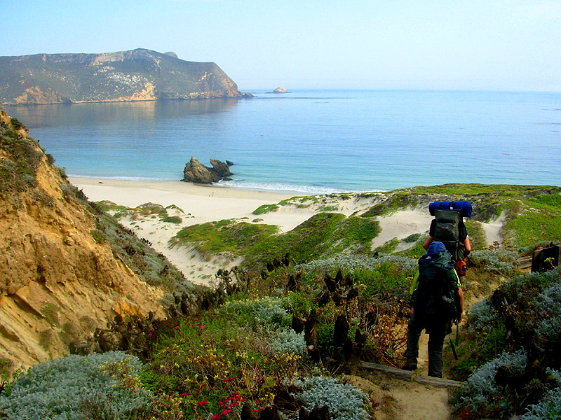 |
34°02′23″N 120°22′31″W[15] | Westernmost Channel Island, measuring 8 miles (13 km) long, 3.7 miles (6.0 km) wide, and containing 9,325 acres (3,774 ha) of land. The island is uninhabited, and is rarely visited. Part of the Greater Los Angeles Area. |
| San Nicolas Island | 33°14′58″N 119°30′01″W[16] | Is said to be the most remote island of the Channel Islands, and is used by the U.S. Navy as a weapons testing and training facility. It has no civilian inhabitants, but is inhabited by military personnel. It covers 14,562 acres (5,893 ha). Part of the Greater Los Angeles Area. | |
| Santa Barbara Island |  |
33°28′32″N 119°02′10″W[17] | Smallest Channel Island at 640 acres (260 ha) in area; it is located roughly between San Nicolas and Santa Catalina Islands. Part of the Greater Los Angeles Area. |
| Santa Catalina Island | 33°23′00″N 118°25′03″W[18] | The most populous of the Channel Islands, with 3,696 residents as of 2000. It is about 22 miles (35 km) long with a maximum width of 8 miles (13 km). It covers 74.98 square miles (194.2 km2). In Los Angeles County. | |
| Santa Cruz Island |  |
34°02′25″N 119°50′37″W[19] | Santa Cruz Island measures 22 miles (35 km) long with an average width of 4 miles (6.4 km), covering 96.5 square miles (250 km2). It is the largest Channel Island. The island is now on public land, but was previously the largest privately owned island of the continental United States. Part of the Greater Los Angeles Area. |
| Santa Rosa Island |  |
33°57′00″N 120°06′04″W[20] | Santa Rosa Island occupies 83.1 square miles (215 km2), and is the second largest Channel Island. The island has a permanent population of 2 persons, and is about 26 miles (42 km) off the coast of Santa Barbara, California. Part of the Greater Los Angeles area. |
| Shag Rock | 33°29′13″N 119°02′10″W[21] | Small islet located off the north shore of Santa Barbara Island, and is only about 1 acre (0.40 ha). | |
| Sutil Island | 33°27′50″N 119°02′54″W[22] | Located off the southwest shore of Santa Barbara Island, and is about 12 acres (4.9 ha). It is named for a Spanish ship exploring the West Coast in an expedition led by Sebastián Vizcaíno. |
Greater Los Angeles Area
The Greater Los Angeles Area is an urban area on the Pacific coast of southern California.
| Island | Image | Coordinates | Description |
|---|---|---|---|
| Island Chaffee | 33°44′23″N 118°08′20″W | An artificial island/oil platform named after astronaut Roger B. Chaffee who died in the Apollo 1 accident. Located in San Pedro Bay. | |
| Deadman's Island |  |
33°43′25″N 118°15′57″W | An island with a landmark mound at the mouth of Los Angeles Harbor, flattened in 1928 for a Federal Prison and Coast Guard Base. Joined by a short causeway to Terminal Island, the newer island is sometimes referred to as Isla del Umberto or more often, Reservation Point. The former mound with a natural arch was called “Deadman’s Island” for the graves at top. |
| Freeman Island | 33°44′29″N 118°09′45″W | An artificial island/oil platform named after astronaut Theodore Freeman who died in a crash. Located in San Pedro Bay. | |
| Island Grissom | 33°45′33″N 118°10′53″W | An artificial island/oil platform named after astronaut Gus Grissom who died in the Apollo 1 accident. Located in San Pedro Bay. | |
| Naples Islands | 33°27′05″N 118°43′12″W | A neighborhood in Long Beach that consists of three different islands divided by canals which empty out into Alamitos Bay. | |
| Terminal Island | 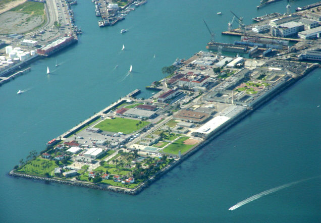 |
33°45′25″N 118°14′53″W | An expansion of natural Rattlesnake Island, which stretched between San Pedro and Long Beach. Earth dredged from shallow San Pedro Bay was used as landfill. It is 3.5 miles (5.6 km) long and covers an area of 4.46 square miles (11.6 km2). The picture shows Reservation Point, formed after Deadman’s Island was leveled. |
| Island White | 33°45′10″N 118°09′33″W | An artificial island/oil platform named after astronaut Ed White who died in the Apollo 1 accident; Located in San Pedro Bay.[23][24] |
Newport Bay
The bay associated with Newport Harbor and the city of Newport Beach, California.
| Island | Image | Coordinates | Description |
|---|---|---|---|
| Balboa Island | 33°36′23″N 117°53′40″W | A 50-hectare (120-acre), densely populated harbor island with 1,500 expensive homes. Partially created as a result of the Santa Ana River flooding in 1824, then artificially expanded to its present size. | |
| Bay Island |  |
33°36′25″N 117°54′18″W | West of Balboa Island. |
| Collins Island | 33°36′31″N 117°54′1″W | A small island located at the end of Balboa Island | |
| Harbor Island | 33°36′01″N 117°54′10″W | ||
| Lido Isle |  |
33°36′14″N 117°55′02″W | Northwest of Balboa Island. |
| Linda Isle |  |
33°36′50″N 117°54′13″W | |
| Newport Island | Located at the far west end of the bay |
Lake islands
| Island | Image | Coordinates | Lake | Description |
|---|---|---|---|---|
| Beaver Island | 40.7566°N 122.3325°W | Shasta Lake | An island in the Pit River Arm of the lake, located just west of the Pit River Bridge and Bridge Bay Resort/marina. | |
| Fannette Island |  |
38°57′15″N 120°06′02″W | Lake Tahoe | The only major island in Lake Tahoe, located within Emerald Bay.[25] |
| Main Island |  |
34°23′41″N 119°20′34″W | Lake Casitas | A 1.5 miles (2.4 km) long, 850-foot (260 m) high island rising 512 feet (156 m) above the lake surface. |
| Mullet Island | Salton Sea | A small volcanic island near the southern end of the Salton Sea near the mouth of the Alamo River | ||
| Negit Island |  |
38°01′22″N 119°02′59″W[26] | Mono Lake | A young volcanic cone, connected to the mainland during low water. It is an important stop for nesting birds, and as a result is closed to visitation during April. |
| Paoha Island | 38°00′02″N 119°01′57″W[27] | Mono Lake | 2.5 miles (4.0 km) long and 2 miles (3.2 km) wide, and is the largest Mono Lake island. | |
| Rattlesnake Island | 39°00′36″N 122°40′44″W | Clear Lake | A 53-acre (21 ha) island desired by the Elem Indian Colony. | |
| Red Island | Salton Sea | A volcanic island near the southern end of the sea, on the San Andreas Fault. | ||
| Ridgeville Islands | 40.8453°N 122.7875°W | Trinity Lake | A group of forested islets in the Stewart Fork arm about 4 mi (6.4 km) northwest of Trinity Dam. | |
| Ski Island | 40.7592°N 122.2587°W | Shasta Lake | An island in the Pit River arm of the lake, located shortly north of Bear Mountain. | |
| Slaughterhouse Island | 40.7651°N 122.3835°W | Shasta Lake | An island in the Sacramento River Arm of the lake, located about 3 mi (4.8 km) northeast of Shasta Dam. |
River islands
| Island | Image | Coordinates | River | Description |
|---|---|---|---|---|
| Cannibal Island | 40.6582°N 124.2883°W | Eel River | An island in the estuary of the Eel River, bounded by the Eel River, Mosley Slough and Sevenmile Slough. | |
| Circle Island | 37.1468°N 120.7641°W | San Joaquin River | An island formed by side channels of the San Joaquin River in the San Luis National Wildlife Refuge near Los Banos. | |
| Cobbs Island | 36.9151°N 119.7692°W | San Joaquin River | An island at mile 259 of the San Joaquin River north of Fresno, contiguous with nearby Island No. 1. | |
| Cock Robin Island | 40.6277°N 124.2775°W | Eel River | An island in the estuary of the Eel River, west of Loleta, between Eel River and Ropers Slough. | |
| Deer Island | 34.1176°N 114.3740°W | Colorado River | An island at mile 169 of the Colorado River on the California–Arizona border, near Parker, Arizona. | |
| Foster Island | 39.8527°N 122.0629°W | Sacramento River | An island at mile 211 of the Sacramento River near Merrills Landing. | |
| Golden State Island | 39.6777°N 121.9533°W | Sacramento River | An island at mile 190 of the Sacramento River between Sacramento River and Murphy Slough, directly across from Phelan Island. | |
| Hall Island | 33.8713°N 114.5188°W | Colorado River | An island at mile 145 of the Colorado River, west of the California–Arizona border. | |
| Hanson Island | 39.4812°N 122.0071°W | Sacramento River | An island at mile 171 of the Sacramento River, near Codora, between Sacramento River and Beehive Bend. | |
| Happy Isles |  |
37.7317°N 119.5587°W | Merced River | A group of small islands in the Merced River at the upper end of Yosemite Valley, in Yosemite National Park. |
| Hartley Island | 39.5198°N 121.9906°W | Sacramento River | An island at mile 174 of the Sacramento River near Glenn. | |
| Horse Island | 33.8610°N 114.5152°W | Colorado River | An island at mile 144 of the Colorado River, west of the California–Arizona border. | |
| Ledger Island | 36.9489°N 119.7403°W | San Joaquin River | An island at mile 264 of the San Joaquin River north of Fresno, shortly below Friant Dam. | |
| Lower Foster Island | 39.8457°N 122.0693°W | Sacramento River | An island at mile 210 of the Sacramento River near Merrills Landing, immediately south of Foster Island. | |
| Mooney Island | 40.1062°N 122.1418°W | Sacramento River | An island at mile 236 of the Sacramento River north of Gerber. | |
| Mosley Island | 40.6427°N 124.3001°W | Eel River | The westernmost and smallest named island in the Eel River estuary, bounded by Eel River, North Bay and Mosley Slough. | |
| Packer Island | 39.4450°N 122.0080°W | Sacramento River | An island at mile 167 of the Sacramento River near Codora, between Sacramento River and Packer Lake (oxbow lake in seasonal channel). | |
| Phelan Island | 39.6839°N 121.9646°W | Sacramento River | An island at mile 189 of the Sacramento River near Rotavele, between the Sacramento River and Negro Sam Slough, directly across from Golden State Island. | |
| Ryan Island | 39.6256°N 121.9858°W | Sacramento River | An island at mile 184 of the Sacramento River near Ordbend. | |
| Scout Island | 36.8593°N 119.8432°W | San Joaquin River | A seasonal island in the San Joaquin River in north Fresno. | |
| Snaden Island | 39.8141°N 122.0521°W | Sacramento River | An island at mile 207 of the Sacramento River near Capay, between the Sacramento River and Snaden Slough. | |
| Todd Island | 40.1144°N 122.1382°W | Sacramento River | An island at mile 237.5 of the Sacramento River near Dairyville. | |
| Turner Island | 37.1653°N 120.6721°W | San Joaquin River | A large island along the San Joaquin River and Mariposa Slough near Los Banos, in Merced National Wildlife Refuge. |
Miscellaneous
| Island | Image | Coordinates | Description |
|---|---|---|---|
| Rincon Island |  |
34°20′51″N 119°26′43″W | A 1 acre (0.40 ha) artificial island off the coast of Ventura County, leased for oil and gas production. |
| Smith Island | 35°09′45″N 120°45′14″W | Rocky island in San Luis Bay, Avila Beach, California |
See also
- Geography of California
- List of islands of the United States
- Outline of California
References
- "GNIS Feature Search". Retrieved 2009-07-29.
- California Department of Fish and Wildlife , California Protected Marine Areas, 14 March 2013
- California Department of Fish and Wildlife, Sugarloaf Island Special Closure, 2015
- Bob Lorentzen; Richard Nichols (1998). Hiking the California Coastal Trail: Oregon to Monterey. Bored Feet Publications. ISBN 978-0-939431-18-2.
- "Bird Rock". Geographic Names Information System. United States Geological Survey, United States Department of the Interior. Retrieved 2009-05-26.
- "Año Nuevo Island". Geographic Names Information System. United States Geological Survey, United States Department of the Interior. Retrieved 2009-05-26.
- "Bird Island". Geographic Names Information System. United States Geological Survey, United States Department of the Interior. Retrieved 2009-05-26.
- Petra Unger; Diana Edwards (December 2017). Palo Alto Baylands: Existing Conditions (Report). AECOM, 2020 L Street, Suite 400, Sacramento, CA 95811. Retrieved 15 September 2020.
- "Atlas of Gulf of the Farallones Region, Central California". United States Geological Survey. Archived from the original on 2014-05-16. Retrieved 2009-05-26.
- David L. Durham, "California's Geographic Names: A Gazetteer of Historic and Modern Names of This State," p. 693 (Quill Driver Books 1998) ISBN 1-884995-14-4.
- "Anacapa Island". Geographic Names Information System. United States Geological Survey, United States Department of the Interior. Retrieved 2009-05-26.
- "Begg Rock". Geographic Names Information System. United States Geological Survey, United States Department of the Interior.
- "San Clemente Island". Geographic Names Information System. United States Geological Survey, United States Department of the Interior. Retrieved 2009-05-26.
- Porcasi; Judith and Paul (1999). "Early Holocene Coastlines of the California Bight" (PDF). Pacific Coast Archaeological Society Quarterly. 2. 35 (Spring/Summer).
- "San Miguel Island". Geographic Names Information System. United States Geological Survey, United States Department of the Interior. Retrieved 2009-05-26.
- "San Nicolas Island". Geographic Names Information System. United States Geological Survey, United States Department of the Interior. Retrieved 2009-05-26.
- "Santa Barbara Island". Geographic Names Information System. United States Geological Survey, United States Department of the Interior. Retrieved 2009-05-26.
- "Santa Catalina Island". Geographic Names Information System. United States Geological Survey, United States Department of the Interior. Retrieved 2009-05-26.
- "Santa Cruz Island". Geographic Names Information System. United States Geological Survey, United States Department of the Interior. Retrieved 2009-05-26.
- "Santa Rosa Island". Geographic Names Information System. United States Geological Survey, United States Department of the Interior. Retrieved 2009-05-26.
- "Shag Rock". Geographic Names Information System. United States Geological Survey, United States Department of the Interior. Retrieved 2009-05-26.
- "Sutil Island". Geographic Names Information System. United States Geological Survey, United States Department of the Interior. Retrieved 2009-05-26.
- "Fallen Astronauts: Book Review".
- "City of Long Beach". Archived from the original on 2010-07-13.
- "Fannette Island". Geographic Names Information System. United States Geological Survey, United States Department of the Interior. Retrieved 2009-05-26.
- "Negit Island". Geographic Names Information System. United States Geological Survey, United States Department of the Interior. Retrieved 2009-05-26.
- "Paoha Island". Geographic Names Information System. United States Geological Survey, United States Department of the Interior. Retrieved 2009-05-26.
Further reading
- Martin, James A.; Lee, Michael T. (2006). The Islands of San Francisco Bay. San Rafael, CA: Down Window Press. ISBN 0-9787241-0-0.
External links
Islands of California.
Sacramento (capital) | ||
| Topics |
|  |
| Regions |
| |
| Metro regions |
| |
| Counties |
| |
| Most populous cities | ||
Другой контент может иметь иную лицензию. Перед использованием материалов сайта WikiSort.org внимательно изучите правила лицензирования конкретных элементов наполнения сайта.
WikiSort.org - проект по пересортировке и дополнению контента Википедии