geo.wikisort.org - Island
Deadman Island is an island near Suisun Bay.[2] It is part of Solano County, California, and not managed by any reclamation district.[3] Its coordinates are 38°13′14″N 122°01′41″W[1], and the United States Geological Survey measured its elevation as 7 ft (2.1 m) in 1981.[1] It is labeled, along with Joice Island, Grizzly Island, Simmons Island, Ryer Island and Roe Island, on a 1902 USGS map of the area.[4]
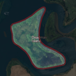 USGS aerial imagery of Deadman Island | |
 Deadman Island  Deadman Island  Deadman Island | |
| Geography | |
|---|---|
| Location | Northern California |
| Coordinates | 38°13′14″N 122°01′41″W[1] |
| Adjacent bodies of water | Sacramento–San Joaquin River Delta |
| Highest elevation | 7 ft (2.1 m)[1] |
| Administration | |
United States | |
| State | |
| County | Solano |
References
- U.S. Geological Survey Geographic Names Information System: Deadman Island
- "Law Proposed To Protect Marsh". Vallejo Times-Herald. Vallejo, California. 1974-02-24. p. 4.
- "Municipal Service Review: Solano County Water, Irrigation, Reclamation, and Flood Management Agencies" (PDF). Solano County LAFCO. Michael Brandman Associates. 13 April 2009. Archived (PDF) from the original on 14 March 2021. Retrieved 25 February 2021.
- Goode, R.U.; Fletcher, L.C. (1902), Topography, State of California: Woodward Island Quadrangle, United States Geological Survey
Map: Islands of Suisun Bay and the Sacramento–San Joaquin River Delta | |
|---|---|
 Rough and Ready (islands of the San Francisco Bay Area) |
San Francisco Bay watershed | ||
|---|---|---|
| Outline |
|  |
| Subdivisions |
| |
| Waterways |
| |
| Parks and protected areas |
| |
| Islands and peninsulas |
| |
| Wetlands |
| |
| Bridges and tubes |
| |
| Ferries |
| |
| Ports and marinas |
| |
| Other |
| |
| ||
This Solano County, California-related article is a stub. You can help Wikipedia by expanding it. |
Текст в блоке "Читать" взят с сайта "Википедия" и доступен по лицензии Creative Commons Attribution-ShareAlike; в отдельных случаях могут действовать дополнительные условия.
Другой контент может иметь иную лицензию. Перед использованием материалов сайта WikiSort.org внимательно изучите правила лицензирования конкретных элементов наполнения сайта.
Другой контент может иметь иную лицензию. Перед использованием материалов сайта WikiSort.org внимательно изучите правила лицензирования конкретных элементов наполнения сайта.
2019-2025
WikiSort.org - проект по пересортировке и дополнению контента Википедии
WikiSort.org - проект по пересортировке и дополнению контента Википедии