geo.wikisort.org - Island
Little Hastings Tract is a mostly submerged island in the Sacramento–San Joaquin River Delta.[2][3] It is in Solano County, California.[4][5][6] Its coordinates are 38°15′02″N 121°41′32″W[1], and the United States Geological Survey gave its elevation as 0 ft (0 m) in 1981.[1] It appears, above water, on a 1978 USGS map.[7]
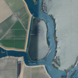 USGS aerial imagery of Little Hastings Tract | |
 Little Hastings Tract  Little Hastings Tract  Little Hastings Tract | |
| Geography | |
|---|---|
| Location | Northern California |
| Coordinates | 38°15′02″N 121°41′32″W[1] |
| Adjacent bodies of water | Sacramento–San Joaquin River Delta |
| Highest elevation | 0 ft (0 m)[1] |
| Administration | |
United States | |
| State | |
| County | Solano |
References
- U.S. Geological Survey Geographic Names Information System: Little Hastings Tract
- "Dikes Holding As Flood Reaches Bay Lowlands". Chico Record. Chico, California. 1936-02-01. p. 4.
- "Delta Area In Hectic Effort To Bar Floods". Santa Cruz Evening News. Santa Cruz, California. 1937-12-15. p. 1.
- "High Tide Is New Delta Flood Threat". The Fresno Bee The Republican. Fresno, California. 1937-12-15. p. 1.
- "Flood Crest Perils Delta". Oakland Tribune. Oakland, California. 1937-12-15. p. 1.
- "Levees Bolstered". San Pedro News-Pilot. San Pedro, California. 1937-12-15. p. 1.
- United States Geological Survey (1978). "Rio Vista Quadrangle, California" (Map). United States Department of the Interior Geological Survey. 1:24000.
Map: Islands of Suisun Bay and the Sacramento–San Joaquin River Delta | |
|---|---|
 Rough and Ready (islands of the San Francisco Bay Area) |
San Francisco Bay watershed | ||
|---|---|---|
| Outline |
|  |
| Subdivisions |
| |
| Waterways |
| |
| Parks and protected areas |
| |
| Islands and peninsulas |
| |
| Wetlands |
| |
| Bridges and tubes |
| |
| Ferries |
| |
| Ports and marinas |
| |
| Other |
| |
| ||
This Solano County, California-related article is a stub. You can help Wikipedia by expanding it. |
Текст в блоке "Читать" взят с сайта "Википедия" и доступен по лицензии Creative Commons Attribution-ShareAlike; в отдельных случаях могут действовать дополнительные условия.
Другой контент может иметь иную лицензию. Перед использованием материалов сайта WikiSort.org внимательно изучите правила лицензирования конкретных элементов наполнения сайта.
Другой контент может иметь иную лицензию. Перед использованием материалов сайта WikiSort.org внимательно изучите правила лицензирования конкретных элементов наполнения сайта.
2019-2026
WikiSort.org - проект по пересортировке и дополнению контента Википедии
WikiSort.org - проект по пересортировке и дополнению контента Википедии