geo.wikisort.org - Island
The Hastings Tract is an island in the Sacramento–San Joaquin River Delta.[3][4][5][6] It is part of Solano County, California, and managed by Reclamation District 2060.[7] Its coordinates are 38°16′19″N 121°43′45″W[1], and the United States Geological Survey measured its elevation as 0 ft (0 m) in 1981.[1]
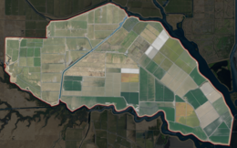 USGS aerial imagery of Hastings Tract | |
 Hastings Tract  Hastings Tract  Hastings Tract | |
| Geography | |
|---|---|
| Location | Northern California |
| Coordinates | 38°16′19″N 121°43′45″W[1] |
| Adjacent bodies of water | Sacramento–San Joaquin River Delta |
| Area | 6,400 acres (2,600 ha)[2] |
| Highest elevation | 0 ft (0 m)[1] |
| Administration | |
United States | |
| State | |
| County | Solano |

References
- U.S. Geological Survey Geographic Names Information System: Hastings Tract
- "State, North Delta Agency Directors Agree On Price For Water Deliveries". The Sacramento Bee. Sacramento, California. 1980-01-19. p. 1.
- "On the Eighteenth day of May, 1858". The Daily Bee. Sacramento, California. 1858-04-28. p. 2.
- "Fishing Line". The Sacramento Bee. Sacramento, California. 2003-12-24. p. C6.
- "Those Hastings Were A Busy Lot". Oakland Tribune. Oakland, California. 1972-11-19. p. 141.
- "4,700 Acre Tract In Delta Is Sold". The Sacramento Bee. Sacramento, California. 1961-08-10. p. 29.
- "Municipal Service Review: Solano County Water, Irrigation, Reclamation, and Flood Management Agencies" (PDF). Solano County LAFCO. Michael Brandman Associates. 13 April 2009. Archived (PDF) from the original on 14 March 2021. Retrieved 25 February 2021.
Map: Islands of Suisun Bay and the Sacramento–San Joaquin River Delta | |
|---|---|
 Rough and Ready (islands of the San Francisco Bay Area) |
San Francisco Bay watershed | ||
|---|---|---|
| Outline |
|  |
| Subdivisions |
| |
| Waterways |
| |
| Parks and protected areas |
| |
| Islands and peninsulas |
| |
| Wetlands |
| |
| Bridges and tubes |
| |
| Ferries |
| |
| Ports and marinas |
| |
| Other |
| |
| ||
This Solano County, California-related article is a stub. You can help Wikipedia by expanding it. |
Текст в блоке "Читать" взят с сайта "Википедия" и доступен по лицензии Creative Commons Attribution-ShareAlike; в отдельных случаях могут действовать дополнительные условия.
Другой контент может иметь иную лицензию. Перед использованием материалов сайта WikiSort.org внимательно изучите правила лицензирования конкретных элементов наполнения сайта.
Другой контент может иметь иную лицензию. Перед использованием материалов сайта WikiSort.org внимательно изучите правила лицензирования конкретных элементов наполнения сайта.
2019-2026
WikiSort.org - проект по пересортировке и дополнению контента Википедии
WikiSort.org - проект по пересортировке и дополнению контента Википедии