geo.wikisort.org - Island
Quimby Island is a small island in the Sacramento–San Joaquin River Delta,[2][3] whose coordinates are 38.0251993°N 121.5713413°W[1]. It is in Contra Costa County, and managed by Reclamation District 2090.[4]
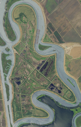 USGS aerial imagery of the island. | |
 Quimby Island  Quimby Island  Quimby Island | |
| Geography | |
|---|---|
| Location | Northern California |
| Coordinates | 38.0251993°N 121.5713413°W[1] |
| Adjacent bodies of water | Sacramento–San Joaquin River Delta |
| Area | 789 acres (319 ha) |
| Length | 2.25 mi (3.62 km)[1] |
| Highest elevation | −10 ft (-3 m)[1] |
| Administration | |
United States | |
| State | |
| County | Contra Costa |
References
- U.S. Geological Survey Geographic Names Information System: Quimby Island
- "New Floods Sweep Valleys". Oakland Tribune. Oakland, California. 1938-02-14. p. 1.
- "Thor Kofod Buys Quimby Island For $34,000". Contra Costa Gazette. Martinez, California. 1943-12-04. p. 1.
- "Countywide Reclamation Services: Municipal Service Review/Sphere of Influence Update (2nd Round) – FINAL" (PDF). Contra Costa Local Agency Formation Commission. 18 November 2015. Archived (PDF) from the original on 1 March 2017. Retrieved 23 February 2021.
Map: Islands of Suisun Bay and the Sacramento–San Joaquin River Delta | |
|---|---|
 Rough and Ready (islands of the San Francisco Bay Area) |
San Francisco Bay watershed | ||
|---|---|---|
| Outline |
|  |
| Subdivisions |
| |
| Waterways |
| |
| Parks and protected areas |
| |
| Islands and peninsulas |
| |
| Wetlands |
| |
| Bridges and tubes |
| |
| Ferries |
| |
| Ports and marinas |
| |
| Other |
| |
| ||
This Contra Costa County, California–related article is a stub. You can help Wikipedia by expanding it. |
Текст в блоке "Читать" взят с сайта "Википедия" и доступен по лицензии Creative Commons Attribution-ShareAlike; в отдельных случаях могут действовать дополнительные условия.
Другой контент может иметь иную лицензию. Перед использованием материалов сайта WikiSort.org внимательно изучите правила лицензирования конкретных элементов наполнения сайта.
Другой контент может иметь иную лицензию. Перед использованием материалов сайта WikiSort.org внимательно изучите правила лицензирования конкретных элементов наполнения сайта.
2019-2026
WikiSort.org - проект по пересортировке и дополнению контента Википедии
WikiSort.org - проект по пересортировке и дополнению контента Википедии