geo.wikisort.org - Island
The Little Holland Tract is a partially submerged island in the Sacramento–San Joaquin River Delta, in Yolo County, California.[2] Its coordinates are 38°19′27″N 121°39′20″W[1], and the United States Geological Survey gave its elevation as 13 ft (4.0 m) in 1981.[1] It appears on a 1952 USGS map as a large rectangular tract; by 1978, survey maps show it cut diagonally by the Sacramento River Deep Water Ship Channel.[3][4]
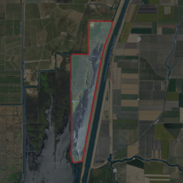 USGS aerial imagery of Little Holland Tract | |
 Little Holland Tract  Little Holland Tract  Little Holland Tract | |
| Geography | |
|---|---|
| Location | Northern California |
| Coordinates | 38°19′27″N 121°39′20″W[1] |
| Adjacent bodies of water | Sacramento–San Joaquin River Delta |
| Highest elevation | 13 ft (4 m)[1] |
| Administration | |
United States | |
| State | |
| County | Yolo |
References
- U.S. Geological Survey Geographic Names Information System: Little Holland Tract
- "More islands submerged in Delta floods". North East Bay Independent and Gazette. Berkeley, California. 1980-02-22. p. 1.
- United States Geological Survey (1952). "Liberty Island Quadrangle, California" (Map). United States Department of the Interior Geological Survey. 1:24000.
- United States Geological Survey (1978). "Liberty Island Quadrangle, California" (Map). United States Department of the Interior Geological Survey. 1:24000.
Map: Islands of Suisun Bay and the Sacramento–San Joaquin River Delta | |
|---|---|
 Rough and Ready (islands of the San Francisco Bay Area) |
San Francisco Bay watershed | ||
|---|---|---|
| Outline |
|  |
| Subdivisions |
| |
| Waterways |
| |
| Parks and protected areas |
| |
| Islands and peninsulas |
| |
| Wetlands |
| |
| Bridges and tubes |
| |
| Ferries |
| |
| Ports and marinas |
| |
| Other |
| |
| ||
This Yolo County, California-related article is a stub. You can help Wikipedia by expanding it. |
Текст в блоке "Читать" взят с сайта "Википедия" и доступен по лицензии Creative Commons Attribution-ShareAlike; в отдельных случаях могут действовать дополнительные условия.
Другой контент может иметь иную лицензию. Перед использованием материалов сайта WikiSort.org внимательно изучите правила лицензирования конкретных элементов наполнения сайта.
Другой контент может иметь иную лицензию. Перед использованием материалов сайта WikiSort.org внимательно изучите правила лицензирования конкретных элементов наполнения сайта.
2019-2026
WikiSort.org - проект по пересортировке и дополнению контента Википедии
WikiSort.org - проект по пересортировке и дополнению контента Википедии