geo.wikisort.org - Island
The Empire Tract is an island in the Sacramento–San Joaquin River Delta[2] in San Joaquin County, California, United States. It has been used for agriculture since the 1800s; in the early 20th century it was used to plant potatoes, and United States president Herbert Hoover operated a beet farm there. In the 1960s, natural gas deposits were discovered beneath the island. In 1936, it was connected to the mainland by the Eight Mile Road Bridge, across King Island. As with many islands in the Delta, the Empire Tract has experienced considerable subsidence, and is well below sea level.
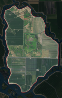 USGS aerial imagery of the Empire Tract | |
 Empire Tract  Empire Tract  Empire Tract | |
| Geography | |
|---|---|
| Location | Northern California |
| Coordinates | 38°03′55″N 121°28′48″W[1] |
| Adjacent bodies of water | Sacramento–San Joaquin River Delta |
| Highest elevation | −10 ft (-3 m)[1] |
| Administration | |
United States | |
| State | |
| County | San Joaquin |
Geography
It is part of San Joaquin County, California, and managed by Reclamation District 2029.[3][4] Its coordinates are 38°03′55″N 121°28′48″W[1], and the United States Geological Survey measured its elevation as −10 ft (−3.0 m) in 1981.[1] To the north is Terminous Tract (across White Slough), and to the northwest is Bouldin Island (across Little Potato Slough).[5] To its west is Venice Island (across Little Connection Slough).[5] To its southwest are Little Venice, Ward, Tinsley, and Fern Islands (across the Ward Cut, part of the Stockton Deepwater Shipping Channel).[5] To its southeast is the Rindge Tract, separated by Connection Slough,[5] and to its east is King Island, separated by the approximately 400 ft (120 m) Honker Cut.[6] The only road access to Empire Tract is the Eight Mile Road Bridge (29C-219), a two-lane bridge built in 1936, connecting to it from King Island.[7] Ferry service runs between Empire Tract and Venice Island.[8][9]

History
In December 1912, Lee A. Philips, a capitalist of Stockton and Los Angeles, purchased several islands in the California Delta, including the Empire Tract,[10] which began to be planted in that year by the Empire Navigation Company.[11] In 1912, 1,500 acres (610 ha) of barley had been planted on the Empire Tract.[11] By 1913, the company planned to plant the tract with 3,310 acres (1,340 ha) of potatoes and only 400 acres (160 ha) of barley.[11]
In a 1923 report on the hydrography of the San Joaquin River, the Empire Tract was measured as having 3,680 acres (1,490 ha) of land in total, with 3,361 acres (1,360 ha) irrigated.[12]: 180 Of these, there were still 1,973 acres (798 ha) of potatoes, but there were also 865 acres (350 ha) devoted to growing fruit, 481 acres (195 ha) to beans, and 42 acres (17 ha) to hay.[12]: 180 That year, 600 acres (240 ha) of the tract were farmed by a partnership between Philip Giriodi, D. Stagi, and G. Lazzarino.[13] The next year, Giriodi would file a lawsuit against the others for a dissolution of the partnership, claiming that they had refused to pay him his share of the profits.[13] Two years later, the island was to be owned in its entirety by California Delta Farms, Incorporated.[6] California Delta Farms would continue to own the Empire Tract for some years, but by 1946 the company was dissolved.[14]

In the 1930s, United States president Herbert Hoover operated "extensive farming property" on the Empire Tract.[15] In 1936, the Hoover Ranch, supervised by his son Allan Hoover, was the site of a "shooting affray"[16] in which two men were killed in a dispute over wages for beets.[17] Between 1931 and 1938, much of the island was devoted to farming sugar beets.[18]: 610 By the 1950s, planting on the Empire Tract involved asparagus; a lawsuit involving 813 acres (329 ha) of asparagus farmland was filed in 1955.[19]
In 1955, levee failures on the Empire Tract and nearby Venice Island would cause both to flood; while 75 men were working on the islands at the time, 73 were successfully evacuated by the Army with amphibious vehicles, and two were picked up in helicopters.[20]
In the late 20th century, natural gas deposits were discovered underneath several Delta islands (such as the Union Island gas field and the Rio Vista gas field). The Union Oil Company of California drilled a 9,400 ft (2,900 m) exploratory well on the Empire Tract[21] in September 1964, but failed to find oil.[21] The next year, the Signal Oil and Gas Company drilled another well.[21] By 1973, the Union Oil Company was leasing land in the Empire Tract area to extract natural gas.[22]
In 2008, The Modesto Bee published an analysis of the Delta area's subsidence, which gave projections for elevations in the year 2100. The Empire Tract was expected to have the lowest elevation of any island or tract in the Delta, at around 30 ft (9.1 m) below sea level.[23] In 2012, a water treatment plant was finished to divert water from the San Joaquin River for use in farming the Empire Tract; construction had begun in 1996.[24]
Ferry and bridge

Prior to 1936, travel to and from the island was done by boat; in 1926, a ferry was being operated along the same path later taken by the bridge, at the expense of California Delta Farms Incorporated.[6] At that time, the ferry went from easterly King Island (which was itself in the process of being connected to the mainland via a drawbridge); despite "adverse conditions surrounding the operation of the ferry", it was heavily trafficked, and gravel roads on the Empire Tract itself allowed transportation to and from the ferry slip.[6] The construction of a bridge was recommended at the time by a report submitted to the San Joaquin County Board of Supervisors that year.[6] A proposal was made for the construction of a county-operated ferry at the same location, whose cost was estimated at $1500 ($22,960 in 2021).[25] In 1928, a permit for construction of this ferry was approved by the War Department.[26] Contracts for building the ferry were awarded to Bundeson & Lauritzen, shipbuilders of Pittsburg.[27] In 1935, construction began on a bridge to replace the ferry;[28] work was completed the following year, allowing vehicle access to the island outside of the ferry's operational hours.[29][7] By 1952, USGS maps of the area show the bridge to King Island and the ferry to Venice Island.[5] In 1954, it was reported that the construction of another bridge, connecting an "Empire Tract" to a "Lower Jones Tract" was proposed (it is not clear which islands were being referred to, as the Lower Jones Tract is some 5 mi (8.0 km) south of the Empire Tract and McDonald Island is between them).[30] As of 1999, regular ferry service operated between the Empire Tract and Venice Island.[9]
References
- U.S. Geological Survey Geographic Names Information System: Empire Tract
- California State Automobile Association (2007). Coast and Valley: Bay Area to Southern California (Map). 1:560,000. American Automobile Association.
- "Municipal Service Review: Selected San Joaquin County Reclamation Districts" (PDF). San Joaquin Local Agency Formation Commission. E Mulberg & Associates. 18 March 2018. Archived (PDF) from the original on 14 March 2021. Retrieved 24 February 2021.
- "Reclamation Districts Map" (PDF). San Joaquin County Geographic Information Systems. San Joaquin County. 16 September 2020. Archived (PDF) from the original on 24 November 2020. Retrieved 24 February 2021.
- United States Geological Survey (1952). "Terminous Quadrangle, California" (Map). United States Department of the Interior Geological Survey. 1:24000.
- "Delta Report Accepted; Open Campaign To Support Roads, Ferries And Bridge". Stockton Independent. Stockton, California. 30 October 1926. p. 5. Retrieved 17 November 2021 – via Newspapers.com.
- San Joaquin County (23 June 2020). "Eight Mile Road Bridge Deck Rehabilitation at Honker Cut".
- Matuk, Vivian; Macmillan, Doug; Parry, Christianne (2012). "Sacramento–San Joaquin Delta Recreational Boating Map" (PDF). Contra Costa County Watershed Program.
- "Portraits of a place – and its history". The Sacramento Bee. Sacramento, California. 30 September 1999. p. 18. Retrieved 17 November 2021 – via Newspapers.com.
- "Bond Men Visit Phillips Company's Island Holdings". The Evening Mail. Stockton, California. 11 January 1913. p. 6. Retrieved 17 November 2021 – via Newspapers.com.
- "King Bean In The Ascendency". Stockton Daily Evening Record. Stockton, California. 25 February 1913. p. 7. Retrieved 17 November 2021 – via Newspapers.com.
- California Division of Water Rights (May 1923). "Hydrographic Investigation of San Joaquin River, May, 1923". California State Printing Office, F.J. Smith, Superintendent – via Google Books.
- "Giriodi Sues For An Accounting Of Farm Partnership". Stockton Daily Evening Record. Stockton, California. 29 February 1924. p. 13. Retrieved 17 November 2021 – via Newspapers.com.
- "$650,000 Is Paid For King Island". The Modesto Bee. Modesto, California. 5 April 1946. p. 3. Retrieved 17 November 2021 – via Newspapers.com.
- "Hoover Dedicates New School Named for Him". The Los Angeles Times. Los Angeles, California. 4 August 1954. p. 14. Retrieved 17 November 2021 – via Newspapers.com.
- "Workmen Slain on Hoover Ranch". The Napa Valley Register. Napa, California. 27 May 1936. p. 9. Retrieved 17 November 2021 – via Newspapers.com.
- "Two Killed in Wage Dispute". Napa Journal. Napa, California. 26 May 1936. p. 1. Retrieved 17 November 2021 – via Newspapers.com.
- Thompson, John (1957). "The Settlement Geography of the Sacramento–San Joaquin Delta, California" (PDF). Stanford University. Archived (PDF) from the original on 24 June 2021. Retrieved 16 June 2021.
- "Court Deciding Asparagus Land Ownership Suit". Tracy Press. Tracy, California. 13 May 1955. p. 15. Retrieved 17 November 2021 – via Newspapers.com.
- "Army Repairs Bridges, Levees". The San Francisco Examiner. San Francisco, California. 28 December 1955. p. 1. Retrieved 17 November 2021 – via Newspapers.com.
- "2 San Joaquin Trial Wells Are Scheduled". The Sacramento Bee. Sacramento, California. 23 June 1965. p. 24. Retrieved 17 November 2021 – via Newspapers.com.
- "Union Oil drills fifth producer". Tracy Press. Tracy, California. 18 July 1973. p. 21. Retrieved 17 November 2021 – via Newspapers.com.
- "Sinking land". The Modesto Bee. Modesto, California. 14 December 2008. p. B5. Retrieved 17 November 2021 – via Newspapers.com.
- "Delta project began in 1996". The Modesto Bee. Modesto, California. 4 June 2012. p. B4. Retrieved 17 November 2021 – via Newspapers.com.
- "Other Suggestions". Stockton Independent. Stockton, California. 9 November 1926. p. 1. Retrieved 17 November 2021 – via Newspapers.com.
- "Notes of Board of Supervisors". Stockton Independent. Stockton, California. 18 February 1928. p. 11. Retrieved 17 November 2021 – via Newspapers.com.
- "Bay Builders Low Bidders On Ferries". Stockton Independent. Stockton, California. 21 February 1928. p. 6. Retrieved 17 November 2021 – via Newspapers.com.
- "Funds Lacking". Stockton Independent. Stockton, California. 24 September 1935. p. 1. Retrieved 17 November 2021 – via Newspapers.com.
- "Honkey Cut Bridge Job Is Nearly Done". Stockton Independent. Stockton, California. 1 September 1936. p. 8. Retrieved 17 November 2021 – via Newspapers.com.
- "Mike Dwyer's Line on the Sportsman". Oakland Tribune. Oakland, California. 7 April 1954. p. 55. Retrieved 17 November 2021 – via Newspapers.com.
Map: Islands of Suisun Bay and the Sacramento–San Joaquin River Delta | |
|---|---|
 Rough and Ready (islands of the San Francisco Bay Area) |
San Francisco Bay watershed | ||
|---|---|---|
| Outline |
|  |
| Subdivisions |
| |
| Waterways |
| |
| Parks and protected areas |
| |
| Islands and peninsulas |
| |
| Wetlands |
| |
| Bridges and tubes |
| |
| Ferries |
| |
| Ports and marinas |
| |
| Other |
| |
| ||
Другой контент может иметь иную лицензию. Перед использованием материалов сайта WikiSort.org внимательно изучите правила лицензирования конкретных элементов наполнения сайта.
WikiSort.org - проект по пересортировке и дополнению контента Википедии