geo.wikisort.org - River
Bolinas Lagoon is a tidal estuary, approximately 1,100 acres (4.5 km2) in area,[2] located in the West Marin region of Marin County, California, United States, adjacent to the town of Bolinas. It is a part of the Greater Farallones National Marine Sanctuary. In 1974, Aubrey Neasham and William Pritchard wrote in support of Bolinas Lagoon as Drake's New Albion landing site.[3]
| Designations | |
|---|---|
Ramsar Wetland | |
| Official name | Bolinas Lagoon |
| Designated | 1 September 1998 |
| Reference no. | 960[1] |


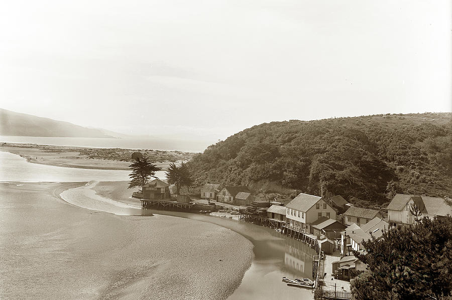
The lagoon is a back bay of Bolinas Bay on the Pacific coast approximately 15 mi (25 km) northwest of San Francisco. The trough in which the lagoon sits was formed by the San Andreas Fault, which runs directly through it. The lagoon is separated from the main bay by a small spit of land, known as Stinson Beach, and the sand bar that encloses this lagoon is full of beachgoers and surfers on hot days, seeking to escape the heat and the urban Bay Area. State Route 1, the Shoreline Highway, runs along the eastern edge of the lagoon.
Bolinas Lagoon is on the list of wetlands of international importance as defined by the Ramsar Convention for the conservation and sustainable utilization of wetlands. Portions of the lagoon are included in Marin County's Bolinas Lagoon Open Space Preserve, and the western shore is part of the Golden Gate National Recreation Area.
The lagoon has a 16.7-square-mile (43 km2) watershed;[2] streams and canyons feeding into it include Audubon Canyon, McKinnan Gulch, Morses Gulch, Picher Canyon, Pike County Gulch, Stinson Gulch, Volunteer Canyon, and Wilkins Gulch. Kent Island is located in the lagoon.
Duxbury Reef State Marine Conservation Area lies offshore from Bolinas. Like an underwater park, this protected marine area helps conserve ocean wildlife and marine ecosystems.

See also
- Drakes Bay
- Fringe theories on the location of New Albion
References
- Notes
- "Bolinas Lagoon". Ramsar Sites Information Service. Retrieved 25 April 2018.
- "Stinson Beach County Water District". Retrieved 2008-01-17.
- Kelleher, Brian T. (1997). Drake's Bay: Unravelling California's Great Maritime Mystery. Kelleher & Associates. pp. 117–118.
External links
 Media related to Bolinas Lagoon at Wikimedia Commons
| Authority control |
|
|---|
This Marin County, California–related article is a stub. You can help Wikipedia by expanding it. |
На других языках
- [en] Bolinas Lagoon
[es] Laguna Bolinas
La laguna Bolinas (en inglés: Bolinas Lagoon) es una laguna costera, estuario de marea o lagoon de la costa del Pacífico de los Estados Unidos. Con aproximadamente 4,5 km² de superficie,[1] está localizada en West Marin, parte de la región del condado de Marin de California. Está dentro del Santuario nacional marino del golfo de los Farallones. La laguna es una contrabahía de la bahía Bolinas, aproximadamente a 25 km al noroeste de San Francisco. La depresión sobre la que se formó la laguna fue creada por la falla de San Andrés que pasa directamente bajo ella. La laguna está separada de la bahía principal por un pequeño banco de arena, conocido como playa Stinson. La lengua de arena que cierra la laguna es un lugar en el que se practica el baño y el surf.[fr] Lagune Bolinas
La lagune Bolinas (en anglais : Bolinas Lagoon) est une lagune américaine dans le comté de Marin, en Californie. Il constitue un site Ramsar depuis le 1er septembre 1998.Другой контент может иметь иную лицензию. Перед использованием материалов сайта WikiSort.org внимательно изучите правила лицензирования конкретных элементов наполнения сайта.
WikiSort.org - проект по пересортировке и дополнению контента Википедии