geo.wikisort.org - Island

Search / Calendar

The following is a list of named islands of the state of Wisconsin. According to the USGS, there are 431 named islands,[1] and many more unnamed ones among Wisconsin's 15,074 lakes.[2] Wisconsin borders both Lake Michigan and Lake Superior producing many of the state's islands. The Mississippi River also has many islands on the state's western boundary. Wisconsin has many rivers including the Wisconsin River and Fox River.

Islands of the state of Wisconsin
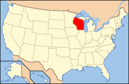
Location of Wisconsin within the United States
Geography
LocationWisconsin
Major islandsWashington Island, Doty Island, Madeline Island, French Island
Administration
 United States
State Wisconsin

Great Lakes


Lake Michigan


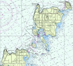
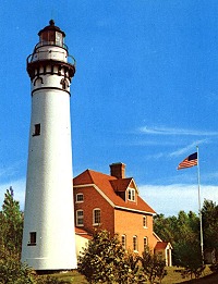
Many of the Wisconsin's islands in Lake Michigan are around the Door Peninsula.[3] Islands in Green Bay include those in and around the Green Bay Breakwater. Washington Island is Wisconsin's largest in Lake Michigan and also has a year-round population of 708 as of the 2010 census. The island has a ferry service and operates Washington Island Airport for air travel.[4] Rock Island is a state park that can only be accessed by ferry from Washington Island. Plum Island is home to a former Coast Guard Life-Saving Station and historic range lights.[5] The islands surrounding the northern part of the peninsula are outcroppings of the Niagara Escarpment.

Washington and surrounding islands
Strawberry Islands
Strawberry Islands
Detroit Island and Detroit Harbor
Pilot Island
Pilot Island
Island Name County Area (acres) Area (sq mi) Coordinates
Adventure Island Door 40 0.06 45°09′32″N 87°15′55″W
Big Sister Island Door 5.4 0.01 45°13′30″N 87°08′53″W
Big Susie Island Door 11.5 0.02 45°20′57″N 86°55′56″W
Birds Tree Island Brown 0.6 <0.01 44°33′32″N 87°59′37″W
Cana Island Door 8.7 0.01 45°05′17″N 87°02′58″W
Cat Island Brown 1.6 <0.01 44°33′36″N 88°00′06″W
Chambers Island Door 2,483 3.88 45°10′56″N 87°21′19″W
Detroit Island Door 637 1.00 45°19′17″N 86°54′58″W
Fish Island Door 1.5 <0.01 45°23′40″N 86°45′52″W
Grassy Island Brown 2.6 <0.01 44°33′23″N 87°59′29″W
Gravel Island Door 4.0 0.01 45°15′13″N 86°57′46″W
Green Island Marinette 19 0.03 45°03′31″N 87°29′46″W
Hat Island Door 8.0 0.01 45°06′08″N 87°19′04″W
Hog Island Door 2.1 <0.01 45°21′26″N 86°51′05″W
Horseshoe Island Door 32 0.05 45°10′44″N 87°12′33″W
Jack Island Door 2.5 <0.01 45°10′24″N 87°15′58″W
Little Sister Island Door 3.1 <0.01 45°13′22″N 87°08′33″W
Little Strawberry Island Door 3.0 <0.01 45°09′59″N 87°16′10″W
Little Susie Island Door 2.2 <0.01 45°20′52″N 86°55′57″W
Pilot Island Door 6.2 0.01 45°17′06″N 86°55′11″W
Pirate Island Door 2.9 <0.01 45°10′38″N 87°15′29″W
Plum Island Door 291 0.46 45°18′29″N 86°57′11″W
Rock Island Door 975 1.52 45°24′55″N 86°49′15″W
Snake Island (Town of Nasewaupee) Door 26 0.04 44°52′17″N 87°31′04″W
Snake Island (Town of Washington) Door 1.4 <0.01 45°21′03″N 86°55′27″W
Spider Island Door 23 0.04 45°12′34″N 86°58′33″W
Squaw Island Door 6.2 0.01 44°50′06″N 87°33′22″W
Texas Rock Milwaukee See below note* See below note* 42°59′27″N 87°52′28″W
Washington Island Door 15,046 23.51 45°22′37″N 86°53′47″W
Willow Island Brown 1.1 <0.01 44°33′49″N 87°59′56″W

Lake Superior


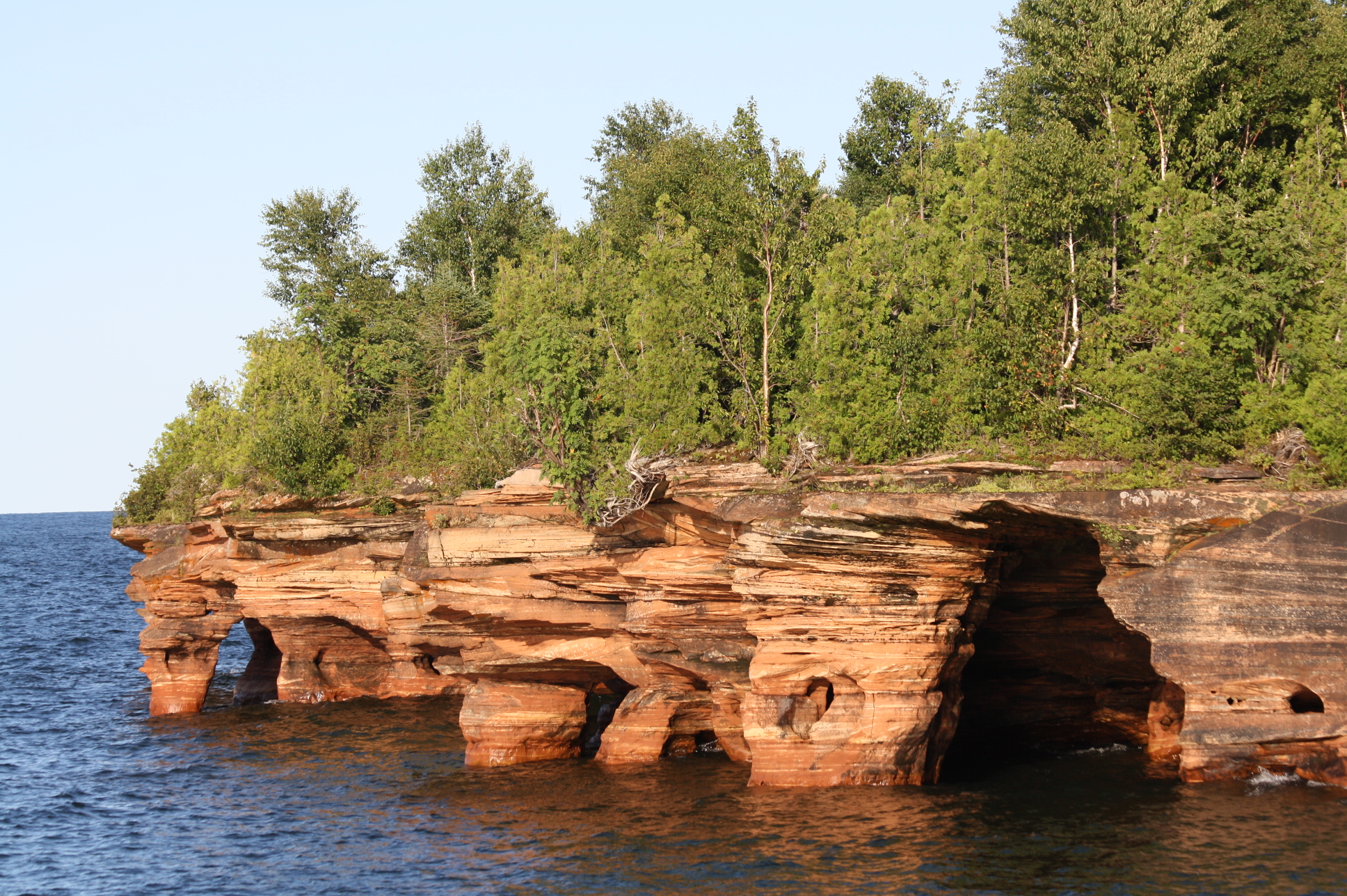
Wisconsin's northernmost point is on Devils Island, part of the Apostle Islands in Lake Superior. It has a population of 302 as of the 2010 census. It can be reached by ferry and airplanes at Major Gilbert Field Airport. The Islands are part of the Apostle Islands National Lakeshore and are featured in Wisconsin's America the Beautiful quarter.[7]

Devils Island Seacaves
York Island
York Island
Outer Island Light on Outer Island
Island Name County Area (acres) Area (sq mi) Coordinates
Barker's Island Douglas 55 0.09 46°43′09″N 92°03′26″W
Basswood Island Ashland 1,914 2.99 46°51′01″N 90°44′47″W
Bear Island Ashland 1,814 2.83 47°00′58″N 90°45′28″W
Cat Island Ashland 1,339 2.09 47°00′48″N 90°33′33″W
Devils Island Ashland 310 0.48 47°04′17″N 90°43′36″W
Eagle Island Bayfield 28 0.04 46°56′38″N 91°02′11″W
Gull Island Ashland 3.5 0.01 46°54′25″N 90°26′33″W
Hermit Island Ashland 788 1.23 46°53′12″N 90°41′07″W
Hog Island Douglas 55 0.09 46°42′16″N 92°02′10″W
Ironwood Island Ashland 666 1.04 47°00′01″N 90°36′56″W
Long Island Ashland 309 0.48 46°43′37″N 90°47′06″W
Madeline Island Ashland 15,359 24.00 46°48′59″N 90°41′21″W
Manitou Island Ashland 1,325 2.07 46°57′56″N 90°39′26″W
Michigan Island Ashland 1,539 2.40 46°52′55″N 90°29′16″W
North Twin Island Ashland 166 0.26 47°04′04″N 90°35′14″W
Oak Island Ashland 5,024 7.85 46°56′14″N 90°43′42″W
Otter Island Ashland 1,323 2.07 46°59′46″N 90°41′28″W
Outer Island Ashland 7,861 12.28 47°02′07″N 90°25′52″W
Raspberry Island Bayfield 288 0.45 46°58′31″N 90°47′40″W
Rocky Island Ashland 1,049 1.64 47°02′21″N 90°40′44″W
Sand Island Bayfield 2,859 4.47 46°58′45″N 90°56′55″W
South Twin Island Ashland 336 0.53 47°02′00″N 90°38′41″W
Stockton Island Ashland 9,892 15.46 46°56′17″N 90°34′43″W
York Island Bayfield 274 0.43 46°58′59″N 90°51′49″W

Inland Lake and River Islands


There are 377 named islands in inland lakes, rivers and marshes, and many more unnamed islands.[8] Over half of the named islands are in the Mississippi River, Wisconsin River, Beaver Dam Lake or Horicon Marsh.

Aerial shot of Garlic Island in Lake Winnebago
Island Name County Body of Water Area (sq mi) Coordinates
Ajax Island Oconto Oconto River 0.03 44°53′03″N 87°51′23″W
Allen Island Crawford Wisconsin River 0.34 43°07′50″N 90°44′33″W
Ames Island Dodge Horicon Marsh <0.01 43°30′05″N 88°40′57″W
Amik Island Douglas Saint Louis River 0.01 46°39′22″N 92°16′44″W
Anchor Island Iron Pine Lake <0.01 46°15′56″N 90°08′28″W
Anderson Island Bayfield Namekagon Lake 0.13 46°13′44″N 91°05′31″W
Ansul Islands Marinette Menominee River 0.12 45°07′07″N 87°40′22″W
Anthony Island Dodge Sinnissippi Lake 0.05 43°21′24″N 88°36′01″W
Antigo Island Oneida Pelican Lake 0.04 45°29′35″N 89°11′39″W
Apple Island Dodge Horicon Marsh <0.01 43°30′53″N 88°39′33″W
Arrowhead Island La Crosse Mississippi River 0.01 43°53′58″N 91°17′11″W
Babbs Island Sawyer Flambeau River 0.01 45°46′09″N 90°45′17″W
Babe Island Dodge Beaver Dam Lake <0.01 43°27′43″N 88°52′12″W
Baby Fourmile Island Dodge Horicon Marsh <0.01 43°29′19″N 88°37′42″W
Baker Island Marinette Menominee River 0.01 45°20′54″N 87°45′24″W
Bald Eagle Island Polk Bone Lake 0.02 45°31′43″N 92°23′17″W
Balls Island Grant Mississippi River 0.10 42°40′11″N 90°51′39″W
Barkers Island Marathon Wisconsin River 0.02 44°57′48″N 89°37′59″W
Barron Island La Crosse Mississippi River 0.44 43°48′55″N 91°15′50″W
Bass Island Florence Bass Lake <0.01 45°53′22″N 88°08′15″W
Battle Island Buffalo Chippewa River 0.07 44°28′40″N 92°03′25″W
Battle Island Vernon Mississippi River 0.05 43°27′29″N 91°13′49″W
Bear Island Polk Balsam Lake <0.01 45°27′46″N 92°26′24″W
Bedker Island Dodge Beaver Dam Lake <0.01 43°31′08″N 88°57′17″W
Beggs Island Waukesha Lac La Belle 0.01 43°07′30″N 88°30′32″W
Bell Island La Crosse Mississippi River ? 43°53′38″N 91°15′22″W
Bell Island Columbia Lake Wisconsin <0.01 43°21'20.5"N 89°38'04.0"W
Belle Island Vilas Mamie Lake 0.01 46°11′38″N 89°23′54″W
Belle Island Wood Wisconsin River 0.01 44°23′13″N 89°49′55″W
Bergman Island Crawford Mississippi River 0.02 43°01′08″N 91°09′37″W
Bertom Island Grant McCartney Lake 0.04 42°40′57″N 90°52′00″W
Beulah Island Walworth Lake Beulah 0.05 42°49′59″N 88°22′52″W
Big Banana Island Sawyer Chippewa Flowage 0.13 45°55′53″N 91°13′57″W
Big Island Burnett Saint Croix River 0.69 46°04′50″N 92°13′28″W
Big Island Iron Turtle-Flambeau Flowage 3.53 46°05′45″N 90°13′08″W
Big Island Marathon Wisconsin River 0.64 44°44′25″N 89°43′50″W
Big Island Oneida Squash Lake <0.01 45°36′08″N 89°33′03″W
Big Island Polk Balsam Lake 0.06 45°27′48″N 92°26′00″W
Big Island Richland Wisconsin River 0.12 43°11′00″N 90°37′56″W
Big Island Sawyer Nelson Lake 0.92 46°05′20″N 91°27′51″W
Big Island Wood Wisconsin River 0.46 44°24′56″N 89°48′27″W
Big Ripley Island Oneida Kawaguesaga Lake 0.03 45°52′20″N 89°44′27″W
Big Skunk Island Dodge Beaver Dam Lake <0.01 43°29′18″N 88°51′16″W
Big Timber Island Sawyer Chippewa Flowage 0.50 45°55′40″N 91°07′49″W
Birch Island Sawyer Chippewa Flowage 0.01 45°56′00″N 91°13′11″W
Bird Island Sawyer Teal Lake <0.01 46°04′42″N 91°06′25″W
Black Oak Island Trempealeau Mississippi River 0.05 44°02′08″N 91°30′34″W
Blackbird Island Winnebago Lake Winnebago <0.01 44°06′45″N 88°27′42″W
Blackhawk Island Juneau Wisconsin River 0.28 43°39′00″N 89°47′35″W
Blueberry Island Marinette Menominee River 0.01 45°06′28″N 87°39′06″W
Bonies Mound Iron Turtle-Flambeau Flowage <0.01 46°05′16″N 90°06′35″W
Boom Island Marinette Menominee River 0.01 45°06′18″N 87°37′54″W
Boom Island Winnebago Wolf River 0.01 44°11′54″N 88°49′07″W
Boomerang Island Vernon Mississippi River 0.03 43°39′39″N 91°14′52″W
Bradys Island Barron Hemlock Lake <0.01 45°34′09″N 91°34′06″W
Brecker Island Dodge Horicon Marsh 0.01 43°29′10″N 88°39′36″W
Broken Bow Island Vernon Mississippi River 0.01 43°39′28″N 91°16′01″W
Broken Gun Island La Crosse Mississippi River 0.01 43°54′47″N 91°17′22″W
Brunet Island Chippewa Cornell Flowage 0.27 45°10′58″N 91°10′04″W
Brush Island Dunn Chippewa River 0.65 44°45′13″N 91°44′11″W
Brushwood Island Dodge Fox Lake 0.02 43°35′15″N 88°54′43″W
Bubar Island Douglas Saint Croix Flowage 0.45 46°15′07″N 91°53′03″W
Buckeye Island Dodge Beaver Dam Lake <0.01 43°27′59″N 88°52′19″W
Bucks Island Buffalo Mississippi River 0.01 44°13′41″N 91°52′02″W
Buffalo Island Buffalo Chippewa River 0.28 44°35′07″N 92°01′26″W
Bullrush Island Buffalo Mississippi River 0.02 44°12′05″N 91°50′38″W
Bunyans Hat Island Rusk Dairyland Reservoir 0.03 45°29′44″N 91°01′24″W
Butternut Island Dodge Sinnissippi Lake 0.05 43°22′46″N 88°37′15″W
Carlson Island Polk Balsam Lake 0.02 45°28′01″N 92°25′49″W
Cedar Island Iowa Wisconsin River 0.70 43°11′04″N 89°54′41″W
Cedar Island Polk Balsam Lake <0.01 45°27′44″N 92°26′51″W
Champaign Island Bayfield Namekagon Lake <0.01 46°12′35″N 91°06′34″W
Chippewa Island Dunn Chippewa River 1.28 44°45′08″N 91°48′01″W
Clare Island Sauk Lake Delton <0.01 43°36′23″N 89°46′49″W
Clark Island Adams & Juneau Wisconsin River 0.27 43°43′32″N 89°50′07″W
Clough Island Douglas Saint Louis River 0.56 46°42′10″N 92°11′21″W
Clubhouse Island Dodge Horicon Marsh 0.01 43°29′34″N 88°39′58″W
Clumbs Island Oneida Lake Minocqua <0.01 45°52′42″N 89°41′45″W
Coleman Islands Dodge Horicon Marsh 0.01 43°28′13″N 88°38′59″W
Coles Island Dodge Rock River 0.01 43°19′22″N 88°35′17″W
Colin Island Vilas Upper Bucktabon Lake 0.01 46°00′59″N 89°20′50″W
Cormorant Island La Crosse Mississippi River 0.01 43°54′12″N 91°17′54″W
Cotton Island Dodge Horicon Marsh 0.01 43°29′05″N 88°37′46″W
Coumbe Island Grant Wisconsin River 0.54 43°11′52″N 90°34′51″W
Crane Island Dodge Sinnissippi Lake 0.01 43°22′26″N 88°36′42″W
Crane Island Vernon Mississippi River ? 43°37′42″N 91°13′31″W
Crats Island Buffalo Mississippi River 0.22 44°22′59″N 92°00′56″W
Crescent Island Oneida Pelican Lake <0.01 45°30′45″N 89°12′32″W
Crownhart Island Douglas Upper Saint Croix Lake 0.01 46°20′25″N 91°48′42″W
Cuba Island Dodge Beaver Dam Lake <0.01 43°27′18″N 88°51′19″W
Darrow Island Sawyer Chippewa Flowage 0.27 45°58′12″N 91°11′48″W
Dead Island Dodge Fox Lake <0.01 43°35′26″N 88°55′20″W
Dead Island Oneida Tomahawk Lake <0.01 45°48′52″N 89°38′28″W
Dead Lake Island Pepin Chippewa River 0.60 44°34′55″N 92°02′14″W
Deakin Island Walworth Middle Lake 0.01 42°46′29″N 88°33′52″W
Deep Hole Island Buffalo Mississippi River 0.02 44°12′12″N 91°50′18″W
Deer Island Jackson Unnamed marsh 0.27 44°16′47″N 90°22′21″W
Deer Island Oconto Wheeler Lake <0.01 45°19′17″N 88°28′46″W
Deer Island Pepin Mississippi River ? 44°27′13″N 92°12′07″W
Deer Island Sauk Wisconsin River ? 43°10′34″N 90°02′09″W
Deer Toe Island Buffalo Mississippi River 0.01 44°12′31″N 91°51′45″W
Denby Island Oneida Medicine Lake 0.04 45°48′37″N 89°07′21″W
Devil Island Dodge Fox Lake <0.01 43°35′07″N 88°56′47″W
Dewings Island Walworth Mill Lake 0.01 42°45′35″N 88°33′37″W
Diamond Island Dodge Rock River ? 43°25′34″N 88°38′06″W
Diamond Island Pierce Mississippi River 0.08 44°36′09″N 92°35′06″W
Dodes Island Sawyer Flambeau River <0.01 45°39′10″N 90°47′40″W
Doty Island Winnebago Fox River 1.11 44°11′37″N 88°26′51″W
Drescher Island Jackson Unnamed marsh ? 44°15′29″N 90°24′37″W
Duck Island Vilas Lac Vieux Desert 0.03 46°08′07″N 89°05′58″W
Dutchman Islands Juneau Wisconsin River 0.05 43°42′29″N 89°49′43″W
Eagle Island Florence Middle Lake <0.01 45°53′38″N 88°08′16″W
Eagle Island Vernon Mississippi River 0.01 43°40′32″N 91°13′45″W
Eagles Nest Island Sawyer Chippewa Flowage 0.03 45°57′32″N 91°10′43″W
East Island Vernon Mississippi River <0.01 43°39′03″N 91°14′21″W
Edwards Island Wood Wisconsin River 0.04 44°22′19″N 89°50′56″W
Elmwood Island Dodge Fox Lake 0.01 43°35′10″N 88°55′15″W
Everbreeze Island Oneida Manson Lake <0.01 45°33′49″N 89°37′59″W
Evergreen Island Dodge Beaver Dam Lake <0.01 43°27′30″N 88°51′59″W
Fairy Island Walworth Booth Lake <0.01 42°48′06″N 88°25′42″W
Faust Island Barron Red Cedar Lake <0.01 45°37′09″N 91°35′19″W
Feather Island Crawford Wisconsin River 0.19 43°09′44″N 90°42′01″W
Fiefield Island Oneida Kawaguesaga Lake 0.01 45°52′05″N 89°43′38″W
Fields Island Portage Wisconsin River 0.48 44°28′08″N 89°33′51″W
First Island Polk Balsam Lake <0.01 45°27′28″N 92°27′03″W
Fisher Island Dodge Beaver Dam Lake <0.01 43°30′58″N 88°53′09″W
Fishers Island Oneida Lake Minocqua 0.01 45°52′21″N 89°41′16″W
Five Islands Menominee Wolf River 0.01 44°59′43″N 88°36′19″W
Flat Island Sawyer Chippewa Flowage 0.37 45°54′57″N 91°13′27″W
Folson Island Sawyer Moose Lake <0.01 46°00′47″N 91°02′14″W
Fourmile Island Dodge Horicon Marsh 0.04 43°29′35″N 88°37′30″W
Fox Island Vilas Rest Lake 0.02 46°08′21″N 89°52′22″W
French Island Clark Black River <0.01 44°26′53″N 90°41′35″W
French Island La Crosse Mississippi River 0.48 43°52′13″N 91°15′46″W
Frog Island Vilas High Lake 0.02 46°09′33″N 89°32′28″W
Garbutt Island Sawyer Lake Chetac ? 45°42′37″N 91°30′31″W
Gardner Island Dodge Horicon Marsh <0.01 43°31′06″N 88°39′11″W
Garlic Island or Island Park Winnebago Lake Winnebago 0.01 44°05′19″N 88°28′54″W
Garrison Island Wood Wisconsin River 0.01 44°22′31″N 89°50′42″W
Goose Island Dodge Beaver Dam Lake <0.01 43°30′37″N 88°52′50″W
Goose Island Dodge Horicon Marsh 0.02 43°32′30″N 88°39′45″W
Goose Island La Crosse & Vernon Mississippi River 0.96 43°43′46″N 91°13′31″W
Government Island Waupaca Chain O' Lakes 0.02 44°20′30″N 89°08′44″W
Governors Island Dane Lake Mendota 0.03 43°07′27″N 89°24′08″W
Grape Island Dane & Iowa Wisconsin River 0.09 43°12′05″N 89°50′24″W
Grape Island Dodge Beaver Dam Lake <0.01 43°27′11″N 88°51′20″W
Grassy Island Vernon Mississippi River 0.01 43°39′04″N 91°14′56″W
Gravel Island Chippewa Chippewa River ? 44°55′10″N 91°26′09″W
Green Island La Crosse Mississippi River 0.37 43°46′59″N 91°14′26″W
Green Island Oconto Leigh Flowage 0.01 45°02′50″N 88°13′55″W
Greenwing Island Vernon Mississippi River <0.01 43°40′10″N 91°13′45″W
Grutt Island Sawyer Lake Chetac 0.02 45°42′00″N 91°30′01″W
Hacklin Island Crawford Wisconsin River 0.08 43°02′08″N 90°58′09″W
Hall Island Dodge Horicon Marsh 0.01 43°30′40″N 88°40′35″W
Happy Island Dunn Chippewa River 1.65 44°45′46″N 91°45′47″W
Harris Island Crawford Wisconsin River 0.11 43°04′23″N 90°53′04″W
Hawk Island Jackson Black River 0.37 44°15′13″N 90°52′15″W
Heelsplitter Island Vernon Mississippi River 0.01 43°37′56″N 91°15′30″W
Heron Island Vernon Mississippi River <0.01 43°38′53″N 91°14′38″W
High Bank Island Iowa Wisconsin River 0.04 43°11′53″N 90°25′11″W
High Island Dodge Beaver Dam Lake <0.01 43°28′40″N 88°52′52″W
Hog Island Dane Lake Waubesa ? 43°01′17″N 89°19′33″W
Hog Island Juneau Unnamed marsh ? 44°14′27″N 90°17′14″W
Honey Island Marathon Honey Island Flowage 0.08 44°42′03″N 89°53′26″W
Honeymoon Island Barron Red Cedar Lake <0.01 45°35′14″N 91°35′13″W
Horseshoe Island Iron Long Lake <0.01 46°15′05″N 90°01′14″W
Hunter Island Crawford Mississippi River 0.12 43°01′33″N 91°09′21″W
Hunter Island Wood Wisconsin River ? 44°24′44″N 89°49′03″W
Hupf Island Dodge Beaver Dam Lake <0.01 43°29′18″N 88°52′29″W
Hurricane Island Grant Mississippi River 0.09 42°39′54″N 90°50′40″W
Ile Le Grand Marinette Menominee River 0.36 45°40′11″N 87°48′27″W
Indernuhle Island Dodge Horicon Marsh 0.02 43°28′13″N 88°36′34″W
Island Number Fifty-four Buffalo Mississippi River 0.03 44°09′07″N 91°46′55″W
Island Number Fifty-three Buffalo Mississippi River 0.04 44°09′20″N 91°47′32″W
Island Number Fifty-two Buffalo Mississippi River 0.01 44°09′23″N 91°47′45″W
Island Number Ninety-one La Crosse Mississippi River 0.05 43°55′38″N 91°21′30″W
Island Number One Vilas Little Saint Germain Lake <0.01 45°55′35″N 89°25′54″W
Island Number One Hundred Eighty-one Grant Mississippi River 0.05 42°54′45″N 91°08′34″W
Island Number One Hundred Fifty-nine Crawford Mississippi River ? 43°13′29″N 91°04′59″W
Island Number One Hundred Fifty-six Crawford Mississippi River <0.01 43°15′49″N 91°03′25″W
Island Number One Hundred Forty-six Vernon Mississippi River 0.32 43°21′32″N 91°12′16″W
Island Number One Hundred Forty-three Crawford & Vernon Mississippi River 1.11 43°22′26″N 91°11′20″W
Island Number One Hundred Ninety-two Grant Mississippi River 0.08 42°43′36″N 91°01′33″W
Island Number One Hundred Seventy Crawford Mississippi River <0.01 43°04′03″N 91°10′44″W
Island Number One Hundred Seventy-seven Grant Mississippi River 0.10 42°56′10″N 91°08′42″W
Island Number One Hundred Seventy-two Crawford Mississippi River 0.97 43°02′32″N 91°10′04″W
Island Number One Hundred Sixty-seven Crawford Mississippi River 0.02 43°05′27″N 91°10′28″W
Island Number One Hundred Sixty-six Crawford Mississippi River 1.66 43°07′00″N 91°09′39″W
Island Number Seventy-one Buffalo Mississippi River 0.07 44°03′58″N 91°38′46″W
Island Number Sixty-three Buffalo Mississippi River 0.23 44°06′43″N 91°42′08″W
Island Number Two Hundred Eleven Grant Mississippi River ? 42°38′42″N 90°43′00″W
Island Number Two Hundred Five Grant Mississippi River <0.01 42°39′33″N 90°48′16″W
Island Number Two Hundred Nine Grant Mississippi River ? 42°39′02″N 90°45′24″W
Island Number Two Hundred One Grant Mississippi River 0.05 42°40′22″N 90°52′47″W
Island Number Two Hundred Seven Grant Mississippi River 0.03 42°39′24″N 90°47′31″W
Island Number Two Hundred Twelve Grant Mississippi River ? 42°37′59″N 90°41′50″W
Island One Hundred Twenty Vernon Mississippi River 0.05 43°40′18″N 91°15′52″W
Islandale Waukesha Lac La Belle 0.01 43°07′22″N 88°30′51″W
Isle La Plume La Crosse Mississippi River 0.25 43°47′35″N 91°15′27″W
Jack Oak Island Grant Mississippi River 0.24 42°41′55″N 90°57′48″W
James Island Winnebago Fox River <0.01 44°12′00″N 88°27′50″W
Jewelwing Island Vernon Mississippi River 0.01 43°37′33″N 91°15′49″W
Johnson Island Trempealeau Mississippi River 0.15 44°00′49″N 91°29′07″W
Jossart Island Oneida Lake Minocqua <0.01 45°51′57″N 89°41′53″W
Keith Island Vilas Big Lake 0.02 46°09′28″N 89°46′16″W
Keller Island Buffalo Mississippi River 0.02 44°13′11″N 91°51′59″W
Ketchum Island Grant & Wood Unnamed marsh ? 44°15′52″N 90°19′44″W
Kirsch Island (also known as Fish Camp Island) Dodge Beaver Dam Lake <0.01 43°30′24″N 88°52′14″W
Kline Island Oneida Lake Minocqua <0.01 45°52′07″N 89°41′53″W
Koch Island Dodge Horicon Marsh 0.01 43°29′00″N 88°36′31″W
Koch Island Dodge Sinnissippi Lake 0.02 43°21′15″N 88°36′26″W
Kopf Island Dodge Beaver Dam Lake <0.01 43°27′48″N 88°52′04″W
Kunz Island Washburn Long Lake <0.01 45°42′15″N 91°43′07″W
Lib Cross Island Columbia Wisconsin River 0.37 43°28′20″N 89°26′40″W
Little Banana Island Sawyer Chippewa Flowage 0.06 45°55′48″N 91°14′01″W
Little Boom Island Waupaca Wolf River 0.01 44°17′32″N 88°52′00″W
Little Chute Islands Outagamie Fox River 0.06 44°16′29″N 88°17′49″W
Little Goose Island Dodge Beaver Dam Lake <0.01 43°26′49″N 88°51′39″W
Little Hoot Island Vernon Mississippi River <0.01 43°37′54″N 91°14′47″W
Little Island Grant Wisconsin River 0.06 43°10′31″N 90°38′33″W
Little Island Oneida Squash Lake <0.01 45°35′43″N 89°33′32″W
Little Ripley Island Oneida Kawaguesaga Lake <0.01 45°52′21″N 89°44′16″W
Little Skunk Island Dodge Beaver Dam Lake <0.01 43°29′18″N 88°51′08″W
Log Island Vernon Mississippi River ? 43°38′06″N 91°13′29″W
Lone Island Dodge Fox Lake <0.01 43°35′25″N 88°54′59″W
Lone Island Washington Big Cedar Lake <0.01 43°24′14″N 88°15′24″W
Lone Willow Island Winnebago Lake Poygan <0.01 44°08′03″N 88°46′12″W
Long Island Barron Hemlock Lake <0.01 45°34′08″N 91°33′54″W
Long Island Iowa Wisconsin River 0.05 43°10′59″N 90°01′15″W
Long Island Marinette Menominee River 0.03 45°17′32″N 87°41′25″W
Long Island Marinette Menominee River 0.01 45°40′21″N 87°47′34″W
Long Island Sauk Wisconsin River 0.43 43°09′59″N 90°11′26″W
Long Point Winnebago Lake Winnebago 0.02 43°54′01″N 88°27′02″W
Loon Island Sawyer Teal Lake <0.01 46°04′40″N 91°07′00″W
Maggies Island Marinette & Menominee, Michigan Menominee River 0.02 45°19′54″N 87°39′22″W
Majestic Island Dodge Beaver Dam Lake <0.01 43°27′34″N 88°52′13″W
Manito Island Vilas Manitowish Lake <0.01 46°06′43″N 89°50′03″W
McClary Island Richland Wisconsin River 0.05 43°12′18″N 90°28′35″W
McDowell Island Waukesha Okauchee Lake 0.01 43°08′02″N 88°26′22″W
McFetridge Island Dodge Fox Lake <0.01 43°34′57″N 88°55′11″W
McHenry Island Barron Red Cedar Lake <0.01 45°36′40″N 91°34′44″W
McNott Island Sawyer Teal Lake 0.03 46°05′09″N 91°06′41″W
Metcalf Island Sauk Wisconsin River 0.08 43°09′46″N 90°06′02″W
Middle Island Dodge Beaver Dam Lake <0.01 43°29′13″N 88°52′39″W
Millers Island Dodge Beaver Dam Lake <0.01 43°27′39″N 88°53′00″W
Miscauno Island Marinette Menominee River 0.15 45°33′58″N 87°50′10″W
Misling Island Dodge Horicon Marsh 0.01 43°31′23″N 88°40′29″W
Moon Island Dodge Beaver Dam Lake <0.01 43°32′13″N 88°55′19″W
Mosquito Island Dane Wisconsin River <0.01 43°16′16″N 89°43′02″W
Mudcat Island Vernon Mississippi River <0.01 43°38′34″N 91°14′19″W
Muench Island Buffalo Mississippi River 0.16 44°14′45″N 91°53′10″W
Mulligan Island Grant Mississippi River 0.02 42°39′25″N 90°46′09″W
Muscoda Island Iowa Wisconsin River 0.04 43°11′56″N 90°25′25″W
Musquash Island Vernon Mississippi River <0.01 43°38′23″N 91°15′08″W
Mussel Island Vernon Mississippi River <0.01 43°38′45″N 91°14′44″W
Negro Island Lincoln Wisconsin River 0.02 45°32′16″N 89°33′47″W
Neilson Island Dodge Beaver Dam Lake <0.01 43°27′28″N 88°52′29″W
Nekuk Island Douglas Saint Louis River 0.03 46°39′25″N 92°16′34″W
New Island Dodge Beaver Dam Lake <0.01 43°30′55″N 88°52′57″W
Newton Island Crawford Wisconsin River 0.16 43°04′27″N 90°52′01″W
Ninemile Island Pepin Chippewa River 2.20 44°40′42″N 91°55′35″W
Nose Peak Island Marinette Menominee River 0.02 45°39′39″N 87°49′33″W
Old Scribbler Island Vernon Mississippi River ? 43°38′00″N 91°13′36″W
Olmstead Island Oneida Tomahawk Lake 0.02 45°49′55″N 89°40′47″W
Onaway Island Waupaca Chain O' Lakes 0.01 44°20′44″N 89°09′04″W
Ondaig Island Douglas Saint Louis River <0.01 46°39′10″N 92°16′27″W
Onemile Island Dodge Horicon Marsh 0.02 43°27′40″N 88°38′23″W
Otter Island Iowa Wisconsin River 0.02 43°11′51″N 89°51′02″W
Otter Island Vernon Mississippi River ? 43°38′20″N 91°14′11″W
Packwaukee Island Marquette Fox River ? 43°42′19″N 89°26′01″W
Paines Island Bayfield Namekagon Lake 0.07 46°12′46″N 91°07′07″W
Paradise Island Iron Pine Lake <0.01 46°15′51″N 90°08′31″W
Paradise Island Polk Balsam Lake 0.01 45°27′27″N 92°25′49″W
Paradise Island Sawyer Teal Lake 0.02 46°05′22″N 91°05′39″W
Pasque Island Vernon Mississippi River <0.01 43°39′56″N 91°13′38″W
Patterson Island Grant Wisconsin River 0.07 43°10′12″N 90°39′55″W
Pelican Island Buffalo Mississippi River 0.01 44°12′46″N 91°51′59″W
Pelican Island Vernon Mississippi River <0.01 43°38′44″N 91°14′39″W
Pemebonwon Islands Marinette Menominee River <0.01 45°39′15″N 87°49′35″W
Phils Island Dodge Horicon Marsh 0.02 43°32′03″N 88°36′01″W
Picnic Island Oneida Tomahawk Lake <0.01 45°48′57″N 89°38′43″W
Pigeon Island La Crosse Mississippi River 0.14 43°58′04″N 91°24′11″W
Pine Island Columbia Wisconsin River 0.40 43°32′59″N 89°34′43″W
Pine Island Marathon Mosinee Flowage 0.04 44°48′03″N 89°42′05″W
Pine Island Polk Balsam Lake <0.01 45°27′35″N 92°26′54″W
Pine Island Rusk Flambeau River 0.06 45°21′12″N 91°12′39″W
Pine Island Sawyer Teal Lake 0.01 46°04′46″N 91°07′11″W
Pleasant Island Walworth Middle Lake 0.01 42°46′12″N 88°33′53″W
Pleasure Island Wood Wisconsin River 0.03 44°26′46″N 89°43′48″W
Pool Nine Island Crawford Mississippi River 1.03 43°18′11″N 91°05′24″W
Poplar Island Dodge Beaver Dam Lake <0.01 43°27′48″N 88°53′01″W
Popple Island Dodge Horicon Marsh <0.01 43°28′29″N 88°39′12″W
Popple Island Sawyer Chippewa Flowage <0.01 45°57′39″N 91°09′58″W
Pork Barrel Island Sawyer Chippewa Flowage 0.01 45°56′54″N 91°09′38″W
Pumpkinseed Island Vernon Mississippi River 0.01 43°37′53″N 91°14′31″W
Radloff Island Dodge Sinnissippi Lake 0.08 43°21′57″N 88°36′39″W
Radloff Islands Dodge Horicon Marsh 0.02 43°30′53″N 88°40′53″W
Rank Island Dodge Horicon Marsh 0.01 43°36′06″N 88°40′01″W
Raspberry Island Sawyer Teal Lake 0.02 46°04′52″N 91°06′27″W
Red Oak Ridge La Crosse Mississippi River 0.09 43°53′14″N 91°17′42″W
Redwing Island Vernon Mississippi River ? 43°37′51″N 91°13′49″W
Rice Island Washburn Long Lake ? 45°43′30″N 91°42′26″W
Robarge Island Barron Hemlock Lake <0.01 45°34′03″N 91°34′29″W
Robbins Island Florence North Lake 0.01 45°54′10″N 88°08′18″W
Rock Island Lincoln Wisconsin River <0.01 45°12′10″N 89°45′17″W
Rock Island Polk Balsam Lake <0.01 45°27′40″N 92°24′02″W
Rock Island Polk Saint Croix River <0.01 45°22′22″N 92°40′40″W
Rosebrook Island Grant Mississippi River 0.07 42°39′27″N 90°47′07″W
Rosebud Island La Crosse Mississippi River 0.28 43°54′26″N 91°15′43″W
Round Island Dodge Beaver Dam Lake <0.01 43°28′24″N 88°51′06″W
Round Island Marinette Menominee River 0.01 45°29′42″N 87°48′00″W
Rudebush Island Dodge Horicon Marsh 0.01 43°29′29″N 88°36′25″W
Rudys Island Sawyer Chippewa Flowage <0.01 45°55′26″N 91°08′59″W
Sager Island Dodge Fox Lake 0.01 43°34′37″N 88°53′49″W
Saint Feriole Island Crawford Mississippi River 0.49 43°03′25″N 91°09′20″W
Sand Island Sawyer Chippewa Flowage <0.01 45°55′06″N 91°14′10″W
Saturday Islands Menominee Wolf River 0.01 45°01′26″N 88°39′38″W
Schmidt Island Crawford Mississippi River 0.07 43°00′54″N 91°09′16″W
Scott Island Sawyer Chippewa Flowage 0.49 45°55′12″N 91°12′09″W
Scout Island Washburn Shell Lake 0.05 45°43′35″N 91°54′40″W
Scrogum Island Crawford Mississippi River 0.45 43°04′30″N 91°10′16″W
Second Stony Island Dodge Horicon Marsh <0.01 43°29′06″N 88°37′21″W
Seering Island Dodge Horicon Marsh <0.01 43°28′37″N 88°39′21″W
Sheep Island Columbia Park Lake 0.01 43°32′55″N 89°17′02″W
Sixty Islands Marinette Menominee River 0.01 45°27′38″N 87°49′30″W
Slingshot Island Vernon Mississippi River <0.01 43°39′51″N 91°14′11″W
Small Fry Island Vernon Mississippi River ? 43°38′33″N 91°13′44″W
Small Island Dodge Beaver Dam Lake <0.01 43°29′28″N 88°52′18″W
Snake Island Crawford Mississippi River 0.06 43°00′11″N 91°09′16″W
Snake Tongue Island Vernon Mississippi River 0.01 43°39′07″N 91°15′26″W
Snipe Island Buffalo Mississippi River 0.03 44°11′39″N 91°50′27″W
Snipe Island Dodge Beaver Dam Lake <0.01 43°27′36″N 88°52′28″W
Soft Shell Island Vernon Mississippi River 0.36 43°37′52″N 91°15′49″W
Squak Island Dodge Horicon Marsh 0.01 43°31′44″N 88°40′16″W
Steamboat Island Dodge Horicon Marsh <0.01 43°30′23″N 88°38′47″W
Steamboat Island Grant Wisconsin River 0.04 43°12′35″N 90°32′33″W
Stephenson Island Marinette Menominee River 0.02 45°06′07″N 87°37′45″W
Stone Island Dodge Sinnissippi Lake 0.01 43°22′15″N 88°36′56″W
Stony Island Dodge Rock River <0.01 43°28′46″N 88°38′53″W
Stony Island Dodge Horicon Marsh <0.01 43°36′57″N 88°39′14″W
Stout Island Barron Red Cedar Lake 0.02 45°36′41″N 91°35′17″W
Strawberry Island Dodge Horicon Marsh 0.01 43°30′40″N 88°39′31″W
Strawberry Island Vilas Flambeau Lake 0.04 45°57′59″N 89°55′11″W
Stroebe Island Winnebago Fox River 0.11 44°14′06″N 88°27′17″W
Stumpf Island Grant Mississippi River 0.31 42°31′55″N 90°37′54″W
Sunfish Island Vernon Mississippi River <0.01 43°40′09″N 91°13′32″W
Sunset Island Vernon Mississippi River <0.01 43°38′37″N 91°14′43″W
Sweet Island Iowa Wisconsin River 0.02 43°08′52″N 90°04′02″W
Tadpole Island Vernon Mississippi River <0.01 43°38′27″N 91°14′13″W
Taylor Island Jackson Unnamed marsh ? 44°11′19″N 90°23′24″W
Taylor Island La Crosse Mississippi River 0.06 43°49′35″N 91°15′54″W
Terrell Island Winnebago Lake Butte des Morts ? 44°04′18″N 88°39′47″W
Tivoli Island Jefferson Rock River 0.01 43°11′16″N 88°42′23″W
Trapping Island Vernon Mississippi River <0.01 43°38′46″N 91°14′33″W
Treasure Island Waukesha Pine Lake 0.01 43°06′34″N 88°23′03″W
Trumbull Island Richland Wisconsin River 0.15 43°10′23″N 90°39′50″W
Turtle Island Vernon Mississippi River 0.02 43°40′00″N 91°15′19″W
Twin Island Marinette Menominee River 0.12 45°16′03″N 87°42′16″W
Twin Islands Sauk Wisconsin River <0.01 43°13′29″N 89°49′17″W
Twin Islands Walworth Lake Beulah 0.01 42°49′19″N 88°23′31″W
Van Tassle Island Jackson Unnamed marsh ? 44°19′17″N 90°19′57″W
Virgin Island Oconto Wheeler Lake <0.01 45°19′21″N 88°28′24″W
Wagon Wheel Island Sawyer Chippewa Flowage <0.01 45°54′13″N 91°07′16″W
Wahbegon Island Douglas Saint Louis River 0.01 46°39′07″N 92°16′29″W
Wahcoutah Island Pepin Chippewa River 0.09 44°27′39″N 92°03′55″W
Wallace Island Polk Wapogasset Lake 0.06 45°20′20″N 92°25′40″W
Water Snake Island Buffalo Mississippi River 0.02 44°12′32″N 91°50′51″W
Wayside Island Dodge Beaver Dam Lake <0.01 43°30′46″N 88°52′45″W
Weniger Island Crawford Wisconsin River 0.32 42°59′45″N 91°03′41″W
Westerberg Island Columbia Wisconsin River 0.06 43°31′55″N 89°28′05″W
Wilcox Island Douglas Saint Croix Flowage 0.34 46°15′37″N 91°50′47″W
Williams Island Waupaca Chain O' Lakes <0.01 44°20′35″N 89°08′56″W
Willow Island Chippewa Chippewa River <0.01 45°06′57″N 91°12′28″W
Willow Island Dodge Horicon Marsh <0.01 43°30′41″N 88°40′01″W
Willow Sprig Island Vernon Mississippi River 0.11 43°38′15″N 91°15′39″W
Wolf Island Sawyer Moose Lake 0.02 46°01′48″N 91°01′20″W
Woods Island Forest Pickerel Lake <0.01 45°24′06″N 88°55′13″W
Zacharias Island Green Lake & Marquette Fox River 2.22 43°44′46″N 89°14′52″W

See also


References


  1. "USGS Official Names Interim Search Tool". United States Geological Survey. Retrieved 11 October 2021.
  2. Wisconsin Dept. of Natural Resources, Wisconsin Lakes Archived 2021-01-09 at the Wayback Machine. 2009.
  3. "Door County WI DOT" (PDF). Wisconsin Department of Transportation. Retrieved 3 February 2020.
  4. "Washington Island". WashingtonIsland.com. Archived from the original on 2021-01-09. Retrieved 2020-02-03.
  5. "Plum Island". Washington Island.com. Archived from the original on 9 January 2021. Retrieved 3 February 2020.
  6. "Boating Safety". Milwaukee Boat Club. Retrieved 12 October 2021.{{cite web}}: CS1 maint: url-status (link)
  7. "Apostle Islands". National Park Service. U.S. Department of the Interior. Archived from the original on 9 January 2021. Retrieved 3 February 2020.
  8. "USGS Official Names Interim Search Tool". United States Geological Survey. Retrieved 11 October 2021.


Текст в блоке "Читать" взят с сайта "Википедия" и доступен по лицензии Creative Commons Attribution-ShareAlike; в отдельных случаях могут действовать дополнительные условия.

Другой контент может иметь иную лицензию. Перед использованием материалов сайта WikiSort.org внимательно изучите правила лицензирования конкретных элементов наполнения сайта.

2019-2024
WikiSort.org - проект по пересортировке и дополнению контента Википедии