geo.wikisort.org - Island
The following is a list of islands of Michigan. Michigan has the second longest coastline of any state after Alaska. Being bordered by four of the five Great Lakes—Erie, Huron, Michigan, and Superior—Michigan also has 64,980 inland lakes and ponds, as well as innumerable rivers, that may contain their own islands included in this list. The majority of the islands are within the Great Lakes. Other islands can also be found within other waterways of the Great Lake system, including Lake St. Clair, St. Clair River, Detroit River, and St. Marys River.
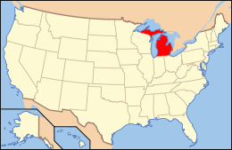 Location of Michigan within the United States | |
| Geography | |
|---|---|
| Location | Michigan |
| Major islands | Beaver, Drummond, Grosse Ile, Harsens, Isle Royale, Mackinac |
| Administration | |
| State | |
The largest of all the islands is Isle Royale in Lake Superior, which, in addition to its waters and other surrounding islands, is organized as Isle Royale National Park. Isle Royale itself is 206 square miles (530 km2). The most populated island is Grosse Ile with approximately 10,000 residents, located in the Detroit River about 10 miles (16 kilometres) south of Detroit. The majority of Michigan's islands are uninhabited and very small. Some of these otherwise unusable islands have been used for the large number of Michigan's lighthouses to aid in shipping throughout the Great Lakes, while others have been set aside as nature reserves. Many islands in Michigan have the same name, even some that are in the same municipality and body of water, such as Gull, Long, or Round islands.
Lake Erie

Only Monroe County and a very small portion of Wayne County have boundaries within the westernmost portion of Lake Erie. The lake has a mean surface elevation of 571 feet (174 m). The islands in the southern portion of the county are part of the North Maumee Bay Archeological District of the Detroit River International Wildlife Refuge, while northern islands are part of Pointe Mouillee State Game Area at the mouth of the Huron River and Detroit River. Turtle Island is the only island in the state of Michigan that is shared by another state, as it is divided with the state of Ohio.
| Island | Municipality | County | Coordinates | Ref |
|---|---|---|---|---|
| Dalhka Island | Brownstown Township | Wayne | 42°02′15.6″N 83°11′32.1″W | [1] |
| Gard Island | Erie Township | Monroe | 41°44′55.3″N 83°26′33.7″W | [2] |
| Indian Island | Erie Township | Monroe | 41°44′53.4″N 83°27′14.3″W | [3] |
| Rat Island | Brownstown Township | Wayne | 42°02′04.2″N 83°11′24.4″W | [1] |
| Smiths Island | Monroe Township | Monroe | 41°52′21.0″N 83°21′40.0″W | [4] |
| Turtle Island | Erie Township | Monroe | 41°45′09.0″N 83°23′28.9″W | [5] |
| Waterman Island | Berlin Township | Monroe | 42°02′02.7″N 83°11′54.7″W | [1] |
Lake Huron

Lake Huron is the second largest of the Great Lakes (after Lake Superior) with a surface area of 23,010 square miles (59,600 km2). Michigan is the only state to border Lake Huron, while the portion of the lake on the other side of the international border belongs to the province of Ontario. The vast majority of Michigan's islands in Lake Huron are centered around Drummond Island in the northernmost portion of the state's lake territory. Another large group of islands is the Les Cheneaux Islands archipelago, which itself contains dozens of small islands. Many of the lake's islands are very small and uninhabited.
As the most popular tourist destination in the state, Mackinac Island is the most well known of Lake Huron's islands. Drummond Island is the state's second-largest island (after Isle Royale) and is the most populous of Michigan's islands in Lake Huron, with a population of 1,058 at the 2010 census. While Mackinac Island had a population of 492, there are thousands more seasonal workers and tourists during the summer months.
Lake Michigan

Michigan only has islands in Lake Michigan in the northern portion of the lake. There are no islands in the southern half of Lake Michigan. The largest and most populated of Michigan's islands in Lake Michigan is Beaver Island at 55.8 square miles (145 km2) and 551 residents. Some of the smaller islands surrounding Beaver Island are part of the larger Michigan Islands National Wildlife Refuge.
Lake Superior

Lake Superior is the largest of the Great Lakes, and the coastline is sparsely populated. At 206 square miles (530 km2), Isle Royale is the largest Michigan island and is the center of Isle Royale National Park, which itself contains over 450 islands. The following is a list of islands in Lake Superior that are not part of Isle Royale National Park. For those islands, see the list of islands in Isle Royale National Park.
Lake St. Clair

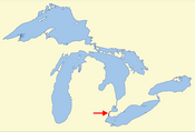
Lake St. Clair connects Lake Huron and Lake Erie through the St. Clair River in the north and the Detroit River in the south. At 430 square miles (1,100 km2), it is one of the largest non-Great Lakes in the United States, but it only contains a small number of islands near the mouth of the St. Clair River, where all of the following islands are located. The largest of these islands is Harsens Island, and all the islands are in Clay Township in St. Clair County.
| Island | Municipality | County | Coordinates | Ref |
|---|---|---|---|---|
| Bruckner Island | Clay Township | St. Clair | 42.57222°N 82.65972°W | [30] |
| Club Island | Clay Township | St. Clair | 42.56111°N 82.67917°W | [31] |
| Dickinson Island | Clay Township | St. Clair | 42.61028°N 82.62722°W | [32] |
| Green Island | Clay Township | St. Clair | 42.56611°N 82.68000°W | [33] |
| Gull Island | Clay Township | St. Clair | 42.53028°N 82.68222°W | [34] |
| Harsens Island | Clay Township | St. Clair | 42.58944°N 82.58861°W | [35] |
| McDonald Island | Clay Township | St. Clair | 42.58389°N 82.65444°W | [36] |
| Middle Island | Clay Township | St. Clair | 42.61750°N 82.67639°W | [37] |
| Muscamoot Ridge | Clay Township | St. Clair | 42.57472°N 82.63639°W | [38] |
| North Island | Clay Township | St. Clair | 42.62111°N 82.65083°W | [39] |
| Russell Island | Clay Township | St. Clair | 42.60833°N 82.52889°W | [40] |
| Sand Island | Clay Township | St. Clair | 42.55278°N 82.71778°W | [41] |
| Strawberry Island | Clay Township | St. Clair | 42.59806°N 82.70944°W | [42] |
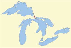
Detroit River
The Detroit River runs for 24 nautical miles (44 km; 28 mi) and connects Lake St. Clair to Lake Erie. For its entire length, it carries the international border between the United States and Canada. Some islands belong to Ontario in Canada and are not included in the list below. All islands on the American side belong to Wayne County. Portions of the southern portion of the river serve as wildlife refuges as part of the Detroit River International Wildlife Refuge. The largest and most populous island is Grosse Ile. Most of the islands are around and closely connected to Grosse Ile.
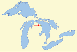
St. Marys River
The St. Marys River connects Lake Superior and Lake Huron at the easternmost point of the Upper Peninsula. It carries the international border throughout its length, and some of the islands belong to neighboring Ontario. The largest of Michigan's islands in the river are Sugar Island and Neebish Island. Wider portions of the river are designated as Lake George, Lake Nicolet, and the Munuscong Lake. The whole length of the Michigan portion of the river is part of Chippewa County.
Inland islands
Michigan has numerous inland lakes and rivers that also contain their own islands. The following also lists the body of water in which these islands are located. Five islands below (* and highlighted in green) are actually islands within an island; they are contained within inland lakes in Isle Royale.
Grand Lake
Grand Lake is a large 8.8 square miles (23 km2) lake in Presque Isle County. While it is not the largest inland lake in Michigan, it does contain the most inland islands that are officially named. At its shortest distance, it is located less than one mile (1.6 kilometres) from Lake Huron, but the two are not connected. Grand Lake contains 14 islands, of which Grand Island is by far the largest.
See also
- Geography of Michigan
- Great Lakes
- Islands of the Great Lakes
- Populated islands of the Great Lakes
- Islands of the Midwest
- List of islands in Isle Royale National Park
- List of islands in the Detroit River
- List of Michigan islands in Lake Huron
- Ferries in Michigan
References
- Michigan Department of Natural Resources (4 September 2018). "Pointe Mouillee State Game Area: Main Units Managed Hunt Area Map" (PDF). Retrieved November 22, 2020.
- "Gard Island". Geographic Names Information System. United States Geological Survey.
- "Indian Island". Geographic Names Information System. United States Geological Survey.
- "Smiths Island". Geographic Names Information System. United States Geological Survey.
- "Turtle Island". Geographic Names Information System. United States Geological Survey.
- "Au Train Island". Geographic Names Information System. United States Geological Survey.
- "Garlic Island". Geographic Names Information System. United States Geological Survey.
- "Grand Island". Geographic Names Information System. United States Geological Survey.
- "Granite Island". Geographic Names Information System. United States Geological Survey.
- "Gull Island". Geographic Names Information System. United States Geological Survey.
- "Huron Island". Geographic Names Information System. United States Geological Survey.
- "Iroquois Island". Geographic Names Information System. United States Geological Survey.
- "Larus Island". Geographic Names Information System. United States Geological Survey.
- "Lighthouse Island". Geographic Names Information System. United States Geological Survey.
- "Little Presque Island". Geographic Names Information System. United States Geological Survey.
- "Manitou Island". Geographic Names Information System. United States Geological Survey.
- "McIntyre Island". Geographic Names Information System. United States Geological Survey.
- "Middle Island". Geographic Names Information System. United States Geological Survey.
- "Naomikong Island". Geographic Names Information System. United States Geological Survey.
- "Partridge Island". Geographic Names Information System. United States Geological Survey.
- "Picnic Rocks". Geographic Names Information System. United States Geological Survey.
- "Porters Island". Geographic Names Information System. United States Geological Survey.
- "Presque Isle". Geographic Names Information System. United States Geological Survey.
- "Presque Isle Point Rocks". Geographic Names Information System. United States Geological Survey.
- "Ripley Rock". Geographic Names Information System. United States Geological Survey.
- "Tahquamenom Island". Geographic Names Information System. United States Geological Survey.
- "Traverse Island". Geographic Names Information System. United States Geological Survey.
- "Williams Island". Geographic Names Information System. United States Geological Survey.
- "Wood Island". Geographic Names Information System. United States Geological Survey.
- "Bruckner Island". Geographic Names Information System. United States Geological Survey.
- "Club Island". Geographic Names Information System. United States Geological Survey.
- "Dickinson Island". Geographic Names Information System. United States Geological Survey.
- "Green Island". Geographic Names Information System. United States Geological Survey.
- "Gull Island". Geographic Names Information System. United States Geological Survey.
- "Harsens Island". Geographic Names Information System. United States Geological Survey.
- "McDonald Island". Geographic Names Information System. United States Geological Survey.
- "Middle Island". Geographic Names Information System. United States Geological Survey.
- "Muscamoot Ridge". Geographic Names Information System. United States Geological Survey.
- "North Island". Geographic Names Information System. United States Geological Survey.
- "Russell Island". Geographic Names Information System. United States Geological Survey.
- "Sand Island". Geographic Names Information System. United States Geological Survey.
- "Strawberry Island". Geographic Names Information System. United States Geological Survey.
- "Belle Isle". Geographic Names Information System. United States Geological Survey.
- "Calf Island". Geographic Names Information System. United States Geological Survey.
- "Celeron Island". Geographic Names Information System. United States Geological Survey.
- "Cherry Island". Geographic Names Information System. United States Geological Survey.
- "Edmond Island". Geographic Names Information System. United States Geological Survey.
- "Elba Island". Geographic Names Information System. United States Geological Survey.
- "Elizabeth Park". Geographic Names Information System. United States Geological Survey.
- "Fox Island". Geographic Names Information System. United States Geological Survey.
- "Grassy Island". Geographic Names Information System. United States Geological Survey.
- "Grosse Ile". Geographic Names Information System. United States Geological Survey.
- City of Gibraltar (1 February 2014). "Parks and Recreation Master Plan 2014–2019" (PDF). pp. 5–6. Retrieved January 23, 2021.
- U.S. Fish & Wildlife Service. "Humbug Marsh Trail Map & Guide" (PDF). Retrieved January 24, 2021.
- "Hickory Island". Geographic Names Information System. United States Geological Survey.
- "Horse Island". Geographic Names Information System. United States Geological Survey.
- "Mamajuda Island". Geographic Names Information System. United States Geological Survey.
- "Meso Island". Geographic Names Information System. United States Geological Survey.
- "Mud Island". Geographic Names Information System. United States Geological Survey.
- "Powder House Island". Geographic Names Information System. United States Geological Survey.
- "Round Island". Geographic Names Information System. United States Geological Survey.
- "Stony Island". Geographic Names Information System. United States Geological Survey.
- "Sturgeon Bar". Geographic Names Information System. United States Geological Survey.
- "Sugar Island". Geographic Names Information System. United States Geological Survey.
- "Swan Island". Geographic Names Information System. United States Geological Survey.
- "Zug Island". Geographic Names Information System. United States Geological Survey.
- "Advance Island". Geographic Names Information System. United States Geological Survey.
- "Bass Reef Island". Geographic Names Information System. United States Geological Survey.
- "Chicken Islands". Geographic Names Information System. United States Geological Survey.
- "Cook Island". Geographic Names Information System. United States Geological Survey.
- "Duck Island". Geographic Names Information System. United States Geological Survey.
- "Edward Island". Geographic Names Information System. United States Geological Survey.
- "Gem Island". Geographic Names Information System. United States Geological Survey.
- "Gull Island". Geographic Names Information System. United States Geological Survey.
- "Hart Island". Geographic Names Information System. United States Geological Survey.
- "Hen Island". Geographic Names Information System. United States Geological Survey.
- "Hog Island". Geographic Names Information System. United States Geological Survey.
- "Island Number Four". Geographic Names Information System. United States Geological Survey.
- "Island Number One". Geographic Names Information System. United States Geological Survey.
- "Island Number Three". Geographic Names Information System. United States Geological Survey.
- "Island Number Two". Geographic Names Information System. United States Geological Survey.
- "Lime Island". Geographic Names Information System. United States Geological Survey.
- "Love Island". Geographic Names Information System. United States Geological Survey.
- "Moon Island". Geographic Names Information System. United States Geological Survey.
- "Munuscong Island". Geographic Names Information System. United States Geological Survey.
- "Neebish Island". Geographic Names Information System. United States Geological Survey.
- "Pilot Island". Geographic Names Information System. United States Geological Survey.
- "Pine Island". Geographic Names Information System. United States Geological Survey.
- "Pipe Island". Geographic Names Information System. United States Geological Survey.
- "Rains Island". Geographic Names Information System. United States Geological Survey.
- "Rock Island". Geographic Names Information System. United States Geological Survey.
- "Round Island". Geographic Names Information System. United States Geological Survey.
- "Round Island". Geographic Names Information System. United States Geological Survey.
- "Sand Island". Geographic Names Information System. United States Geological Survey.
- "Steamboat Island". Geographic Names Information System. United States Geological Survey.
- "Sugar Island". Geographic Names Information System. United States Geological Survey.
- "Twin Island". Geographic Names Information System. United States Geological Survey.
- "Two Tree Island". Geographic Names Information System. United States Geological Survey.
- "Allen Island". Geographic Names Information System. United States Geological Survey.
- "Applegate Island". Geographic Names Information System. United States Geological Survey.
- "Bear Island". Geographic Names Information System. United States Geological Survey.
- "Brown Island". Geographic Names Information System. United States Geological Survey.
- "Burnt Island". Geographic Names Information System. United States Geological Survey.
- "Cedar Island". Geographic Names Information System. United States Geological Survey.
- "Crescent Island". Geographic Names Information System. United States Geological Survey.
- "Grand Island". Geographic Names Information System. United States Geological Survey.
- "Horseshoe Island". Geographic Names Information System. United States Geological Survey.
- "Indian Island". Geographic Names Information System. United States Geological Survey.
- "Macombers Island". Geographic Names Information System. United States Geological Survey.
- "Round Island". Geographic Names Information System. United States Geological Survey.
- "Tanglewood Island". Geographic Names Information System. United States Geological Survey.
- "Three Sisters Island". Geographic Names Information System. United States Geological Survey.
External links
Lansing (capital) | |||||
| Topics |
|  | |||
| Society |
| ||||
| Regions |
| ||||
| Largest municipalities |
| ||||
| Counties |
| ||||
Great Lakes of North America | |||||||||||||
|---|---|---|---|---|---|---|---|---|---|---|---|---|---|
| Main lakes | |||||||||||||
| Secondary lakes | |||||||||||||
| Bays and channels |
| ||||||||||||
| Waterways |
| ||||||||||||
| Islands | |||||||||||||
| Historic geology |
| ||||||||||||
| Organizations |
| ||||||||||||
| Related topics |
| ||||||||||||
| Authority control: National libraries |
|---|
Другой контент может иметь иную лицензию. Перед использованием материалов сайта WikiSort.org внимательно изучите правила лицензирования конкретных элементов наполнения сайта.
WikiSort.org - проект по пересортировке и дополнению контента Википедии