geo.wikisort.org - Island
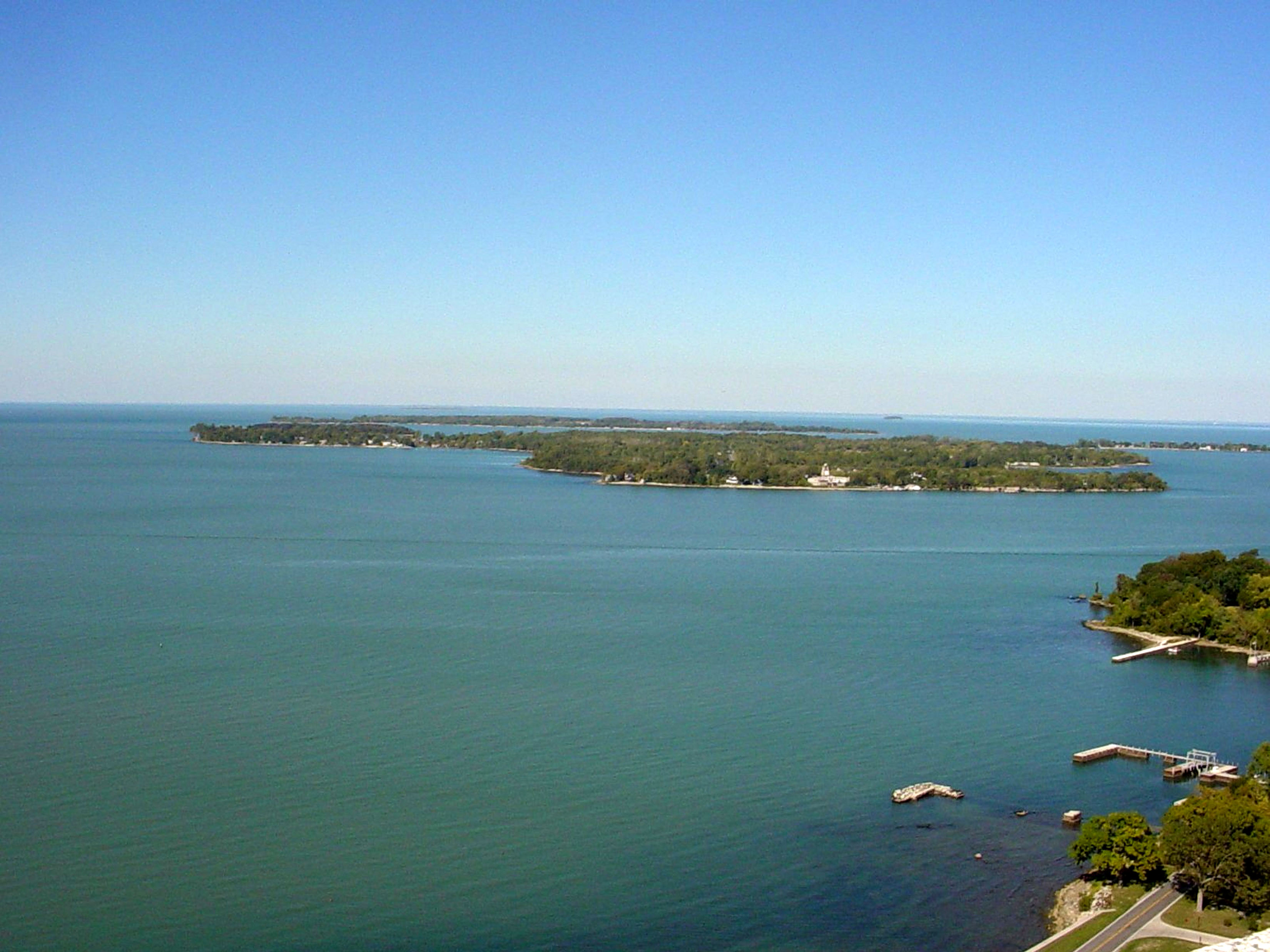
The Lake Erie Islands are a chain of archipelagic islands in Lake Erie. They include Kelleys Island, Erie Island,[1] Pelee Island, the Bass Islands, and several others. The majority of these islands are under the sovereignty of the State of Ohio in the United States. Pelee Island is the only major inhabited island within the province of Ontario, while the smaller Middle Island is the southmost point of land in Canada.
Most of the larger islands are popular tourist attractions, served by car ferries running from the mainland and between some islands. Some small airports and numerous private marinas offer other ways for visitors to reach the islands. Combined with nearby Sandusky and Port Clinton, Ohio, the islands are part of the collective area known regionally as "Vacationland".[2]
Geology


The Lake Erie Islands are geologically part of the Silurian Columbus Limestone. When the Pleistocene ice sheets carved out the basin of modern-day Lake Erie, these hard rocks proved more resistant to erosion than the shales in the east, and as a result, Lake Erie's western end is much shallower than the basins in the east, so that the islands remain above water. Quarrying operations on Kelleys Island revealed glacial grooves in the bedrock, which would in time be regarded as some of the best direct evidence of the Pleistocene ice sheets available anywhere. The glacial grooves are now protected as part of Kelleys Island State Park.[3] [4]
Economy
Most of the islands are supported financially via tourism. Grape growing and wineries were once the mainstay of the economy. Kelleys Island is heavily forested and woods have replaced vineyards there almost entirely. South Bass Island is more developed and still has a few vineyards. Pelee Island is the only major island where vineyards remain common. Limestone quarrying still occurs on Kelleys Island, and also there are a few hobby farms. South Bass, Middle Bass, North Bass, and Kelleys Islands all have active state parks part of the Ohio Department of Natural Resources with North Bass Island State Park being the largest at 593 acres and 90% of North Bass Island (also known as Isle St. George).[5]
Residents
Most of the islands are headed by a small group of year-round residents. However, eager vacationers often raise the populations dramatically during the summer months, most notable on South Bass Island, which is the most tourist-friendly of the islands despite its small size. The islands vary by year-round population of approximately 500 on South Bass Island, 100 for Kelleys Island, 40 at Middle Bass Island and 12 on North Bass Island.
Kelleys Island, Middle Bass, North Bass and South Bass (Put-in-Bay) have active school districts with North Bass Local School District being the last operating one-room schoolhouse in Ohio.[6] Of the islands with year-round residents, only North Bass has no ferry service. Put-in-Bay Township Port Authority operates public airports for Middle, North and South Bass Islands.[7] Kelleys Island and Pelee Island operate paved, public runways and Rattlesnake Island maintains a private grass landing strip.
Lake Erie islands


| Name | State/Province | Area sq. mi.[8](km²)[9] | Location | Inhabited?[10] |
|---|---|---|---|---|
| Pelee Island | Ontario | 16.140 sq. mi. (41.79 km²) | 41°46′00″N 82°38′27″W | Yes |
| Kelleys Island | Ohio | 4.41 sq. mi. (11.42 km²) | 41°36′05″N 82°41′51″W | Yes |
| South Bass Island | Ohio | 2.482 sq. mi. (6.428 km²) | 41°38′59″N 82°49′08″W | Yes |
| Middle Bass Island | Ohio | 1.258 sq. mi. (3.258 km²) | 41°40′45″N 82°48′40″W | Yes |
| North Bass Island | Ohio | 1.076 sq. mi. (2.786 km²) | 41°43′00″N 82°49′00″W | Yes |
| Johnson's Island | Ohio | 0.469 sq. mi. (1.215 km²) | 41°29′47″N 82°44′05″W | Yes |
| Rattlesnake Island | Ohio | 0.133 sq. mi. (0.344 km²) | 41°40′45″N 82°50′57″W | Yes |
| West Sister Island | Ohio | 0.120 sq. mi. (0.311 km²) | 41°44′23″N 83°06′19″W | No Longer |
| Middle Island | Ontario | 0.072 sq. mi. (0.186 km²) | 41°40′57″N 82°41′04″W | No Longer |
| East Sister Island | Ontario | 0.058 sq. mi. (0.150 km²) | 41°48′47″N 82°51′23″W | No |
| Sugar Island | Ohio | 0.047 sq. mi. (0.123 km²) | 41°41′31″N 82°49′34″W | Yes |
| Green Island | Ohio | 0.027 sq. mi. (0.069 km²) | 41°38′44″N 82°51′54″W | No Longer |
| Ballast Island | Ohio | 0.019 sq. mi. (0.049 km²) | 41°40′40″N 82°47′07″W | Yes |
| Mouse Island | Ohio | 41°35′28″N 82°49′59″W | No Longer | |
| Gibraltar Island | Ohio | 0.010 sq. mi. (0.026 km²) | 41°39′30″N 82°49′14″W | Yes |
| Indian Island | Michigan | 41°45′08″N 83°23′27″W | No | |
| Hen Island and her "Chickens": Big Chicken, Chick, and Little Chicken islands |
Ontario | 41°47′18″N 82°47′51″W | Hen Yes, the "chickens" No | |
| Middle Sister Island | Ontario | 0.015 sq. mi. (0.039 km²) | 41°50′55″N 83°00′03″W | No Longer |
| North Harbour Island | Ontario | 41°49′30″N 82°51′36″W | Yes | |
| Turtle Island | Michigan/Ohio | 0.002 sq. mi. (0.005 km²) | 41°45′09″N 83°23′28″W | No Longer |
| Ryerson's Island | Ontario | 42°36′08″N 80°16′54″W | Yes | |
| Second Island | Ontario | 42°35′24″N 80°16′15″W | No | |
| Starve Island | Ohio | 0.003 sq. mi. (0.008 km²) | 41°37′36″N 82°49′21″W | No |
| Buckeye Island | Ohio | 41°39′53″N 82°47′25″W | No | |
| Lost Ballast Island | Ohio | 41°40′32″N 82°47′11″W | No | |
| Snow Island | Ontario | 42°34′47″N 80°15′33″W | No | |
| Mohawk Island (formerly Gull Island) | Ontario | 0.015 sq. mi. (0.039 km²) | 42°50′02″N 79°31′21″W | No Longer |
| Gull Island, Ohio | Ohio | 41°39′35″N 82°41′14″W | No[11] | |
| Catawba Island (former island)[12] |
Ohio | 5.700 sq. mi. (14.8 km²) | 41°33′49″N 82°50′20″W | Yes |
| Gard Island | Michigan | 41°45′00″N 83°26′32″W | No Longer | |
| Presque Island (former island) |
Pennsylvania | 4.863 sq. mi. (12.594 km²) | 42°09′47″N 80°06′03″W | Yes |
| Kafralu Island | Ohio | 41°27′53″N 82°40′25″W | No Longer | |
| Bird Island | New York | 42°53′43″N 78°54′24″W | No |
See also
- Battle of Lake Erie
- Islands of the Great Lakes
References
- "Climate of Erie Island, Ohio (zone 8b)". erieisland.simdif.com. Retrieved 2021-01-09.
- "Vacationland" history - Sandusky Library
- Publishers: (1) Lake Erie Coastal Ohio Trail National Scenic Byway (2) Ohio Chapter of The Nature Conservancy (3) Ohio Sea Grant; Editors: Art Weber, Melinda Huntley of the Ohio Sea Grant College Program, Explore the Lake Erie Islands Archived 2012-02-22 at the Wayback Machine, Retrieved September 1, 2014, (see page 5) "...Lake Erie’s shallow, nutrient-rich western basin and the much deeper central and eastern basins....The western basin... dolomite and limestone are more durable than the softer shales ... glacier dug through the stones ... resistance from the dolomite and limestone in the western basin..."
- "Kelleys Island State Park". Retrieved 2017-01-07.
- "North Bass Island State Park". parks.ohiodnr.gov. Retrieved 2019-08-09.
- "7th Generation: Return of the Native: Restoring North Bass Island". ideastream. 2004-07-22. Retrieved 2019-08-09.
- "Home". Put-in-Bay Twp Port Authority. Retrieved 2019-08-09.
- Land Area - Census.gov
- Land Area - Statcan.gc.ca
- Population - Middle Bass 2.org
- "Lake Erie Island Sites". Middle Bass on the Web. Retrieved 2008-10-25.
- "Catawba Island, the Great Peach Growing Center of Ohio" (PDF). Retrieved March 6, 2014.
External links
- How many islands are there in Lake Erie?
- Explore the Lake Erie Islands: Self-guided Tours to Natural Wonders & Historic Tales (pdf) — A Guide to Nature and History along the Lake Erie Coastal Ohio Trail.
| Michigan |  | |
|---|---|---|
| Ontario | ||
| Ohio |
| |
| Pennsylvania | ||
| New York | ||
Columbus (capital) | ||
| Topics |
|  |
| Society |
| |
| Regions |
| |
| Metro areas |
| |
| Largest cities |
| |
| Counties |
| |
Great Lakes of North America | |||||||||||||
|---|---|---|---|---|---|---|---|---|---|---|---|---|---|
| Main lakes | |||||||||||||
| Secondary lakes | |||||||||||||
| Bays and channels |
| ||||||||||||
| Waterways |
| ||||||||||||
| Islands | |||||||||||||
| Historic geology |
| ||||||||||||
| Organizations |
| ||||||||||||
| Related topics |
| ||||||||||||
На других языках
- [en] List of Lake Erie Islands
[ru] Список островов озера Эри
Большинство островов озера Эри (Канада — США) административно относятся к округу Оттава (штат Огайо, США), так как сгруппированы в западной, самой мелкой части озера. Многие из островов озера Эри являются популярным местом отдыха для туристов обеих стран, до них курсируют паромы, на некоторых островах есть маленькие аэродромы и стоянки яхт. Эти острова, а также города Огайо Сандаски и Порт-Клинтон[en] в связи с этим зовутся «Страной каникул»[en].Другой контент может иметь иную лицензию. Перед использованием материалов сайта WikiSort.org внимательно изучите правила лицензирования конкретных элементов наполнения сайта.
WikiSort.org - проект по пересортировке и дополнению контента Википедии