geo.wikisort.org - Island
Indian Island is a small island of the U.S. state of Michigan, located at the north end of Maumee Bay in Lake Erie. It is located just off shore of the northeast tip of the "Lost Peninsula", an exclave created by the Michigan-Ohio boundary line. It is part of Erie Township in Monroe County.
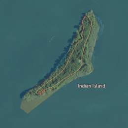 USGS aerial imagery of Indian Island | |
 Indian Island Location within the state of Michigan | |
| Geography | |
|---|---|
| Location | North Maumee Bay Lake Erie |
| Coordinates | 41°44′55″N 83°27′14″W |
| Highest elevation | 569 ft (173.4 m) |
| Administration | |
United States | |
| State | Michigan |
| County | Monroe |
| Township | Erie Township |
| Demographics | |
| Population | 0 (permanent) |

It was never known to have been inhabited.[1] On older USGS topographic maps, it was labeled (possibly erroneously) as "Odeen Island", while an island nearby to the west was referred to as "Indian Island".[2]
References
| Michigan |  | |
|---|---|---|
| Ontario | ||
| Ohio |
| |
| Pennsylvania | ||
| New York | ||
This Monroe County, Michigan location article is a stub. You can help Wikipedia by expanding it. |
Текст в блоке "Читать" взят с сайта "Википедия" и доступен по лицензии Creative Commons Attribution-ShareAlike; в отдельных случаях могут действовать дополнительные условия.
Другой контент может иметь иную лицензию. Перед использованием материалов сайта WikiSort.org внимательно изучите правила лицензирования конкретных элементов наполнения сайта.
Другой контент может иметь иную лицензию. Перед использованием материалов сайта WikiSort.org внимательно изучите правила лицензирования конкретных элементов наполнения сайта.
2019-2026
WikiSort.org - проект по пересортировке и дополнению контента Википедии
WikiSort.org - проект по пересортировке и дополнению контента Википедии