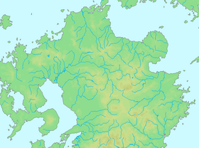
geo.wikisort.org - Mountains
Mount Aso (阿蘇山, Aso-san), is also known as Aso Volcano and in this sense is the largest active volcano in Japan, and is among the largest in the world. Common use relates often only to the somma volcano in the centre of the Aso Caldera. It stands in Aso Kujū National Park in Kumamoto Prefecture, on the island of Kyushu. Its tallest peak, Takadake, is 1,592 meters (5,223 ft) above sea level. Mount Aso is in a fairly large caldera (25 kilometers (16 miles) north-south and 18 km (11 mi) east-west) with a circumference of around 120 km (75 mi), although sources vary on the exact distance.
| Mount Aso | |
|---|---|
| Aso Volcano | |
 Aerial image of Mount Aso | |
| Highest point | |
| Elevation | 1,592 m (5,223 ft) |
| Listing |
|
| Coordinates | 32°53′04″N 131°06′14″E |
| Geography | |
| Location | Kyushu, Japan |
| Geology | |
| Mountain type | Somma volcano in Caldera complex |
| Last eruption | 20 October 2021 - Present |


Geography


The central cone group of Aso consists of five peaks, often called the "Five Mountains of Aso" (阿蘇五岳): Mt. Neko, Mt. Taka (also called Takadake or Taka-Dake), Mt. Naka (also called Nakadake or Naka-Dake), Mt. Eboshi, and Mt. Kishima (also called Kishimadake or Kishima-Dake ). The highest point is the summit of Mt. Taka, at 1592 m above sea level. The crater of Mt. Naka, the west side of which is accessible by road, contains an active volcano which continuously emits smoke and has occasional eruptions. Only the northernmost crater (the first crater) has been active for the last 70 years—1974, 1979, 1984–1985, 1989–1991,[1] 2009, 2011, 2015,[2] 2016[3][4] and 2021.[5]
The present Aso Caldera formed as a result of four huge caldera eruptions occurring over a range of 90,000–300,000 years ago.[6] The caldera, one of the largest in the world, contains the city of Aso as well as Takamori and Minamiaso enclosing the caldera extends about 18 km east to west and about 25 km north to south. Viewpoints from the somma overlooking the caldera are perched upon lava formed before the volcanic activity which created the present caldera. Ejecta from the huge caldera eruption 90,800 years ago covers more than 600 km3 and roughly equals the volume of Mount Fuji; with a pyroclastic flow plateau that covered a significant part of Kyushu.
History
The eruption which formed the present somma occurred approximately 300,000 years ago. Four large-scale eruptions (Aso 1 – 4) occurred during a period extending from 300,000 to 90,000 years ago. As large amounts of pyroclastic flow and volcanic ash were emitted from the volcanic chamber, a huge depression (caldera) was formed as the chamber collapsed. The fourth eruption (Aso 4) was the largest, with volcanic ash covering the entire Kyushu region and even extending to Yamaguchi Prefecture.
Mt. Taka, Mt. Naka, Mt. Eboshi, and Mt. Kishima are cones formed following the fourth above-mentioned huge caldera eruption. Mt. Naka remains active today. Aso's pyroclastic flow deposits (welded tuff) were utilized for bridge construction in the region, There are approximately 320 arched stone bridges in Kumamoto Prefecture, including the Tsujun-kyo and Reitai-kyo bridges on the Midorikawa River, which are important national cultural properties.[1]
A new eruption began at 11:43 a.m. on 20 October 2021.[7]
Climate
With an elevation of 1,143 metres (3,750 ft).,[8] Mount Aso has a climate that falls as humid continental (Köppen climate classification "Dfb"), with warm summers and cold winters. Precipitation is high throughout the year, which brings the area to have borderline subtropical characteristics as well. They are particularly heavy in June and July, where over 500 millimetres (20 in) of rain fell in each month.
| Climate data for Mount Aso, 1991–2020 normals, extremes 1932–2017 | |||||||||||||
|---|---|---|---|---|---|---|---|---|---|---|---|---|---|
| Month | Jan | Feb | Mar | Apr | May | Jun | Jul | Aug | Sep | Oct | Nov | Dec | Year |
| Record high °C (°F) | 14.0 (57.2) |
16.6 (61.9) |
19.3 (66.7) |
23.8 (74.8) |
27.2 (81.0) |
27.2 (81.0) |
29.6 (85.3) |
29.8 (85.6) |
28.0 (82.4) |
25.1 (77.2) |
20.7 (69.3) |
15.8 (60.4) |
29.8 (85.6) |
| Average high °C (°F) | 1.9 (35.4) |
4.0 (39.2) |
8.0 (46.4) |
13.4 (56.1) |
17.9 (64.2) |
20.0 (68.0) |
23.4 (74.1) |
24.3 (75.7) |
21.5 (70.7) |
16.5 (61.7) |
10.7 (51.3) |
4.6 (40.3) |
13.8 (56.9) |
| Daily mean °C (°F) | −1.4 (29.5) |
0.1 (32.2) |
3.6 (38.5) |
8.9 (48.0) |
13.5 (56.3) |
16.7 (62.1) |
20.1 (68.2) |
20.6 (69.1) |
17.7 (63.9) |
12.4 (54.3) |
6.9 (44.4) |
1.0 (33.8) |
10.0 (50.0) |
| Average low °C (°F) | −4.5 (23.9) |
−3.6 (25.5) |
−0.3 (31.5) |
5.0 (41.0) |
9.8 (49.6) |
14.0 (57.2) |
17.8 (64.0) |
18.2 (64.8) |
14.9 (58.8) |
9.0 (48.2) |
3.4 (38.1) |
−2.2 (28.0) |
6.8 (44.2) |
| Record low °C (°F) | −15.4 (4.3) |
−15.9 (3.4) |
−13.1 (8.4) |
−7.6 (18.3) |
−1.0 (30.2) |
5.5 (41.9) |
9.8 (49.6) |
10.5 (50.9) |
4.5 (40.1) |
−4.0 (24.8) |
−7.7 (18.1) |
−13.0 (8.6) |
−15.9 (3.4) |
| Average precipitation mm (inches) | 93.5 (3.68) |
132.6 (5.22) |
215.7 (8.49) |
230.3 (9.07) |
272.6 (10.73) |
712.8 (28.06) |
634.1 (24.96) |
348.4 (13.72) |
287.4 (11.31) |
133.5 (5.26) |
122.4 (4.82) |
86.9 (3.42) |
3,270.2 (128.74) |
| Average snowfall cm (inches) | 26 (10) |
21 (8.3) |
9 (3.5) |
1 (0.4) |
0 (0) |
0 (0) |
0 (0) |
0 (0) |
0 (0) |
0 (0) |
1 (0.4) |
14 (5.5) |
72 (28.1) |
| Average precipitation days (≥ 1.0 mm) | 8.9 | 9.4 | 12.4 | 11.5 | 11.7 | 16.7 | 16.5 | 14.6 | 12.0 | 8.8 | 8.7 | 8.3 | 139.5 |
| Average snowy days (≥ 1 cm) | 6.1 | 5.0 | 1.9 | 0.2 | 0 | 0 | 0 | 0 | 0 | 0 | 0.3 | 4.1 | 17.6 |
| Average relative humidity (%) | 84 | 79 | 76 | 73 | 74 | 86 | 90 | 88 | 85 | 80 | 80 | 82 | 81 |
| Mean monthly sunshine hours | 92.1 | 111.8 | 139.8 | 157.7 | 168.0 | 100.1 | 114.5 | 131.9 | 127.2 | 148.2 | 120.4 | 107.9 | 1,525.4 |
| Source 1: JMA[9] | |||||||||||||
| Source 2: JMA[10] | |||||||||||||
National Park
The mountain is a key feature that contributed to the original Aso Kujū National Park.[11] Spectacular sights such as the seasonal flowering of Rhododendron kiusianum on the slopes of Takadake reflect significant protected botanical ecosystems.[12]
Tourism
A cable car system, the Mount Aso Ropeway, opened in 1958 to provide access to the mountain. It closed in 2016, and has since been dismantled. A shuttle bus now runs to the crater's edge.
At the foot of the mountain there are also various campsites, and horse riding at Kusasenrigahama.[13]
Because Mount Aso is a volcano, there are many onsen hot springs in the area.
Hiking
Mt. Aso has numerous hiking trails leading to the interesting peaks and mountains around the crater. The Nakadake trail will take you to the highest peak which is part of the active crater and often closed when volcanic gas or volcanic activity is too high. The other surrounding trails offer enjoyable terrain and unique views over the grasslands, the Aso crater, and a small conical peak called Komezuka. Nearly all of the trails (excluding Nekodake) can be accessed from the bus stop at the museum.
In popular culture
In Ishirō Honda's kaiju films, Mount Aso is home to the giant pteranodon creature Rodan. In Rodan, the creature and its mate perish in the volcano's eruption.[14]
Mount Aso serves as the inspiration of Mt. Chimney in Pokémon Ruby and Sapphire, Pokémon Emerald and the remake Pokémon Omega Ruby and Alpha Sapphire.
In the manga Magical Girl Spec-Ops Asuka by Makoto Fukami and Seigo Tokiya, the final battle of the Distonian War that took place 3 years before the events of the series takes place on Mount Aso.
See also
- List of volcanoes in Japan
- Aso Shrine
- Aso Volcano Museum
References
General
- "Asosan". Global Volcanism Program. Smithsonian Institution.
Cited
- "Cities on Volcanoes 5". u-tokyo.ac.jp.
- "Small volcanic eruption recorded from Mount Aso in Kumamoto Prefecture". The Japan Times. 8 August 2015.
- "Small eruption seen on Mount Aso after latest quakes". The Japan Times Online. 2016-04-16. ISSN 0447-5763. Retrieved 2016-04-23.
- "Japan's Mount Aso erupts, no reports of injuries". Reuters. 2016-10-07.
- "Japanese volcano spews plumes of ash, people warned away". Reuters. 2021-10-20.
- Smithsonian Institution (2013). "Global Volcanism Program: Asosan". Archived from the original on 2021-10-21. Retrieved 2021-10-21.
- "Mount Aso in Kumamoto erupts". nhk.or.jp. Retrieved October 20, 2021.
- "Asosan Climate Normals 1961-1990". National Oceanic and Atmospheric Administration. Retrieved January 6, 2013.
- 観測史上1~10位の値(年間を通じての値). JMA. Retrieved February 16, 2022.
- 気象庁 / 平年値(年・月ごとの値). JMA. Retrieved February 16, 2022.
- "MT. ASO: ERUPTIONS, CRATERS AND HIKES". Retrieved 2022-09-28.
- "Aso-Kuju National Park: Scent of Grasslands, Breath of the Volcanoes, Wind Playing across the Majestic Landscape". Retrieved 2022-09-28.
- "Aso Kusasenri horseback riding club Details / Explore| Japan Travel by NAVITIME - Japan Travel Guides, Maps, Transit Search and Route Planner". japantravel.navitime.com. Retrieved 2020-02-14.
- Grebey, James (May 29, 2019). "Meet the Monster: The History of Rodan, Godzilla's Greatest Frenemy". Syfy Wire. Retrieved April 1, 2021.
External links
- Asosan - Japan Meteorological Agency (in Japanese)
- Asosan: National catalogue of the active volcanoes in Japan - Japan Meteorological Agency
- Aso Volcano - Geological Survey of Japan
- Asosan - Smithsonian Institution: Global Volcanism Program
- Aso Geopark
| Hokkaidō | |||||||||
|---|---|---|---|---|---|---|---|---|---|
| Tōhoku region Jōshinetsu region |
| ||||||||
| Kantō region | |||||||||
| Chūbu region |
| ||||||||
| Western Japan | |||||||||
| |||||||||
Authority control | |
|---|---|
| General |
|
| National libraries | |
На других языках
[de] Aso (Vulkan)
Der Aso (japanisch .mw-parser-output .Hani{font-size:110%}阿蘇山 .mw-parser-output .Latn{font-family:"Akzidenz Grotesk","Arial","Avant Garde Gothic","Calibri","Futura","Geneva","Gill Sans","Helvetica","Lucida Grande","Lucida Sans Unicode","Lucida Grande","Stone Sans","Tahoma","Trebuchet","Univers","Verdana"}Aso-san) ist ein Vulkan im Osten der Präfektur Kumamoto auf der japanischen Insel Kyūshū. Er besteht aus einer Caldera und mehreren Vulkankegeln, die in der Caldera entstanden.- [en] Mount Aso
[es] Monte Aso
El monte Aso (阿蘇山, Aso-san?), también conocido como la Caldera de Aso, es un supervolcán localizado en la Prefectura de Kumamoto y la prefectura está ubicada en la parte central de la isla Kyushu en Japón.[fr] Mont Aso
Le mont Aso (阿蘇山, Aso-san?) est le plus vaste des volcans du Japon, mais aussi un des plus actifs. Sa caldeira compte parmi les plus grandes du monde. Du fait de sa fréquentation et de son activité fréquente, il présente un risque géologique majeur.[it] Monte Aso
Il monte Aso (阿蘇山 Aso-san?) è il più grande vulcano attivo nel Giappone, ed è tra i maggiori al mondo. Esso si trova nella prefettura di Kumamoto, sull'isola di Kyūshū. La sua vetta è a 1592 m s.l.m. Il monte Aso ha una delle più grandi caldere del mondo (25 km a nord-sud e 18 km a est-ovest). La caldera ha una circonferenza di circa 120 km, anche se fonti diverse variano il perimetro esatto.[ru] Асо (вулкан)
А́со[2] (яп. 阿蘇山 Асо-сан) — вулкан, расположен на острове Кюсю (Япония)[3]. Основные пики находятся в префектуре Кумамото[4], часть вулкана находися в префектуре Оита[3].Другой контент может иметь иную лицензию. Перед использованием материалов сайта WikiSort.org внимательно изучите правила лицензирования конкретных элементов наполнения сайта.
WikiSort.org - проект по пересортировке и дополнению контента Википедии