geo.wikisort.org - Mountains
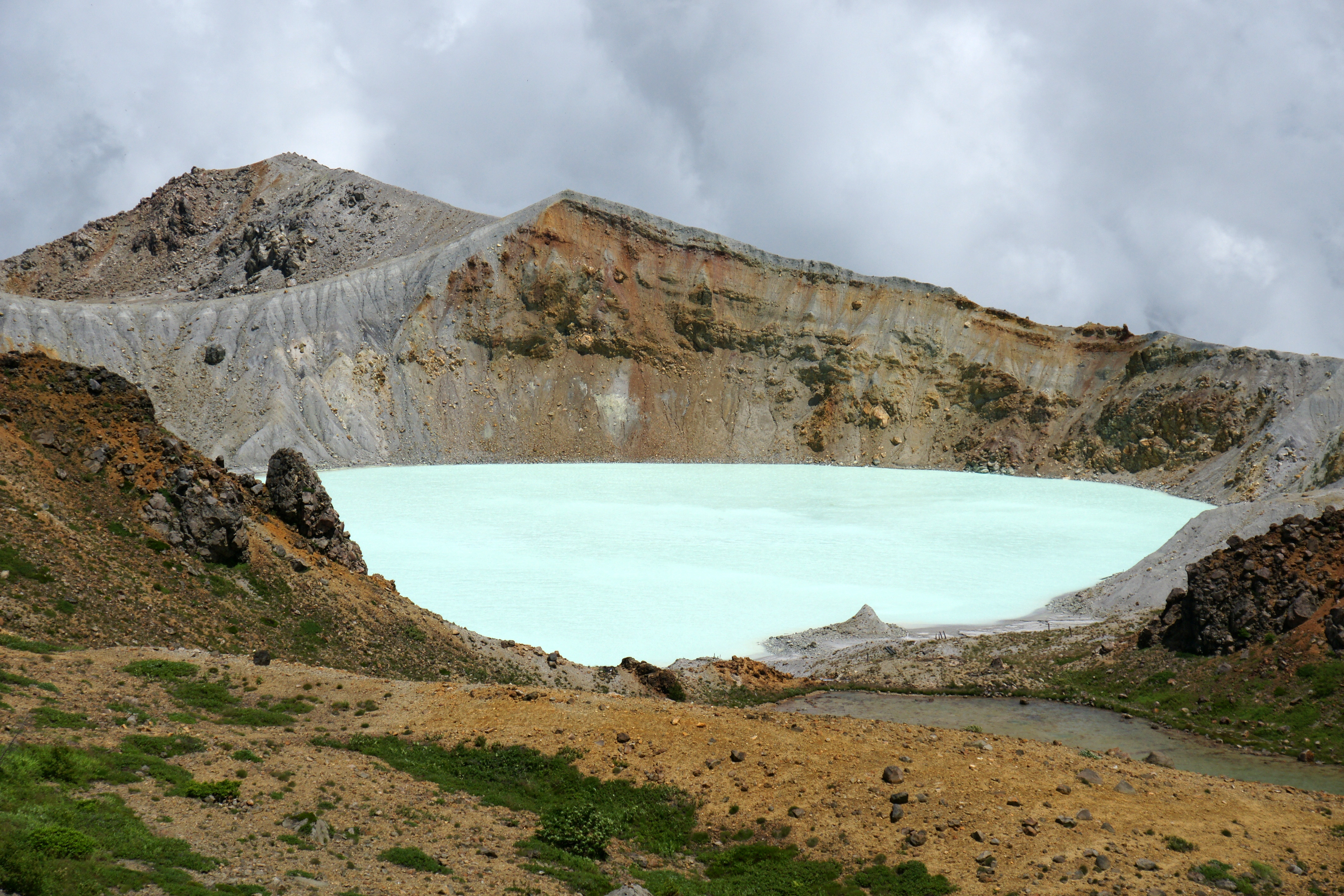
Mount Kusatsu-Shirane (草津白根山, Kusatsu Shirane-san) is a 2,165 m (7,103 ft) active stratovolcano in Kusatsu, Gunma, Japan.[2] It is called Kusatsu Shirane to differentiate it from the Mount Nikkō-Shirane on the other side of Gunma Prefecture. The summit of Kusatsu-Shirane volcano, located immediately north of Asama volcano, consists of a series of overlapping pyroclastic cones and three crater lakes. The largest of these is Yu-gama, an acidic emerald green lake with rafts of yellow sulfur sometimes seen floating on its surface.[3][4]
| Mount Kusatsu-Shirane | |
|---|---|
 Viewed from the southeast | |
| Highest point | |
| Elevation | 2,165 m (7,103 ft) |
| Coordinates | 36.6438°N 138.5279°E |
| Naming | |
| Native name | 草津白根山 (Japanese) |
| Geography | |
 Mount Kusatsu-Shirane Honshū, Japan | |
| Geology | |
| Mountain type | Stratovolcano |
| Last eruption | January 23, 2018[1] |
On January 23, 2018, a minor phreatic eruption of the volcano occurred.[5] One person was killed, and others were injured in an avalanche triggered by the eruption.[6] The next day, new activity forced police to suspend search operations.[7] One month after the eruption, it was announced by prefectural officials that only the summit of the volcano was off limits to the public.[8]
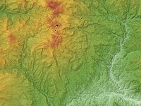 Relief map of Kusatsu-Shirane Volcano
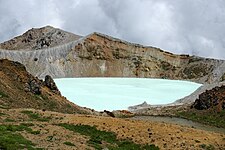 Yugama crater

See also
- List of volcanoes in Japan
- List of mountains in Japan
References
- 草津白根山が噴火 警戒レベル3に 気象庁. NHK News Web (in Japanese). NHK. Archived from the original on 23 January 2018. Retrieved 23 January 2018.
- "Kusatsu-Shirane". OSU Department of Geosciences. Oregon State University. Retrieved 23 January 2018.
- "Mt. Kusatsu-Shiranesan". Gunma Tourist Guide. Bureau of Tourism, GUNMA Prefectural Government. Retrieved 24 January 2018.
- "Kusatsu-Shiranesan". Global Volcanism Program. Smithsonian Institution. Retrieved 2021-06-24.
- "Mt. Kusatsu-Shirane saw repeated eruptions in the past". The Mainichi. The Mainichi Newspapers. 24 January 2018. Retrieved 24 January 2018.
- McCurry, Justin. "Japan: fatal avalanche engulfs skiers after volcano erupts". The Guardian. Retrieved 23 January 2018.
- "Volcanic tremors halt search ops after eruption". Japan Today. AFP. 24 January 2018. Retrieved 24 January 2018.
- "One month since eruption of Mt. Kusatsu-Shirane". NHK World. NHK. 23 February 2018. Archived from the original on 24 February 2018. Retrieved 23 February 2018.
External links
- Kusatsu-Shiranesan - Japan Meteorological Agency (in Japanese)
- "Kusatsu-Shiranesan: National catalogue of the active volcanoes in Japan" (PDF). - Japan Meteorological Agency
- Kusatsu-Shirane Volcano - Geological Survey of Japan
| Hokkaidō | |||||||||
|---|---|---|---|---|---|---|---|---|---|
| Tōhoku region Jōshinetsu region |
| ||||||||
| Kantō region | |||||||||
| Chūbu region |
| ||||||||
| Western Japan | |||||||||
| |||||||||
This Gunma Prefecture location article is a stub. You can help Wikipedia by expanding it. |
На других языках
[de] Kusatsu-Shirane
Der Kusatsu-Shirane (jap. 草津白根山, Kusatsu Shirane-san), amtlich nur Shirane (白根山, -san), ist ein 2160 m T.P. hoher Schichtvulkan auf der japanischen Insel Honshū. Der Berg liegt 6 km westlich der Kleinstadt Kusatsu in der Präfektur Gunma im Norden der Region Kantō, 150 km nordöstlich von Tokio.- [en] Mount Kusatsu-Shirane
[fr] Mont Kusatsu-Shirane
Le mont Kusatsu-Shirane (草津白根山, Kusatsu Shirane-san?) est un volcan actif de 2 160 m d'altitude situé dans la préfecture de Gunma, au Japon.[it] Monte Kusatsu-Shirane
Il monte Kusatsu-Shirane (草津白根山 Kusatsu Shirane-san?) (2.171 m s.l.m.) è un vulcano attivo che si trova a Kusatsu, Giappone. Si chiama Kusatsu Shirane per distinguerlo dal Monte Nikkō-Shirane dall'altra parte della prefettura di Gunma. La cima di questo vulcano si trova immediatamente a nord del Monte Asama, si compone di una sovrapposizione di coni vulcanici e di tre laghi vulcanici. Il più grande di questi è Yu-Gama, un lago acido di colore turchese.[ru] Сиране
Сира́не[2][3][4] (яп. 草津白根山 Кусацу-Сиранэ-сан) — активный вулкан в Японии неподалёку от посёлка Кусацу префектуры Гумма. Это самая высокая вершина хребта Этиго[5]: его высота — 2165 м[1]. В Гумме, в Национальном парке Никко, находится одноимённый вулкан Сиране.Другой контент может иметь иную лицензию. Перед использованием материалов сайта WikiSort.org внимательно изучите правила лицензирования конкретных элементов наполнения сайта.
WikiSort.org - проект по пересортировке и дополнению контента Википедии