geo.wikisort.org - Mountains
Mount Kirigamine (霧ヶ峰, Kiri-ga-mine) is a 1,925m volcano, located in Nagano Prefecture, Japan.
| Mount Kirigamine | |
|---|---|
| 霧ヶ峰 | |
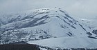
 Kirigamine seen from the east. Taken from Mount Tateshina. | |
| Highest point | |
| Elevation | 1,925 m (6,316 ft)[1] |
| Coordinates | 36°06′00″N 138°10′01″E[2] |
| Geography | |
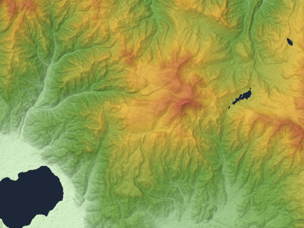
 Mount Kirigamine Location of Mount Kirigamine in Japan. | |
| Location | Nagano Prefecture, Japan |
| Geology | |
| Mountain type | Lava flow, Lava dome[3] |
| Last eruption | 0.75 Ma[3] |
Outline
The tallest peak of Mount Kirigamine is Mount Kuruma, on which there is a weather radar site. Most of the mountain is covered in grass with sparse bushes and rocks. The south and east sides are suitable for gliding with a narrow landing zone in the vicinity of a parking lot and a huge emergency landing at the west side of the mountain. The southeast cliffs are a launching point for gliders, with winds above 3 meters[clarification needed]. The north part is equipped with ski-lifts.
Access
Vehicle access to the bottom of Kirigamine does not require four-wheel drive but snow chains may be necessary if there is heavy snow.
Gallery
 Mount Kuruma is a tallest peak
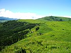 Mount Kuruma from Mount Minaminomimi
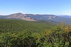 Kirigamine seen from the east.
 Mount Kirigamine and Yashimagahara Wetland
 A weather radar site on the top of Mount Kuruma


See also
- List of volcanoes in Japan
- List of mountains in Japan
References
- Giga Atlas, ISBN 4-398-64180-7
- KIRIGAMINE JAPAN (GENERAL) JAPAN Geography Population Map City and cities coordinates location
- Kirigamine - Geological Survey of Japan
External links
Wikimedia Commons has media related to Kirigamine.
- "Kirigamine". Global Volcanism Program. Smithsonian Institution. Retrieved 2021-06-24.
- Kirigamine - Geological Survey of Japan
На других языках
- [en] Mount Kirigamine
[fr] Mont Kirigamine
Le mont Kirigamine (霧ヶ峰, Kiri-ga-mine?) est un volcan de 1 925 m d'altitude situé dans la préfecture de Nagano au Japon. C'est l'une des 100 montagnes célèbres du Japon.Текст в блоке "Читать" взят с сайта "Википедия" и доступен по лицензии Creative Commons Attribution-ShareAlike; в отдельных случаях могут действовать дополнительные условия.
Другой контент может иметь иную лицензию. Перед использованием материалов сайта WikiSort.org внимательно изучите правила лицензирования конкретных элементов наполнения сайта.
Другой контент может иметь иную лицензию. Перед использованием материалов сайта WikiSort.org внимательно изучите правила лицензирования конкретных элементов наполнения сайта.
2019-2026
WikiSort.org - проект по пересортировке и дополнению контента Википедии
WikiSort.org - проект по пересортировке и дополнению контента Википедии