geo.wikisort.org - Mountains
Mount Kasa (笠ヶ岳, Kasa-ga-take) is one of the 100 Famous Japanese Mountains, reaching the height of 2,897 m (9,505 ft). It is situated in Japan's Hida Mountains in Gifu Prefecture and in Chūbu-Sangaku National Park.[3] The shape of the mountain looks like the Umbrella("Kasa"-笠) in the triangle. Therefore, it became this name.[4] There are many mountains with same name in Japan and this is the tallest.
| Mount Kasa | |
|---|---|
| 笠ヶ岳 | |
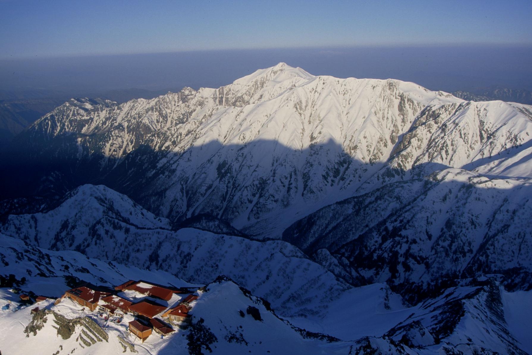 Mount Kasa from Mount Yari | |
| Highest point | |
| Elevation | 2,897.48 m (9,506.2 ft)[1] |
| Listing | List of mountains in Japan 100 Famous Japanese Mountains |
| Coordinates | 36°18′55″N 137°37′00″E[2] |
| Naming | |
| Language of name | Japanese |
| Pronunciation | [kasaɡatake] |
| Geography | |
 Takayama, Gifu Prefecture Japan | |
| Parent range | Hida Mountains |
| Topo map | Geospatial Information Authority 25000:1 笠ヶ岳[2] 50000:1 上高地 |
| Climbing | |
| First ascent | 1683(Enkū) |
| Easiest route | Hike |
History
- In 1683 – It was said that Enkū had opened this mountain.[5]
- In 1894, August 2 – Englishman Walter Weston had climbed on the top.[6]
- In 1913, August – Usui Kojima had climbed on the top.[5]
- In 1932 – Mountain hut of Kasa Mountain Cottage (笠ヶ岳山荘) was constructed near the top.[7]
- In 1934, December 4 – This area was specified to the Chūbu-Sangaku National Park.[3]
- In 1964 – "Kasa-shin-dō"(笠新道) of the new Trail had been made.[4] Then it is the main route to the Mount Kasa.
- In 1993 – Postage stamp of Mount Kasa and Takayama Festival was put on the market by the Ministry of Posts and Telecommunications (Japan).[8]
- In 1995 – Sumie Tanaka (田中澄江 Tanaka Sumie) completed New Flowers of the 100 Mountains, which featured many of the Alpine plant(Trollius japonicus シナノキンバイ and others) on Mount Kasa.[9]
Mountaineering
Main ascent routes

There are three climbing routes to the top of the mountain.[10][11]
- Kasa-shin-dō
- Shin-Hotaka Onsen(新穂高温泉) – Mount Nukedo – Kasa Mountain Cottage – Mount Kasa
- Valley Kuriya
- Nakao-Kōgen-guchi(中尾高原口) – Valley Kuriya – Mount Kasa
- Traverses Route of Northern Japanese Alps(Hida Mountains) from north side
- Mount Sugoroku – Mount Yumiori – Mount Nukedo – Kasa Mountain Cottage – Mount Kasa
Mountain hut
Thera are several Mountain hut around Mount Kasa.[11] Around Shin-Hotaka-Onsen, there are many hot spring (Onsen) to take the tiredness and to relax.
- Kasa Mountain Cottage (笠ヶ岳山荘) – near the top (with Campsite)
- Wasabi-Daira Hut (ワサビ平小屋) – near the entrance of Kasa-shin-dō
- Kagami-Daira Mountain Cottage (鏡平山荘) – near the Pond Kagami(鏡池)
- Sugoroku Hut (双六小屋) – between Mount Sugoroku and Mount Momisawa (with Campsite)
Geography

It is the mountain that consists chiefly of the Porphyry (geology).[4] The higher region than Shakushi-daira(杓子平) are the forest limit of Siberian Dwarf Pine belt, and the place that Alpine plant grows naturally and Rock Ptarmigan live.
Nearby mountains
Mount Kasa is on the subridge (from Mount Sugoroku) of the main ridge line in the southern part of the Hida Mountains.[10] There are Mount Shakujō and Mount Ōkibanotsuji on the southern ridge.

| Image | Mountain | Elevation | Distance from the Top |
Note |
|---|---|---|---|---|
 |
Mt. Yari 槍ヶ岳 |
3,180 m (10,433 ft) | 9.2 km (5.7 mi) | 100 Famous Japanese Mountains |
 |
Mt. Kasa 笠ヶ岳 |
2,897 m (9,505 ft) | 0 km (0.0 mi) | 100 Famous Japanese Mountains |
 |
Mt. Shakujō 錫杖岳 |
2,168 m (7,113 ft) | 3.8 km (2 mi) | Rock climbing on the rock peak |
 |
Mt. Hotaka 穂高岳 |
3,190 m (10,466 ft) | 9.2 km (6 mi) | Tallest mountain in Hida Mountains 100 Famous Japanese Mountains |
 |
Mt. Haku 白山 |
2,702 m (8,865 ft) | 72.3 km (44.9 mi) | Tallest mountain in Ishikawa Prefecture 100 Famous Japanese Mountains |
Rivers
The mountain is the source of the following rivers, each of which flows to the Sea of Japan.[11]
- Sugoroku River (a tributary of the Jinzū River)
- Gamata River (tributaries of the Takahara River)
Gallery
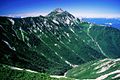 Mount Kasa
from Mount Nukedo Mount Kasa
from south Mount Kasa
from Mount Kurai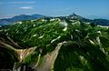 Mount Kasa and Hida Mountains
from Mount Suisho


References
- "Information inspection service of the Triangulation station". Geospatial Information Authority of Japan,(高山-上高地-笠ヶ岳). Archived from the original on June 9, 2009. Retrieved December 1, 2010.
- "Map inspection service". Geospatial Information Authority of Japan,(高山-上高地-笠ヶ岳). Retrieved December 1, 2010.
- "Chūbu-Sangaku National Park". Ministry of the Environment (Japan). Archived from the original on February 27, 2012. Retrieved December 1, 2010.
- Dictionary of name of Japanese mountain (日本山名辞典). Sanseido. 1992. p. 122. ISBN 4-385-15403-1.
- 1000 Japanese Mountains. YAMA-KEI Publishers. 1992. ISBN 4-635-09025-6.
- Mountaineeraing and exploration in Japanese alps, (in 1896 by Walter Weston) (new ed.). translated into Japanese (日本アルプスの登山と探検),Iwanami Shoten. 2005. ISBN 4-00-334741-2.
- The story of mountain huts in Northern Japanese Alps. Tokyo Shimbun. 1997. ISBN 4-8083-0374-4.
- 100 Famous Japanese Mountains with postmark of stamp with the scenery. Hukurōsha. 2007. ISBN 978-4-89806-276-0.
- Sumie Tanaka (1995). New Flowers of the 100 Mountains (新・花の百名山). Bunsyunbunko. ISBN 4-16-731304-9.
- Alpen guide Kamikōchi,Mount Yari and Mount Hotaka (アルペンガイド). YAMA-KEI Publishers. 2000. ISBN 4-635-01319-7.
- Mountain and plateau map, Mount Yari, Mount Hotaka and Kamikōchi (山と高原地図). Shobunsha Publications. 2010. ISBN 978-4-398-75717-3.
See also
- Hida Mountains
- Chūbu-Sangaku National Park
- List of mountains in Japan
- 100 Famous Japanese Mountains
| Wikimedia Commons has media related to Mount Kasa. |
| Hokkaidō | |||||||||
|---|---|---|---|---|---|---|---|---|---|
| Tōhoku region Jōshinetsu region |
| ||||||||
| Kantō region | |||||||||
| Chūbu region |
| ||||||||
| Western Japan | |||||||||
| |||||||||
На других языках
[de] Kasagatake
Der Kasagatake (jap. 笠ヶ岳) ist ein Berg im Nordosten der japanischen Präfektur Gifu mit einer Höhe von 2897 m T.P. Er ist einer der 100 berühmten japanischen Berge. Die Erstbesteigung wird dem buddhistischen Mönch Enkū im Jahr 1683 zugeschrieben.- [en] Mount Kasa
[fr] Mont Kasa
Le mont Kasa (笠ヶ岳, Kasa-ga-take?) est l'une des 100 montagnes célèbres du Japon, culminant à 2 898 m. Elle fait partie des monts Hida dans la préfecture de Gifu et dans le parc national de Chūbu-Sangaku[2]. La forme de la montagne ressemble à un parapluie (Kasa-笠) ce qui lui a donné son nom[3]. Il y a de nombreuses montagnes au Japon qui portent ce nom mais celle-ci est la plus élevée.Другой контент может иметь иную лицензию. Перед использованием материалов сайта WikiSort.org внимательно изучите правила лицензирования конкретных элементов наполнения сайта.
WikiSort.org - проект по пересортировке и дополнению контента Википедии