geo.wikisort.org - Mountains
Mount Norikura (乗鞍岳, Norikura-dake) is a potentially active volcano located on the borders of Gifu and Nagano prefectures in Japan. It is part of the Hida Mountains and is listed among the 100 Famous Japanese Mountains[4] and the New 100 Famous Japanese Mountains.[5]
| Mount Norikura | |
|---|---|
| 乗鞍岳 | |
 Mount Norikura in spring | |
| Highest point | |
| Elevation | 3,025.64 m (9,926.6 ft)[1] |
| Prominence | 1,236 m (4,055 ft) |
| Listing | • List of mountains in Japan • List of volcanoes in Japan • 100 Famous Japanese Mountains |
| Coordinates | 36°06′23″N 137°33′13″E[2] |
| Naming | |
| English translation | Riding Saddle Peak |
| Geography | |
 Mount Norikura Location in Japan | |
| Location | Gifu Prefecture Nagano Prefecture Japan |
| Parent range | Hida Mountains |
| Topo map | Geographical Survey Institute, 25000:1 乗鞍岳, 50000:1 上高地 |
| Geology | |
| Mountain type | Stratovolcano (active) |
| Last eruption | 50 BCE (?) |
| Climbing | |
| First ascent | Enkū in the 1680s[3] |
Outline
The mountain is located on the borders of Gifu and Nagano prefectures in Chūbu-Sangaku National Park.[6]
The Norikura Plateau borders the mountain on its northern side in Nagano Prefecture. The mountain, whose name means "riding saddle," received its name because its shape looks like a horse saddle. It is known for being the easiest to climb among the mountains in Japan that are above 3000-meters.
History
- 1680s - It is said that Enkū was the first to reach the peak.[3]
- 1878 - Englishman William Gowland became the first non-Japanese man to reach the peak.[7][8]
- 1892 - Englishman Walter Weston climbed on the peak.[9][10]
- December 4, 1934 - This area was specified to the Chūbu-Sangaku National Park.[6]
- 1973 - Norikura Skyline to the vicinity of the top of a mountain was opened. It is the road that exists in the highest place in Japan.[3]
Nature
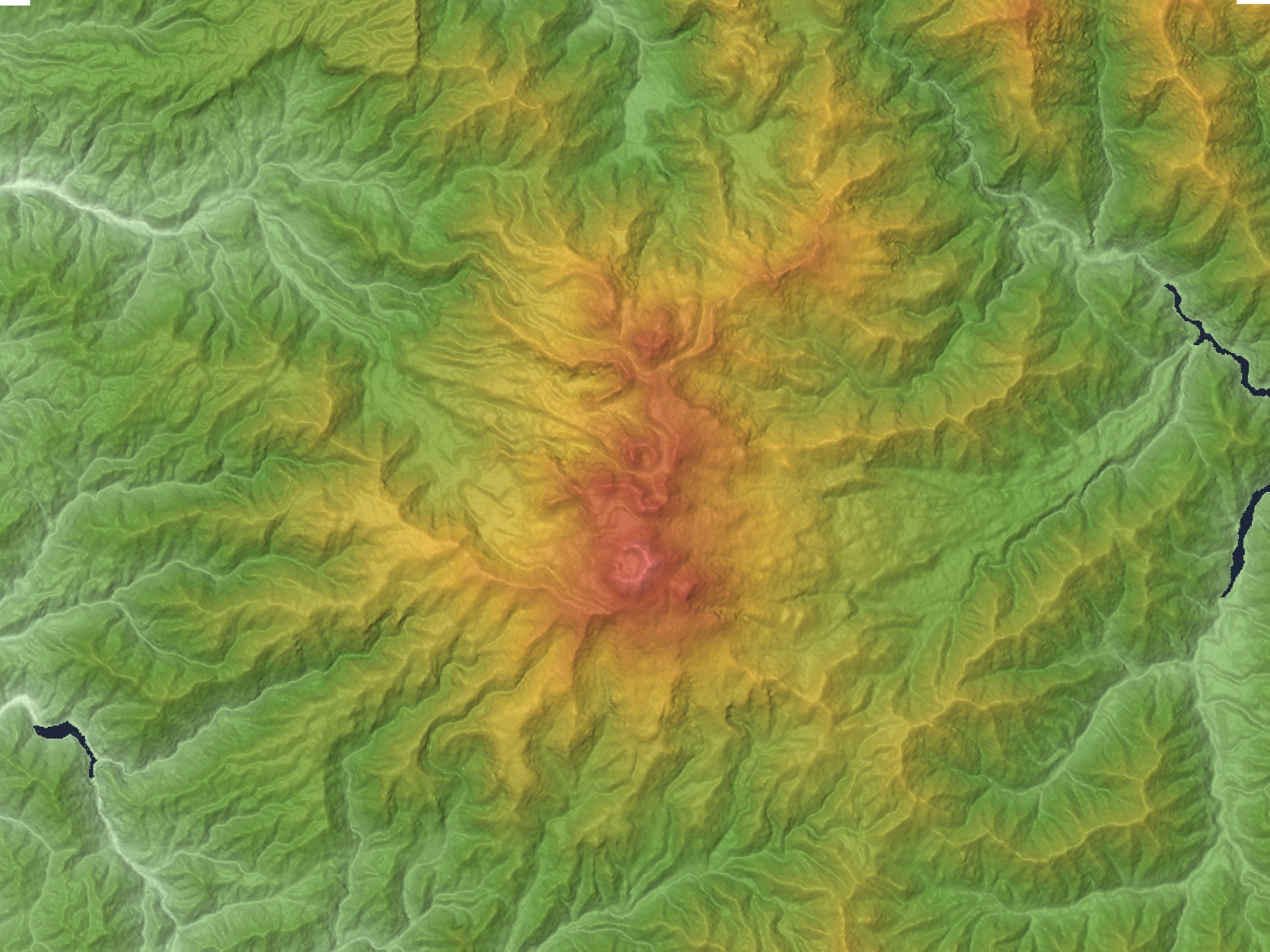
After Mount Fuji and Mount Ontake, Mount Norikura is the third tallest volcano in Japan. It is a stratovolcano and hardened lava flows can still be seen near the peak. There are eight plains and 12 crater lakes on the mountain that were formed by volcanic activity. The Norikura Skyline is a road through the mountain, but it has to be closed for much of the year because of heavy snow fall. Even in the summer, some snow remains on the northeastern face of the mountain.
Plant and animal life
Mount Norikura has a variety of plant and animal life on its slopes. In addition to the alpine accentor and martins, the rock ptarmigan (one of Japan's natural monuments) also makes its home on the mountain.
There are various alpine plants and other flowers, including rhododendrons, lilies, and komakusa.
Geography
Geological features
Mount Kengamine (剣ヶ峰 Kengamine), one peak on the mountain, was formed in two eruptions 9,600 and 9,200 years ago. Mount Ebisu (恵比寿岳 Ebisu-dake), another peak, was formed during an eruption 2,000 years ago. Though the volcano has lost some of its eruptive power, volcanic gas is still escaping through the Yū River (湯川 Yū-gawa) and there are many spa areas in the surrounding area.
River of source
Each following river of the source[clarification needed] flows to the Sea of Japan or Ise Bay.[11]
- Tributary of Azusa River that joins to the Shinano River
- Tributary of Takahara River
- Tributary of Hida River
See also
- Chūbu-Sangaku National Park
- Hida Mountains
- Three-thousanders (in Japan)
- 100 Famous Japanese Mountains
- List of mountains in Japan
- List of volcanoes in Japan
- Volcano
References
- "Information inspection service of the Triangulation station". Geospatial Information Authority of Japan,(高山-乗鞍). Archived from the original on June 9, 2009. Retrieved December 4, 2010.
- "Mountains altitude list in Japan(Gife prefecture)". Geospatial Information Authority of Japan. Retrieved December 4, 2010.
- 1000 Japanese Mountains. YAMA-KEI Publishers. 1992. ISBN 4-635-09025-6.
- Kyūya Fukada (1982). 100 Famous Japanese Mountains. The Asahi Shimbun Companyin. ISBN 4-02-260871-4.
- Motoo Iwasaki (2006). New 100 Famous Japanese Mountains. YAMA-KEI Publishers. ISBN 4-635-53047-7.
- "Chūbu-Sangaku National Park". Ministry of the Environment (Japan). Archived from the original on February 27, 2012. Retrieved December 4, 2010.
- Chronology of the climbing mountain history in Japan. YAMA-KEI Publishers. 2005. ISBN 4-635-17814-5.
- William Gowland (1881). A Hand book for Travellers in Central and Northern Japan. ISBN 4-635-53047-7.
- Dictionary of name of Japanese mountain (日本山名辞典). Sanseido. 1992. ISBN 4-385-15403-1.
- Walter Weston (2005). Mountaineeraing and exploration in Japanese alps (new ed.). translated into Japanese (日本アルプスの登山と探検),Iwanami Shoten. ISBN 4-00-334741-2.
- Mountain and plateau map, Norikura Plateau (山と高原地図). Shobunsha Publications. 2010. ISBN 978-4-398-75718-0.
External links
| Wikimedia Commons has media related to: Mount Norikura (category) |
- Norikuradake - Japan Meteorological Agency (in Japanese)
- "Norikuradake: National catalogue of the active volcanoes in Japan" (PDF). - Japan Meteorological Agency
- Norikura Dake - Geological Survey of Japan
- "Norikuradake". Global Volcanism Program. Smithsonian Institution. Retrieved 2021-06-24.
| Hokkaidō | |||||||||
|---|---|---|---|---|---|---|---|---|---|
| Tōhoku region Jōshinetsu region |
| ||||||||
| Kantō region | |||||||||
| Chūbu region |
| ||||||||
| Western Japan | |||||||||
| |||||||||
На других языках
[de] Norikura-dake
Der Norikura-dake (jap. 乗鞍岳) ist ein potentiell aktiver Vulkan im Hida-Gebirge und mit einer Höhe von 3026 m der dritthöchste Vulkan und die elfthöchste Erhebung Japans. Er liegt in den Präfekturen Nagano und Gifu und ist einer der 100 berühmten japanischen Berge (Hyakumeizan).[3]- [en] Mount Norikura
[fr] Mont Norikura
Le mont Norikura (乗鞍岳, Norikura-dake?) est un stratovolcan du Japon située à la frontière entre la préfecture de Gifu et la préfecture de Nagano, dans le parc national de Chūbu-Sangaku.Другой контент может иметь иную лицензию. Перед использованием материалов сайта WikiSort.org внимательно изучите правила лицензирования конкретных элементов наполнения сайта.
WikiSort.org - проект по пересортировке и дополнению контента Википедии