geo.wikisort.org - Mountains
Mount Iwate (岩手山, Iwate-san) is a stratovolcano complex in the Ōu Mountains of western Iwate Prefecture, in the Tōhoku region of northern Honshū, Japan. With an elevation of 2,038 metres (6,686 ft), it is the highest in Iwate Prefecture. It is included as one of the 100 famous mountains in Japan, a book composed in 1964 by mountaineer and author Kyūya Fukada.[2] The mountain is on the borders of the municipalities of Hachimantai, Takizawa, and Shizukuishi, west of the prefectural capital of Morioka. Much of the mountain is within the borders of the Towada-Hachimantai National Park.[3][4][5] The mountain is also referred to as the "Nanbu Fuji" for its resemblance to Mount Fuji.
| Mount Iwate | |
|---|---|
 Mount Iwate from the city of Morioka | |
| Highest point | |
| Elevation | 2,038 m (6,686 ft)[1] |
| Prominence | 1,745 m (5,725 ft)[1] |
| Listing | 100 Famous Mountains of Japan Ultra |
| Coordinates | 39°51′12″N 141°00′03″E[1] |
| Naming | |
| Native name | 岩手山 (Japanese) |
| Geography | |
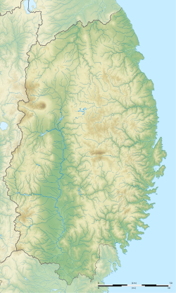 Mount Iwate Mount Iwate  Mount Iwate Mount Iwate (Japan) | |
| Location | Iwate Prefecture, Japan |
| Parent range | Ōu Mountains |
| Geology | |
| Mountain type | Stratovolcano complex |
| Last eruption | July 1919 |
Geology


Mount Iwate consists of a younger eastern symmetrical stratovolcano (Higashi-Iwate, "East Iwate") overlapping an older western stratovolcano (Nishi-Iwate, "West Iwate") which has collapsed to form a caldera.[6] Nishi-Iwate was formed approximately 700,000 years ago, and forms two-thirds of the mountain body. Higashi-Iwate was a later (300,000 years ago) parasitic volcano, which now forms the summit of the mountain. The oval-shaped, 1.8 x 3 km caldera of Nishi-Iwate has a 0.5 km wide crater, partially filled by a crater lake called Lake Onawashiro. Several somma including Yakushidake, the largest, surround the more recent Higashi Iwate crater rim.
During the historical period, Mount Iwate erupted in 1686-1687 with a pyroclastic surge; however, the eruption of 1732 was much larger and resulted in a substantial lava flow on the northeast slopes of the mountain. This four-kilometre long lava flow ("Yakebashiri Lava Flow") has been designated a Natural Monument by the Japanese government. Mount Iwate has largely been quiet since 1732, with a small emission of steam and ash in 1919 and a series of volcanic earthquakes from 1998 to 2003.
See also
- List of Ultras of Japan
- List of volcanoes in Japan
- List of mountains in Japan
References
- "Japan Ultra-Prominences". Peaklist.org. Retrieved 2015-01-01.
- Hyakumeizan, Hiking Japan! Archived 2007-01-09 at the Wayback Machine. Japan Gazetteer. Accessed June 27, 2008.
- "Introducing places of interest: Towada-Hachimantai National Park". Ministry of the Environment. Archived from the original on 27 February 2012. Retrieved 29 February 2012.
- "Towada-Hachimantai National Park". Natural Parks Foundation. Archived from the original on 3 July 2017. Retrieved 29 February 2012.
- Sutherland, Mary; Britton, Dorothy (1995). National Parks of Japan. Kodansha. pp. 48–50. ISBN 4-7700-1971-8.
- "Iwatesan". Global Volcanism Program. Smithsonian Institution.
External links
- "Iwatesan: National catalogue of the active volcanoes in Japan" (PDF). - Japan Meteorological Agency
- Iwate Volcano - Geological Survey of Japan
- Iwatesan - Smithsonian Institution: Global Volcanism Program
- - Hiking in Japan, Mount Iwate
- Iwate Prefectural Tourism site
- Hachimantai city tourism site
| Hokkaidō | |||||||||
|---|---|---|---|---|---|---|---|---|---|
| Tōhoku region Jōshinetsu region |
| ||||||||
| Kantō region | |||||||||
| Chūbu region |
| ||||||||
| Western Japan | |||||||||
| |||||||||
На других языках
[de] Iwate (Berg)
Der Iwate (jap. 岩手山, Iwate-san) ist ein Schichtvulkan des Ōu-Gebirges in Sichtweite der japanischen Stadt Morioka, der Hauptstadt der nordjapanischen Präfektur Iwate.- [en] Mount Iwate
[fr] Mont Iwate
Le mont Iwate (岩手山, Iwate-san?) est un stratovolcan du Japon situé dans la préfecture d'Iwate, dans la région du Tōhoku, sur l'île de Honshū. Il fait partie des 100 montagnes célèbres du Japon.[ru] Ивате (гора)
Ивате — это комплекс стратовулканов горного хребта Оу в западной части префектуры префектуры Ивате, в регионе Тохоку в северной части Хонсю, Япония. Его высота составляет 2038 метров. Он включён в книгу «100 знаменитых гор Японии», составленную в 1964 году альпинистом и автором Кюей Фукадой[2]. Гора находится на границе муниципалитетов Хатимантай, Такидзава и Сидзукуиси, к западу от столицы префектуры Мориоки. Большая часть горы находится в пределах национального парка Товада-Хатимантай[3][4][5].Другой контент может иметь иную лицензию. Перед использованием материалов сайта WikiSort.org внимательно изучите правила лицензирования конкретных элементов наполнения сайта.
WikiSort.org - проект по пересортировке и дополнению контента Википедии