geo.wikisort.org - Mountains
Mount Adatara (安達太良山, Adatara-yama) is a stratovolcano in Fukushima Prefecture, Japan.
| Mount Adatara | |
|---|---|
 Viewed from the SE. | |
| Highest point | |
| Elevation | 1,728 m (5,669 ft)[1] |
| Listing | Volcanoes in Japan |
| Coordinates | 37°38′39″N 140°17′10″E |
| Naming | |
| Native name | 安達太良山 (Japanese) |
| Geography | |
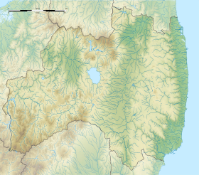
 Mount Adatara Fukushima Prefecture, Honshu, Japan | |
| Parent range | Ōu Mountains |
| Geology | |
| Mountain type | Stratovolcano |
| Last eruption | AD 1900[2] |
It is located about 15 kilometres southwest of the city of Fukushima and east of Mount Bandai. Its last known eruption was in 1996.[1] An eruption in 1900 killed 72 workers at a sulfur mine located in the summit crater.[1]
History
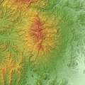
The mountain is actually multiple volcanoes forming a broad, forested massif. It abuts Mount Azuma, a dormant volcano to the north. The peak is called Minowa-yama. It is the highest peak in the Adatara range, which stretches about 9 km in a north-south direction.[3]
The active summit crater is surrounded by hot springs and fumaroles. Sulfur mining was carried out in the 19th century, and 72 mine workers were killed in an eruption in 1900. Poems about Mount Adatara by Kōtarō Takamura from his book "Chieko-sho" helped make it famous.
Gallery
- Massif of Adatara Volcano
- Numanotaira Crater
- Summit
See also
- List of volcanoes in Japan
- List of mountains in Japan
References
- "Adatara". Global Volcanism Program. Smithsonian Institution. Retrieved 2014-12-30.
- Adatara Yama - Geological Survey of Japan
- Takeda T., page 92.
- Sources
- Takeda, Toru; Hishinuma, Tomio; Kamieda, Kinuyo; Dale, Leigh; Oguma, Chiyoichi (August 10, 1988). Hello! Fukushima - International Exchange Guide Book (1988 ed.). Fukushima City: Fukushima Mimpo Press.
See also
External links
- Adatarayama - Japan Meteorological Agency (in Japanese)
- Adatarayama: National catalogue of the active volcanoes in Japan - Japan Meteorological Agency
- Adatara Yama - Geological Survey of Japan
- Adatarayama: Global Volcanism Program - Smithsonian Institution
На других языках
[de] Adatara
Der Adatara (jap. .mw-parser-output .Hani{font-size:110%}安達太良山, -yama) ist ein Schichtvulkan auf der japanischen Insel Honshū.- [en] Mount Adatara
[fr] Mont Adatara
Le mont Adatara (安達太良山, Adatara-yama?) est un volcan complexe du Japon situé dans la préfecture de Fukushima, sur l'île de Honshū. Son point culminant est le mont Minowa à 1 728 mètres d'altitude. Sa faune et sa flore sont protégées par le gouvernement japonais du fait de son intégration au parc national de Bandai-Asahi depuis 1950. Dans ses immédiats environs, l'activité touristique se développe grâce à l'exploitation de trois stations de sports d'hiver et de nombreuses stations thermales. Il est inscrit sur la liste des 100 montagnes célèbres du Japon.[ru] Адатара
Адатара (яп. 安達太良山 Адатара-яма) — группа вулканов, расположенных на японском острове Хонсю в префектуре Фукусима.Другой контент может иметь иную лицензию. Перед использованием материалов сайта WikiSort.org внимательно изучите правила лицензирования конкретных элементов наполнения сайта.
WikiSort.org - проект по пересортировке и дополнению контента Википедии


