geo.wikisort.org - Mountains
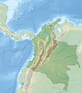
This is a list of active and extinct volcanoes in Colombia.
| Name | Elevation | Coordinates | Last eruption | |
|---|---|---|---|---|
| meters | feet | |||
| Azufral | 4070 | 13,353 | 1.08°N 77.68°W | 930 BC ? |
| Cerro Bravo | 4000 | 13,123 | 5.092°N 75.30°W | 1720 ± 150 years |
| Cerro Machín | 2749 | 9,019 | 4.48°N 75.40°W | 1180 |
| Cerro Negro de Mayasquer | 4445 | 14,583 | 0.98°N 77.88°W | 1936 |
| Chiles | 4756 | 15,616 | 0°47′52″N 77°57′3″W | 1936 |
| Cumbal | 4764 | 15,630 | 0.82°N 77.96°W | 1926 |
| Doña Juana | 4137 | 13,573 | 1.47°N 76.92°W | 1906 |
| Galeras | 4276 | 14,029 | 1°13′0″N 77°22′0″W | 2014 |
| Nevado del Huila | 5365 | 17,601 | 2.92°N 76.05°W | 2012 |
| Nevado del Tolima | 5276 | 17,310 | 4.67°N 75.33°W | 1943 |
| Nevado del Ruiz | 5321 | 17,457 | 4°53′N 75°22′W | 2012 |
| Petacas | 4054 | 13,300 | 1.57°N 76.78°W | 5950 BC ± 500 years |
| Puracé | 4646 | 15,243 | 2.32°N 76.40°W | 1977 |
| Romeral | 3858 | 12,657 | 5.206°N 75.364°W | 5950 BC ± 500 years |
| Santa Isabel | 4950 | 16,240 | 4.82°N 75.37°W | 2800 BC ± 100 years |
| Sotará | 4580 | 15,030 | 2.12°N 76.58°W | Unknown |
See also
- List of earthquakes in Colombia
- List of fossiliferous stratigraphic units in Colombia
- Geology of Colombia
References
- Siebert L, Simkin T (2002–present). Volcanoes of the World: an Illustrated Catalog of Holocene Volcanoes and their Eruptions. Smithsonian Institution, Global Volcanism Program Digital Information Series, GVP-3 (http://www.volcano.si.edu).
На других языках
[de] Liste von Vulkanen in Kolumbien
Dies ist eine Liste von Vulkanen in Kolumbien, die während des Quartärs mindestens einmal aktiv waren.- [en] List of volcanoes in Colombia
[es] Anexo:Volcanes de Colombia
Colombia presenta actividad volcánica por estar situada en la zona de interacción de tres placas tectónicas: la Placa de Nazca, la Placa Sudamericana y la Placa del Caribe. En particular, el territorio colombiano se localiza dentro del llamado cinturón de fuego del Pacífico donde placas oceánicas entran en subducción, llevando hacia el manto sedimentos cargados de agua que al deshidratarse producen un cinturón de vulcanismo. La mayoría de volcanes de Colombia están ubicados en la cordillera central, aunque hay vestigios de actividad volcánica en las cordilleras occidental y oriental.[fr] Liste des volcans de Colombie
Cet article recense les volcans de Colombie. Tous sont situés dans la cordillère Centrale et le nœud de los Pastos.Текст в блоке "Читать" взят с сайта "Википедия" и доступен по лицензии Creative Commons Attribution-ShareAlike; в отдельных случаях могут действовать дополнительные условия.
Другой контент может иметь иную лицензию. Перед использованием материалов сайта WikiSort.org внимательно изучите правила лицензирования конкретных элементов наполнения сайта.
Другой контент может иметь иную лицензию. Перед использованием материалов сайта WikiSort.org внимательно изучите правила лицензирования конкретных элементов наполнения сайта.
2019-2025
WikiSort.org - проект по пересортировке и дополнению контента Википедии
WikiSort.org - проект по пересортировке и дополнению контента Википедии

