geo.wikisort.org - Mountains
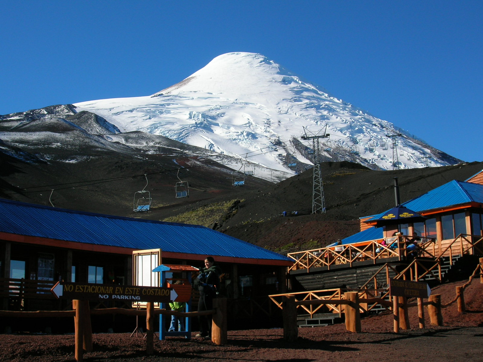
Osorno Volcano is a 2,652-metre (8,701 ft) tall conical stratovolcano lying between Osorno Province and Llanquihue Province, in Los Lagos Region of Chile. It stands on the southeastern shore of Llanquihue Lake, and also towers over Todos los Santos Lake. Osorno is considered a symbol of the local landscape and as such, tends to be the referential element of the area in regards to tourism.
This article needs additional citations for verification. (February 2010) |
| Osorno | |
|---|---|
 Osorno Volcano and Llanquihue Lake | |
| Highest point | |
| Elevation | 2,652 m (8,701 ft)[1] |
| Coordinates | 41°06′00″S 72°29′35″W[1] |
| Geography | |

| |
| Location | Chile |
| Parent range | Andes |
| Geology | |
| Mountain type | Stratovolcano |
| Volcanic arc/belt | South Volcanic Zone |
| Last eruption | 1869[1] |
| Climbing | |
| First ascent | 1848 by Jean Renous |
| Easiest route | rock/snow/ice climb |
Osorno is one of the most active volcanoes of the southern Chilean Andes, with 11 historical eruptions recorded between 1575 and 1869, including an eruption on January 19, 1835, which was witnessed by British Naturalist, Charles Darwin.[2] The basalt and andesite lava flows generated during these eruptions reached both Llanquihue and Todos los Santos Lakes. The upper slopes of the volcano are almost entirely covered in glaciers despite its very modest altitude and latitude, sustained by the substantial snowfall in the very moist maritime climate of the region. This mountain also produces pyroclastic flow, since it is a composite volcano.
Osorno sits on top of a 250,000-year-old eroded stratovolcano, La Picada, with a 6-km-wide caldera.[3]
Trivia
- Charles Darwin glimpsed Volcán Osorno from a distance in the course of the second voyage of the Beagle, catching sight of its eruption in January 1835.[4][5]
- The volcano looks similar in appearance to Mt Fuji in Japan.[6][7]
Image gallery
|


See also
References
- "Osorno". Global Volcanism Program. Smithsonian Institution. Retrieved 2010-05-06.
- "Darwin's earthquakes". Darwin Correspondence Project. 2016-01-18. Retrieved 2022-03-04.
- "Volcanoes of South America". Global Volcanism Program. Smithsonian Institution. Retrieved 2010-02-23.
- "Sierra magazine, Jan/Feb 2006, travel column, "Good Going"". Archived from the original on 2017-07-05. Retrieved 2006-02-02.
- "The American Museum of Natural History: A Trip Around the World". Archived from the original on 2006-01-28. Retrieved 2006-02-02.
- "Osorno Volcano, Chile". www.patagonia-calling.com. Retrieved 2022-03-01.
- "Osorno Volcano |". Alluring World. 2017-08-16. Retrieved 2022-03-01.
- Biggar, John (2005). The Andes: A Guide for Climbers (3rd ed.). Andes Publishing (Scotland). p. 304 pp. ISBN 0-9536087-2-7.
- González-Ferrán, Oscar (1995). Volcanes de Chile. Santiago, Chile: Instituto Geográfico Militar. p. 640 pp. ISBN 956-202-054-1. (in Spanish; also includes volcanoes of Argentina, Bolivia, and Peru)
| Authority control: National libraries |
|---|
На других языках
[de] Osorno (Vulkan)
Der Osorno ist ein 2652 m hoher Vulkan im Süden von Chile. Er liegt in der Región de los Lagos (Region X) einige Kilometer östlich des Llanquihue-See. Er gilt als kleiner Fuji Chiles. Der Osorno ist eines der beliebtesten Touristenziele Chiles.- [en] Osorno (volcano)
[es] Volcán Osorno
El volcán Osorno es un estratovolcán del sur de Chile que se encuentra en la cordillera de los Andes, al este del lago Llanquihue. Es conocido mundialmente por los paisajes que otorga al ser la puerta de entrada a la Patagonia chilena, siendo el icono visual natural más reconocible de la Región de los Lagos[fr] Osorno (volcan)
L'Osorno est un stratovolcan situé entre la province d'Osorno et celle de Llanquihue, dans la région des Lacs au Chili. D'une altitude de 2 652 mètres, il est le volcan le plus actif dans le sud des Andes chiliennes.[it] Monte Osorno
L'Osorno è uno stratovulcano cileno delle Ande, che si trova nel territorio della Provincia di Llanquihue.[ru] Осорно (вулкан)
Осорно (исп. Osorno) — активный вулкан в Андах на территории Чили.Другой контент может иметь иную лицензию. Перед использованием материалов сайта WikiSort.org внимательно изучите правила лицензирования конкретных элементов наполнения сайта.
WikiSort.org - проект по пересортировке и дополнению контента Википедии