geo.wikisort.org - Mountains
Tupungato, one of the highest mountains in the Americas, is a massive Andean lava dome dating to Pleistocene times.[2] It lies on the border between the Chilean Metropolitan Region (near a major international highway about 80 km (50 mi) east of Santiago) and the Argentine province of Mendoza, about 100 km (62 mi) south of Aconcagua, the highest peak of both the Southern and Western hemispheres. Immediately to its southwest is the active Tupungatito volcano (literally, little Tupungato), which last erupted in 1987.
| Tupungato | |
|---|---|
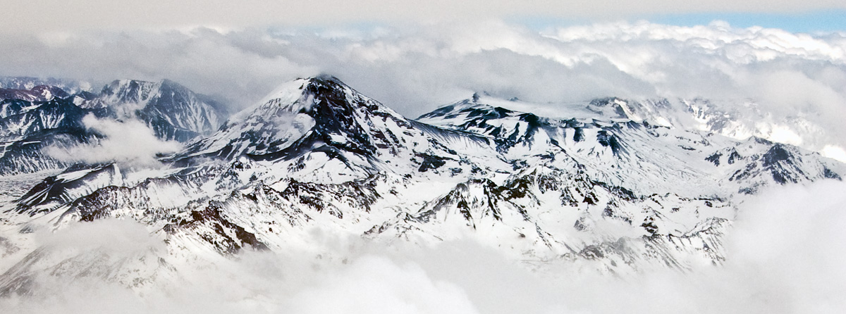
 Aerial view of Tupungato volcano from Argentina. | |
| Highest point | |
| Elevation | 6,570 m (21,560 ft)[upper-alpha 1] |
| Prominence | 2,765 m (9,072 ft)[1] |
| Listing | Ultra |
| Coordinates | 33°21′30″S 69°46′12″W[1] |
| Geography | |
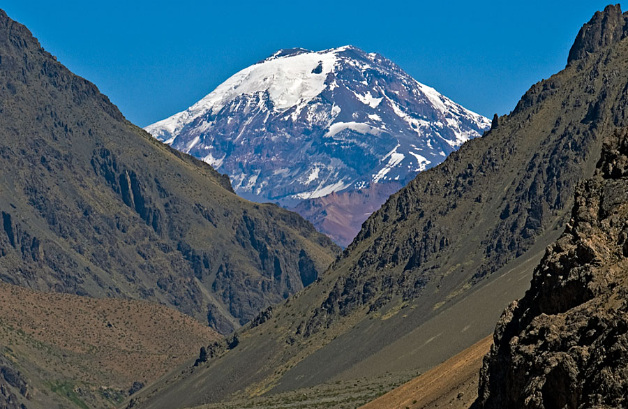
 Tupungato Location on the Argentina–Chile border | |
| Location | Mendoza Province, Argentina – Metropolitan Region, Chile |
| Parent range | Principal Cordillera, Andes |
| Geology | |
| Age of rock | Pleistocene[2] |
| Mountain type | Lava dome[2] |
| Volcanic arc/belt | South Volcanic Zone |
| Last eruption | 0.8 million years ago.[3] |
| Climbing | |
| First ascent | 1897 by Matthias Zurbriggen and Stuart Vines |
Tupungato Department, an important Argentine wine-producing region in Mendoza province, is named for the volcano. Recent Chilean mapping indicates it has a height of 6635m.[4]
1947 plane crash
On 2 August 1947, the airliner Star Dust, an Avro Lancastrian carrying six passengers and five crew over the Andes range, crashed into a steep glacier high on the Argentine side of Tupungato. The plane was quickly buried in the resulting avalanche and heavy snowfall that was taking place at the time. The plane lay undetected deep beneath the snow and glacial ice for over 50 years. Its remnants finally re-emerged at the glacier terminus in 2000. Shortly thereafter, an Argentine army expedition discovered the scattered debris and wreckage, collecting some of the evidence for investigation.
See also
- Incapillo
- List of volcanoes in Argentina
- List of volcanoes in Chile
- List of mountains in the Andes
- List of Ultras of South America
Notes
- The given elevation of 6,570 m (21,560 ft) comes from Chilean 1:50.000 topographic mapping and is in accordance with SRTM data; the frequently given elevation of 6,800 m (22,300 ft) is incorrect
References
Citations
- "Argentina and Chile, Central Ultra Prominences". Peaklist.
- González Díaz, Emilio F. (1961). "Contribución al Conocimiento de la Petrografía del Cerro Tupungato (Provincia de Mendoza) y de otras Rocas Efusivas de la Región". Dirección Nacional de Geología y Minería (in Spanish). Retrieved 2 August 2022.
- "Tupungato". Global Volcanism Program. Smithsonian Institution.
- Biggar, John (2020). The Andes – A Guide for Climbers and Skiers (5th ed.). Andes. p. 265. ISBN 978-0-9536087-6-8.
Bibliography
- Biggar, John (2020). The Andes: A Guide for Climbers and Skiers (5th ed.). Andes Publishing (Scotland). ISBN 978-0-9536087-6-8.
External links
- Andeshandbook: complete description, history, place name and routes of Tupungato
- Pictures of Mount Tupungato
- "Tupungato". Peakware.com. Archived from the original on 4 March 2016.
- "Cerro Tupungato, Argentina/Chile" on Peakbagger
- Star Dust Plane Crash Mystery
- Andes Mountains (Spanish)
На других языках
[de] Tupungato (Vulkan)
Der Tupungato ist ein über 6500 m hoher, erloschener Vulkan in den Anden, an der Grenze zwischen Argentinien und Chile.- [en] Tupungato
[es] Volcán Tupungato
El volcán Tupungato[4] (voz huarpe: 'mirador de estrellas') es un domo volcánico ubicado en la cordillera de los Andes, en la frontera de la Argentina y Chile. Es el monte más alto al Sur del Aconcagua, décimo en altura de Argentina,[5] ganando así el privilegio de ser uno de los más altos de Sudamérica. Métodos precisos de medición han arrojado una altitud de 6570 m s. n. m..[fr] Tupungato
Le Tupungato est un volcan éteint situé dans les Andes, à la frontière entre l'Argentine et le Chili.[it] Tupungato
Il Tupungato è una delle montagne più alte dell'America meridionale. È uno stratovulcano.[ru] Тупунгато
Тупунга́то[2] — активный вулкан. Высота 6565 м.Другой контент может иметь иную лицензию. Перед использованием материалов сайта WikiSort.org внимательно изучите правила лицензирования конкретных элементов наполнения сайта.
WikiSort.org - проект по пересортировке и дополнению контента Википедии