geo.wikisort.org - Mountains
Sangay (also known as Macas, Sanagay, or Sangai)[7] is an active stratovolcano in central Ecuador. It exhibits mostly strombolian activity. Geologically, Sangay marks the southern boundary of the Northern Volcanic Zone, and its position straddling two major pieces of crust accounts for its high level of activity. Sangay's approximately 500,000-year-old history is one of instability; two previous versions of the mountain were destroyed in massive flank collapses, evidence of which still litters its surroundings today.
| Sangay | |
|---|---|
 | |
| Highest point | |
| Elevation | 5,286 m (17,343 ft)[1][2] |
| Prominence | 1,588 m (5,210 ft)[3] |
| Listing | Ultra |
| Coordinates | 2°0′9″S 78°20′27″W[4] |
| Naming | |
| English translation | The Frightener[5] |
| Language of name | Quechua |
| Pronunciation | [saŋˈɡaj][needs Quechua IPA] |
| Geography | |
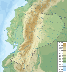 Sangay Location of Sangay in Ecuador | |
| Location | Ecuador |
| Parent range | Andes |
| Geology | |
| Mountain type | Stratovolcano |
| Volcanic arc/belt | North Volcanic Zone |
| Last eruption | 1934 to present (2022) |
| Climbing | |
| First ascent | 4 August 1929[5] |
| Easiest route | Rock/Snow climb[6] |
Due to its remoteness, Sangay hosts a significant biological community with fauna such as the mountain tapir, giant otter, Andean cock-of-the-rock and king vulture. Since 1983, its ecological community has been protected as part of the Sangay National Park. Although climbing the mountain is hampered by its remoteness, poor weather conditions, river flooding, and the danger of falling ejecta, the volcano is regularly climbed, a feat first achieved by Robert T. Moore in 1929.
Geological setting

Lying at the eastern edge of the Andean cordillera,[8] Sangay was formed by volcanic processes associated with the subduction of the Nazca Plate under the South American Plate at the Peru–Chile Trench.[9] It is the southernmost volcano in the Northern Volcanic Zone, a subgroup of Andean volcanoes whose northern limit is Nevado del Ruiz in Colombia.
The next active volcano in the chain, Sabancaya, is in Peru, 1,600 km (990 mi) to the south. Sangay is above a seismogenic tectonic slab about 130 km (80 mi) beneath Sabancaya, reflecting a sharp difference in the thermal character of the subducted oceanic crust, between older rock beneath southern Ecuador and Peru (dated more than 32 million years old), and younger rock under northern Ecuador and Colombia (dated less than 22 million years old). The older southern rock is more thermally stable than the northern rock, and to this is attributed the long break in volcanic activity in the Andes; Sangay occupies a position at the boundary between these two bodies, accounting for its high level of activity.[8]
Legend
Many say that gold lies under Sangay.
Geology
Sangay developed in three distinct phases. Its oldest edifice, formed between 500,000 and 250,000 years ago, is evidenced today by a wide scattering of material opening to the east, defined by a crest about 4,000 m (13,120 ft) high, pockmarked by secondary ridges; it is thought to have been 15–16 km (9–10 mi) in diameter, with a summit 2 to 3 km (1 to 2 mi) southeast of the present summit. The curved shape of the remnants of this first structure shows that it suffered a massive flank collapse, scattering the nearby forest lowlands with debris and causing a large part of its southern caldera wall to slide off the mountain, forming an embayment lower on its slopes. This 400 m (1,312 ft) thick block, the best-preserved specimen of Sangay's early construction, consists of sequentially layered breccias, pyroclastic flows, and lahar deposits. Acidic andesites with just under 60% silicon dioxide dominate these flows, but more basic andesites can be found as well.[8]

Sangay's second edifice began to form anew after the massive sector collapse that damaged the first, being constructed between 100,000 and 50,000 years ago. Remnants of its second structure are within the southern and eastern parts of the debris from its first collapse; some remnants of the volcano lie to the west and north as well. Sangay's second structure is believed to have had an east-to-west elongated summit, and like its first summit structure, it suffered a catastrophic collapse that created a debris avalanche 5 km (3 mi) wide and up to 20 km (12 mi) in length. It was likely less voluminous than the volcano's first version, and its summit lay near Sangay's current summit.[8]
Sangay currently forms an almost perfect glacier-capped cone 5,286 m (17,343 ft) high, with a 35° slope and a slight northeast-southwest tilt.[8] Its eastern flank marks the edge of the Amazon Rainforest, and its western flank is a flat plain of volcanic ash, sculpted into steep gorges up to 600 m (1,970 ft) deep by heavy rainfall.[4] It has a west-east trending summit ridge, capped by three active craters and a lava dome. Sangay has been active in its current form for at least 14,000 years, and is still filling out the area left bare by its earlier incarnations, being smaller than either of them. Uniquely, in its 500,000 years of activity, its magma plume has never changed composition or moved a significant distance.[8]
Mainly andesitic in composition, Sangay is highly active. The earliest report of a historical eruption was in 1628;[4] ash fell as far away as Riobamba, located 50 km (31 mi) northwest of Sangay, and was severe enough to cover pastures and starve local livestock.[10] The volcano erupted again in 1728, remaining essentially continuously active through 1916,[4] with particularly heavy activity in 1738–1744, 1842–1843, 1849, 1854–1859, 1867–1874, 1872, and 1903.[8] After a brief pause, it erupted again on August 8, 1934, and has not completely quelled ever since,[4] with heavy eruptive periods occurring in 1934–1937 and 1941–1942.[8]
Eruptions at Sangay exhibit strombolian activity, producing ashfall, lava flows, pyroclastic flows, and lahars.[10] All known eruptions at the volcano have had a Volcanic Explosivity Index (VEI) of 3.[citation needed] Despite its activity, Sangay is located in a remote, uninhabited region; only a large Plinian eruption could threaten occupied areas 30–100 km (19–62 mi) to its west.[10] Nonetheless, a flank collapse on its eastern side, possible given the volcano's construction and history, could displace nearby forest and possibly affect settlements.[8] Access to the volcano is difficult, as its current eruptive state constantly peppers the massif with molten rock and other ejecta. For these reasons it is not nearly as well-studied as other, similarly active volcanoes in the Andes and elsewhere; the first detailed study of the volcano was not published until 1999.[8]
Ecology

Sangay is one of two active volcanoes in the Sangay National Park, the other being Tungurahua to the north. As such it has been listed as a UNESCO World Heritage Site since 1983. The area's isolation has allowed it to maintain a pristine ecology relatively untouched by human interaction, and the park hosts a biome ranging from alpine glaciers on the volcanoes' peaks to tropical forest on their flanks. Altitude and rainfall are the most significant local factors affecting fauna, and therefore the lushest ecosystems are found on the wetter parts of the volcano's eastern slope.[11]
The highest level below the snowline is dominated by lichen and bryophytes. Below this lies a zone of small trees and shrubs which develops into montane forest, principally in western valleys and on well-irrigated eastern slopes, which occurs below 3,750 m (12,303 ft). Tree heights develop from 5 m (16 ft) near the top to up to 12 m (39 ft) below 3,000 m (9,843 ft); below 2,000 m (6,562 ft), subtropical rainforest is present, with temperatures between 18 and 24 °C (64 and 75 °F) and up to 500 cm (196.9 in) of rainfall.[11]
Fauna is similarly distributed, with distinct altitudinal zonation present. The highest altitudes support the endangered mountain tapir, cougar, guinea pig, and Andean fox. Lower down, the spectacled bear, jaguar, ocelot, margay, white-tailed deer, brocket deers, northern pudú, and endangered giant otter can all be found. Bird species common in the area include the Andean condor, Andean cock-of-the-rock, giant hummingbird, torrent duck, king vulture, and swallow-tailed kite.[11]
Recreation

Sangay can and has been climbed. It was first ascended in 1929 by Robert T. Moore, prior to its current eruption beginning in 1934.[5][12] However, the volcano's current active state presents dangers to mountaineers in the form of falling ejecta;[6] in 1976, two members of an expedition on the volcano were struck and killed by falling debris. In addition, the volcano is located in a remote region with poor roads and is difficult to access, and periods of heavy rainfall can flood rivers and cause landslides, rendering the mountain routes impassable. Nonetheless, the Instituto Ecuatoriano Forestal y de Areas Naturales, which maintains an office near the mountain, facilitate such activities by providing local guides and rooms for rent to visitors. Ascension takes between 7 and 10 days from Quito. Conditions on the volcano are usually very wet and foggy, which may impair visibility significantly during the ascent.[6]
Recent Activity


Sangay has erupted at least eleven times during the Holocene epoch.[13] Its most recent eruption began on 26 March 2019,[14] and it has remained in continuing eruption status (intermittent eruptive events without a break of 3 months or more) as of 15 October 2021.[15]
On 15 June 2022, the National Weather Service issued an ashfall advisory as the volcano went into a state of unrest, producing a plume of volcanic ash. Mariners traveling in the vicinity were cautioned about the possibility of debris.[16][17]
See also
- Lists of volcanoes
- List of volcanoes in Ecuador
References
- "Ecuador: 15 Mountain Summits with Prominence of 1,500 meters or greater". Peaklist.org. Retrieved 7 May 2015.
- Estimate based on SRTM and ASTER data, which agree that the often quoted elevation of 5230 metres is too low.
- Jonathan de Ferranti and Aaron Maizlish. "Ecuador". Retrieved 10 February 2012.
- "Sangay". Global Volcanism Program. Smithsonian National Museum of Natural History. Retrieved 5 June 2020.
- Jason Wilson (2009). The Andes: A Cultural History. Oxford University Press. p. 103. ISBN 978-0-19-538636-3. Retrieved 5 February 2012.
Sangay quechua.
- Yossi Brain (2000). Ecuador: A Climbing Guide. The Mountaineers Books. ISBN 978-0-89886-729-9. Retrieved 5 February 2012.
- "Sangay: Synonyms and subfeatures". Global Volcanism Program. Smithsonian National Museum of Natural History. Retrieved 5 June 2020.
- Monzier, Michel; et al. (1999). "Sangay volcano, Ecuador: structural development, present activity and petrology". Journal of Volcanology and Geothermal Research. Elsevier. 90 (1–2): 49–79. Bibcode:1999JVGR...90...49M. doi:10.1016/S0377-0273(99)00021-9. ISSN 0377-0273.
- Miller, Meghan S.; et al. (24 January 2009). "Upper mantle structure beneath the Caribbean-South American plate boundary from surface wave tomography". Journal of Geophysical Research. American Geophysical Union. 114 (B1): B01312. Bibcode:2009JGRB..114.1312M. doi:10.1029/2007JB005507.
- John Seach. "Sangay Volcano – John Seach". Retrieved 5 February 2012.
- "Sangay National Park". World Heritage Centre. UNESCO. Retrieved 5 February 2012.
- Lewis, G. Edward (1950). "El Sangay, Fire-breathing Giant of the Andes". National Geographic. National Geographic Society: 17–24.
- "Global Volcanism Program | Sangay".
- "Reventador Eruption History - Global Volcanism Program". volcano.si.edu. Smithsonian. Retrieved 17 October 2021.
- "Global Volcanism Program | Current Eruptions".
- "High Seas Forecast (Tropical NE Pacific)". www.nhc.noaa.gov. Retrieved 2022-06-15.
- "Offshore Waters Forecast (E Pacific Offshore of Central America/Colombia/Ecuador)". www.nhc.noaa.gov. Retrieved 2022-06-15.
External links
- National Geographic: Collecting Clues to Solve a Volcanic Mystery
- Sangay Volcano Erupts, Coats Parts of Ecuador in Ash - Jun. 9, 2020 on YouTube
- Sangay Volcano Erupts, Turns Day to Night in Ecuador - Sept. 20, 2020
| Authority control: National libraries |
|---|
На других языках
[de] Sangay
Der Sangay ist ein 5230 m hoher aktiver Vulkan im Südosten Ecuadors.- [en] Sangay
[es] Volcán Sangay
Sangay es un estratovolcán continuamente activo ubicado en la República del Ecuador. Es el volcán más activo del Ecuador, y es conocido por su expresión explosiva la cual se manifiesta por nubes gruesas de ceniza, que han formado una especie de bóveda desde 1976.[fr] Sangay
Le Sangay est un stratovolcan d'Équateur culminant à 5 260 mètres d'altitude, de type strombolien. Il se situe à environ 200 kilomètres au sud de Quito. Recouvert de neige, il a été en éruption constante de 1934 à 2013.[it] Sangay
Sangay è uno stratovulcano costantemente attivo nel sud-est dell'Ecuador. Si trova nella Provincia di Morona-Santiago.[ru] Сангай (вулкан)
Санга́й[2] (исп. Sangay) — действующий стратовулкан в Южной Америке.Другой контент может иметь иную лицензию. Перед использованием материалов сайта WikiSort.org внимательно изучите правила лицензирования конкретных элементов наполнения сайта.
WikiSort.org - проект по пересортировке и дополнению контента Википедии