geo.wikisort.org - Mountains
Cerro Negro de Mayasquer is a volcano on the border of Colombia and Ecuador. It lies 3 kilometres (2 mi) north-west of the volcano Chiles, and the two peaks are considered part of the same Chiles-Cerro Negro volcanic complex. These volcanoes, together with Cumbal are andesitic in rock type.[2] A 1936 eruption reported by the Colombian government agency INGEOMINAS may have been from the Ecuadorean volcano Reventador, otherwise the volcano has not erupted for around 160,000 years.[1]
| Cerro Negro de Mayasquer | |
|---|---|
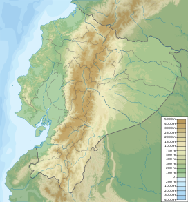 Cerro Negro de Mayasquer Location of Cerro Negro de Mayasquer in Colombia & Ecuador | |
| Highest point | |
| Elevation | 4,445 m (14,583 ft)[1] |
| Listing | Volcanoes of Colombia |
| Coordinates | 0°49′39″N 77°57′52″W[1] |
| Geography | |
| Location | Nariño Carchi |
| Parent range | Central Ranges Cordillera Real Andes |
| Geology | |
| Age of rock | Pleistocene |
| Mountain type | Andesitic stratovolcano |
| Volcanic belt | Northern Volcanic Zone, Andean Volcanic Belt |
| Last eruption | July 1936(?)[1] |
See also
- List of volcanoes in Colombia
- List of volcanoes in Ecuador
- List of volcanoes by elevation
References
- "Chiles-Cerro Negro". Global Volcanism Program. Smithsonian Institution. Retrieved May 2, 2011.
- Plancha 447-447bis, 2003
Bibliography
- , and . 2003. Plancha 447 Ipiales & 447bis Tallambí - 1:100,000, 1. INGEOMINAS. Accessed 2017-06-06.
Further reading
- , and . 2016. Contribución al registro de actividad de los volcanes Chiles y Cerro Negro (frontera colombo-ecuatoriana). Boletín de Geología, Universidad Industrial de Santander 38. 61-78. Accessed 2017-06-15.
| Western Ranges |  | |
|---|---|---|
| Central Ranges |
| |
| Eastern Ranges | ||
| Other |
| |
| Source |
| |
This Colombian location article is a stub. You can help Wikipedia by expanding it. |
На других языках
- [en] Cerro Negro de Mayasquer
[fr] Cerro Negro de Mayasquer
Le Cerro Negro de Mayasquer est un stratovolcan situé à la frontière entre la Colombie et l'Équateur.[ru] Серро-Негро-де-Маяскер
Серро-Негро-де-Маяскер (исп. Cerro Negro de Mayasquer) — стратовулкан, расположенный в колумбийском департаменте Нариньо у границы с Эквадором.Текст в блоке "Читать" взят с сайта "Википедия" и доступен по лицензии Creative Commons Attribution-ShareAlike; в отдельных случаях могут действовать дополнительные условия.
Другой контент может иметь иную лицензию. Перед использованием материалов сайта WikiSort.org внимательно изучите правила лицензирования конкретных элементов наполнения сайта.
Другой контент может иметь иную лицензию. Перед использованием материалов сайта WikiSort.org внимательно изучите правила лицензирования конкретных элементов наполнения сайта.
2019-2026
WikiSort.org - проект по пересортировке и дополнению контента Википедии
WikiSort.org - проект по пересортировке и дополнению контента Википедии