geo.wikisort.org - Mountains
Slievelamagan (from Irish: Sliabh Lámhagáin, meaning 'creeping mountain')[1] is a mountain in County Down, Northern Ireland. It is part of the Mourne Mountains.[1]
| Slievelamagan | |
|---|---|
| Sliabh Lámhagáin | |
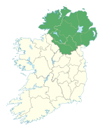
 Slievelamagan Location in Ireland | |
| Highest point | |
| Elevation | 702.2 m (2,304 ft)[1] |
| Prominence | 198 m (650 ft)[2] |
| Listing | Hewitt, Marilyn |
| Coordinates | 54°9′58″N 5°57′58″W[2] |
| Naming | |
| English translation | creeping mountain |
| Language of name | Irish |
| Geography | |
| Location | County Down, Northern Ireland |
| Parent range | Mourne Mountains |
See also
- Lists of mountains in Ireland
- List of mountains of the British Isles by height
- List of Marilyns in the British Isles
- List of Hewitt mountains in England, Wales and Ireland
References
- "Slievelamagan". MountainViews.ie. Retrieved 30 March 2022.
- "Slievelamagan". Peakbagger.com. Retrieved 30 March 2022.
Текст в блоке "Читать" взят с сайта "Википедия" и доступен по лицензии Creative Commons Attribution-ShareAlike; в отдельных случаях могут действовать дополнительные условия.
Другой контент может иметь иную лицензию. Перед использованием материалов сайта WikiSort.org внимательно изучите правила лицензирования конкретных элементов наполнения сайта.
Другой контент может иметь иную лицензию. Перед использованием материалов сайта WikiSort.org внимательно изучите правила лицензирования конкретных элементов наполнения сайта.
2019-2025
WikiSort.org - проект по пересортировке и дополнению контента Википедии
WikiSort.org - проект по пересортировке и дополнению контента Википедии


