geo.wikisort.org - Mountains
Sgùrr na Cìche (Scottish Gaelic for 'rocky peak of the breast') is a mountain in Knoydart, in the Northwest Highlands of Scotland. It lies on the edge of Knoydart in an area known as the Rough Bounds of Knoydart.
| Sgùrr na Cìche | |
|---|---|
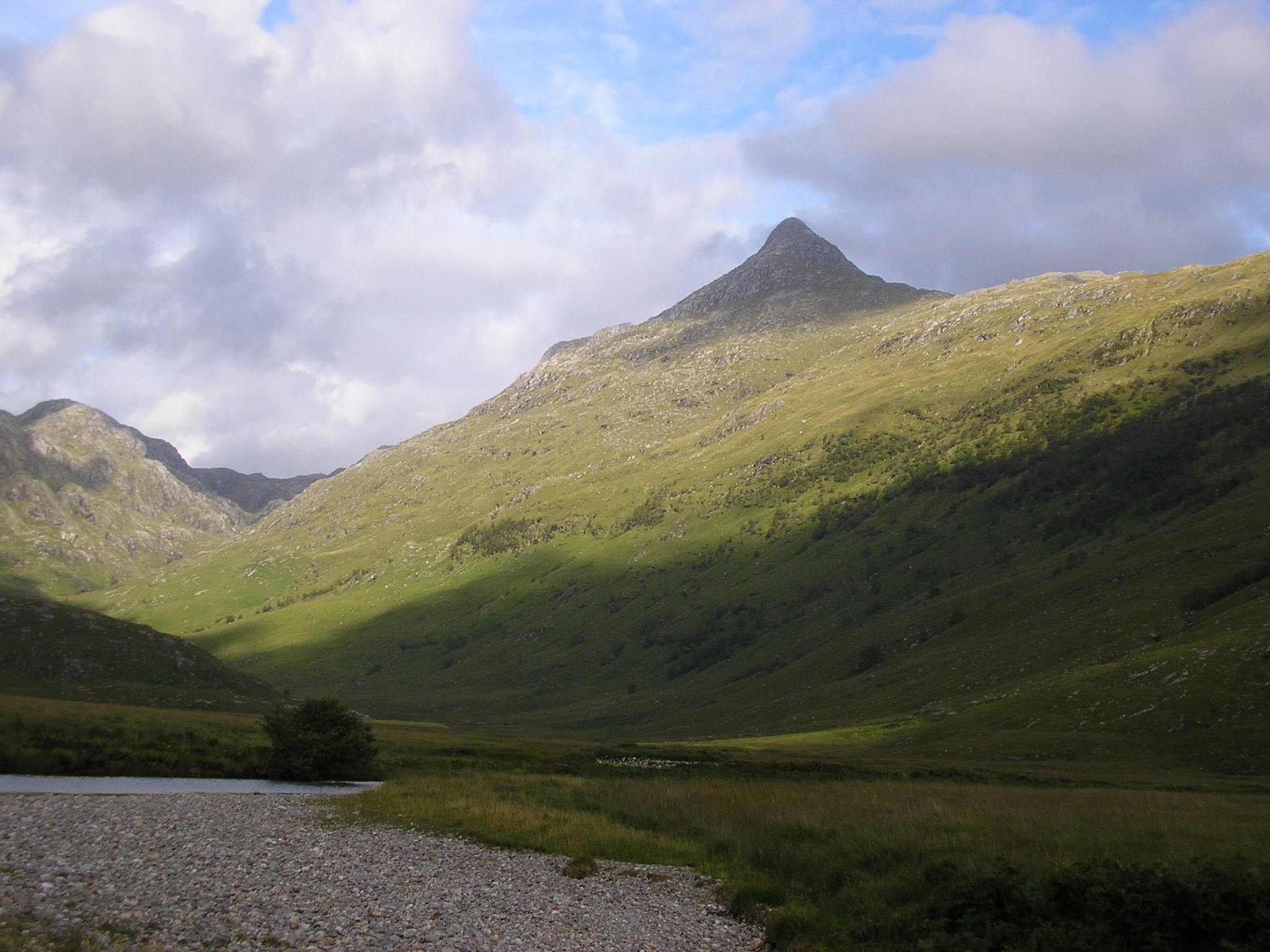 Sgùrr na Cìche seen from the head of Loch Nevis to the west. | |
| Highest point | |
| Elevation | 1,040 m (3,410 ft)[1] |
| Prominence | 839 m (2,753 ft)Ranked 25th in British Isles |
| Parent peak | Carn Eige |
| Listing | Marilyn, Munro |
| Naming | |
| English translation | rocky peak of the breast |
| Language of name | Gaelic |
| Pronunciation | Scottish Gaelic: [ˈs̪kuːrˠ nə ˈkʰʲiːçə] |
| Geography | |
| Location | Knoydart, Scotland |
| Parent range | Northwest Highlands |
| OS grid | NM902966 |
| Topo map | OS Landranger 33, 40 |
The peak has a distinctive pointy shape, making it recognisable in views from many of Scotland's mountains, including Càrn Eige and Ben Nevis. Its close neighbours include Ladhar Bheinn and The Saddle, but thanks to the deep gulf separating it from them, it has a high prominence — the 25th highest in Britain.
Sgùrr na Cìche may be climbed from the head of Loch Nevis on the southern side of Knoydart by following the ridge of Druim a' Ghoirtein. However, due to the remoteness of the Knoydart peninsula, it is more commonly climbed as part of a circuit from the head of Glen Dessarry, via a route that also takes in the neighbouring Munros of Garbh Cìoch Mhòr and Sgùrr nan Coireachan.
It is also the wettest place in the United Kingdom, with a yearly rainfall average of 200 inches (510 cm).[2]
References
- Translation and pronunciation information come from this page
- This list gives information about map, grid ref and neighbours
- The Munros: Scottish Mountaineering Club Hillwalkers Guide, by Donald J. Bennet. ISBN 0-907521-57-6
Citations
- "walkhighlands Sgurr na Ciche". walkhighlands.co.uk. 2014. Retrieved 9 January 2014.
- "The Wettest Place in the British Isles". Nature. 140 (3543): 540. 1 September 1937. Bibcode:1937Natur.140Q.540.. doi:10.1038/140540a0.
External links
- Computer generated digital panoramas Sgùrr na Cìche Index
 |
|  | |
List of Munros | |||
Most prominent mountains of Britain and Ireland (the P600s) | ||
|---|---|---|
| Northern Highlands (20) |    | |
| Western Highlands (20) | ||
| Central and Eastern Highlands (13) | ||
| Southern Highlands (15) |
| |
| Islands (13) | ||
| Scottish Lowlands, England and Wales (13) | ||
| Republic of Ireland, Northern Ireland (25) | ||
This Highland location article is a stub. You can help Wikipedia by expanding it. |
На других языках
[de] Sgùrr na Cìche
Der Sgùrr na Cìche (Felsiger Berg der Brust oder brustförmiger Berg auf Gälisch[1]) ist ein 1.040 m (3.412 ft) hoher Berg in Schottland. Er liegt an der Westküste am östlichen Ende der zur Council Area Highland gehörenden Halbinsel Knoydart und westlich des Loch Arkaig. Durch sein gleichmäßiges und spitzes Erscheinungsbild sowie aufgrund seines heute als sexuell anzüglich wahrgenommenen Namens[2] zählt der Berg trotz seiner entlegenen Lage auf Knoydart zu den bekanntesten Munros der westlichen Highlands.[3] Berge mit anzüglichen oder vulgären Namen finden sich wiederholt in den Highlands, andere Beispiele sind der Cac Càrn Beag („Kleine Kothaufen“) oder der Bod an Deamhain („Der Penis des Teufels“).- [en] Sgùrr na Cìche
[fr] Sgurr na Cìche
Le Sgurr na Cìche (skur na kixʲɪ) est le point culminant de la péninsule de Knoydart, à l'ouest de l'Écosse. Il se dresse au bord de Knoydart dans une zone appelée Rough Bounds of Knoydart (« frontière sauvage de Knoydart »).Другой контент может иметь иную лицензию. Перед использованием материалов сайта WikiSort.org внимательно изучите правила лицензирования конкретных элементов наполнения сайта.
WikiSort.org - проект по пересортировке и дополнению контента Википедии