geo.wikisort.org - Mountains
Beinn Ìme (Scottish Gaelic for 'butter mountain') is the highest mountain in the Arrochar Alps of Argyll, in the Southern Highlands of Scotland. It reaches 1,011 metres (3,317 ft), making it a Munro.
| Beinn Ìme | |
|---|---|
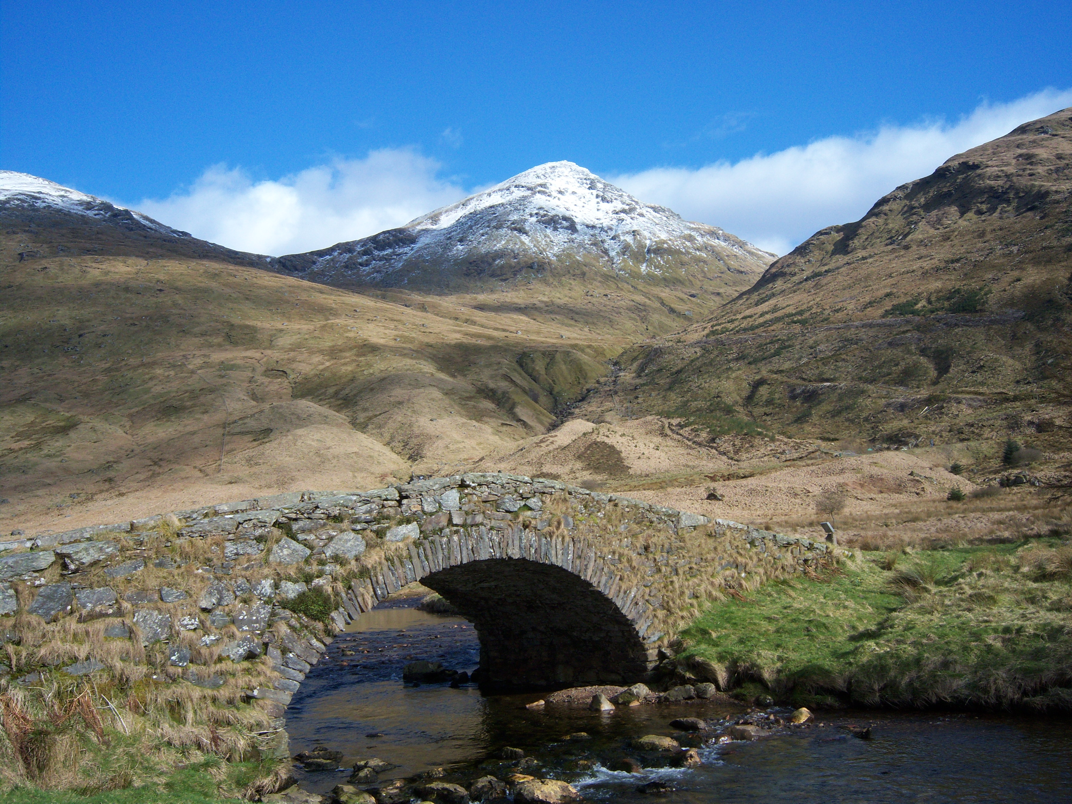 Beinn Ime seen from Butterbridge below Rest and be Thankful. | |
| Highest point | |
| Elevation | 1,011 m (3,317 ft)[1] |
| Prominence | c. 696 m |
| Parent peak | Ben Oss |
| Listing | Munro, Marilyn |
| Naming | |
| English translation | butter mountain |
| Language of name | Scottish Gaelic |
| Pronunciation | English: /bɛn ˈiːmə/ ben EE-mə[2] Scottish Gaelic: [peɲ ˈimə] ( |
| Geography | |
| Location | Argyll and Bute, Scotland |
| Parent range | Arrochar Alps, Grampian Mountains |
| OS grid | NN255084 |
There are three usual routes of ascent. From Succoth, one may follow the same path that is used to reach The Cobbler before taking the right fork near the base of the Cobbler's main crags and continuing up the glen, across the bealach and up Ben Ìme's eastern ridge. Alternatively, the summit can be reached from the pass of Rest and be Thankful and from the Loch Lomond side, using the private road that leads to Loch Sloy.


References
- "walkhighlands Beinn Ime". walkhighlands.co.uk. 2013. Retrieved 16 October 2013.
- G.M. Miller, BBC Pronouncing Dictionary of British Names (Oxford UP, 1971), p. 8.
External links
 |
|  | |
List of Munros | |||
Most prominent mountains of Britain and Ireland (the P600s) | ||
|---|---|---|
| Northern Highlands (20) |    | |
| Western Highlands (20) | ||
| Central and Eastern Highlands (13) | ||
| Southern Highlands (15) |
| |
| Islands (13) | ||
| Scottish Lowlands, England and Wales (13) | ||
| Republic of Ireland, Northern Ireland (25) | ||
This Argyll and Bute location article is a stub. You can help Wikipedia by expanding it. |
На других языках
[de] Beinn Ìme
Der Beinn Ìme ist ein 1.011 m (3.317 ft) hoher Berg in Schottland. Sein gälischer Name bedeutet ungefähr Butterhügel.[1] Der Berg ist die höchste Erhebung der Arrochar Alps. Diese Berggruppe liegt zwischen dem nördlichen Ende von Loch Long und dem Westufer von Loch Lomond in den südlichen Highlands im Loch Lomond and the Trossachs National Park. Der Beinn Ìme ist als Munro eingestuft.- [en] Beinn Ìme
[it] Beinn Ìme
Beinn Ìme /ˌbɛn ˈiːmə/ (gaelico scozzese: Beinn Ime) [1] è la montagna più alta delle Alpi Arrochar, nelle Highlands meridionali della Scozia.Текст в блоке "Читать" взят с сайта "Википедия" и доступен по лицензии Creative Commons Attribution-ShareAlike; в отдельных случаях могут действовать дополнительные условия.
Другой контент может иметь иную лицензию. Перед использованием материалов сайта WikiSort.org внимательно изучите правила лицензирования конкретных элементов наполнения сайта.
Другой контент может иметь иную лицензию. Перед использованием материалов сайта WikiSort.org внимательно изучите правила лицензирования конкретных элементов наполнения сайта.
2019-2026
WikiSort.org - проект по пересортировке и дополнению контента Википедии
WikiSort.org - проект по пересортировке и дополнению контента Википедии