geo.wikisort.org - Mountains
Beinn Tulaichean is a Scottish mountain. It is not much more than the southern top of Cruach Ardrain, with a descent of only 120m before the ascent to its larger neighbour. It is located approximately 10 km to the north of Loch Katrine close to the site of Robert Roy MacGregor's house.
| Beinn Tulaichean | |
|---|---|
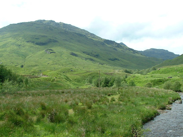 View of Beinn Tulaichean from Inverlochraig Glen | |
| Highest point | |
| Elevation | 946 m (3,104 ft)[1] |
| Prominence | 121 m (397 ft)[2] |
| Listing | Munro |
| Naming | |
| Native name | Beinn Thulaichean (Scottish Gaelic) |
| English translation | Hill of Hillocks [3] |
| Pronunciation | Scottish Gaelic: [peɲ ˈhul̪ˠɪçən] ( |
| Geography | |
| Location | Stirling, Scotland |
| Parent range | Grampian Mountains |
| OS grid | NN41691960 |
| Topo map | OS Landranger 50, 56. |
| Climbing | |
| Easiest route | Hike |
References
Wikimedia Commons has media related to Beinn Tulaichean.
- "walkhighlands Beinn Tulaichean". walkhighlands.co.uk. 2013. Retrieved 15 October 2013.
- "Beinn Tulaichean, Scotland". Peakbagger.com.
- Beinn Tulaichean (Munro) - MunroMagic.com
- The Munros, Scottish Mountaineering Trust, 1986, Donald Bennett (Editor) ISBN 0-907521-13-4
Munros of Scotland: Firth of Clyde to Strath Tay | |||
|---|---|---|---|
 |
|  | |
List of Munros | |||
This Stirling location article is a stub. You can help Wikipedia by expanding it. |
На других языках
[de] Beinn Tulaichean
Der Beinn Tulaichean ist ein 946 m (3.104 ft) hoher Berg in Schottland. Sein gälischer Name bedeutet etwa Berg der Hügelchen.[1] Er liegt in den südlichen Highlands südlich der Ortschaft Crianlarich im Loch Lomond and the Trossachs National Park und zählt zu den Munros.- [en] Beinn Tulaichean
Текст в блоке "Читать" взят с сайта "Википедия" и доступен по лицензии Creative Commons Attribution-ShareAlike; в отдельных случаях могут действовать дополнительные условия.
Другой контент может иметь иную лицензию. Перед использованием материалов сайта WikiSort.org внимательно изучите правила лицензирования конкретных элементов наполнения сайта.
Другой контент может иметь иную лицензию. Перед использованием материалов сайта WikiSort.org внимательно изучите правила лицензирования конкретных элементов наполнения сайта.
2019-2026
WikiSort.org - проект по пересортировке и дополнению контента Википедии
WikiSort.org - проект по пересортировке и дополнению контента Википедии