geo.wikisort.org - Mountains
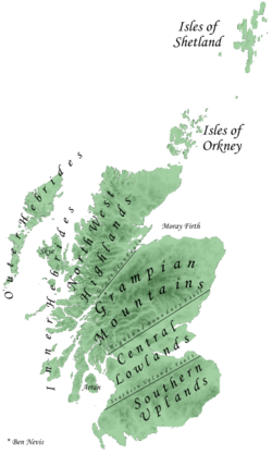
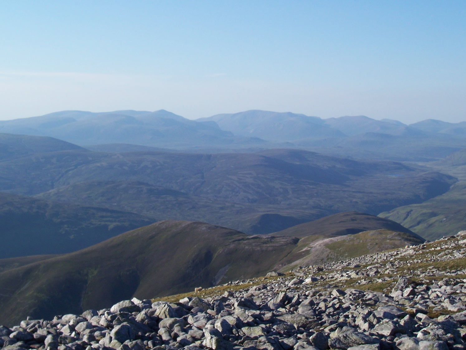
The Grampian Mountains (Am Monadh in Gaelic) are one of the three major mountain ranges in Scotland, occupying a considerable portion of the Scottish Highlands in northern Scotland. The other major mountain ranges in Scotland are the Northwest Highlands and the Southern Uplands. The Grampian range extends southwest to northeast between the Highland Boundary Fault and the Great Glen, occupying almost half of the land area of Scotland and including the Cairngorms and the Lochaber hills. The range includes many of the highest mountains in the British Isles, including Ben Nevis (the highest point in the British Isles at 1,345 m or 4,413 ft above sea level) and Ben Macdui (the second-highest at 1,309 m or 4,295 ft).
A number of rivers and streams rise in the Grampians, including the Tay, Spey, Cowie Water, Burn of Muchalls, Burn of Pheppie, Burn of Elsick, Cairnie Burn, Don, Dee and Esk.[1] The area is generally sparsely populated.
There is some ambiguity about the extent of the range, and until the nineteenth century, they were generally considered to be more than one range, which all formed part of the wider Scottish Highlands. This view is still held by many today, and they have no single name in the Scottish Gaelic language or the Doric dialect of Lowland Scots. In both languages, a number of names are used. The name "Grampian" has been used in the titles of organisations covering parts of Scotland north of the Central Belt, including the former local government area of Grampian Region (translated into Scots Gaelic as Roinn a' Mhonaidh), NHS Grampian, and Grampian Television.
Name
The Roman historian Tacitus recorded Mons Graupius as the site of the defeat of the native Caledonians by Gnaeus Julius Agricola c. 83 AD. The actual location of Mons Graupius, literally 'Mount Graupius' (the element 'Graupius' is of unknown meaning), is a matter of dispute among historians, though most favour a location within the Grampian massif, possibly at Raedykes, Megray Hill or Kempstone Hill. The spelling Graupius comes from the Codex Aesinas, a mediaeval copy of Tacitus's Germania believed to be from the mid-9th century.[2] "Graupius" was incorrectly rendered "Grampius" only in the 1476 printed edition of Tacitus's Agricola.[3] The name Grampians is believed to have first been applied to the mountain range in 1520 by the Scottish historian Hector Boece, an adaptation of the incorrect Mons Grampius. Thus the range owes its name to this day to a typesetter's mistake.[3] In the Middle Ages, this locale was known as the Mounth, a name still held by a number of geographical features.
Etymology
Recorded first as Graupius in 83 A.D,[4] the origin of the name Grampians is uncertain.[4] The name may be Brittonic and represent a corrupted form, of which the genuine would be *Cripius, containing *crip meaning "ridge" (c.f. Welsh crib).[4]
Extent
There is some ambiguity about the extent of the range. Fenton Wyness, writing about Deeside, puts the northern edge of the Grampians at the River Dee in the introduction to his 1968 book Royal Valley : The Story Of The Aberdeenshire Dee:
... until comparatively recent times, Deeside was an isolated and little frequented region and the reason for this is the extensive mountain barrier of the Grampians which begins in a low range on the seacoast immediately south of Aberdeen and rise through various intervening heights such as Cairn-mon-earn (1,245 ft), Kerloch (1,747 ft), Mount Battoch (2,555 ft), Mount Keen (3,007 ft), Lochnagar (3,786 ft), Beinn a' Ghlo (3,671 ft), to Beinn Dearg (3,556 ft)
— Fenton Wyness[5]
This introduction appears to suggest that Wyness defines the Grampians as being the range of mountains running from immediately south of Aberdeen westward to Beinn Dearg in the Forest of Atholl. Similarly, Adam Watson, when defining the extent of the Cairngorms, specifically excluded the range south of the River Dee, writing:
The other main hill group is the long chain running from Drumochter in the west almost to the sea just south of Aberdeen. Many maps and books have given its name as 'the Grampians' but although children have to learn this at school, they do not learn it at home and nowhere is it used in local speech. Some map-makers have confused the issue by printing 'Grampians' over the Cairngorms and Strath Don hills as well!
— Adam Watson[6]
Both Wyness and Watson appear to exclude the Cairngorms from the Grampians, regarding them as a separate range. In effect, Wyness' and Watson's definition of the Grampians is as a synonym for the Mounth. However Robert Gordon, writing in the 1650s, used the term Grampians to refer to hills on either side of the River Dee, and thus explicitly included the Cairngorms within the range.[7]
Wyness and Watson both exclude areas west of the Pass of Drumochter from the Grampians, but the 1911 Encyclopedia Britannica adopted a wider definition, including the highlands as far as Dunbartonshire in the west.
Geology
The Grampian Mountains are chiefly made up of metamorphic and igneous rocks.[8] The mountains are composed of granite, gneiss, marble, schists and quartzite.[citation needed]
The Quaternary glaciation (<2.6 Ma) eroded the region significantly, and glacial deposits, such as tills, are largely those of the last Ice Age (< 20 Ka).[8]
Sub-ranges
The following ranges of hills and mountains fall within the generally recognised definition of the Grampians, i.e. lying between the Highland and Great Glen fault lines:[citation needed]
- Cairngorms
- Monadh Liath
- Mounth
- Grey Corries
- Mamores
- Ben Alder Forest
- The mountains of Glen Coe and Glen Etive
- Black Mount
- Breadalbane Hills
- Trossachs
- Arrochar Alps
- Cowal
- The Isle of Arran

See also
- Ben Nevis
- Buachaille Etive Mòr
- Glen Coe
- List of deaths on eight-thousanders
- Mount Hood climbing accidents
- Mountains and hills of Scotland
- Scottish Highlands
References
- United Kingdom Ordnance Survey Map, Landranger 45, Stonehaven and Banchory, 1:50,000 scale, 2002
- Agricola, edited by Ogilvie and Richmond
- History in the making: a Roman map... and an 18th-century hoax. Edited extract from Under Another Sky: Journeys in Roman Britain by Charlotte Higgins published in The Guardian, 19 July 2013
- Andrew, Breeze (2002). "Philology on Tacitus's Graupian Hill and Trucculan Harbour". Proc Soc Antiq Scot. 132: 305–311.
- Wyness, Fenton (1968), Royal Valley : The Story Of The Aberdeenshire Dee, Alex P. Reid & Son, Aberdeen, p. 1
- Watson, Adam (1975). The Cairngorms. Edinburgh: The Scottish Mountaineering Trust. p. 19.
- Ian R Mitchell. Scotland's Mountains Before the Mountaineers, pp. 62–63. Published 2013, Luath Press.
- Stephenson, D, and Gould, D. 1995. British regional geology: the Grampian Highlands. Fourth edition. Reprint 2007. Keyworth, Nottingham: British Geological Survey.
External links
- Chisholm, Hugh, ed. (1911). . Encyclopædia Britannica. Vol. 12 (11th ed.). Cambridge University Press. p. 333.
Authority control | |
|---|---|
| General |
|
| National libraries | |
На других языках
[de] Grampian Mountains
Die Grampian Mountains (auch Grampians, schottisch-gälisch Am Monadh) sind einer der Hauptgebirgszüge Schottlands im Norden des Landes. Sie erstrecken sich von Südwesten nach Nordosten zwischen der so genannten Highland Boundary Fault und dem Glen More. Sie nehmen fast die Hälfte der Landfläche Schottlands ein. Der höchste Berg der britischen Inseln, der Ben Nevis (1345 m) in der Region Lochaber, sowie der zweithöchste Berg Ben Macdui mit 1309 m in der Region Cairngorms, liegen in den Grampians. Das Gebiet ist, abgesehen von einigen Regionen wie Aviemore, ein Winter- und Schneesportzentrum, sehr dünn besiedelt.- [en] Grampian Mountains
[es] Montes Grampianos
Los montes Grampianos (en gaélico escocés: Am Monadh) es una de las tres principales cadenas montañosas de Escocia (Reino Unido), que se encuentra en la zona central de la región.[fr] Monts Grampians
Les monts Grampians (Am Monadh en gaélique écossais) sont l'une des trois principales chaînes de montagne d'Écosse. Ils dominent les plateaux de gneiss et de granites des massifs du sud et s'élèvent entre la vallée glaciaire et lacustre du Glenmore (en) et la dépression qui unit les firths du Forth et de la Clyde. Ils constituent la région la plus élevée des îles Britanniques et contiennent leur point culminant : le Ben Nevis (1 345 m). Sur les 283 montagnes classées comme munros car dépassant 914,5 mètres d'altitude, 164 se trouvent dans les Grampians.[it] Monti Grampiani
I Monti Grampiani o in inglese Grampians (Am Monadh in gaelico) sono una delle tre maggiori catene montuose della Scozia, occupanti gran parte delle Highlands nel nord-est della regione. Le altre due principali catene montuose scozzesi sono le Northwest Highlands e le Southern Uplands.[ru] Грампианские горы
Грампиа́нские го́ры (гэльск. Am Monadh) — один из трёх главных горных хребтов Шотландии, занимающий юго-восточную часть Шотландского высокогорья. Грампианские горы — самые высокие горы Великобритании[2].Другой контент может иметь иную лицензию. Перед использованием материалов сайта WikiSort.org внимательно изучите правила лицензирования конкретных элементов наполнения сайта.
WikiSort.org - проект по пересортировке и дополнению контента Википедии