geo.wikisort.org - Mountains
Scotland is the most mountainous country in the United Kingdom. Scotland's mountain ranges can be divided in a roughly north to south direction into: the Scottish Highlands, the Central Belt and the Southern Uplands, the latter two primarily belonging to the Scottish Lowlands. The highlands eponymously contains the country's main mountain ranges, but many hills and mountains are to be found south of these as well. The below lists are not exhaustive; there are countless subranges throughout the country.
Ben Nevis, the highest mountain in Scotland and the United Kingdom,[1] is in the Highland region at the western end of the Grampian Mountains.
As of 2019, hundreds of thousands of people visit mountains in Scotland every winter[2] and 130,000 climb to the summit of Ben Nevis every year.[1]


Highlands
Scotland's main mountainous region can be broadly further split into the Northwest Highlands, the Grampian Mountains and the islands off the west coast. As the name implies, the NW Highlands begin at the suture north and west of the Great Glen and include 100 of the 282 Munros. The mountains found here are generally very rough and steep, but can also often provide walking on short grass. Long ridges are to be found on both sides of Glen Shiel in Kintail and more range-like mountains are to be found further north, such as in the Fannichs. The Torridon Hills are exceptionally well-regarded by hillwalking, scrambling and climbing communities; some of them, such as Beinn Eighe, are crowned by white quartzite, which gives a highly-distinctive appearance. The trend continues to the north, with larger caps of the white rock at Foinaven and Arkle. Some of these hills are made of Lewisian Gneiss, making them some of the oldest rocks on Earth. Many of the peaks within this region are isolated, particularly within Assynt and Sutherland, and, although sometimes smaller, possess a great grandeur. These include: Stac Pollaidh, Suilven, An Teallach and Maiden Pap. The southern portion of this area south of Glenfinnan consists of lower mountains of Corbetts and Grahams, but maintain the rough character of those found further north. The highest mountain in this area is Càrn Eige, also the second most prominent mountain in Britain, although twelfth by height.
- Torridon, west and southwest of Kinlochewe
- The Fannichs, north-east of Kinlochewe
- Dundonnel and Fisherfield Forest, north of Kinlochewe
- Knoydart, north-east of Mallaig
- The Mullardochs and Glen Affric, west of Cannich
- Assynt, north of Ullapool
The Grampians make up the bulk of Scotland's highlands and contain the highest peaks and largest ranges, extending south and east of the Great Glen down to the Highland Boundary Fault, occupying almost half of the country's land area. Some of the area is relatively low lying, but not necessarily without topographical character. These regions include the Kintyre peninsula, Knapdale and Mid Argyll on the west coast, as well as eastern Aberdeenshire and Moray on the east. Rannoch Moor is a well-known area of low-lying land in an area surrounded by very high mountains and usually harks travellers' entrance into the highlands. The partly-forested Cowal peninsula has hills of intermediate height and considerable cragginess. The Grampians has the highest number of distinct mountain ranges in Scotland, particularly towards the west in Lochaber, where the mountains have much steeper sides than those found easterly. The highest eastern ranges can be split primarily into the Monadhliath, the Cairngorms and the Mounth. Many well-known mountains and hills are to be found here, such as Ben A'an, The Cobbler, Buachaille Etive Mòr, Bidean nam Bian, Schiehallion, Ben Macdui and Lochnagar. The highest mountain in this area is Ben Nevis, the highest mountain in Britain.
- The Arrochar Alps, north-west of Arrochar
- The Braes of Balquhidder, north-west of Callander
- Breadalbane, west and north of Killin
- Lorne, north-east of Oban
- Cowal, north-west of Greenock
- The Black Mount, north-west of Bridge of Orchy
- Glen Coe, east of Ballachulish
- The Mamores, south-east of Fort William
- The Grey Corries, east of Fort William
- The Monadhliath, west of Aviemore
- The Cairngorms, north and north-west of Braemar
- The Mounth, south-east of Braemar
- Bennachie, north-west of Aberdeen
The main mountainous islands of Scotland are Skye, Mull and Rùm in the Inner Hebrides and Harris within the Outer Hebrides, however Islay, Jura and, although separated from the Hebrides, Arran are all very well-regarded for their hills and mountains. Skye's Black Cuillin, composed of basalt and rough gabbro, is generally regarded as the most serious mountain terrain in Britain with bare rock, jagged in outline and steep cliffs and deep cut corries. Ropes are required for some summits and the area is host to the only Munro necessitating climbing apparatus, the In Pinn. The neighbouring Red Cuillin is composed primarily of granite and has more isolated, cone-shaped mountains of a slightly lesser height. Skye is also very well known for the Quiraing and its Old Man of Storr on the Trotternish peninsula. The isle of Rùm has its own Cuillin, also composed of gabbro but shorter, grassier; necessitating good scrambling ability, and a head for heights. Multiple characteristic smaller hills are to be found on the island as well. Although only having one Munro, Ben More, Mull is a very mountainous island in its centre with a number of Grahams and lower hills. The walking here is not as precipitous as the latter but still requires good competence. Jura is best known by the Paps of Jura, three cone-shaped, quartzite hills which are home to the Isle of Jura Fell Race and necessitate a great deal of height gain despite their size. A number of smaller hills are to be found nearby to them and on the remote northern half of the island. Within the Outer Hebrides, the mountains of Harris dominate, providing a stark contrast to the flatness of Lewis. The four highest mountains here are separated from each other by deep valleys, however the areas highest mountain, An Cliseam, can be climbed via a short horseshoe route. South Uist, further south in the archipelago, also has a number of small enjoyable mountains and hills. The final island of considerable concern is Arran, which has four Corbetts and one Graham. These mountains require considerable care in places and include the A'Chir ridge, an area well-regarded by climbers; a number of approaches and routes are possible, usually starting from Glen Rosa or Glen Sannox. The St. Kilda archipelago, 40-miles west-northwest of North Uist, is also worth mentioning, consisting of four exceptionally steep-sided islands and multiple sea stacks, all but one requiring special planning and authorisation to visit and almost all necessitating safety ropes. These islands are sought after by hill baggers. Scotland also has a number of smaller islands with conspicuous summits not part of a range, such as Dùn Caan on Raasay. The highest point of this area is Sgùrr Alasdair.
- The Skye Cuillin
- The Quiraing
- The Rùm Cuillin
- Isle of Mull
- Paps of Jura
- An Sgùrr (Eigg)
- St. Kilda
Central Lowlands
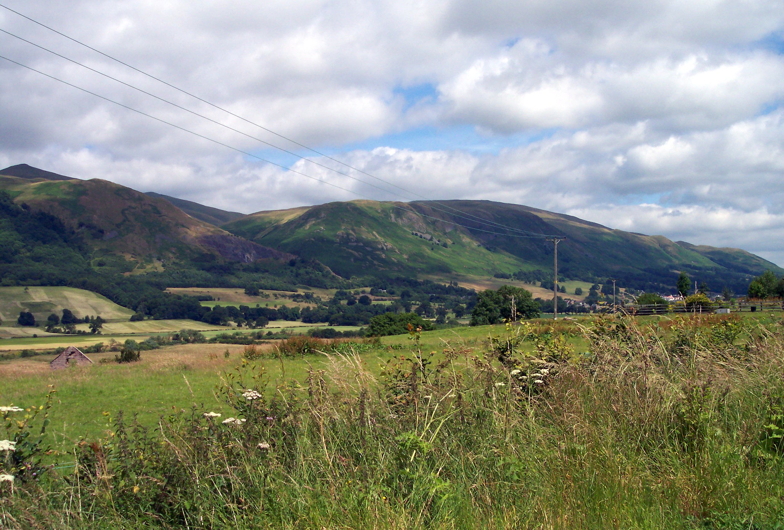
The southern and eastern parts of Scotland are usually referred to as the Scottish Lowlands, but these areas also have significant ranges of hills, although these are lower than the Highland mountains. Because they are much closer to towns and cities, they are more popular for hill walking and rambling than the more distant mountains of the Highlands. The highest mountain in this area is Ben Cleuch.
- Sidlaw Hills, north of Dundee but south east of the Highland Boundary Fault
- Ochil Hills, east of Stirling
- Kilpatrick Hills, north-west of Glasgow
- Campsie Fells, north of Glasgow
- Lomond Hills, east of Kinross
In addition to the main ranges, there are numerous individual hills in the Lowlands, often volcanic in origin. Many are known by the Scots word Law, meaning hill.
Southern Uplands
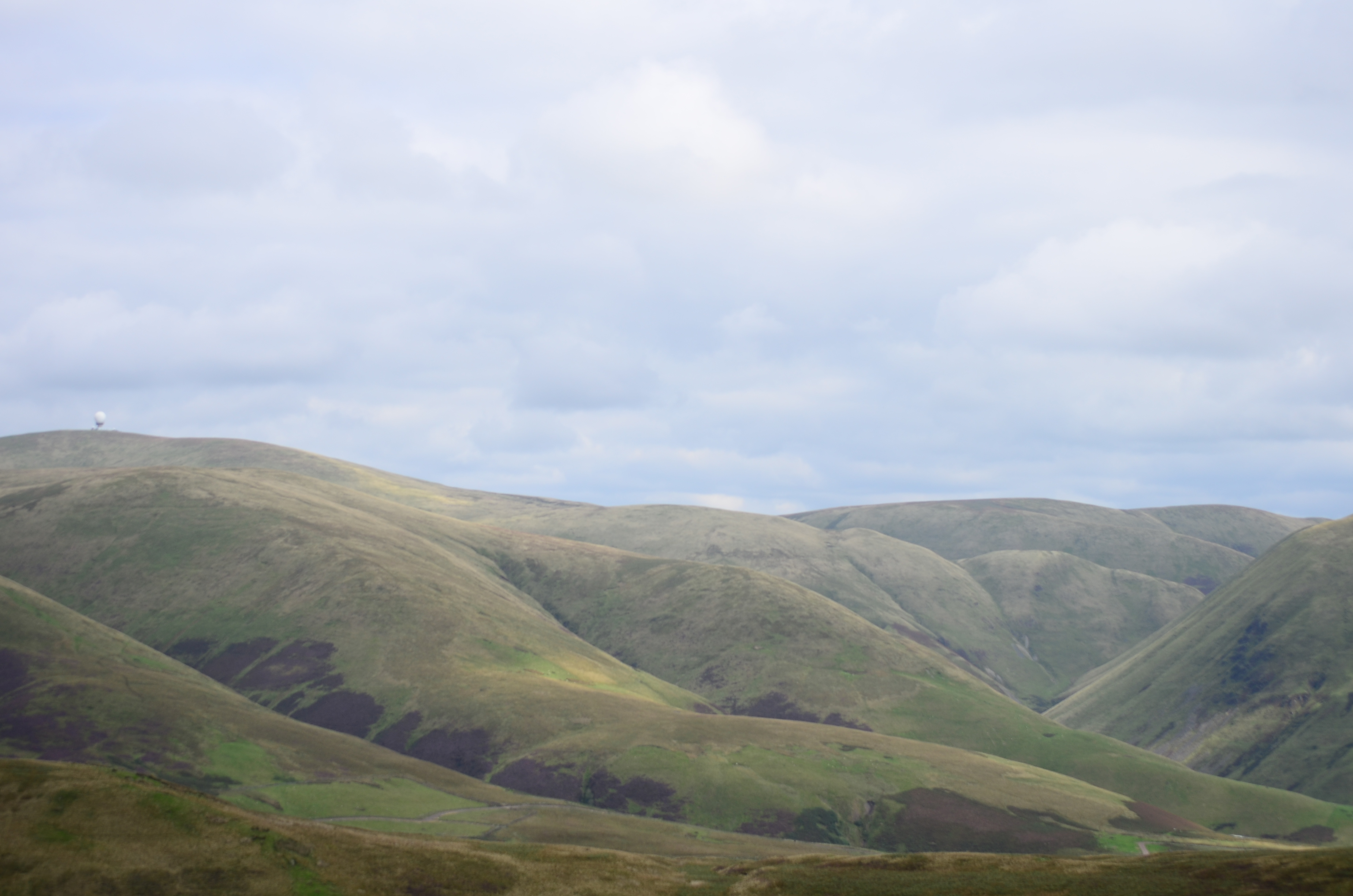
The Southern Uplands form a continuous belt of hills across southern Scotland from Dumfries and Galloway to the Scottish Borders, with the northern sections spilling into Ayrshire, South Lanarkshire and Lothian. These uplands are divided into several local ranges. The heartland of the Galloway Hills lies to the north of Loch Trool, and many excellent walks start from the extensive car park by Bruce's Stane. The ranges within the Scottish Borders are somewhat bigger and flatter than in Galloway but are of a similar height and are arguably just as remote. There are also a number of isolated hills which do not fit into any specific range, such as Tinto and Cairnsmore of Fleet. The highest mountain in this area is Merrick.
- Galloway Hills
- Carsphairn and Scaur Hills
- Lowther Hills
- Moffat Hills
- Pentland Hills
- Moorfoot Hills
- Manor Hills
- Lammermuir Hills
- Ettrick Hills
- Cheviot Hills, which lie mostly in England and form part of the border between the two countries
Scotland's highest mountains
The ten highest mountains in Scotland are also the ten highest in the UK:
1. Ben Nevis (Beinn Nibheis), 4,411.1 ft (1,344.5 m)[3]
2. Ben Macdui (Beinn Macduibh), 4,295 ft (1,309 m)[4]
3. Braeriach (Am Bràigh Riabhach), 4,252 ft (1,296 m)[5]
4. Cairn Toul (Càrn an t-Sabhail), 4,236 ft (1,291 m)[6]
5. Sgòr an Lochain Uaine, 4,127 ft (1,258 m)[7]
6. Cairn Gorm (An Càrn Gorm), 4,084 ft (1,244.8 m)[8]
7. Aonach Beag, 4,049 ft (1,234 m)[9]
8. Aonach Mòr, 4,004 ft (1,220.4 m)[10]
9. Càrn Mòr Dearg, 4,003 ft (1,220 m)[11]
10. Ben Lawers (Beinn Labhair), 3,983 ft (1,214 m)[12]
Listings
Scottish peaks are categorised in the following hill lists. A peak may qualify for inclusion in more than one list.
- The Munros are the most significant hills in Scotland over 3,000 feet (914.4 m), according to original compiler Sir Hugh Munro. The list was first drawn up in 1891, and is modified from time to time by the Scottish Mountaineering Club (SMC). It currently comprises 282 peaks,[13] following the demotion of Sgurr nan Ceannaichean in September 2009 and of Beinn a' Chlaidheimh in 2012.[14]
- The Corbetts are hills in Scotland between 2,500 and 3,000 feet (762 and 914.4 m), with a relative height of at least 500 feet (152.4 m). The list is maintained by the SMC. There are currently 222 hills.
- The Grahams are hills in Scotland between 2,000 and 2,500 feet (609.6 and 762 m), with a relative height of at least 150 metres (492 ft). The list of hills fitting these criteria was first published by Alan Dawson in The Relative Hills of Britain.[15] under the provisional name Elsies (LCs, short for Lesser Corbetts). They were later named Grahams after the late Fiona Torbet (née Graham) who had compiled a similar list around the same time.[16] The SMC incorporated the list into Munro's Tables[17] in 1997 but Dawson continues to maintain the list. There were originally 224 Grahams, but the current total stands at 221 after Corwharn, Ben Aslak and Ladylea Hill were surveyed as falling short of 609.6 m[18]
- The Donalds are hills in the Scottish Lowlands over 2,000 feet (609.6 m). The list was originally compiled by Percy Donald, and is maintained by the SMC. It comprises 89 summits and 51 subsidiary tops, giving a total of 140 hills.
- The Marilyns are hills in the British Isles that have a relative height of at least 150 m, regardless of distance, absolute height or merit. The list was compiled and is maintained by Alan Dawson. There are 1,216 Scottish Marilyns, see List of Marilyns in Scotland.
Injuries and deaths
Injuries and deaths from avalanches
| Time Period | Location | Died | Total injured |
|---|---|---|---|
| 1970 | Ben Nevis | 3[19] | |
| 1994 | Buachaille Etive Mor | 1[19] | |
| 1995 | Buachaille Etive Mor | 3[19] | |
| 2009 | Buachaille Etive Mor | 3[20][19] | 1[19] |
| 2009 | Ben Nevis | 2[21] | |
| 2013 | Bidean nam Bian | 4[22] | 1[22] |
| 2016 | Ben Nevis | 2[23] | |
| 2016 | Creag Meagaidh | 1[24] | 1[24] |
| 2019 | Ben Nevis | 3[25] | 1[25] |
See also
- Ben Nevis
- Buachaille Etive Mòr
- Geography of Scotland
- List of deaths on eight-thousanders
- List of mountains of the British Isles by height
- Lists of mountains and hills in the British Isles
- Lists of mountains in Ireland
- List of Munro mountains in Scotland
- List of Murdos (mountains)
- List of Corbetts (mountains)
- List of Grahams (mountains)
- List of Donald mountains in Scotland
- List of Furth mountains in the British Isles
- List of P600 mountains in the British Isles
- Mount Hood climbing accidents
References
- "Ben Nevis". John Muir Trust. Archived from the original on 3 July 2022. Retrieved 30 October 2016.
- Carrell, Severin (12 March 2019). "Ben Nevis avalanche kills three people". The Guardian. Archived from the original on 3 July 2022. Retrieved 3 July 2022.
- "Great Britain's tallest mountain is taller". Ordnance Survey. 2016-03-18. Retrieved 20 June 2019.
- "Ben Macdui (Beinn Macduibh)". Hill Bagging - the online version of the Database of British and Irish Hills (DoBIH). 2019. Retrieved 20 June 2019.
- "Braeriach (Am Bràigh Riabhach)". Hill Bagging - the online version of the Database of British and Irish Hills (DoBIH). 2019. Retrieved 20 June 2019.
- "Cairn Toul (Càrn an t-Sabhail)". Hill Bagging - the online version of the Database of British and Irish Hills (DoBIH). 2019. Retrieved 20 June 2019.
- "Sgòr an Lochain Uaine". Hill Bagging - the online version of the Database of British and Irish Hills (DoBIH). 2019. Retrieved 20 June 2019.
- "Cairn Gorm". Hill Bagging - the online version of the Database of British and Irish Hills (DoBIH). 2019. Retrieved 20 June 2019.
- "Aonach Beag". Hill Bagging - the online version of the Database of British and Irish Hills (DoBIH). 2019. Retrieved 20 June 2019.
- "Aonach Mòr". Hill Bagging - the online version of the Database of British and Irish Hills (DoBIH). 2019. Retrieved 20 June 2019.
- "Càrn Mòr Dearg". Hill Bagging - the online version of the Database of British and Irish Hills (DoBIH). 2019. Retrieved 20 June 2019.
- "Ben Lawers (Beinn Labhair)". Hill Bagging - the online version of the Database of British and Irish Hills (DoBIH). 2019. Retrieved 20 June 2019.
- "SMC: List of Munros". Archived from the original on 2009-08-27. Retrieved 2009-08-27.
- Beinn a' Chlaidheimh on munromagic.com
- Dawson, Alan (1992). The Relative Hills of Britain. Milnthorpe: Cicerone Press. ISBN 1-85284-068-4. Archived from the original on 2010-09-21.
- Dawson, Alan (1999). The Grahams and the New Donalds. Cambuskenneth, Stirling: TACit Press. ISBN 0-9534376-0-4. Archived from the original on 2008-03-27. Retrieved 2008-04-23.
- Bearhop, D.A. (1997). Munro's Tables. Scottish Mountaineering Club & Trust. ISBN 0-907521-53-3.
- The Grahams and the Donalds. Scottish Mountaineering Trust. 2015. ISBN 978-1-907233-19-7.
- "Rescuer tells of horror as Glencoe avalanche kills three climbers: "There were hundreds of tons of snow"". The Scotsman. 25 Jan 2009. Archived from the original on 24 December 2013. Retrieved 23 December 2013.
- Ormsby, Avril (24 January 2009). "Three killed in Scottish avalanche". Reuters. Archived from the original on 27 May 2018. Retrieved 23 December 2013.
- Carrell, Severin (30 December 2009). "Ben Nevis avalanche kills two climbers". The Guardian. Archived from the original on 3 July 2022.
- Smith, Bob (19 January 2013). "Four Glencoe climbers confirmed dead after Bidean nam Bian avalanche". Grough. Archived from the original on 9 July 2022. Retrieved 9 July 2022.
- "Missing Ben Nevis couple were hit by 'massive avalanche'". The Herald (Glasgow). 24 March 2016. Archived from the original on 4 July 2022. Retrieved 4 July 2022.
- "Climber who died after Scotland avalanche named by police". The Guardian. 19 February 2016. Archived from the original on 4 July 2022. Retrieved 4 July 2022.
- "Third climber dies after Ben Nevis avalanche". Grough. 12 March 2019. Archived from the original on 9 July 2022. Retrieved 9 July 2022.
This article needs additional citations for verification. (June 2019) |
External links
- Scottish Mountaineering Club - The SMC maintain the lists of Munros, Munro Tops, Furths, Corbetts and Donalds. They also keep a record of Completionists.
- Walkhighlands – Features podcasts giving the correct pronunciation and place-name meanings, a 3D visualisation of every route, gradient profiles and route downloads for GPS devices.
- MunroMagic.com – Munro, Corbett and Graham descriptions, pictures, location maps, walking routes and weather reports.
- Hill Bagging - the online version of the Database of British and Irish Hills - Survey reports, the change control database and the GPS database are on Hill Bagging.
- The Munros and Tops 1891–1997 – Spreadsheet showing changes in successive editions of Munros Tables.
- Ordnance Survey Munro Blog - OS is Britain's mapping agency. They make the most up-to-date and accurate maps of the United Kingdom. They have also produced a blog on the Munros.
- Harold Street Munros Lists of GPS waypoints + Grid References for walking in UK mountains and hills in various GPS file formats.
- ScottishHills.com – Hillwalking forum with Munro, Corbett, Graham and Donald, Sub 200's log, maps and trip reports.
Bibliography
- Poucher, W.A. (1998). The Scottish Peaks:. London: Frances Lincoln Ltd. ISBN 0 7112 2406 4.
Scotland articles | |||||||||||||
|---|---|---|---|---|---|---|---|---|---|---|---|---|---|
| |||||||||||||
| History |
|  | |||||||||||
| Geography |
| ||||||||||||
| Politics |
| ||||||||||||
| Economy |
| ||||||||||||
| Society |
| ||||||||||||
| |||||||||||||
| British Isles |  | |
|---|---|---|
| Scotland | ||
| Outside Scotland | ||
| England | ||
| Ireland | ||
| County tops | ||
На других языках
[de] Liste der Berge in Schottland
Diese Liste der Berge in Schottland führt nennenswerte Erhebungen, geordnet nach der absoluten Höhe auf. Aufgenommen sind die höchsten 20 Munros, höchste Erhebungen auf schottischen Inseln, prominente Hausberge, sowie anderweitig wissenschaftlich interessante Berge.- [en] Mountains and hills of Scotland
Другой контент может иметь иную лицензию. Перед использованием материалов сайта WikiSort.org внимательно изучите правила лицензирования конкретных элементов наполнения сайта.
WikiSort.org - проект по пересортировке и дополнению контента Википедии