geo.wikisort.org - River
The South Esk (Scottish Gaelic: Easg Dheas) is a river in Angus, Scotland. It rises in the Grampian Mountains at Loch Esk in Glen Doll and flows through Glen Clova to Strathmore at Cortachy, 5 km north of Kirriemuir. Its course takes it past Brechin and enters the North Sea at Montrose.[1]
- Note: the southern headwater of the River Esk in Lothian is also known as the South Esk.
| South Esk | |
|---|---|
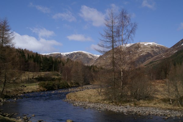 River Esk at Glen Doll | |
| Location | |
| Country | Scotland |
| Physical characteristics | |
| Source | Loch Esk |
| • location | Glen Doll, Angus |
| • coordinates | 56°53′55.4814″N 3°15′15.2526″W |
| • elevation | 730 m (2,400 ft) |
| Mouth | Montrose Basin, North Sea |
• location | Montrose, Angus, UK |
• coordinates | 56°42′10.9074″N 2°26′27.3192″W |
• elevation | 0 m (0 ft) |
| Basin features | |
| Tributaries | |
| • left | Burn of Fafernie, Burn of Gowal, Style Burn, Ketchie Burn, Burn of Gourrock, Moulzie Burn, Capel Burn, Cald Burn, Rottal Burn, Burn of Kinrive, Noran Water, Steinshell Burn |
| • right | Burn of Altcluthie, Burn of Loupshiel, Burn of Leck, Whitewater, Burn of Gourach, Burn of Farthal, Prosen Water |
River South Esk | |||||||||||||||||||||||||||||||||||||||||||||||||||||||||||||||||||||||||||||||||||||||||||||||||||||||||||||||||||||||||||||||||||||||||||||||||||||||||||||||||||||||||||||||||||||||||||||||||||||||||||||||||||||||||||||||||||||||||||||||||||||||||||||||||||||||||||||||||||||||||||||||||||||||||||||
|---|---|---|---|---|---|---|---|---|---|---|---|---|---|---|---|---|---|---|---|---|---|---|---|---|---|---|---|---|---|---|---|---|---|---|---|---|---|---|---|---|---|---|---|---|---|---|---|---|---|---|---|---|---|---|---|---|---|---|---|---|---|---|---|---|---|---|---|---|---|---|---|---|---|---|---|---|---|---|---|---|---|---|---|---|---|---|---|---|---|---|---|---|---|---|---|---|---|---|---|---|---|---|---|---|---|---|---|---|---|---|---|---|---|---|---|---|---|---|---|---|---|---|---|---|---|---|---|---|---|---|---|---|---|---|---|---|---|---|---|---|---|---|---|---|---|---|---|---|---|---|---|---|---|---|---|---|---|---|---|---|---|---|---|---|---|---|---|---|---|---|---|---|---|---|---|---|---|---|---|---|---|---|---|---|---|---|---|---|---|---|---|---|---|---|---|---|---|---|---|---|---|---|---|---|---|---|---|---|---|---|---|---|---|---|---|---|---|---|---|---|---|---|---|---|---|---|---|---|---|---|---|---|---|---|---|---|---|---|---|---|---|---|---|---|---|---|---|---|---|---|---|---|---|---|---|---|---|---|---|---|---|---|---|---|---|---|---|---|---|---|---|---|---|---|---|---|---|---|---|---|---|---|---|---|---|---|---|---|---|---|---|---|---|---|---|---|---|---|---|---|---|
| |||||||||||||||||||||||||||||||||||||||||||||||||||||||||||||||||||||||||||||||||||||||||||||||||||||||||||||||||||||||||||||||||||||||||||||||||||||||||||||||||||||||||||||||||||||||||||||||||||||||||||||||||||||||||||||||||||||||||||||||||||||||||||||||||||||||||||||||||||||||||||||||||||||||||||||
The river gives its name to the title of Earl of Southesk, held by the Carnegie family.[2]
References
- Gazetteer for Scotland overview
- "Southesk, Earl of". Cracroft's Peerage. Retrieved 1 May 2015.
На других языках
[de] South Esk (Nordsee)
Der South Esk ist ein Fluss in der schottischen Council Area Angus. Er entspringt in 960 m Höhe an den Hängen der Grampians unterhalb des 1012 Meter hohen Cairn Bannoch.- [en] River South Esk
[it] South Esk
Il South Esk è un fiume scozzese dell'autorità unitaria dell'Angus.Текст в блоке "Читать" взят с сайта "Википедия" и доступен по лицензии Creative Commons Attribution-ShareAlike; в отдельных случаях могут действовать дополнительные условия.
Другой контент может иметь иную лицензию. Перед использованием материалов сайта WikiSort.org внимательно изучите правила лицензирования конкретных элементов наполнения сайта.
Другой контент может иметь иную лицензию. Перед использованием материалов сайта WikiSort.org внимательно изучите правила лицензирования конкретных элементов наполнения сайта.
2019-2026
WikiSort.org - проект по пересортировке и дополнению контента Википедии
WikiSort.org - проект по пересортировке и дополнению контента Википедии