geo.wikisort.org - Mountains
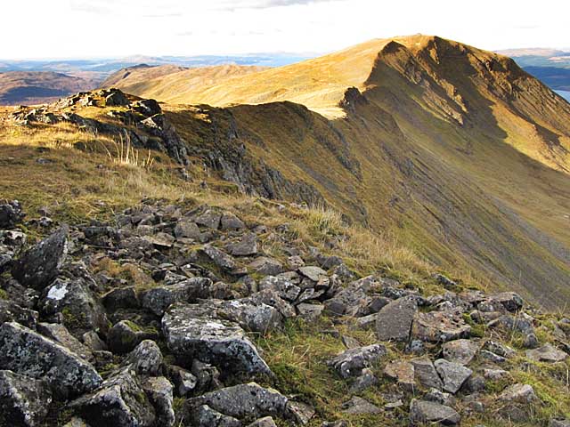
Dùn da Ghaoithe (Scottish Gaelic: Dùn da Ghaoithe, meaning "fort of the two winds") is the second highest mountain on the Isle of Mull, western Scotland, and the island's only Corbett.[1] It reaches 766 metres (2,513 ft) high, but "its long ridge and deep corries make it seem far higher".[2] It boasts sea views "in almost every direction",[2] and is the main mountain seen by visitors to the island on leaving the Caledonian MacBrayne ferry from Oban at Craignure.[1]
| Dùn da Ghaoithe | |
|---|---|
 | |
| Highest point | |
| Elevation | 766 m (2,513 ft) |
| Prominence | 659 m (2,162 ft) |
| Parent peak | Ben More (Mull) |
| Listing | Corbett, Marilyn |
| Coordinates | 56°27′38″N 5°46′47″W |
| Naming | |
| Pronunciation | Scottish Gaelic: [ˈt̪uːn ˈt̪aː ˈɣɤjə] |
| Geography | |
| Location | Argyll and Bute, Scotland |
| OS grid | NM672362 |
| Topo map | OS Landranger 49 |
References
- Terry Marsh (2011). "Walk 2.14. Dùn da Ghaoithe". The Isle of Mull. British Hills Series. Cicerone Press. pp. 130–135. ISBN 978-1-85284-595-7.
- Kirstie Shirra (2010). "39. Dun da Ghaoithe (766 m)". Scotland's Best Small Mountains. Cicerone Press. pp. 223–227. ISBN 978-1-85284-578-0.
This Argyll and Bute location article is a stub. You can help Wikipedia by expanding it. |
Текст в блоке "Читать" взят с сайта "Википедия" и доступен по лицензии Creative Commons Attribution-ShareAlike; в отдельных случаях могут действовать дополнительные условия.
Другой контент может иметь иную лицензию. Перед использованием материалов сайта WikiSort.org внимательно изучите правила лицензирования конкретных элементов наполнения сайта.
Другой контент может иметь иную лицензию. Перед использованием материалов сайта WikiSort.org внимательно изучите правила лицензирования конкретных элементов наполнения сайта.
2019-2026
WikiSort.org - проект по пересортировке и дополнению контента Википедии
WikiSort.org - проект по пересортировке и дополнению контента Википедии