geo.wikisort.org - Mountains
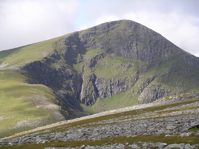
Sgùrr Mòr is the highest of the nine Munros in the mountain range known as the Fannichs in northern Scotland. This range is located between Loch Fannich and the A835 Ullapool road — a remote area with few habitations, but these Munros, which are usually climbed in groups or occasionally in a single hike, are mostly gentle sloped and fairly accessible from either of these locations. If approached from Loch Fannich, a bicycle or permission to drive on the private road would be helpful.
| Sgùrr Mòr | |
|---|---|
 | |
| Highest point | |
| Elevation | 1,109 m (3,638 ft)[1] |
| Prominence | 914 m Ranked 12th in British Isles |
| Parent peak | Carn Eige |
| Listing | Marilyn, Munro |
| Naming | |
| English translation | big peak |
| Language of name | Gaelic |
| Pronunciation | Scottish Gaelic: [ˈs̪kuːrˠ ˈmoːɾ] |
| Geography | |
| Location | Highland, Scotland |
| Parent range | Fannichs |
| OS grid | NH203718 |
| Topo map | OS Landranger 20 |
| Climbing | |
| Easiest route | Hike |
Footnotes
- "walkhighlands Sgurr Mor". walkhighlands.co.uk. 2014. Retrieved 26 February 2014.
See also
External links
Wikimedia Commons has media related to Sgùrr Mòr (Fannichs).
- Sgurr Mòr (Fannichs) is at coordinates 57.700744°N 5.015067°W
Munros of Scotland: Loch Carron to Loch Maree | |||
|---|---|---|---|
 |
|  | |
List of Munros | |||
Most prominent mountains of Britain and Ireland (the P600s) | ||
|---|---|---|
| Northern Highlands (20) |    | |
| Western Highlands (20) | ||
| Central and Eastern Highlands (13) | ||
| Southern Highlands (15) |
| |
| Islands (13) | ||
| Scottish Lowlands, England and Wales (13) | ||
| Republic of Ireland, Northern Ireland (25) | ||
This Highland location article is a stub. You can help Wikipedia by expanding it. |
На других языках
[de] Sgùrr Mòr (Fannichs)
Der Sgùrr Mòr ist ein als Munro und Marilyn eingestufter, 1.109 m (3.638 ft) hoher Berg in den schottischen Highlands. Sein gälischer Name kann in etwa mit Große Spitze oder Großer Berg übersetzt werden.[1] Er liegt in der Berggruppe der Fannichs, gut 50 Kilometer nordwestlich von Inverness.- [en] Sgùrr Mòr (Fannichs)
Текст в блоке "Читать" взят с сайта "Википедия" и доступен по лицензии Creative Commons Attribution-ShareAlike; в отдельных случаях могут действовать дополнительные условия.
Другой контент может иметь иную лицензию. Перед использованием материалов сайта WikiSort.org внимательно изучите правила лицензирования конкретных элементов наполнения сайта.
Другой контент может иметь иную лицензию. Перед использованием материалов сайта WikiSort.org внимательно изучите правила лицензирования конкретных элементов наполнения сайта.
2019-2025
WikiSort.org - проект по пересортировке и дополнению контента Википедии
WikiSort.org - проект по пересортировке и дополнению контента Википедии