geo.wikisort.org - Mountains
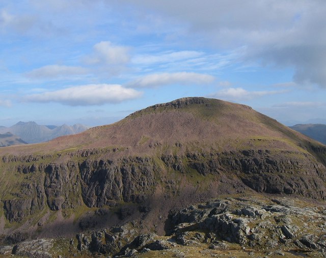
Ruadh Stac Mor or Ruadh-Stac Mòr (Gaelic)[2] is a mountain with a height of 919 metres (3,015 ft) in the Northwest Highlands of Scotland. It is located in the Dundonnell and Fisherfield Forest in Wester Ross.
| Ruadh Stac Mor | |
|---|---|
| An Ruadh-Stac Mòr | |
 | |
| Highest point | |
| Elevation | 919 m (3,015 ft)[1] |
| Prominence | 167 m (548 ft) |
| Listing | Munro, Marilyn |
| Coordinates | 57°43′36″N 5°19′45″W |
| Naming | |
| English translation | great red stack |
| Language of name | Scottish Gaelic |
| Geography | |
| Location | Wester Ross, Scotland |
| Parent range | Northwest Highlands |
| OS grid | NH018756 |
| Topo map | OS Landranger 19 |
One of the remotest Munros in Scotland, it provides superb views from its summit. Climbs generally start from the village of Poolewe to the west.[3]
References
- "Ruadh Stac Mor". hill-bagging.co.uk. Retrieved 31 May 2019.
- "Ruadh Stac Mor". Ainmean-Àite na h-Alba: Gaelic Place-Names of Scotland.
- "walkhighlands Ruadh Stac Mor". walkhighlands.co.uk. Retrieved 31 May 2019.
This Europe mountain, mountain range, or peak related article is a stub. You can help Wikipedia by expanding it. |
This Scottish location article is a stub. You can help Wikipedia by expanding it. |
На других языках
[de] Ruadh Stac Mòr
Der Ruadh Stac Mòr ist ein als Munro und Marilyn eingestufter, 918 m (3.012 ft) hoher Berg in den schottischen Highlands. Sein gälischer Name kann in etwa mit Großer roter Gipfel oder Großer roter steiler Berg übersetzt werden.[1] Er liegt im Fisherfield Forest in den Northwest Highlands, gut zehn Kilometer nördlich von Kinlochewe.- [en] Ruadh Stac Mor
Текст в блоке "Читать" взят с сайта "Википедия" и доступен по лицензии Creative Commons Attribution-ShareAlike; в отдельных случаях могут действовать дополнительные условия.
Другой контент может иметь иную лицензию. Перед использованием материалов сайта WikiSort.org внимательно изучите правила лицензирования конкретных элементов наполнения сайта.
Другой контент может иметь иную лицензию. Перед использованием материалов сайта WikiSort.org внимательно изучите правила лицензирования конкретных элементов наполнения сайта.
2019-2026
WikiSort.org - проект по пересортировке и дополнению контента Википедии
WikiSort.org - проект по пересортировке и дополнению контента Википедии